
PERSEIDS METEOR SHOWER LIGHTS UP PHOTOGRAPHER’S LANDSCAPES CAPTURING THE SOUTHWEST NIGHT’S SKY ADDNG SPARKLE TO MOAB ‘S ARCH COUNTRY


BROKEN ARCH
Milky Way Landscape Photography and the Perseid Meteor Shower by Eugene Louie
This was my first attempt photographing The Milky Way galaxy so I drove to Arches National Park, one of the darkest night skies in the country, to capture the galaxy hovering above the dramatic rock formations. This is Broken Arch. I used it to provide a reference point that even the most amazing Hubble Telescope pictures do not. I wanted to inspire my audience by creating a “scene setter,” which gives the viewer a feeling this scene could exist on another planet. Utah’s stark Moab desert was a perfect backdrop. Scientists studying what the likely conditions of a manned voyage to Mars use the red rocks of Utah to emulate condition on Mars for a possible manned mission to the red planet.
Capturing the Milky Way galaxy over Broken Arch was my original goal, but the experiment became enhanced by an accidental meteor streaking toward earth, probably part of the Perseus meteor shower. The Perseid meteor shower is the most famous, dependable annual meteor shower, producing on average between 60 to 90 meteors per hour, at peak observation times. The real show doesn’t start until after midnight, but meteors can be seen earlier staring around 10pm, a couple hours before the moonsets; the crescendo does not start until hours after midnight when the skies get darker as night turns into day. The prime viewing dates are: Aug. 10th, 11th, and 12th. Fortunately in 2016 observers will enjoy a longer viewing period as the moon is cooperating, setting earlier as it will be in a waning gibbous moon phase.
Visibility will be best for folks living in the mid Northern Hemisphere. All you need do is find the darkest spot possible, as far away from city light pollution, set up a comfy adjustable lawn chair, kick back and make sure you have a wide open sky above you, as meteors will come from every direction. If you are an intrepid meteor watcher be prepared to pull an all nighter.

Where Do These Meteors Come From?
The Perseid meteor shower look like they come from the constellation Perseus. The Perseid “shooting stars” are bits of space debris made of debris from the Comet Swift-Tuttle. Each piece ranges in size from a tiny piece of dust to about 10 meters. They are called meteoroids when traveling in outer space. They become meteors upon entering earth’s atmosphere, and if the meteor strikes the earth, and remains intact, it is called a meteorite. If these pieces of comet are larger than 10 meters they are called asteroids. The Comet Swift-Tuttle was discovered in 1862 and takes 133 years to make one trip around the sun. Astronomers use the term “radiant,” to describe the line that leads back to where the visible meteor seems to originate. The last time Swift Tuttle reached perihelion, the closest point to the sun, was December1992. It will do so again in 2126.
Smart Phone Apps to Locate the Perseus Constellation:
To locate the Perseus Constellation iPhone users can download “Sky Guide,” a free app available through the Apple Store and Android phone owners can use “Photo Pills,” which
cost about $10. Both are excellent and easy to use to locate The Milky Way, deep space objects constellations, nebulae, planets and more. I prefer “Sky Guide” because if you touch an object on the screen information about the object appears in an info box. This satisfies my need for immediate gratification. Sky Guide provides both scientific and the origin of the mythology behind the naming of the objects.
Technical Info About the Making of this Milky Way Landscape:
The newest camera technology allows photographers to use higher ISO settings in combination with exposures 30 seconds or less, just long enough to record points of starlight before the stars begin to leave light trails. If you enlarge the photo you can see stars, located in the upper corner of the frame, begin to leave evidence of light trails as they move across the sky even with a 17 mm wide-angle lens.
I used a 15 – 35 mm f/2.8 Canon zoom lens with the focal length set at 16 mm, ISO was 16,000, exposure 12 seconds long with the aperture set at f/2.8. Color temperature manually set to 3900 degrees kelvin. I prefer a bluer night sky and from trial and error discovered that 3900 degrees kelvin is my sweet spot to begin photographing. As the Milky Way moves across the sky and it gets closer to dawn I will raise the color temperature. Generally, I do not go higher than 6400 degrees kelvin, and only when the night passes closer to dawn. 6400 degrees kelvin produces a warmer sky. The color temperature is all personal preference so experiment to determine what degree of cool and warmth works for your sky. The camera was mounted on a carbon fiber Gitzo tripod with a Really Right Stuff ball head. At the bottom of the tripod’s center column, I installed a metal hook and hang my backpack on it to steady the camera during the 12-second exposure.
 I stood behind my tripod making exposure after exposure. By luck I watched a bright streak of light appear above me while the camera shutter was open and was delighted to find the meteor trail recorded on the preview screen. My initial intention was to capture our Milky Way galaxy with an unearthly object, but I got the bonus meteor because the picture was made during the prolific Perseid Meteor Shower. In August the most dependable meteor watching nights occur during a moonless night. There is no way to predict if it will be a terrific or boring display.
I forgot to bring a cable release. Instead I used my finger to gently trip the shutter with the camera’s self-timer set for a two-second delay to eliminate mirror slap. Capturing a 40,000-mile per hour streaking meteor moving across the heavens is honestly a game of chance. Many Milky Way photographers will use an intervalometer attaching to a digital camera, resembling a cable release, and allow the camera to be placed on autopilot. The intervalometer will open and close your camera’s shutter automatically as well as start the next exposure, according to the parameters you decide. To ask questions about this blog please send an email to this address. I will respond as quickly as possible.
Canon and Nikon manufacture their own brand of intervalometer but are expensive. A less expensive work around I used was buying the Vello brand, a third party timer, which works very well and is less expensive.

STAR PHOTOGRAPHER EUGENE LOUIE
American Photographer Magazine nominated Eugene Louie as a “New Face” in photojournalism when he was just 26 years old. That same year, Louie’s photographs helped Washington’s Longview Daily News win a staff Pulitzer Prize for covering the eruption of Mount St. Helens on May 18, 1980. The volcanic eruption, equivalent to 400 million tons of TNT, toppled 20 square miles of forest in six minutes. Louie’s prize-winning images were horrifying and stark. Gritty ash covered most of Washington and neighboring states. The rooftops of multi-story houses became the new high ground. Previously gentle Cowlitz River overflowed with icebergs the size of cars that had broken from melting glaciers and sped down streams.
The San Jose Mercury News recruited Louie during the after-glow of Pulitzer Prize fame, when he also won a bronze medal in the Photographer of the Year Pacific Northwest competition. Fast forward to 1989; Louie’s photography contributed to a second Pulitzer Prize win, this time for The San Jose Mercury News’ coverage of the Loma Prieta Earthquake and the aftermath.
“The Ansel Adams Yosemite Summer Workshop gave me the privilege to learn the famous landscape photographer’s “Zone System,” which in simplistic terms, gives photographers a way to communicate visual and technical issues with each other,” Louie said. For Louie, this skill was filed away to pursue a public service career in photojournalism.
Louie set out to become a psychologist and during his senior year completing a bachelor’s degree in psychology decided to pursue photojournalism, in the tradition of Life Magazine photographer W. Eugene Smith, which became Louie’s photographic hero. The late start at California State University Long Beach makes Louie’s rapid rise all the more notable. He didn’t have a degree in journalism, and competed with hungry photographers in a competitive field. “If you are meant to accomplish a specific goal, I believe, you will find a way, “ said Louie.
In 2010, during his first winter to Yosemite National Park, Louie experienced an epiphany. “Winter’s misty fog drifted around granite cathedrals altering the color, intensity and direction of light, in ways I never saw during the summer, Louie said. “That Yosemite winter quieted my mind like no experience before. Photography became a meditation. I realized the purpose of my second career is to photograph the natural world, with the same passion I felt for journalism. Today I look back to the Ansel Adams workshop for renewed inspiration. As Robert Frost is so often paraphrased, I have returned to “the road not taken.”
Perseiid Meteor Shower: NASA meteor shower, Animation; 2015:
How to Photograph the Milky Way Galaxy, Photography Tips: Photograph the Milky Way in 12 Steps;
Arches National Park: Broken Arch Loop Trail:
Kelvin Light Color Temperature Explained:Lowell EDU:
RAINBOW GOLD GROWTH ? ORO VALLEY AT THE TURNING POINT, SAVING THE SANTA CATALINA RANGE AND ORO VALLEY FROM ITSELF…


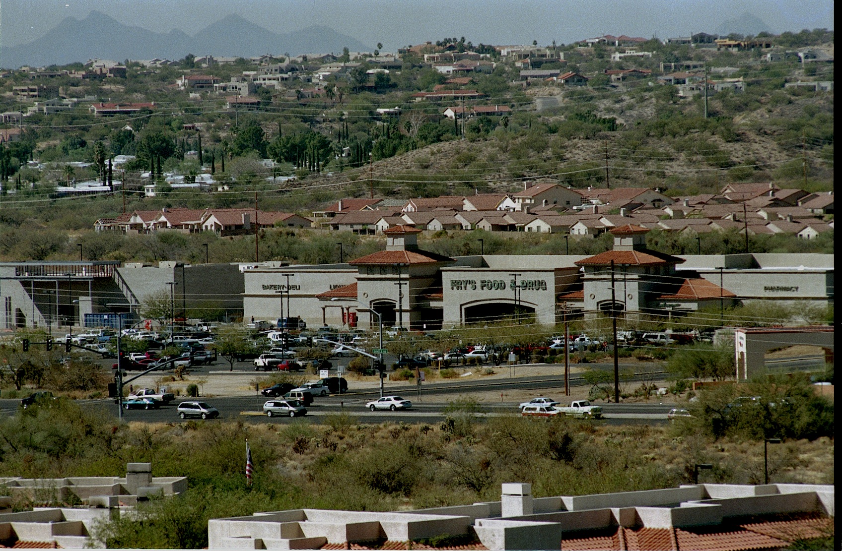
The Canon del Oro Valley is the gold at the end of the rainbow. The original Rancho Vistoso was a large Adobe ranch house located where the Walmart parking lot at Oro Valley’s Marketplace Plaza buzzes with activity as shoppers visit big box stores.
Life rarely gives us second-chances, but they do happen. Oro Valley Arizona has a second chance to decide what their Future should look like. Town residents have banded into two groups, recall elections are November 3rd, emotions have flared-assault charges and lawsuits filed and election signs vandalized and tossed into the bushes. The usual politics one finds in Small Town USA all over the country. Oro Valley’s problem: it’s one of the most beautiful places in the United States and finding the proper balance between preserving the Canon Del Oro Valley’s “Drop Dead Gorgeous” status and developing the town wanna be city so everybody is happy. Making everyone happy will be a tall order.

Walmart Shopping Center at MarketPlace

Same view as above 40 years earlier…
Mainly, because Oro Valley has become a developer’s paradise and any change there will be bumping heads with BIG bucks. Oracle Road, which is State Highway 77, which is the town’s main drag has been a 7 mile construction zone for so long know one can remember when it started. Much of this work is ramping up and adding another lane, taking two lanes to three, making room for future development. They are also building expensive wild life crossings, both over and under styles. In Colorado they have found predators just await their prey on the blind side of these crossings and just gobble till they are full. Speedtrap.org lists 80,000 bothersome speed revenue mills and knows Hwy 77.
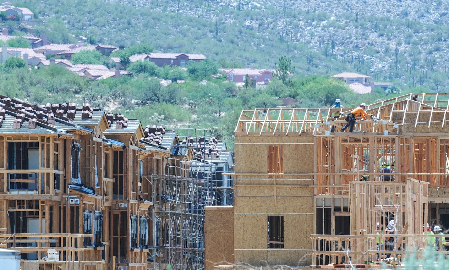
Developers in Oro Valley in recent years, have squeezed in 800 apartments, providing housing for Iowa farmers who want to get out of the snow. Sun Dorado, the next generation of Mark-Taylor Apts, has the prime spot nestled into the Santa Catalina range at 1st Ave and Oracle Road, featuring the “largest health center you have ever seen in a apartment complex”, dog-friendly and walking access to all the unique shopping nearby. Mountain views cost extra, it’s cheaper to stare at Oro Valley and Oracle Rd, for a one bedroom it’s $930 with a view, large kitchen and a closet but a three bedroom with a view tops out around $1650-but up to six people can sign the lease. No one bedrooms available now, but some might open up.

That boutique shopping experience as you leave San Dorado’s lighted gated community begins with CVS Drugs; store number 10,006 now found on most corners near you, the next shop is a FIRM mattress shop and everyone needs one, the next is a Nail Spa, also found everywhere. So the question facing the voters, what premium do you place on living in one of the most beautiful places in the U.S., or is growth-any growth worthwhile ? Some voters might argue that building all those apartments at the junction of lst Ave and Oracle Road and providing pads for businesses found on most every street corner in Tucson on a spot which was the community’s focal point of the Catalina Mountains might have been insensitive and might better have been a green space for the community to feed their souls and revel in the beauty that GOD has provided. That would not have made someone rich but it would have made the community richer.


Catalina Arizona sits next to Oracle Road north of Sun CityRancho Vistoso just south of the Pima-Pinal County Line…in the distance stands the Santa Catalina Mountains
Oro Valley has some nice green spaces, along the (dry) riverbed–Steam Pump Ranch was a nice idea until it was squeezed in by gas stations and commercials strip malls, something was lost. Lunching on day at the amazing Saguaro Cafe in Oro Valley my dog engaged me in a conversation with two realtors who suggested Oro Valley’s real prosperity will come from commercial development along Tangerine Road. “It will be the next Speedway”, they agreed since it is a major I-10 to Oro Valley corridor.

Oro Valley No vote Council members meet with residents explaining how “dirty” actions from the Mayor and the other YES votes for the new City of Oro Valley Recreation Center compromised their vote with a rushed agenda. Councilman Mike Zinkin in the foreground, Councilen William Garner in RED, and Brendan Burns in blue behind.

Oro Valley residents listen to Councilmen opposed to the purchase of the Old Conquistador Country Club also stressed concerns about Golf dying as a business, water woes. In Phoenix several golf course are rebranding their communities, they are tearing out the fairways and adding boulevards. An uncertain future shadowed these concerns…
Now Oro Valley has a second chance to make the right decisions. It is my opinion the present mayor, will continue to fuel development since a large portion of his election campaign has been financed by the folks doing the building, that’s the way politics works. Mayor Satish Hiremath is running to hold onto his office in the Nov. 3 recall election along with town council members Lou Waters, Joe Hornat and Mary Snider. The recall was initiated by the Oro Valley Citizens for Open Government after the Town Council voted 4-3 in December to buy El Conquistador Country Club and increase the town’s sales tax to raise money to remodel the facility into a community and recreation center. The council members facing recall all voted in favor of the proposal. The facility was purchased for $1 million and includes 324 acres, 45 holes of golf, 31 tennis courts and two swimming pools. A 31,475 square-foot building that requires renovation will be paid for with a half cent sales tax that took effect in March.

Rancho Vistoso in 1975 today its someone’s front yard in the HoneyBee Reserve gated community…
Oro Valley was incorporated in 1974 and has grown from a shady Oasis to one of the more prosperous communities in Arizona with almost 130,000 people within seven miles, incomes averaging around $70,000, it has been voted Best Place to Raise Kids, Good Place to Retire because of the strong property values and low crime. Truth is, Oro Valley and the Tortolita Mts

Arizona Governor Bruce Babbit turns over the soil dedicating Catalina State Park and at the same moment he opens Rancho Vistoso Sun City for business.
for decades was everyone’s backyard. Quail Hunters reveled in the explosion of birds they found there, javalina hunters still tell tales of the hunt and folks like me, explored and hiked, searched for the wild herd of mustangs running free in those hills. After the land swap, when Governor Bruce Babbitt, created Catalina State Park and in return made possible Rancho Vistoso Sun City, locked gates started appearing–pushing long-time Tortolita Mountain lovers from their haunts. Thinking maybe when they are through building, I thought, but that is when the gated communities started popping up, so for most of us, it was goodbye to the Tortolitas. Growth has continued unabated, in 2008 when housing all over the U.S. died. Oro Valley barely skipped a beat sales slowed and inventory faded but not like the rest of the country.
Cows on trust land equals tax break, the field feed the cows. A lean farm operation.
In the early 1970’s John Ratliff and his associates requested that Pima County rezone a 4,000-acre parcel of land lying east of Oracle Road, north of Tucson. The property known as Rancho Romero was located adjacent to the western slopes of the Coronado National Forest’s Santa Catalina Mountains. The proposed development included a variety of housing units that would accommodate 17,000 people, which would surround golf courses along the Canada de Oro and Sutherland Washes. When this rezoning request came before the Pima County Planning and Zoning Commission, there was so much opposition from the public that the proposed plan was put on hold. Tucson residents said they preferred the preservation of this area as open space, with developed recreational facilities, this was the beginning of Catalina State Park. But not the last attempt by developers to put subdivisions on the east side of Oracle Road.
Before Oro Valley, the grassy field is today’s Marketplace.
The Oro Valley Conquistador Hotel, the first construction on the east side of Oracle, has been on the auction block, off and on, last time was 2012. The 400 room structure began life as a Sheraton Hotel, then Hilton presently Premier Hospitality Management maintains the contract. Its restaurants were a big draw in the beginning but as growth came to Oro Valley more restaurants came in and greater variety made expensive Mexican food less interesting.

Desert Springs was one proposal recently turned down, Sabino Springs popped up in 1990 but developers will be back.


For me, the building East of Oracle Road is the most offensive. West of Oracle, growth will continue north until it hits Oracle Junction, nothing will change that. More than once, developers have attempted massive subdivisions featuring more than 500 homes, shops, condo and apartments east of Oracle Road where Tangerine Road intersects, Sabino Springs
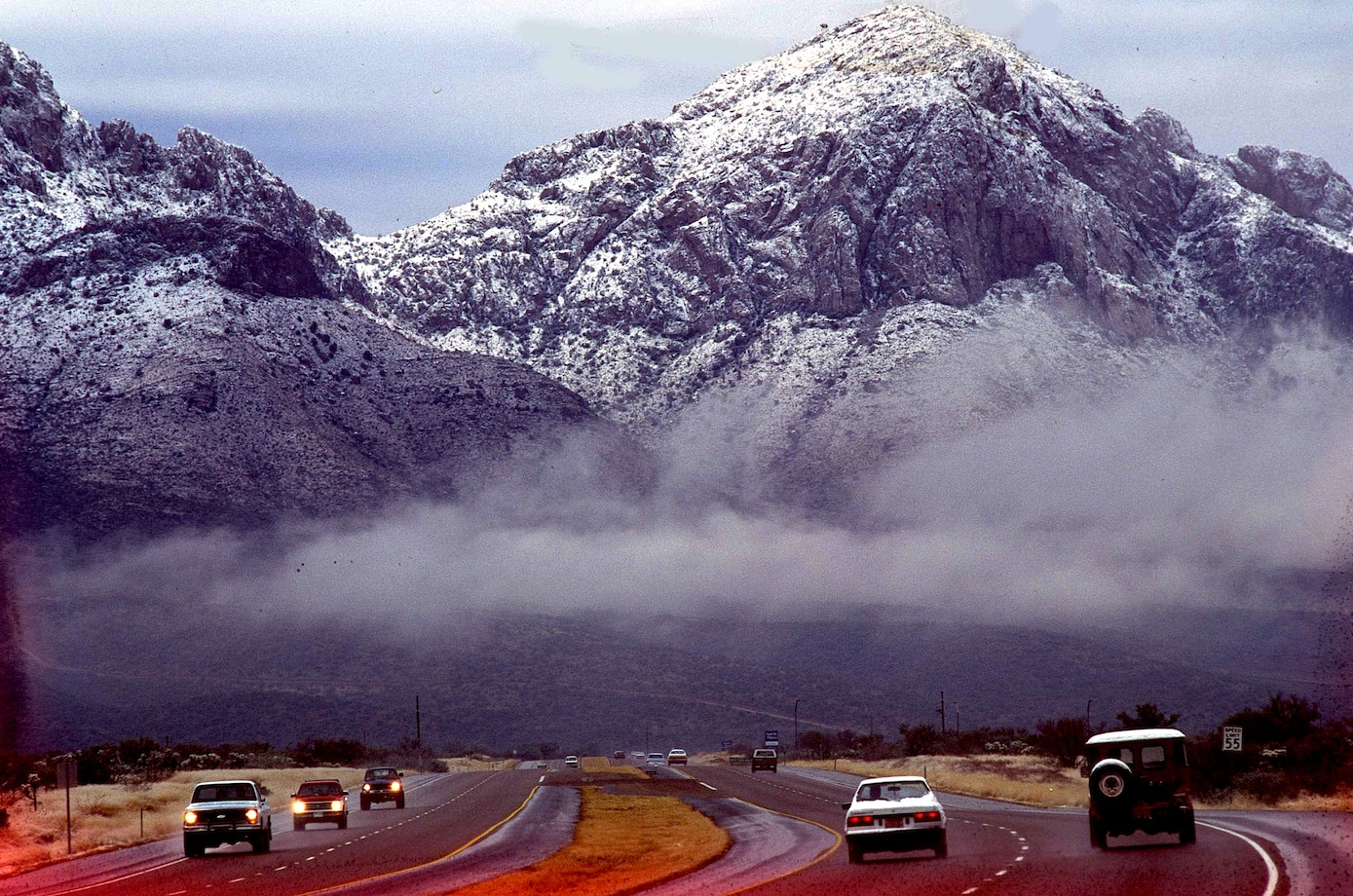
Oracle Road after a winter dusting of snow.
was one name, others will come and they will keep coming until they get their prize butted up against Catalina State Park. Folks will awake in the campground and stare into someone’s back yard. SunChase Holdings Inc. pledged “a high quality project” that would be tasteful and would fit in with the surroundings. Another attempt for this prize was fought off in 1990, with a progrowth Mayor, they will get the land and that will be the beginning of the end for the Catalina Mountain Range. Sunchase said they needed 85 acres with up to five homes per acre, 13 acre of five home per acre and up 11 acres of commercial and offices. In between they plan to weave hiking and biking trails, blending stores, offices and a mix of housing types. One caveat floated was the possibility of a Tram from Oro Valley to Mt Lemmon, making Oro Valley a must stop for all tourist blowing through Tucson. Much shorter ride than when it was first suggested from downtown Tucson decades ago.
Oro Valley’s First Avenue and Oracle Road has become downtown for the community…
With the new animal crossings on Oracle Road, any concern about “wildlife corridor” between the Catalina and the Tortolita Mountains pretty much go out the window, regardless of major habitat fragmentation.  A short while ago I listen to an Oro Valley resident wish she was living in SaddleBrook just up the road. She was simply amazed by all the wildlife those residents enjoy. After the bright lights of Oro Valley chased off the last of the Desert Bighorn living atop Pusch Ridge-the town adopted the Bighorn as a symbol of the community erecting several life-sized statues throughout the town. Today new bighorn have been transplanted atop the nearby ridge but disease and mountain lions have taken their toll.

Many years ago, I was out-raged by the wall built to block the view across the Canon Del Oro Wash that eliminates out the most perfect view of the mountains. I was sure they just wanted to be sure everyone had their eye on the road (now they are texting) but after while I realized how wrong I was. That wall is a sound barrier for all the expensive homes that soon will be built above the road level and on top of the first foothills, most money gets the highest spot. No one will pay big bucks for the spectacular sunset views if the road noise from below drowns out the elevator music.

Sound Wall for the big bucks lots yet to come.
It is all going to change soon, unless it is stopped now. The Town of Oro Valley Special Recall Election will be held Tuesday November 3, 2015. A polling place election, voters may request an early mail ballot, for more information call the Pima County Recorder 520-724-4330…

I began this blog pointing out that Oro Valley’s problem is that it is one of the most beautiful places in the United States. What I haven’t said is when folks finally end their long journey on I-10 and the Catalina’s finally come into view, there is a sigh, and I know I’m home again. We all take their beauty for granted but try to imagine that skyline without those hills and take stock in what we have and the responsibility to leave this beauty for the children, our future-what will Oro Valley look like tomorrow.
ORO VALLEY CITIZENS FOR OPEN GOVERNMENT
PIMA COUNTY RECORDER-REGISTERING TO VOTE
![]()

<a href=” SPANISH TRANSLATIONS:">
IN TOUCH WITH THE MIMBRES, MOGOLLON, SALADO PROBLEM IN MULE CREEK NEW MEXICO, SOUTHWEST ARCHAEOLOGY FIELD SCHOOL PROBES FOR ANSWERS


Using Stone Axes DIANA TREVIZO and ALEXANDRA NORWOOD try to scrape the bark from the roof poles for the 13th Century Pueblo they are building near Mule Creek, New Mexico. They are building a adobe pueblo at the same time they are digging one up near Cliff.
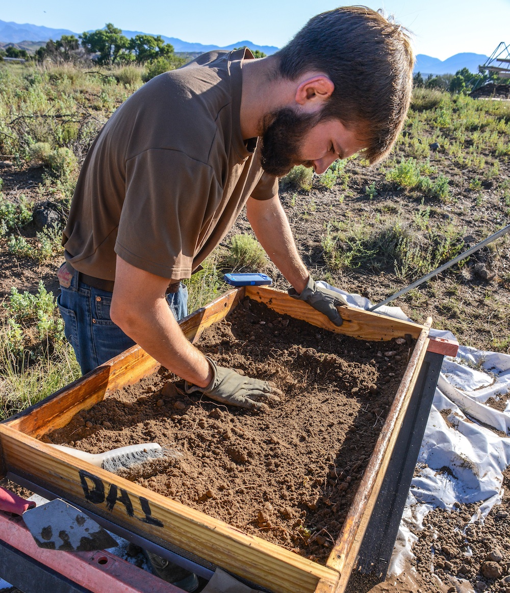
JOE HALL screens fill from a new room block using window screen for every fourth load. Lots of info can fall through the cracks, like fish bones, turquoise bead.
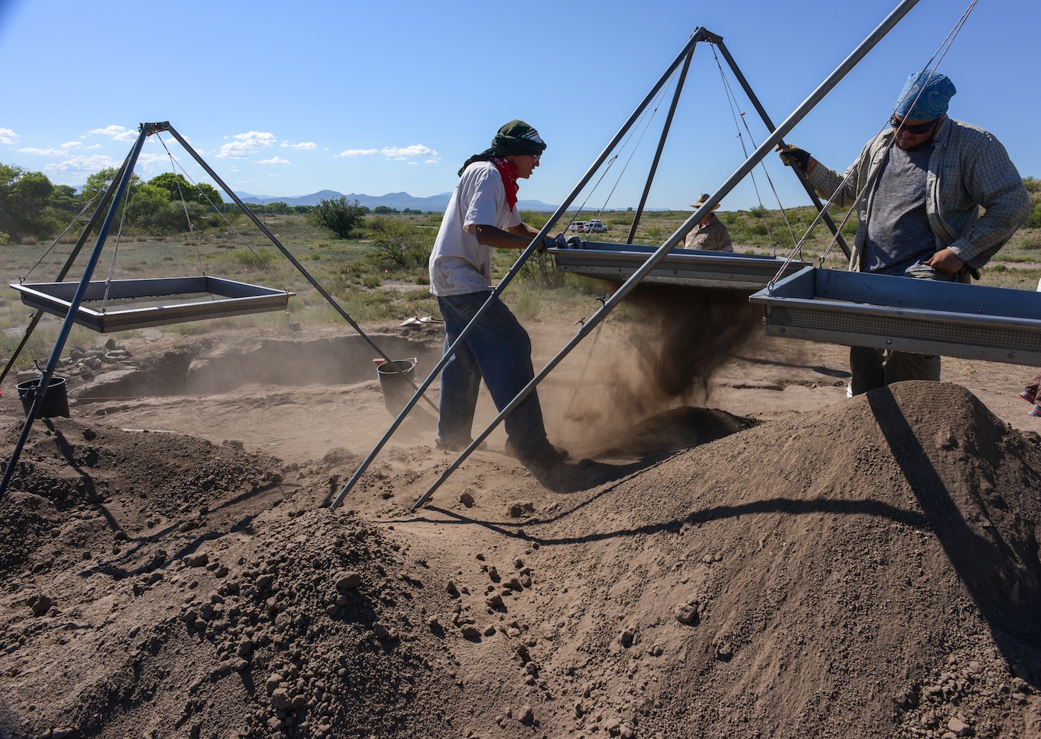
Students in the 40-day Preservation Archaeology Field School sift through fill from a prehistoric Pueblo called the Dinwiddie Site in east central New Mexico. Fourteen students, the best of the best, 4.0 students were turned away, each student chosen brought a special something to the school. Unlike the traditional Field School this curriculum highlights preservation archaeology, an experimental component has the students building an adobe pueblo like the one they are digging up. Students also compete throwing 4′ Atlatl darts.
The peopling of the South West is a story best told by pottery. Ceramic pottery can tell archaeologist what they ate, where it was made, who made it and with whom the owner traded or aligned with…in a sense what was important to that culture and how successful or influential the culture was, how long it survived, and finally where did they go. But until tree ring dates, the chronology of all the ruins of the southwest, was a mystery until one afternoon when two pieces of charcoal crystalized everything that was known about the prehistory of the South West. In the one hundred years since man began probing the earth beneath their feet looking for secrets from the past much has been learned revealing to archaeologist how little they know or understand about early residents. So new strategies have evolved aided by the quick fresh minds of the next generation of archaeologist, new software that peels back the past, reveals pigment lost by time, using the sum knowledge from the past to build on future studies by incorporating all the data from all the earlier digs, aided by data from neighboring or regional sites. But more importantly, these new-age archaeologist, are tearing down fences that have long existed in the Cliff Valley and getting a first hand look at the prehistoric cultures that once called southwestern New Mexico home.
ALEXANDRA BALLESTEROS

MONICA VEALE
The 2015 Preservation Archaeology Field School staff is a combination of a lot of talent from Archaeology Southwest, Desert Archaeology, ASU and University of Arizona to structure a learning experience for a group of fourteen students who signed up for this opportunity to learn the general field and team work and the lab techniques necessary to extract science and knowledge from the soil.
Students are exposed to the principles of preservation archaeology, acquire the basic skills of excavation and survey, develop working strategies and write notes and reports that apply the logic of archaeological thinking to fieldwork, laboratory analysis, and applying the data we gather to answering anthropological questions. Finally think critically of issues about archaeological ethics.
As prehistoric man moved about he enjoyed a nomadic lifestyle of visiting old haunts places where they might have dropped some seed but most usually had luck hunting or gathering seasonal fruit. As more migrants entered the area, the nomadic Mogollon hunter found himself being crowded out and his old haunts now taken by the Anasazi fleeing their homes south east of Mesa Verde and looking for places to farm and live in safety. Local nomads soon were forced to stay at home and watch the crops.
The Mogollon and the Anasazi Material Cultures merge and disappear as the two groups diverge. Some Archaeologist believe the Kayenta Anasazi was traveling light, carrying what they could, leaving most of their culture behind. The nomadic Mogollon become seditary farmers, adopting some of the practices of their new neighbors, and soon they look pretty much alike. Except for ceramics! Archaeologist believe the Kayenta maintained contact with folks back home, perhaps opening trade connections with folks back home but meanwhile looping in the new immigrants settlements and establishing a trade network. When the bottom dropped out of the Colorado Plateau and everyone started looking for someplace wetter, the Kayenta knew where to go and who to stay with. They thought!
Rough corrugated ceramic pots are a clay signature for the Kayenta Anasazi and corrugated pottery left a trail from the Arizona Strip with some eventually reaching the Rio Grande and more was found south into Arizona Rim Country, visiting Mogollon Pueblos like Kinishba, Grasshopper Pueblo, Point-of-Pines, Cline Terrace. The Kayenta would build fortified hilltops above the floodplain along the Gila and San Pedro Rivers. Many of these sites are linked by signal towers to quickly communicate up and down the stream. The black and white pottery found at Salado sites suggests to some Archaeologist that the Kayenta continued to trade north to south until the end. But then Salado appears and everything changes. Four different archaeologist saw “Salado” arrive in different areas of the South West, but Harold Galdwin of Gila Pueblo received the credit for defining the Salado Culture but 85 years later we still disagree on much.
Agreement seems to be centering on Salado as a religion characterized by a distinct polychrome pottery and adobe compounds. The Salado message centered on fertility and cooperation, instead of honoring elite rulers, and some archaeologist have called it the first feminist movement, because in the day it was believed women did the most potting of clay and saved the South West from self destructing by intervening and preaching peace and working together. Others say shaman wheeled great power by producing the Mimbres Pottery characterized by “kill holes” which released the soul of the potter from the pot after his death.
The pottery design adapted reflected Mesoamerican imagery and changed in time but
researchers believe folks began thinking of themselves as Hohokam Salado or Kayenta Salado.
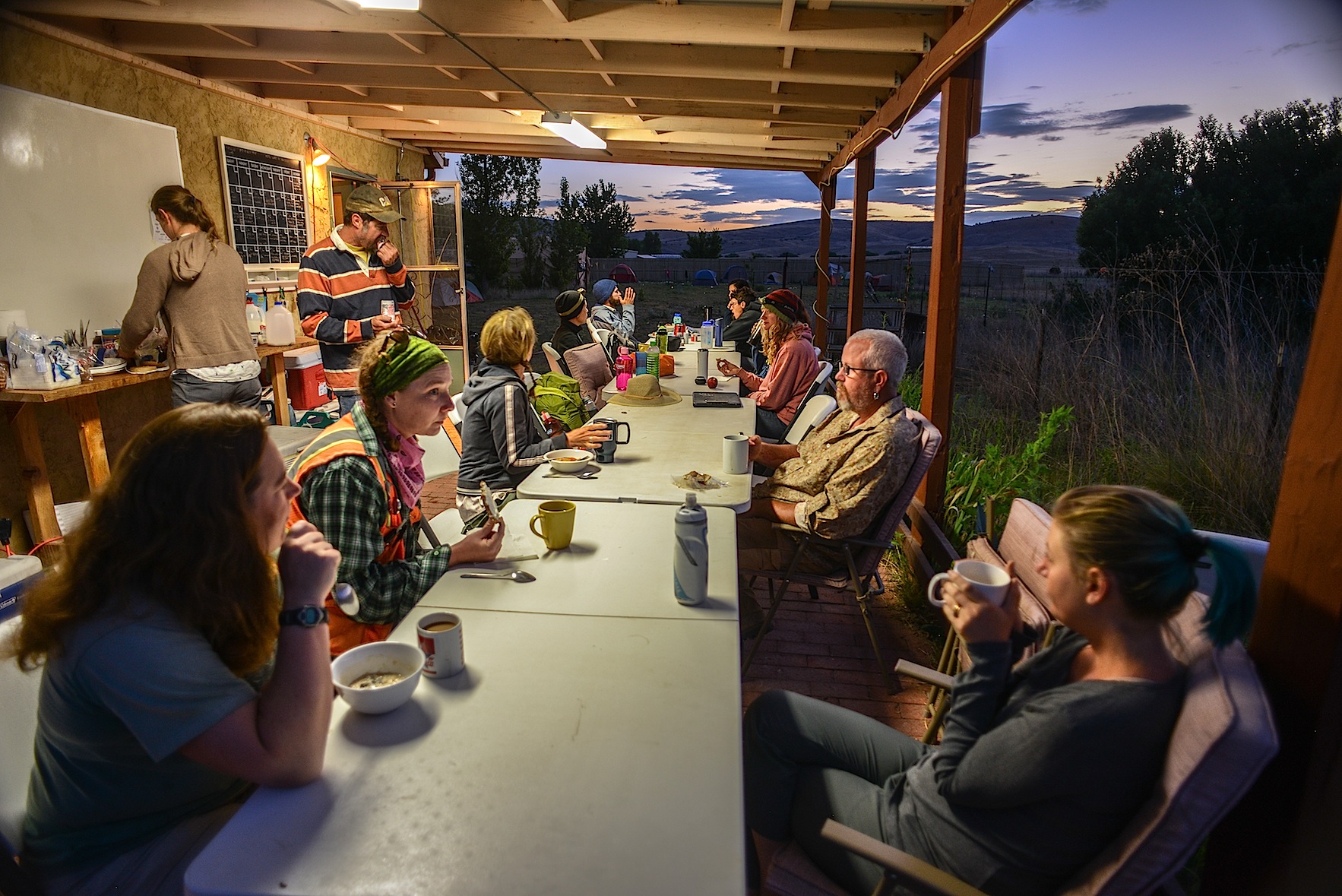
BREAKFAST can be the quiet time of the day as folks scurry around to make a lunch, finish breakfast and do the dishes and dash off for a full day in the sun.
The Archaeology Southwest Preservation Field School in it’s 5th season is an important component of our Upper Gila research, writes Karen Schollmeyer. “The results of this work contributes to Archaeology Southwest’s research on the formation and dissolution of late prehistoric communities. Dinwiddie’s occupation in the 1300s occurred during a period of substantial changes in the Southwest. Centuries earlier, large Classic Mimbres period villages were inhabited throughout the area. Around 1130, residents left these villages, and local populations remained small and scattered for the next 150-200 years. In the 1300s, large villages again began to form in the area. While people in the Upper Gila area were aggregated in large communities in the late 1300s, much of the rest of the southern Southwest was experiencing population decline. Our research examines the effects of the 14th century influx of residents to the Upper Gila. How did migrants from diverse cultural groups form cohesive villages? How did they structure social relationships with existing communities in their new home? How were social and natural resources affected by the long-term patterns of human population aggregation, dispersal, and re-aggregation? Our research at Dinwiddie will provide insights into these questions.”
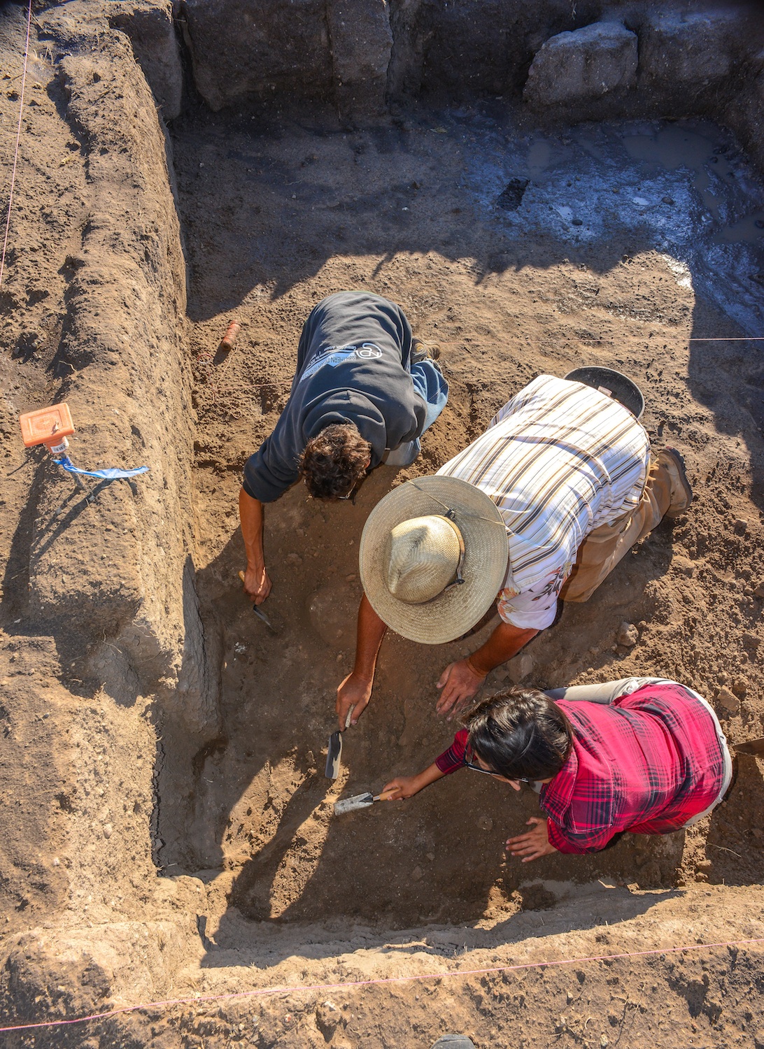
Archaeologist Will Russell from ASU works with Alexander Ballesteros and Alisha Stalley to get the knack of working with a trowel in an archaeological dig. The Dinwiddie site was dug
Will Russell, one of ASU’s ceramics experts, oversees the trowel work and lectures the students crawling in the dirt “to move
Negative Mimbres Pottery
from what you know to what you don’t”. Emphasizing the feel of the trowel and how it changes as it moves through the fill. “You can kinda feel these powdery, sugar forms on the floor, so you can see the visual clues…flecks of white (from the floor). You learn to read the vibrations he says. The trowel vibrates differently when hitting large particles and sounds differently–many different senses come in to play when excavating. Time is tight for the group they are half way through the 40 day class and they still have digging to do. Some of their time is filled with their preparation of displays for the community updates, reports, class trips to Silver City, the Gila Cliff Dwellings, Chaco Canyon, Acoma and the Zuni Pueblo. Screening is essential to separate the ceramics from the dirt and every fourth screen is window screen diameter to make sure nothing of importance is slipping through like the bones of fish and prairie dog which supplemented the prehistoric diet here in west central New Mexico.

A morning monsoon drizzle dampens breakfast as students prepare for a wet day in the field.
My first morning in Mule Creek where the field school is headquartered at the Rocker Diamond X Ranch there was a morning drizzle and students scurried around before sunrise eating breakfast, brushing teeth and making lunches and preparing for their day. Everyone has a job each day, each serves as a cog in the wheel and things happened smoothly until dinner when Mary shows up with dinner for the hungry staff, students and visitors. Students divide up into the field crews, survey and the experiemental crew who spend the day with archaeologist Allan Denoyer who is a master flintnapper and he and his crews are putting the finishing touches on a Salado Pueblo which they have constructed during the past field seasons. Denoyer has reverse engineered the adobe pueblos the field crews are excavating at the Dinwiddie Site with hopes the students will gain a greater insight into pueblos by building one as well as digging up what remains of numerous melted room blocks. Students learn to skin the timbers using stone axes and how to construct the roof. All knife work is from obsidian blades that slice as quick and accurately as steel.

Dinwiddie site under excavation near CLIFF New Mexico.
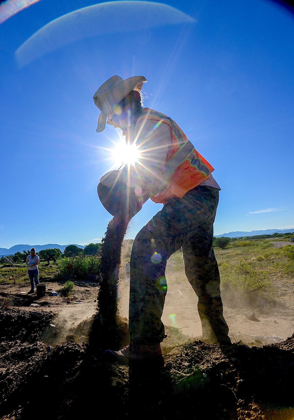
Field Supervisor LESLIE ARAGON pours off buckets of fill taken from the Dinwiddie Ruin dig. Three days will be spent back-filling the excavations with the soil they pain removed.
Students are responsible for blog posts, and displays for community outreach projects which hold public meetings in the region giving archaeologist the opportunity to explain to residents what they are looking for, what they found and often those exchanges open doors to archaeology not presently known and the field school survey crew go out looking for sites people tell them about. One student turned up a ten-room pueblo which was previously unrecorded. The survey crew often camps, to allow more boots on the ground than drive time. The easy duty appears to be the field work until you see there is no shade, students on their hands and knees with metal trowels pushing back the dirt from a solid polished adobe floor.

Ceramic marbles ? Fired in the flame and preserved but why ? Checkers, board games, marbles ?
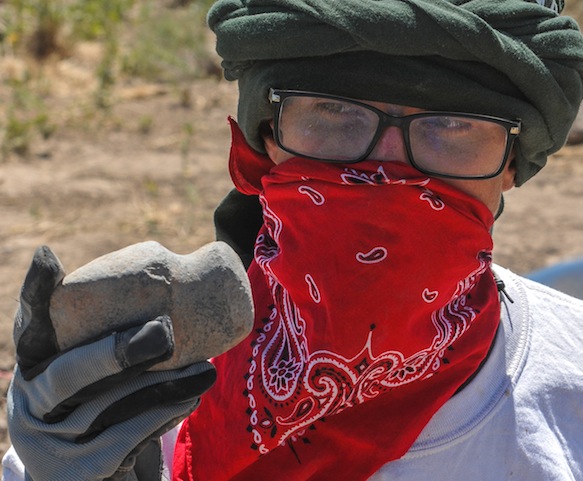
For the past few days they have turned up almost 50 ceramic marbles of varying diameters and for whose purpose is unknown, today, they turned up a nice 3/4 groove axe head next to the unique t-shaped doorway recently unearthed. At room one, a cry alerts us, a metate and a mano, together, intact–beautifully preserved.

A vocational archaeologist working in the 1960s and 1970s and some early work contributed important information to our knowledge of Salado archaeology.  These excavations did not follow collection and reporting standards of their era, and information from these older excavations is now unavailable. Collections from these excavations were housed in private museums and everything disappeared upon their owners’ deaths, scattering collections so that they are no longer available for research. The Dinwiddie site saw several field seasons of avocational excavation, with 37 rooms in two room blocks partially excavated by Jack and Vera Mills (1972) they are thought to have taken more than a hundred pots from these rooms, some of those pots reside today in Safford, Arizona at the Museum for Eastern Arizona State.
Archaeology SouthWest’s interest in the Cliff Valley “Dinwiddie” site came as a part of the Upper Gila research, using the field school as an important component of the research, searching for the formation and dissolution of late prehistoric communities. Dinwiddie’s occupation in the 1300s came at a time of big changes in the Southwest. Centuries earlier, large Classic Mimbres period villages had inhabited throughout the area. Around 1130, those residents left these villages, and local populations remained small and scattered for the next 150-200 years. In the 1300s, large villages again began to form. People in the Upper Gila moved into large communities in the late 1300s, while much of the southern Southwest was experiencing population decline. Karen Gust Schollmeyer, believes the Dinwiddie dig will provide insights into the 14th century influx of residents to the Upper Gila. In 2008, Archaeology Southwest received a National Science Foundation grant to study the Salado phenomenon in the greater Upper Gila region of southwestern New Mexico, an area traditionally assigned to the Mogollon archaeological culture area

EXPERIMENTAL FIELD SUPERVISOR ALLAN DENOYER THROWS THE ATLATL DARTS AT A DEER TARGET
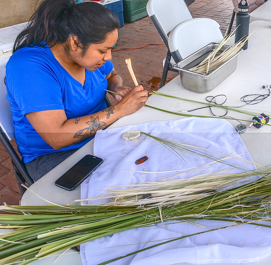
Marcy Pablo, a Tohono O’odham from Topawa prepares basket weaves for their “Community OutReach” Pablo intends to assist New Mexican residents to begin weaving their own basket using her starts. The School tries to lower barriers between locals and archaeologist by sharing their research with locals.

JOE HALL (Sierra Vista) and DEVINNE FACKELMAN (Allendale, Mich.) together dug up this Metate and Mano while searching for a wall.
“The Archaeology Southwest Field School was a life changing experience. I learned more about the southwest in those 6 weeks than in my two and a half years prior exploring in Southeastern Arizona. I had just graduated from Cochise College with a degree in Anthropology and immediately attended the ASW Field School with no real experience in archaeology. I am so fortunate to be given such a great opportunity to learn. From the field trips to the guest lectures, there was never a dull moment around the camp. Even in our down time we used the skills we had learned from experimental archaeology and our guests to do assorted crafts. The research the group of students accomplished was also inspiring, and attention grabbing. Post-field school I am more interested in Archaeology than ever. I plan to use my Non-Profit Leadership and Management degree at Arizona State University to get myself and others involved in the Archaeology field.”..Joe Hall

This Pueblo erected with the energy of field school students but with the same technology that the Mogollon used.
Field school students had some unstructured time in the evenings. But most worked on their field reports, blogs and burning designs

Archaeozoology – The study of animal remains, usually bones, from the past. Alexandra Norwood (Pasadena, CA) enjoys the final product.
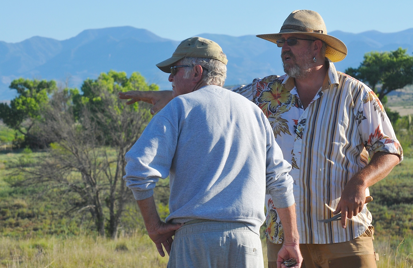
Field Supervisor Will Russell (ASU) fields questions from Bill Jamison, a Duck Creek resident for the past forty years. Jamison mentioned about 10 years ago, a burial fell into the creek.
The next morning at the Dinwiddie Dig a 40 year resident of the Duck Creek Community dropped by to visit the site and Will Russell was able to share with Bill Jamison the Field School’s focus and share with him some of what had been found. Jamison pointed out for a decade a burial eroded out of the river bank
and eventually was washed away. He did say a friend now living in San Diego had collected enough sherds to completely restore three pots and Russell asked him if photos were available or if they could be sent Another lead to another piece of the puzzle.

VICTORIA BOWLER shows ALEXANDAR BALLESTEROS how to throw ATLATL darts. Bowler works as an archaeologist and interpreter at Fort Bowie and Chiricahua National Monument and feels this field school will allow her to put these new ideas into practice.

Mixture of water and mud

Flintknapper Allan Denoyear made these two points at the field school for his orientation discussion.

Allan Denoyer mixes adobe mud for the walls of the pueblo.

JODI REEVES-FLORES (ASU) adds a layer of mud to the walls of the adobe Pueblo.
Digital Antiquity is a nonprofit grassroots effort to get all Archaeological data archived by creating a multi-institutional, non-profit organization dedicated to overseeing the use, development, and maintenance of the Digital Archaeological Record (tDAR), an international repository for the digital records of archaeological investigations, organizations, projects, and research.

Students listen to a digital workshop produced by ASU’s Jodi Reeves-Flores on Digital Antiquity’s tDAR, an archaeological online data base where data input will be preserved, and reinterpreted as a piece of the whole.
One of Digital Antiquity’s key objectives is to foster the use of tDAR and ensure its financial, technical, and professional sustainability. Use of tDAR has the potential to transform archaeological research by providing direct access to digital data from current and historic investigations along with powerful tools to analyze and reuse it.
Digital Antiquity was created through the collaboration of archaeologists, library scientists, and administrators from the Archaeology Data Service, the University of Arkansas, Arizona State University, the Pennsylvania State University, the SRI Foundation, and Washington State University.
By enhancing preservation of and access to digital archaeological records, the mission of Digital Antiquity to permit researchers to more effectively create and communicate knowledge of the long-term human past; enhance the management, interpretation, and preservation of archaeological resources; and provide for the long-term preservation of irreplaceable records
Using Decorrelation Stretch to Enhance Rock Art Images
By Jon Harman, Ph.D. (dstretch@prodigy.net) Web site: http://www.DStretch.com
Decorrelation stretch, an image enhancement technique first used in remote sensing, can be usefully applied to rock art. In pictograph images from Baja California, Utah and Arizona I demonstrate its ability to bring out elements nearly invisible to the eye and to improve visualization of difficult sites. A decorrelation stretch plugin to the imaging program ImageJ is available from the author, free for personal use. It’s free but suggested contribution is $50. You can make a contribution via PayPal. My account is JonHarman “at” prodigy.net, if you want to send a check you will find his address on the email he sends back.

Lizard shaped pictograph in a cave near Mulege BAJA Sur…. This rock art is made with paints perhaps from crushed rock with iron.
Decorrelation stretch was developed at JPL and it has been used in remote sensing to enhance multispectral images. NASA used it to enhance Mars Rover images. DStretch has become a very useful tool for archaeologists

Filtered photograph of Lizard now only shows a hand print which was made by an artist filling his mouth with paint and blowing it through a reed toward his hand on the rock.
involved in the study and documentation of rock art. Its enhancement techniques can bring out very faint pictographs almost invisible to the eye. Subtle differences in hue are enhanced to puzzle out faint elements. Use of DStretch is simple as just hitting a button, but it also contains sophisticated tools for the manipulation of false color images. Because the enhancement works by increasing differences in hue, the technique gives better results for pictographs than petroglyphs.
The technique applies a Karhunen-Loeve transform to the colors of the image. This diagonalizes the covariance (or optionally the correlation) matrix of the colors. Next the contrast for each color is stretched to equalize the color variances. At this point the colors are uncorrelated and fill the colorspace. Finally the inverse transform is used to map the colors back to an approximation of the original. DStretch supports several different colorspaces, the image is converted from RGB to the colorspace, the calculation and transformation is performed, and then the colors are converted back to RGB before writing into a digital image.

Cave in Northern Baja along Highway One
The most common color found in pictographs is red, followed by black, then white, then rarely other hues. Often the rock shelter or cave wall is reddish or blackened. There are common types in the color distributions of pictograph images and this causes a consistency in the decorrelation stretch enhancements. DStretch works well to enhance red pigment but suppresses white and blacks. By bringing out the red painting and suppressing the background shades it can help clarify image composition.
DStretch is a plugin to ImageJ which is a full-featured imaging program. It is written in Java and can run on PC’s, Mac’s and Linux computers. When the button is pressed the plugin calculates the covariance matrix of the image colors (within the chosen colorspace) and then determines the transformation. Different decorrelation results are possible by selecting different parts of the image.
Different colorspaces give different results. DStretch has implemented the algorithm in the standard RGB and LAB colorspaces and also in the colorspaces: YDS, YBR, YBK, LDS, LRE. These colorspaces are modifications of the YUV or LAB colorspaces that give good decorrelation stretch results on images of rock art. The YDS and LDS colorspaces are good for general enhancements and can bring out faint yellow pigments. YBR and espeically LRE enhance reds. YBK can help with black and blue pigments and also enhances yellows well. The user can design their own colorspaces using the YXX and LXX buttons. The enhanced image is false color, the color scan be radically different from the original. In Expert Mode DStretc has the ability to shift the hues in the enhanced image to increase contrast.
CLICK HERE FOR SLIDE SHOW OF ROCK ART USING FALSE COLOR TO PRODUCE ADDITIONAL DETAIL…
http://pkweis.photoshelter.com/gallery/ROCK-ART-FILTERS/G0000oUHzJSUXcUI
Each image enhances differently, depending on its own unique distribution of colors. Another useful enhancement technique, not related to decorrelation stretch, is the manipulation of the hue and saturation of the image. DStretch (in expert mode) can do hue histogram equalization and saturation stretching. DStretch also contains a tool that allows a region of the enhanced image to be isolated by hue and then added back to the original image. This can be used to isolate an enhanced element then return it to the original image.
http://pkweis.photoshelter.com/gallery/ROCK-ART-FILTERS/G0000oUHzJSUXcUI
3D Scanning: Cultural Heritage and the Arts
Using 3D or “White Light” Scanners can uncover details from the past and today there is no better way to record a complex object than with a high resolution 3D white light scanner. The fringe projection method used in 3D white light scanning make non-contact digitization of art and sculpture and historical artifacts possible. Direct comparisons can be made of dimension and shape. Structured light Scanning allows revisitation of any object over time, creation of databases, redrawings of cross sections and 3D volume calculations. Today 3D scan data has a growing value in archaeology, paleontology and cultural heritage, collection of 3D scan data provides a digital archival record allowing access in remote locations, and the ability to produce replicas useful for exhibits.
One strategy under consideration at the Preservation Field School is the possibility of being able to actually see the “fingerprints” of the potter in ceramics. If that study moves forward there is a hope that not only will archaeologists know where the “Ancient Ones” went, they may be able to follow the fingerprints of a single women walking across an prehistoric landscape to her final resting place.
Kristin Safi in this month’s Kiva Journal outlines his “least cost” migration routes from the San Juan region to the Rio Grande Pueblo area. In this study 1200 possible routes are identified but many overlap and others had more costly terrain boiling the study down to 30 routes but when known archaeological sites were factored in, five routes were identified as the probable exodus path taken by the Kayenta Anasazi as they left the Northeast Arizona. Three of the routes probably were used by the later migrations because closer Pueblos were filled up earlier by early migrations. As for the question, “Where did the Ancient Ones go!” Not only do we know where the Kayenta went, we know why. FEAR!
![]()
<a href=” SPANISH TRANSLATIONS:">
TUCSON’S NEW SKATE BOARD GENERATION CATCHES WAVE TOWARD THE NATIONS BEST SKATESCAPE …
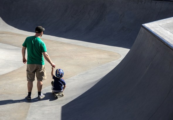
 The first skateboarding wave washed across the United States in the 1960’s. Like all fads from the coast I had seen the hula-hoop and had little hope skateboarding would last long, locals nailed their sister’s skates to the bottom of a board and went for the downhill. You either knew if you were a skater or not, I was not the right stuff and knew it instantly. Historically the first skate park was made of plywood on a half acre sand lot in Kelso, Washington in 1966 and it had lights. The first modern concrete skate park opened in 1976 in Port Orange Florida and Carlsbad California, followed by indoor parks in less temperate climates but high insurance premiums caused the first wave of skateboarding died in court, but realized a resurgence followed in the United States when legislation in states like California’s 1998 law that said skateboarding is an inherently “Hazardous Recreation Activity” and cities will not be held liable for claims of negligence resulting in a skateboarding injury. Skateboard construction improved and skate parks have become more common.

TUCSON’S 22ND STREET SKATE PARK
 Today some cities put in skate parks with features not designed for skateboarding, but are street legal for skaters, other not. Tucson’s has a number skate parks in different parts of town, Tucson was once one of the best skateboarding scenes in the country, which is a little known fact about earlier times when Tucson skateboarders had permission to skate “THE BLOCKS” at El Presidio Plaza after 5pm until 1994. Rumor has it Skateboarders got the skate park at Randolph Park in exchange for no longer skating at “The Blocks” downtown. Today Tucson Skateboarding is a new force and has hopes of becoming politically active and wants to approach the city council in hopes of taking back “The Blocks”, and Tucson’s claim to top ten spots in the US to skate. Downtown Tucson has a new skateboarding shop opened by two brothers Kenzo and Zen Butler and their partner Jerry Jordon have moved into The Arches, a high ceiling warehouse at 35 E. Toole Ave and have spacious floor space and stylish fashions, boards at their The BLX Skate Shop dedicated to the “Golden Age of Skateboards” and the Skateboard culture which has its own set of values and language. Since downtown is the heart of this skateboarding culture, BLX is pronounced “Blocks” named for the feature now off-limits to skaters, but a short distance away.


 Skateboarding is a popular recreational activity among children and teenagers — especially boys. In recent years, skateboarding spin-offs, such as long-boarding and mountain boarding, have become increasingly common. Although it is a fun activity, skateboarding can result in a serious injury.
  In 2011, skateboard-related injuries accounted for more than 78,000 emergency room visits among children and adolescents 19 years old or younger. On average, about 52% of skateboard injuries involve children under age 15. Eighty-five percent of the children injured are boys. Many injuries happen when a child loses balance, falls off the skateboard and lands on an outstretched arm. Skateboarding injuries often involve the wrist, ankle, or face. Injuries to the arms, legs, neck and trunk range from cuts and bruises to sprains, strains, and broken bones. Wrist fractures are quite common. Wearing wrist guards can reduce the frequency and severity of these fractures. Facial injuries, such as a broken nose or jawbone, are also common. Severe injuries include concussion and other head injuries. There are many things that parents and children can do to help prevent skateboarding injuries, such as carefully selecting safe places to ride, and wearing protective gear, especially helmets. According to the American Academy of Pediatrics, children under age 5 years should not ride skateboards. Children aged 6 to 10 years old need close supervision from an adult whenever they ride a skateboard.
Practice tricks and jumps in a controlled environment, such as a skate park that has adult supervision and appropriate access to emergency medical care.
Be considerate of fellow skateboarders, especially those who are younger and/or less skilled. Take turns on ramps or other equipment.
Learn the basic skills of skateboarding, especially how to stop, slow down, and turn. Be able to fall safely: If you are losing your balance, crouch down on the skateboard so that you will not have as far to fall. Try to land on the fleshy parts of your body rather than your arms. Relax and roll.
Skateboard according to your ability level. Skateboarding skill is not acquired quickly or easily. Do not take chances by skateboarding faster than your experience allows, or faster than is safe for the surrounding conditions.
Practice and master each skill before moving on to a more challenging trick. Staying in good physical condition can help to prevent skateboarding injuries.

Directions to follow to Santa Rita Skate Park I-10 Fwy Westbound – exit Starr Pass Blvd/22nd St, take 2nd right at 22nd St, left at 3rd Ave into Santa Rita Park. 
Albert M. Gallego Skate Park Santa Rita Park 3rd Ave and 22nd St GPS 32.207522,-110.963395 Date Opened 2009 Square Footage 12,000 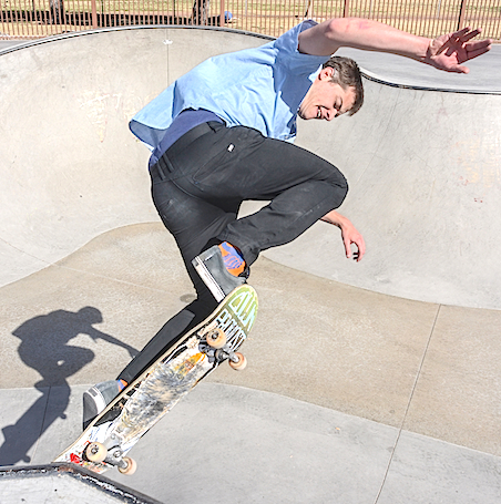 Just off the 10 Fwy in Tucson lies Santa Rita Skatepark.
The Albert M. Gallego Skate Park is located within the Santa Rita Park and should be on your list of places to go. This park opened in 2009 after almost 10 years of fundraising and plan changes. Santa Rita consists of three separate bowls: The Bonnie Bowl (a 12’ deep keyhole), a 4-6’ deep flow bowl, and a good size kidney. The Bonney Bowl is a classic 80’s style keyhole. It felt 12’ deep and fast. The shape is not perfectly round, but slightly squashed and the lip is finished with tiles and orange pool coping. The flow bowl varies in depth from 4′ to 6′ with a clamshell in the middle and a couple of hips. The bowl is finished with metal coping. The last bowl is a righthand kidney with an 8′ deep end and 3′ shallow end. This bowl is pretty mellow and good for beginners learning to carve. Santa Rita skate park opens at 6am and has lights until 10:30pm, which is necessary considering the daytime heat of the desert.
Now go check this one off.


WORLD’S LARGEST SKATE PARK….CLICK HERE
MORE PHOTOS FROM THE 22ND STREET SKATE PARK CLICK HERE
ARIZONA’S BEST SKATE PARKS…CLICK HERE
TUCSON’S BEST SKATE PARKS….CLICK HERE
<a href=” SPANISH TRANSLATIONS:">CLICK HERE FOR SPANISH
SOUTHWEST BORDER WARS or MEXICO: THE WAR NEXT DOOR
 ”
”
“PECK CANYON is heavily patrolled and the terrain rugged.”
Few saw that the US-MEXICO BORDER would tear apart families or tribes whose cultures and languages are threatened but the cities that sprang up on both sides were predictable the division created entrepreneurial opportunity which sprung from the law, culture and needs of society. The international border became a way of life, a geological oddity (like the Grand Canyon) right in their own backyard, if their property had backed up to a great viewpoint they would have set up a pay parking lot and required admission.
The fence or border brought traders who provided the needs of the locals, like Sasabe Merchantile sells both parlor and kitchen stoves all wood-burning and priced for a population where electricity and gas are a new world commodity. Until recently, places like the San Miguel Gate, (a strip of no man’s land) became a row of boxes and traders on Saturday mornings who tried to sell goods to folks who needed their products from either sides of the border.
Recently I spoke with a young man who grew up in the Peck Canyon corridor and he believed crossings may be down “but business was being done, and if a load needed to go, it went and arrived intact! Business has been conducted through Peck Canyon since the day when Geronimo used those foothills’s perfect cover as he made tracks for the border. In our last posting, a local deer hunter said, “all border traffic was being funneled into Peck Canyon” much of this because of the high-tech sensing equipment elsewhere and the high profiles of the National Guard and additional manpower to the Border Patrol.
Unique to Peck Canyon, is the mixing of wilderness and residential, its close proximity to dense high
desert terrain and I-19, which is next to the large Border Patrol Checkpoint on I-19. I thought it would be quite easy for drug cartels to own several houses along I-19 where folks could move north from one house to another, for $5000 a head, many things are possible, like tunnels. Locals can think of four or five houses that might fit that description or have, from time to time. Likewise, the bandits who prey on crossers and smugglers alike, they probably live right there and know the terrain like the back of their hand and could be watching TV while border patrol searches.
Maybe, these Border businessmen started out young as mules! Perhaps, in the beginning they carried marijuana on their backs into the US, for $200 a pound, forty pounds equals $8000, 50 pounds or $10000, whatever they could carry quickly. Once in, they drop their load in a remote spot and hotfoot back to Mexico. When they drop their packs a man on a hillside watches and carefully telephones “his crew” who he directs to the load and they bring it further north. For decades, people have stuffed their doors and wheel wells full with pounds of grass and more than 200 pounds might be stuffed into a single ride to travel north without a second look. Driver of a loaded car might make $2000 traveling between Rio Rico and Tucson where the keys are passed to new driver to take the car on into Phoenix. This practice limits anyone person having full knowledge of the network. Lots of stolen or borrowed cars end up abandoned in the desert and they are quickly stripped by yet other border entrepreneurial opportunity. Living on the border separates families and social responsibilities can collide with professional responsibilities may result in a phone call home where an agent tells his wife he is stopping for bread on the way home. That might mean he will not be on a certain mountain and that route will be open for cousin Jaime to bring his load through. Some people living on the line, say “it business!” and others, call it “family”. Anything is possible, here. If a load needs to go, it does so successfully!
Here are some links to recent articles on the Peck Canyon and its every growing violence and how the cartels are pushing back against Mexico and USA …
A Border Patrol swat team member was shot and killed Tuesday night in a gun battle with suspected bandits south of Tucson. Agent Brian A. Terry, 40, was killed when his team exchanged fire with a group of five people about 11 p.m. in a remote area west of Rio Rico, said the FBI. Four of the five suspected bandits were in custody Wednesday morning, including one man who was hospitalized with gunshot wounds. Border Patrol since “have buttoned down the Pena Blanca Lake area” covering all the squeeze points and by placing agents on quads and horseback into the interior they are looking for a fifth member of the group. The shooting occurred in a remote area near Forest Service Road 4197, west of Interstate 19, said Santa Cruz County Sheriff Tony Estrada. When deputies arrived at Peck Canyon Drive and Circulo Sombrero in Rio Rico, they found Terry dead of gunshot wounds, Estrada said. The remote area where the shooting occurred is an area frequently used by drug traffickers and people-smugglers.”All these canyons in Santa Cruz County are notorious for smuggling humans and drugs,” Estrada said. “Obviously, it is a very dangerous situation for anyone patrolling those remote areas, particularly for Border Patrol. There is always that threat.”Santa Cruz Sheriff’s Department was only serving in a support role, Estrada said. The FBI is handling the investigation.”Our thoughts and prayers are with the Terry family for their tragic loss,”
Border Patrol Agent Brian A. Terry was shot and killed Tuesday night in a fire fight with suspected bandits near Rio Rico, south of Tucson.


VIDEO: Mexico the War next Door…

Mexican Crime Reporter Speaks Out
RARE TWISTERS SLAM NORTHERN ARIZONA

 Last Wednesday four or more Tornados slammed into Northern Arizona while I was driving from Tucson to the North Rim of the Grand Canyon, I had left Tucson 6am and was just 30 miles from Flagstaff when I heard a radio severe weather warning advising everyone to be on the lookout for funnel clouds until 11am. Around noon, another twister was reported off 1-17 about where I heard the first reports. Apparently around 5:30 am two f1 tornados hit Bellemont, Az with more than a 100 mph winds ripping off roofs, rolling semis trying to sit out the storm and then derailed a freight train, damaging 200 homes before moving north toward Flagstaff. This tornado or another later dropped suddenly into the forest west of Flagstaff cutting a mile-long path through the forest, across AzHwy 180 and eventually mowing down 250-300 fir and aspens. Many of these trees were 40′-50′ in height, some were topped, others snapped at the base, even more were pulled from the ground–roots and all. While there were no serious injuries most folks in this neck of woods won’t soon forget the Day of the Tornados.
TUCSON’S FIRST DAY OF AUTUMN


Preparing for flight on the PINAL PIONEER PARKWAY Thursday Morning ten TURKEY BUZZARDS warmed and dried their wings against the Morning Sun near the entrance to the FALCON VALLEY RANCH on AZ HWY 79 nine miles north of Oracle Junction. These area has been recognized as a key spot for raptor viewing, even an osprey has nested nearby, the Turkey Buzzards are an added bonus. The Turkey Vulture is common in the United States, its keen sense of smell is vital for finding carrion, contrary to popular belief, this bird enjoys plant matter as well. The Turkey Vulture soars above the ground for most of the day, searching for food with its excellent eyesight and highly developed sense of smell. Extremely non-confrontational, the Turkey vulture will not feed on live prey, an occasional habit of its cousin the black vulture. Turkey Vultures, like these, are often seen along roadsides, cleaning up roadkill. The turkey vulture is one of the most skilled gliders among the North American birds. It migrates across the continents with minimal energy output. Vultures launch themselves from their perches only after the morning air has warmed. Then, they circle upward, searching for pockets of rising warm air, or thermals. Once they have secured a thermal, they allow it to carry them upward in rising circles. When they reach the top of the thermal, they dive across the sky at speeds near 60 miles per hour, losing altitude until they reach another thermal. All this is done without the necessity to flap. In fact, the turkey vulture can glide for over 6 hours at a time without flapping a wing! …
BARREL CACTUS TIME

Landscape photography requires the photographer to have a link with the land, he must be attuned to the weather, the time of year, the movements of the moon and sun, blooms and fall-all things natural, but often out of sight and out of mind, not something city-dwellers easily track. Therefore the challenge, Ansel Adams described the landscape photograph as often the source of great hope and often the source of severe disappointment, it’s hard to keep it all together and be there when great things happen, unfold and become a lasting digital moment. That doesn’t mean that untold numbers of photographers won’t strive to accomplish what Ansel Adams did, with every breath they take. His record selling “Moonrise Hernandez New Mexico” was one of those “drove into the ditch, threw up the tripod, slammed in a film holder into his camera, pulled the slide, guessed the exposure, made the exposure, light faded. Then he pulled a light meter and made his readings and developed according. Hernandez New Mexico print sold recently for $609,600, more recently, the Adam’s photo “Winter Storm clearing” has sold for $722,000.00 bypassing all other Adam’s photos for a price paid. I asked Ansel about “Winter Storm clearing” once he said that he often visited that view and some times there was a photo but often nothing and he drove on. So luck, has a lot to do with Ansel Adams “luck” but his diligence and tenacity always the deciding factor, he was out there working and checking out ideas that may bear fruit, but maybe not today, keep checking. Years ago I decided that Landscape work needed total devotion and tried to devise ways of improving my chances, without living in the desert the rest of the year. A few tricks that help, the moon calendar on this website’s blog roll, tells you when the full moon will present itself, it also shows you the dark of the moon, for night shots. The AZ Highways scenic drive and monthly event calender gives you ideas of pretty drives that can dove-tail with up-coming events like the Fort Verde Days October 8 thru 10, lots of living history, drilling, posing for tourists. Maybe enroute or on the way home you decide to visit wet Beaver Creek, the road travels across several one-lane bridges and a country boarding school to the V-Bar-V Heritage Site, where after a short half-mile hike, visitors can see more than 1,300 petroglyphs depicting everything from snakes to humans with walking sticks. A nice diversion, breaks up a long drive and a good thing to shoot mid-day and gives you some variety and more bang for your buck.<!–
SW SPRINGPK WeisI have a habit of picking up rocks along the way and over the years I find myself with a huge rock garden and in the nooks and crannies of these rock, cactus adorn and bloom annually right in my backyard. Frequently cactus blooms at home fill in the blanks when I need a particular bloom but better still it keeps me in touch with the desert and when I notice the blooms in my garden I realize things are heating up out in the Sonoran Desert and I might do well to take a look.

THE COLORADO RIVER IS 2013’s “MOST ENDANGERED RIVER” ARE WATER BANKS AND RATIONING, OUR FUTURE?

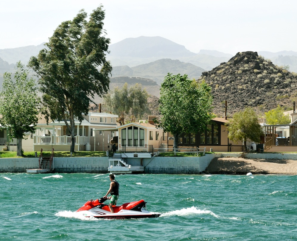
WILL THIS POPULAR ARIZONA, CALIFORNIA AND NEVADA PLAY GROUND RUN DRY?

THE CAP IN TAKES WATER BENEATH HOOVER DAM.
What happens next year? “Maybe we’ll have a wet year”, seems to the extent of the plan, it’s a lot like me buying lottery tickets for my retirement, its proactive, optimistic but nothing to take to the bank.
I visited the New York Times, the editorial page of the Salt Lake Tribune, the Las Vegas Headlight-Sun, the Los Angeles Times and the Arizona Republic to see how each spun the story about Lake Mead facing shortages. Perhaps the best story I found was a gardening column for the LA Times, complaining that they were getting mixed signals whether or not they should put in lawns. The Vegas spin was more sobering when you realize Sin City gets 90 percent of its drinking water from Mead. Vegas has two large siphons attached to the lake and a third under construction, they are scared–by the end of the year one siphon may be above Mead’s water level and worthless. The new siphon runs through the bottom of the lake and will be able to literally suck Lake Mead dry. Nobody believes that will happen-but the new siphon is nearing completion in spite of setbacks. The Southern Nevada Water Authority has begun pursuing permits necessary to build a $3.5 billion, 300-mile pipeline to shuttle water from the mountains in northern Nevada, many question the plan.
Southern California believes every time a sprinkler is turned on, choices are being made between lawns and their fisheries and still-no one believes anything will change until the courts start ordering changes. Already California water companies are trying to linkup with snow melt from the Northern High Sierra, just in case, they say. Lake Mead’s reservoirs have reached 1087 feet for the first time since 1956 when the lake dropped ten feet in order to fill Lake Powell. These twin reservoirs will require years of snow melt and runoff to make up the deficit and tree ring dating data frankly doesn’t support that optimism, it does suggest the droughts since 1990 frankly are nothing out of the ordinary and things could get worse. Utah has a $2billion “pie-in-the-sky” pipe line planned to bring more water from Lake Powell…water that might not be there. Kinda of reminds me of the Hohokam, all we really find of them are the water canals they built to bring water to the desert and therefore brought life itself.
In Phoenix, the Arizona Republic reports Lake Mead water levels determine drought status on the river under a set of guidelines adopted in 2007 by the seven Colorado River states: Arizona, California, Nevada, Utah, Wyoming, Colorado and New Mexico. If the lake reaches the first drought trigger, measured at an elevation of 1,075 feet above sea level, water deliveries below Lake Mead are reduced by a little more than 10 percent. Additional cutbacks would occur if the lake continued to drop. For Arizona, the stakes are high. Arizona absorbs 96 percent of any water rationing on the river under a decades-old agreement that ensured construction of the 336-mile CAP Canal. Nevada absorbs the other 4 percent under a separate deal with Arizona. Although rationing would affect some users on the river in western Arizona, most of the cuts would come from the canal, whose annual flow of 1.5 million acre-feet would be reduced in stages. (An acre-foot is 325,851 gallons, enough to serve two average families for one year.)
Farmers and users of excess water, such as underground-storage programs, would be affected first. It’s unlikely cities and business in Phoenix and Tucson would lose any water in the earliest stages.

IN SAN LUIS BAJA NORTE MEXICO THE RIVER IS DRY LESS THAN TEN MILES SOUTH OF THE BORDER
“It’s a clear warning,” said Tim Barnett, a scientist and Lake Mead expert from the Scripps Institution of Oceanography who sounded the alarm in 2008 that Mead had a 50% chance of running dry by 2021. “The thing that’s astounding to me is the head-in-the-sand attitude of the bureaucrats that we’ve talked to.” “The water situation in Southern California is serious,” he added, “But I don’t think it’s dire yet. Six months or a year from now, we might not be using ‘serious.’ ‘We might be using dire'”.
During the last decade the Southwest has loss snow pack, vegetation and endured serial wildfires and increased temperature and all the while the region has grown faster than any other part of the US. Study after study predict that climate change will reduce the banked snow pack from 6 to 45 percent over the next half century. Every year more water is drained than deposited with an annual deficit of 1.6 million acre-feet, still without a “full-fledged crisis” most folks won’t do anything. In Las Vegas, for instance”, the “Cash for Grass” program pays homeowners $1-per-square-foot to convert to desert landscaping.
In 2007 the Feds mandated an agreement between the seven US states sharing the rivers flow. The lowest reduction cuts deliveries by 333,000 acre-feet, about half of what Las Angeles consumes in a year. Should the lake’s surface fall another 12 feet to 1075 feet below sea level or about 33 percent capacity. some say this will happen next year. When the 28.5-million-acre-foot reservoir’s surface hits 1,050 feet, or about 26 percent capacity, deliveries get slashed by 417,000 acre-feet, Las Vegas shuts down one of its two intakes and Hoover Dam’s massive turbines lose the hydraulic pressure needed to generate electricity. The maximum cutback of 500,000 acre-feet kicks in when Mead surfaces hits 1,025 foot, or about 20 percent capacity.

YUMA WATER USERS
The mighty Colorado carries the lifeblood of the Southwest. It services the water needs of an area the size of France, in which live 40 million people. In its natural state, the river poured 15.7 million acre-feet of water into the Gulf of California each year. Today, twelve years of drought have reduced the flow to about 12 million acre-feet, and human demand siphons off every bit of it; at its mouth, the riverbed is nothing but dust.
The U.S. intelligence community understands what is happening, according to one report released last year, the global need for water will exceed the global supply of “current sustainable water supplies” by 40 percent by the year 2030…
SOUTHWEST DROUGHT ENDS LIFE 700 YEARS AGO … WILL TUCSON be the next CHACO

WATER is always a emotional topic in the Southwest United States. Talk of water rights and who owns the rights to Green Valley’s CAP allotment, can they sell it and who can use the Central Arizona Project will always be big news and the fights will just get bigger and more important as time goes by. The new CAP spur being built to Green Valley is said allow the new ROSEMONT MINE access to all the water they will need but what about LOS ANGELES and LAS VEGAS, I thought these U.S. cities got whatever water that was left over and wasn’t sent south to MEXICO and we owe MEXICO water by TREATY. Shall we assume since the mine will not have to pump ground water that its construction on the slopes of the Santa Rita Range is now a slam dunk. Better get used to the idea says Congresswomen Gabbie Giffords. According to Giffords, there has never been a Copper Mine not allowed to be built in ARIZONA because of the 1872 Mining Law, a law written, passed and enacted long before Global Warming

Abandoned due to drought which made farming impossible, fuel scarce and building supplies 50 miles away.
PETERMANN GLACIER, WE BARELY KNEW YOU !

Satellite images of the Petermann Glacier in Greenland before and after breaking off
Monday, August 9, 2010 – 20:39

On the 5th of August we reported that a massive chunk of the Petermann Glacier broke off in Greenland, this was the biggest chunk of ice to break from the Petermann Glacier in a long time. Nasa recorded satellite images of the ice after and before it broke off so we can easily compare the two and see just how big this chunk of ice was.
According to NASA:
On August 5, 2010, an enormous chunk of ice, roughly 97 square miles (251 square kilometers) in size, broke off the Petermann Glacier, along the northwestern coast of Greenland. The Canadian Ice Service detected the remote event within hours in near real-time data from the Moderate Resolution Imaging Spectroradiometer (MODIS) on NASA’s Aqua satellite. The Peterman Glacier lost about one-quarter of its 70-kilometer (40-mile) long floating ice shelf, said researchers who analyzed the satellite data at the University of Delaware.
The Moderate Resolution Imaging Spectroradiometer (MODIS) on NASA’s Terra satellite captured these natural-color images of Petermann Glacier 18:05 UTC on August 5, 2010 (top), and 17:15 UTC on July 28, 2010 (bottom). The Terra image of the Petermann Glacier on August 5 was acquired almost 10 hours after the Aqua observation that first recorded the event. By the time Terra took this image, skies were less cloudy than they had been earlier in the day, and the oblong iceberg had broken free of the glacier and moved a short distance down the fjord.
Icebergs calving off the Petermann Glacier are not unusual. Petermann Glacier’s floating ice tongue is the Northern Hemisphere’s largest, and it has occasionally calved large icebergs. The recently calved iceberg is the largest to form in the Arctic since 1962, said the University of Delaware.
UPDATE: STOCKHOLM — An island of ice more than four times the size of Manhattan is drifting across the Arctic Ocean after breaking off from a glacier in Greenland. Potentially in the path of this unstoppable giant are oil platforms and shipping lanes – and any collision could do untold damage. In a worst case scenario, large chunks could reach the heavily trafficked waters where another Greenland iceberg sank the Titanic in 1912. It’s been a summer of near biblical climatic havoc across the planet, with wildfires, heat and smog in Russia and killer floods in Asia. But the moment the Petermann glacier cracked last week – creating the biggest Arctic ice island in half a century – may symbolize a warming world like no other.
“It’s so big that you can’t prevent it from drifting. You can’t stop it,” said Jon-Ove Methlie Hagen, a glaciologist at the University of Oslo.Few images can capture the world’s climate fears like a 100-square- mile (260-sqare-kilometer) chunk of ice breaking off Greenland’s vast ice sheet, a reservoir of freshwater that if it collapsed would raise global sea levels by a devastating 20 feet (6 meters).
The world’s newest ice island already is being used as a powerful emblem in the global warming debate, with U.S. Rep. Edward Markey of Massachusetts suggesting it could serve as a home for climate change skeptics.Researchers are in a scramble to plot the trajectory of the floating ice shelf, which is moving toward the Nares Strait separating Greenland’s northwestern coast and Canada’s Ellsemere Island. If it makes it into the strait before the winter freeze – due to start next month – it would likely be carried south by ocean currents, hugging Canada’s east coast until it enters waters busy with oil activities and shipping off Newfoundland.”That’s where it starts to become dangerous,” said Mark Drinkwater, of the European Space Agency.
Update by Karl Ritter/AP


