
IN TOUCH WITH THE MIMBRES, MOGOLLON, SALADO PROBLEM IN MULE CREEK NEW MEXICO, SOUTHWEST ARCHAEOLOGY FIELD SCHOOL PROBES FOR ANSWERS


Using Stone Axes DIANA TREVIZO and ALEXANDRA NORWOOD try to scrape the bark from the roof poles for the 13th Century Pueblo they are building near Mule Creek, New Mexico. They are building a adobe pueblo at the same time they are digging one up near Cliff.
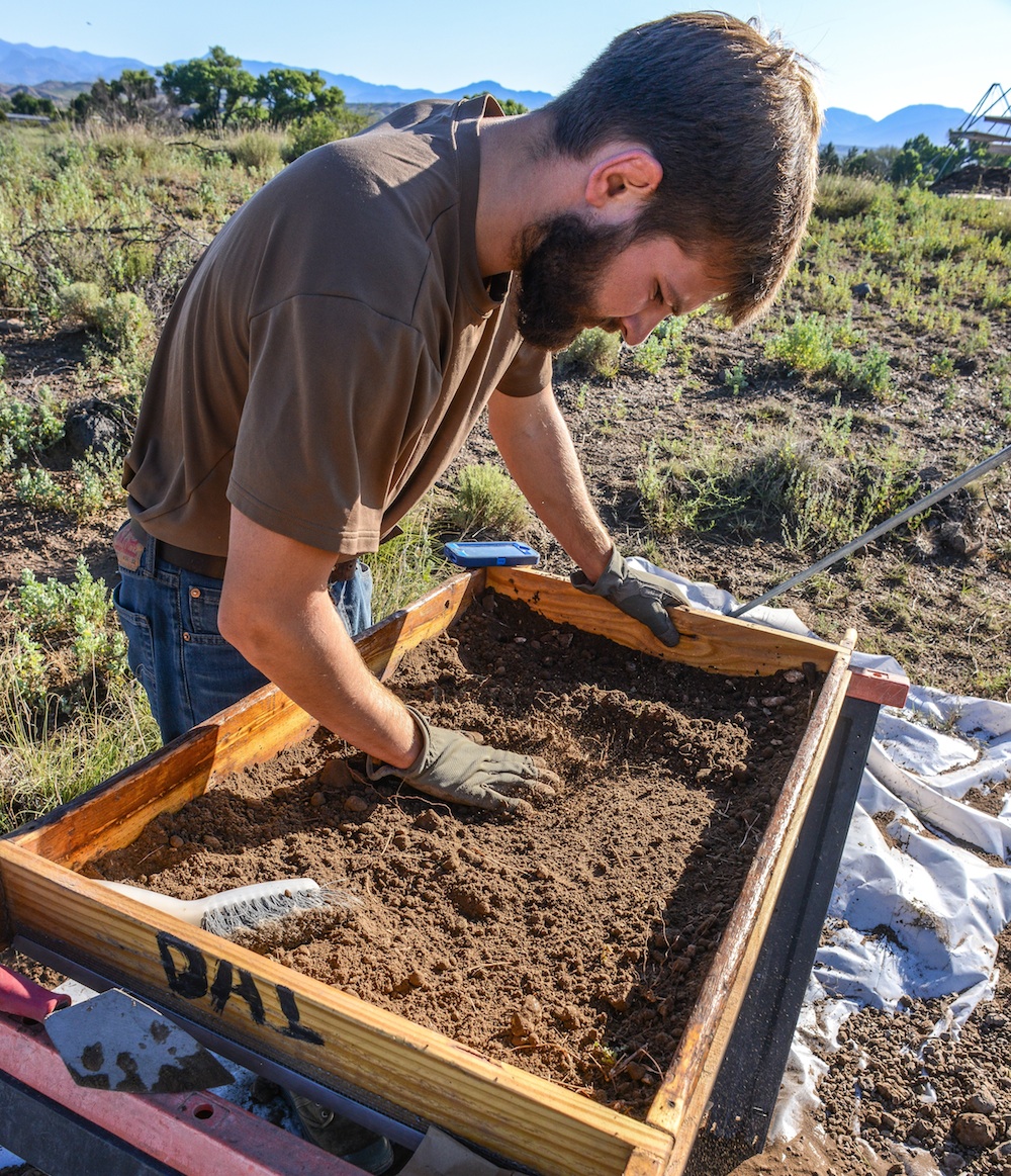
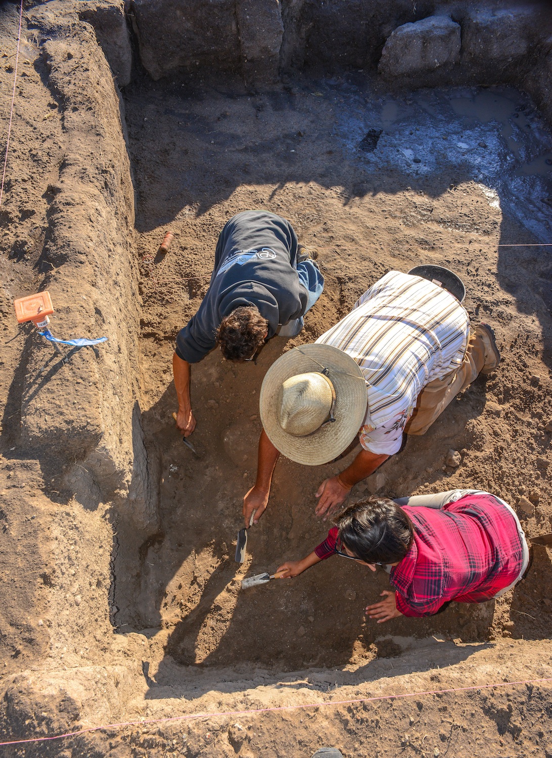
JOE HALL screens fill from a new room block using window screen for every fourth load. Lots of info can fall through the cracks, like fish bones, turquoise bead.
Students in the 40-day Preservation Archaeology Field School sift through fill from a prehistoric Pueblo called the Dinwiddie Site in east central New Mexico. Fourteen students, the best of the best, 4.0 students were turned away, each student chosen brought a special something to the school. Unlike the traditional Field School this curriculum highlights preservation archaeology, an experimental component has the students building an adobe pueblo like the one they are digging up. Students also compete throwing 4′ Atlatl darts.
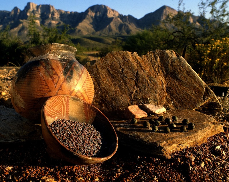
The peopling of the South West is a story best told by pottery. Ceramic pottery can tell archaeologist what they ate, where it was made, who made it and with whom the owner traded or aligned with…in a sense what was important to that culture and how successful or influential the culture was, how long it survived, and finally where did they go. But until tree ring dates, the chronology of all the ruins of the southwest, was a mystery until one afternoon when two pieces of charcoal crystalized everything that was known about the prehistory of the South West. In the one hundred years since man began probing the earth beneath their feet looking for secrets from the past much has been learned revealing to archaeologist how little they know or understand about early residents. So new strategies have evolved aided by the quick fresh minds of the next generation of archaeologist, new software that peels back the past, reveals pigment lost by time, using the sum knowledge from the past to build on future studies by incorporating all the data from all the earlier digs, aided by data from neighboring or regional sites. But more importantly, these new-age archaeologist, are tearing down fences that have long existed in the Cliff Valley and getting a first hand look at the prehistoric cultures that once called southwestern New Mexico home.
ALEXANDRA BALLESTEROS

MONICA VEALE
The 2015 Preservation Archaeology Field School staff is a combination of a lot of talent from Archaeology Southwest, Desert Archaeology, ASU and University of Arizona to structure a learning experience for a group of fourteen students who signed up for this opportunity to learn the general field and team work and the lab techniques necessary to extract science and knowledge from the soil.
Students are exposed to the principles of preservation archaeology, acquire the basic skills of excavation and survey, develop working strategies and write notes and reports that apply the logic of archaeological thinking to fieldwork, laboratory analysis, and applying the data we gather to answering anthropological questions. Finally think critically of issues about archaeological ethics.
As prehistoric man moved about he enjoyed a nomadic lifestyle of visiting old haunts places where they might have dropped some seed but most usually had luck hunting or gathering seasonal fruit. As more migrants entered the area, the nomadic Mogollon hunter found himself being crowded out and his old haunts now taken by the Anasazi fleeing their homes south east of Mesa Verde and looking for places to farm and live in safety. Local nomads soon were forced to stay at home and watch the crops.
The Mogollon and the Anasazi Material Cultures merge and disappear as the two groups diverge. Some Archaeologist believe the Kayenta Anasazi was traveling light, carrying what they could, leaving most of their culture behind. The nomadic Mogollon become seditary farmers, adopting some of the practices of their new neighbors, and soon they look pretty much alike. Except for ceramics! Archaeologist believe the Kayenta maintained contact with folks back home, perhaps opening trade connections with folks back home but meanwhile looping in the new immigrants settlements and establishing a trade network. When the bottom dropped out of the Colorado Plateau and everyone started looking for someplace wetter, the Kayenta knew where to go and who to stay with. They thought!
Rough corrugated ceramic pots are a clay signature for the Kayenta Anasazi and corrugated pottery left a trail from the Arizona Strip with some eventually reaching the Rio Grande and more was found south into Arizona Rim Country, visiting Mogollon Pueblos like Kinishba, Grasshopper Pueblo, Point-of-Pines, Cline Terrace. The Kayenta would build fortified hilltops above the floodplain along the Gila and San Pedro Rivers. Many of these sites are linked by signal towers to quickly communicate up and down the stream. The black and white pottery found at Salado sites suggests to some Archaeologist that the Kayenta continued to trade north to south until the end. But then Salado appears and everything changes. Four different archaeologist saw “Salado” arrive in different areas of the South West, but Harold Galdwin of Gila Pueblo received the credit for defining the Salado Culture but 85 years later we still disagree on much.
Agreement seems to be centering on Salado as a religion characterized by a distinct polychrome pottery and adobe compounds. The Salado message centered on fertility and cooperation, instead of honoring elite rulers, and some archaeologist have called it the first feminist movement, because in the day it was believed women did the most potting of clay and saved the South West from self destructing by intervening and preaching peace and working together. Others say shaman wheeled great power by producing the Mimbres Pottery characterized by “kill holes” which released the soul of the potter from the pot after his death.
The pottery design adapted reflected Mesoamerican imagery and changed in time but
researchers believe folks began thinking of themselves as Hohokam Salado or Kayenta Salado.
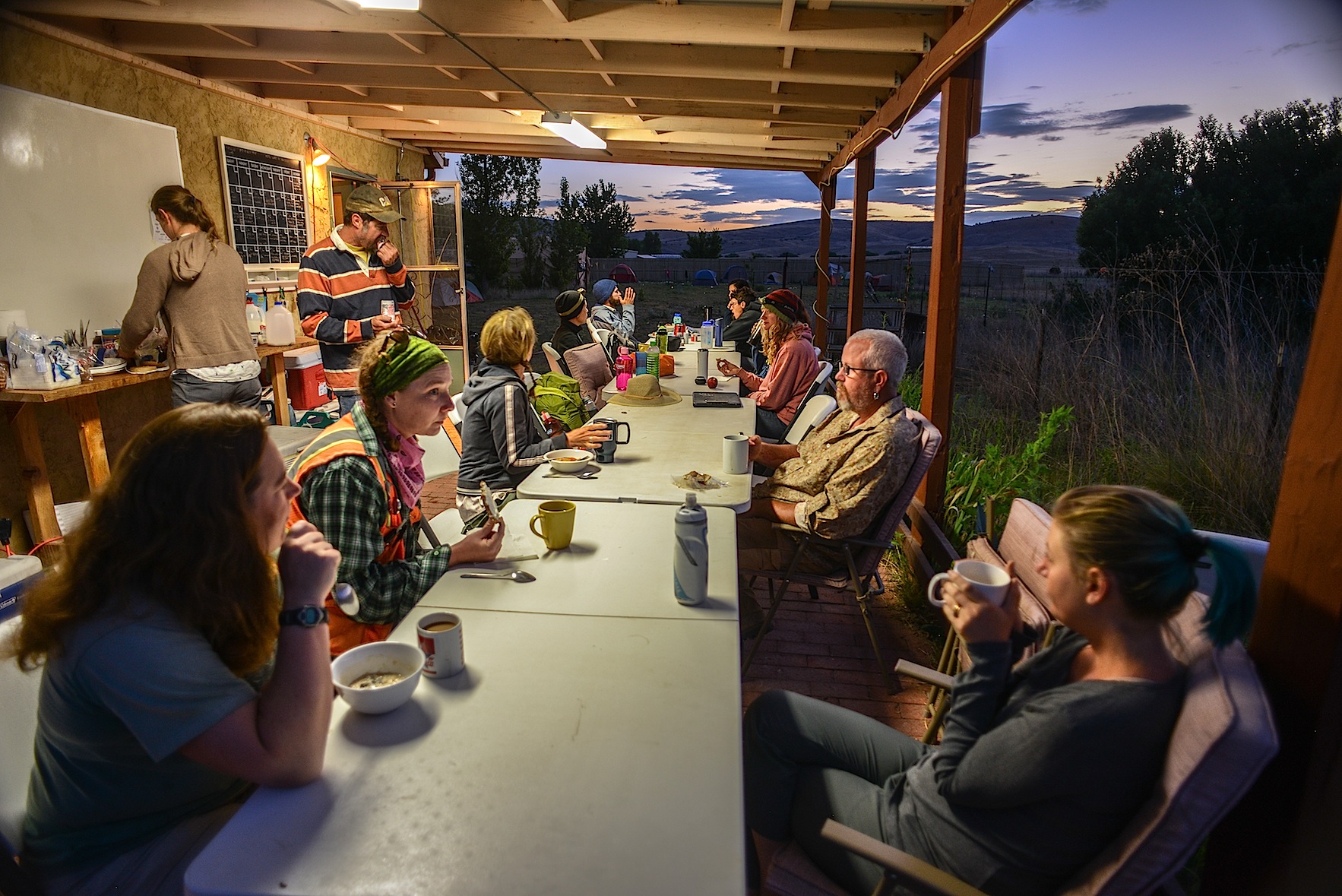
BREAKFAST can be the quiet time of the day as folks scurry around to make a lunch, finish breakfast and do the dishes and dash off for a full day in the sun.
The Archaeology Southwest Preservation Field School in it’s 5th season is an important component of our Upper Gila research, writes Karen Schollmeyer. “The results of this work contributes to Archaeology Southwest’s research on the formation and dissolution of late prehistoric communities. Dinwiddie’s occupation in the 1300s occurred during a period of substantial changes in the Southwest. Centuries earlier, large Classic Mimbres period villages were inhabited throughout the area. Around 1130, residents left these villages, and local populations remained small and scattered for the next 150-200 years. In the 1300s, large villages again began to form in the area. While people in the Upper Gila area were aggregated in large communities in the late 1300s, much of the rest of the southern Southwest was experiencing population decline. Our research examines the effects of the 14th century influx of residents to the Upper Gila. How did migrants from diverse cultural groups form cohesive villages? How did they structure social relationships with existing communities in their new home? How were social and natural resources affected by the long-term patterns of human population aggregation, dispersal, and re-aggregation? Our research at Dinwiddie will provide insights into these questions.”
Archaeologist Will Russell from ASU works with Alexander Ballesteros and Alisha Stalley to get the knack of working with a trowel in an archaeological dig. The Dinwiddie site was dug
Will Russell, one of ASU’s ceramics experts, oversees the trowel work and lectures the students crawling in the dirt “to move
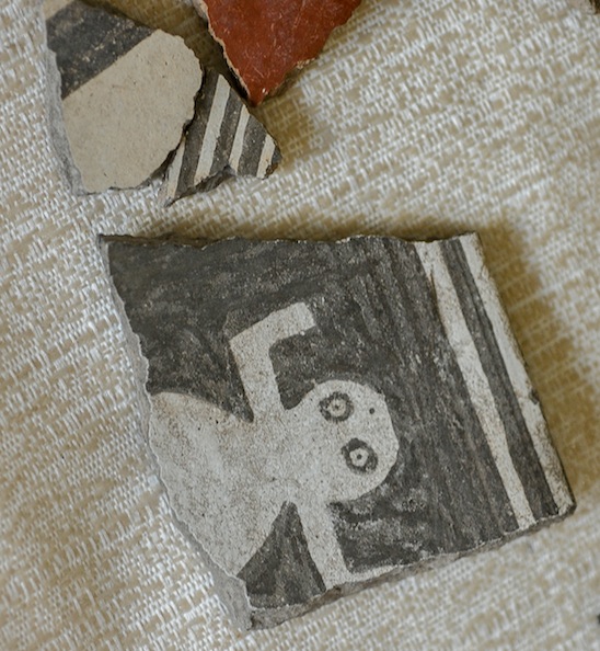
Negative Mimbres Pottery
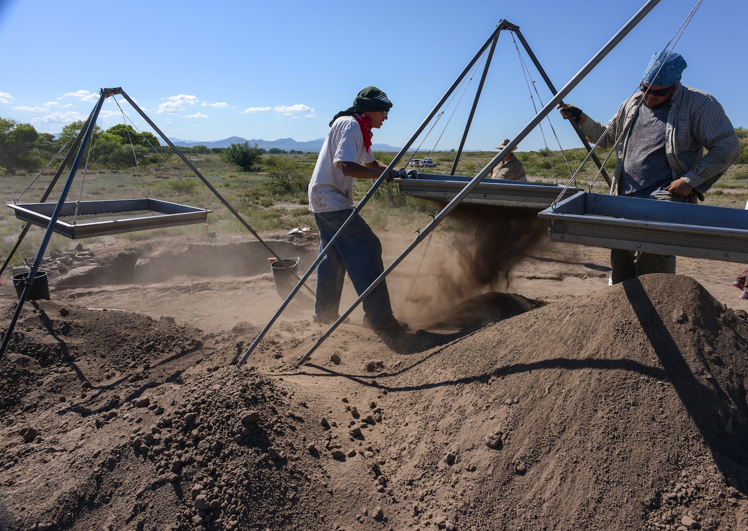
from what you know to what you don’t”. Emphasizing the feel of the trowel and how it changes as it moves through the fill. “You can kinda feel these powdery, sugar forms on the floor, so you can see the visual clues…flecks of white (from the floor). You learn to read the vibrations he says. The trowel vibrates differently when hitting large particles and sounds differently–many different senses come in to play when excavating. Time is tight for the group they are half way through the 40 day class and they still have digging to do. Some of their time is filled with their preparation of displays for the community updates, reports, class trips to Silver City, the Gila Cliff Dwellings, Chaco Canyon, Acoma and the Zuni Pueblo. Screening is essential to separate the ceramics from the dirt and every fourth screen is window screen diameter to make sure nothing of importance is slipping through like the bones of fish and prairie dog which supplemented the prehistoric diet here in west central New Mexico.

A morning monsoon drizzle dampens breakfast as students prepare for a wet day in the field.
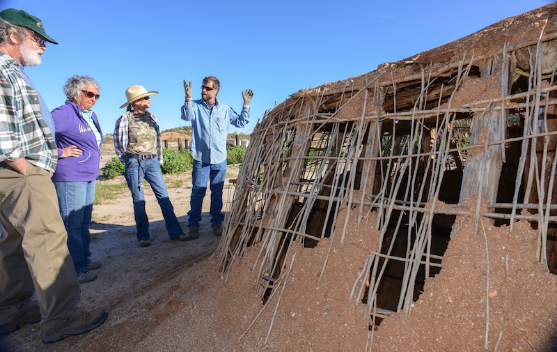
My first morning in Mule Creek where the field school is headquartered at the Rocker Diamond X Ranch there was a morning drizzle and students scurried around before sunrise eating breakfast, brushing teeth and making lunches and preparing for their day. Everyone has a job each day, each serves as a cog in the wheel and things happened smoothly until dinner when Mary shows up with dinner for the hungry staff, students and visitors. Students divide up into the field crews, survey and the experiemental crew who spend the day with archaeologist Allan Denoyer who is a master flintnapper and he and his crews are putting the finishing touches on a Salado Pueblo which they have constructed during the past field seasons. Denoyer has reverse engineered the adobe pueblos the field crews are excavating at the Dinwiddie Site with hopes the students will gain a greater insight into pueblos by building one as well as digging up what remains of numerous melted room blocks. Students learn to skin the timbers using stone axes and how to construct the roof. All knife work is from obsidian blades that slice as quick and accurately as steel.

Dinwiddie site under excavation near CLIFF New Mexico.
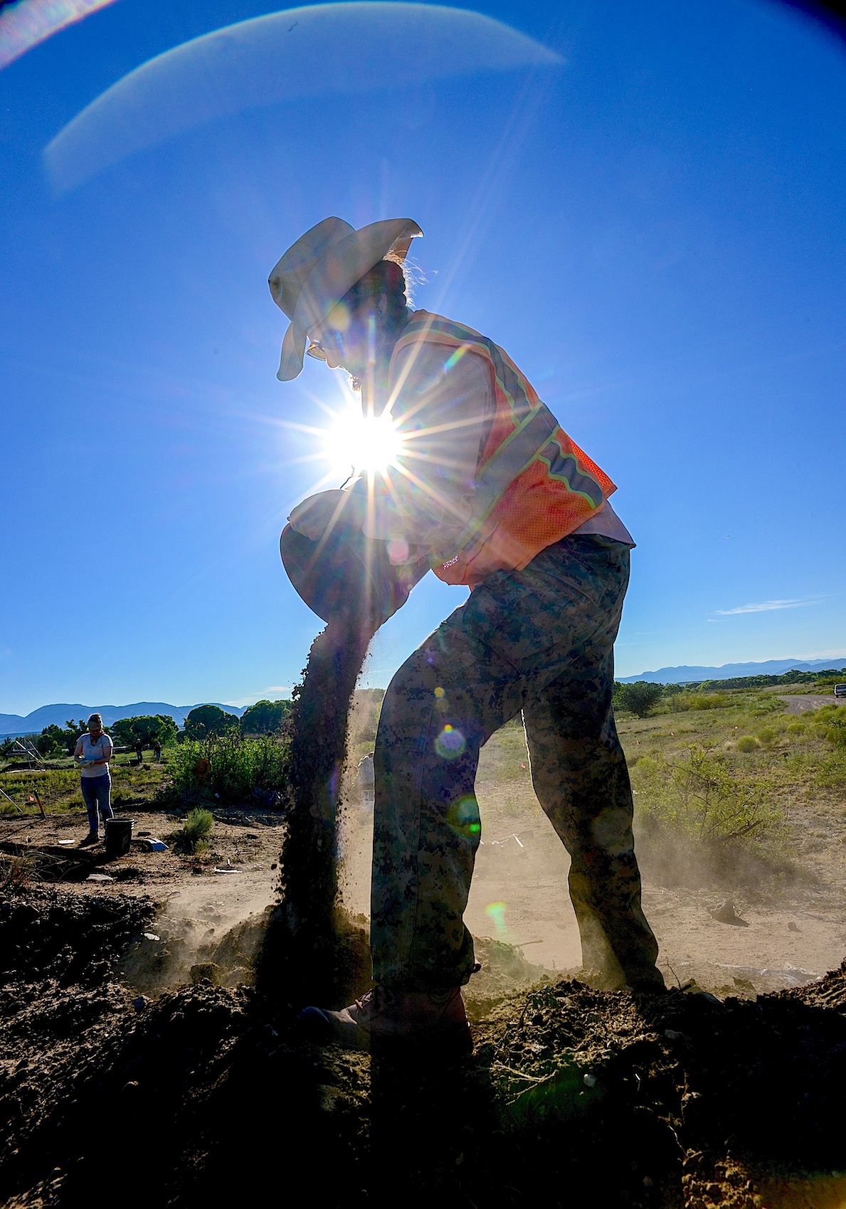
Field Supervisor LESLIE ARAGON pours off buckets of fill taken from the Dinwiddie Ruin dig. Three days will be spent back-filling the excavations with the soil they pain removed.
Students are responsible for blog posts, and displays for community outreach projects which hold public meetings in the region giving archaeologist the opportunity to explain to residents what they are looking for, what they found and often those exchanges open doors to archaeology not presently known and the field school survey crew go out looking for sites people tell them about. One student turned up a ten-room pueblo which was previously unrecorded. The survey crew often camps, to allow more boots on the ground than drive time. The easy duty appears to be the field work until you see there is no shade, students on their hands and knees with metal trowels pushing back the dirt from a solid polished adobe floor.

Ceramic marbles ? Fired in the flame and preserved but why ? Checkers, board games, marbles ?
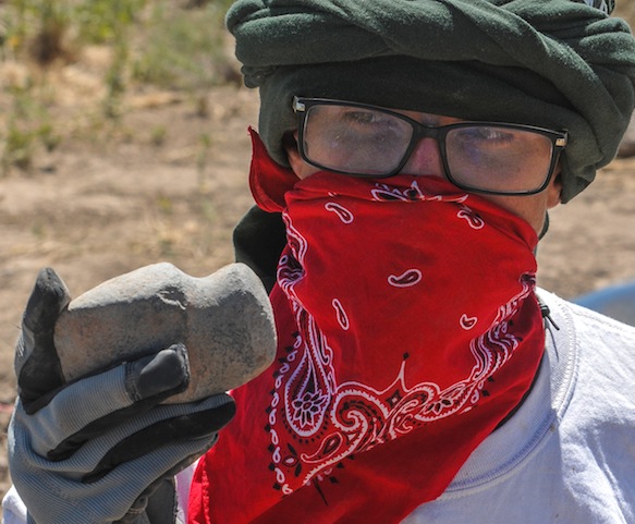
For the past few days they have turned up almost 50 ceramic marbles of varying diameters and for whose purpose is unknown, today, they turned up a nice 3/4 groove axe head next to the unique t-shaped doorway recently unearthed. At room one, a cry alerts us, a metate and a mano, together, intact–beautifully preserved.

A vocational archaeologist working in the 1960s and 1970s and some early work contributed important information to our knowledge of Salado archaeology.  These excavations did not follow collection and reporting standards of their era, and information from these older excavations is now unavailable. Collections from these excavations were housed in private museums and everything disappeared upon their owners’ deaths, scattering collections so that they are no longer available for research. The Dinwiddie site saw several field seasons of avocational excavation, with 37 rooms in two room blocks partially excavated by Jack and Vera Mills (1972) they are thought to have taken more than a hundred pots from these rooms, some of those pots reside today in Safford, Arizona at the Museum for Eastern Arizona State.
Archaeology SouthWest’s interest in the Cliff Valley “Dinwiddie” site came as a part of the Upper Gila research, using the field school as an important component of the research, searching for the formation and dissolution of late prehistoric communities. Dinwiddie’s occupation in the 1300s came at a time of big changes in the Southwest. Centuries earlier, large Classic Mimbres period villages had inhabited throughout the area. Around 1130, those residents left these villages, and local populations remained small and scattered for the next 150-200 years. In the 1300s, large villages again began to form. People in the Upper Gila moved into large communities in the late 1300s, while much of the southern Southwest was experiencing population decline. Karen Gust Schollmeyer, believes the Dinwiddie dig will provide insights into the 14th century influx of residents to the Upper Gila. In 2008, Archaeology Southwest received a National Science Foundation grant to study the Salado phenomenon in the greater Upper Gila region of southwestern New Mexico, an area traditionally assigned to the Mogollon archaeological culture area

EXPERIMENTAL FIELD SUPERVISOR ALLAN DENOYER THROWS THE ATLATL DARTS AT A DEER TARGET
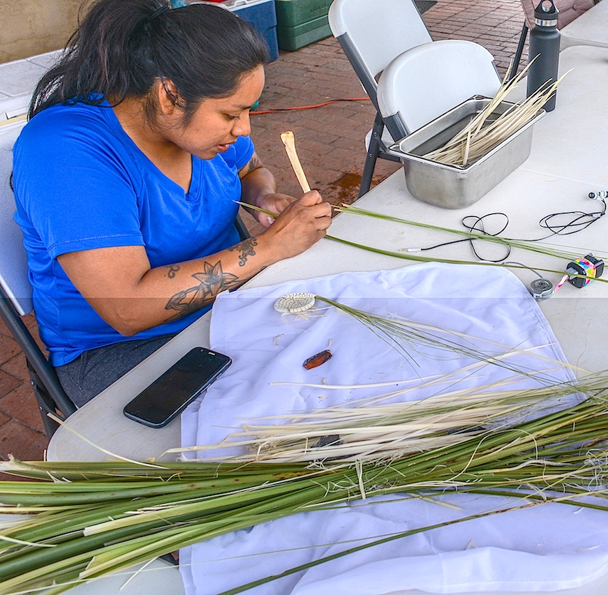
Marcy Pablo, a Tohono O’odham from Topawa prepares basket weaves for their “Community OutReach” Pablo intends to assist New Mexican residents to begin weaving their own basket using her starts. The School tries to lower barriers between locals and archaeologist by sharing their research with locals.

JOE HALL (Sierra Vista) and DEVINNE FACKELMAN (Allendale, Mich.) together dug up this Metate and Mano while searching for a wall.
“The Archaeology Southwest Field School was a life changing experience. I learned more about the southwest in those 6 weeks than in my two and a half years prior exploring in Southeastern Arizona. I had just graduated from Cochise College with a degree in Anthropology and immediately attended the ASW Field School with no real experience in archaeology. I am so fortunate to be given such a great opportunity to learn. From the field trips to the guest lectures, there was never a dull moment around the camp. Even in our down time we used the skills we had learned from experimental archaeology and our guests to do assorted crafts. The research the group of students accomplished was also inspiring, and attention grabbing. Post-field school I am more interested in Archaeology than ever. I plan to use my Non-Profit Leadership and Management degree at Arizona State University to get myself and others involved in the Archaeology field.”..Joe Hall

This Pueblo erected with the energy of field school students but with the same technology that the Mogollon used.
Field school students had some unstructured time in the evenings. But most worked on their field reports, blogs and burning designs

Archaeozoology – The study of animal remains, usually bones, from the past. Alexandra Norwood (Pasadena, CA) enjoys the final product.
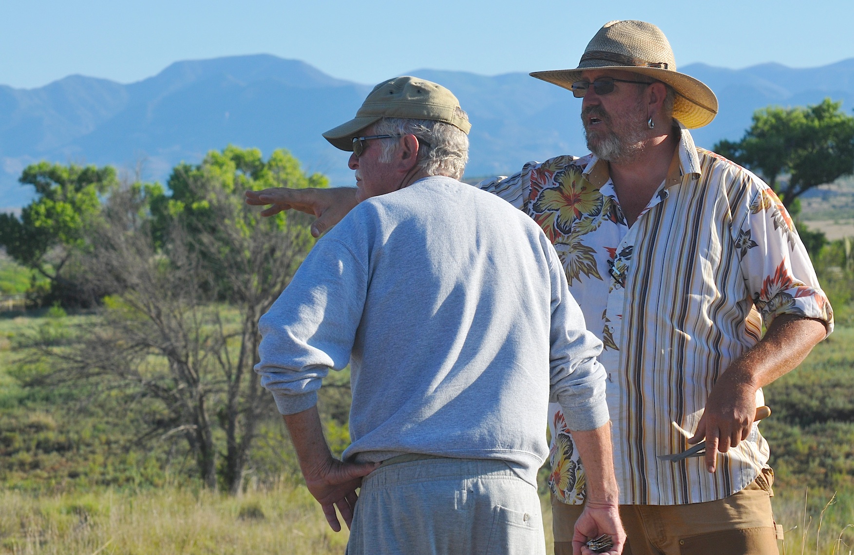
Field Supervisor Will Russell (ASU) fields questions from Bill Jamison, a Duck Creek resident for the past forty years. Jamison mentioned about 10 years ago, a burial fell into the creek.
The next morning at the Dinwiddie Dig a 40 year resident of the Duck Creek Community dropped by to visit the site and Will Russell was able to share with Bill Jamison the Field School’s focus and share with him some of what had been found. Jamison pointed out for a decade a burial eroded out of the river bank
and eventually was washed away. He did say a friend now living in San Diego had collected enough sherds to completely restore three pots and Russell asked him if photos were available or if they could be sent Another lead to another piece of the puzzle.

VICTORIA BOWLER shows ALEXANDAR BALLESTEROS how to throw ATLATL darts. Bowler works as an archaeologist and interpreter at Fort Bowie and Chiricahua National Monument and feels this field school will allow her to put these new ideas into practice.

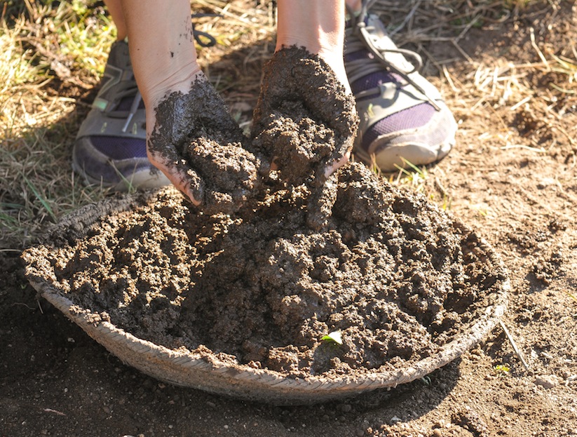
Mixture of water and mud

Flintknapper Allan Denoyear made these two points at the field school for his orientation discussion.

Allan Denoyer mixes adobe mud for the walls of the pueblo.

JODI REEVES-FLORES (ASU) adds a layer of mud to the walls of the adobe Pueblo.
Digital Antiquity is a nonprofit grassroots effort to get all Archaeological data archived by creating a multi-institutional, non-profit organization dedicated to overseeing the use, development, and maintenance of the Digital Archaeological Record (tDAR), an international repository for the digital records of archaeological investigations, organizations, projects, and research.

Students listen to a digital workshop produced by ASU’s Jodi Reeves-Flores on Digital Antiquity’s tDAR, an archaeological online data base where data input will be preserved, and reinterpreted as a piece of the whole.
One of Digital Antiquity’s key objectives is to foster the use of tDAR and ensure its financial, technical, and professional sustainability. Use of tDAR has the potential to transform archaeological research by providing direct access to digital data from current and historic investigations along with powerful tools to analyze and reuse it.
Digital Antiquity was created through the collaboration of archaeologists, library scientists, and administrators from the Archaeology Data Service, the University of Arkansas, Arizona State University, the Pennsylvania State University, the SRI Foundation, and Washington State University.
By enhancing preservation of and access to digital archaeological records, the mission of Digital Antiquity to permit researchers to more effectively create and communicate knowledge of the long-term human past; enhance the management, interpretation, and preservation of archaeological resources; and provide for the long-term preservation of irreplaceable records
Using Decorrelation Stretch to Enhance Rock Art Images
By Jon Harman, Ph.D. (dstretch@prodigy.net) Web site: http://www.DStretch.com
Decorrelation stretch, an image enhancement technique first used in remote sensing, can be usefully applied to rock art. In pictograph images from Baja California, Utah and Arizona I demonstrate its ability to bring out elements nearly invisible to the eye and to improve visualization of difficult sites. A decorrelation stretch plugin to the imaging program ImageJ is available from the author, free for personal use. It’s free but suggested contribution is $50. You can make a contribution via PayPal. My account is JonHarman “at” prodigy.net, if you want to send a check you will find his address on the email he sends back.

Lizard shaped pictograph in a cave near Mulege BAJA Sur…. This rock art is made with paints perhaps from crushed rock with iron.
Decorrelation stretch was developed at JPL and it has been used in remote sensing to enhance multispectral images. NASA used it to enhance Mars Rover images. DStretch has become a very useful tool for archaeologists

Filtered photograph of Lizard now only shows a hand print which was made by an artist filling his mouth with paint and blowing it through a reed toward his hand on the rock.
involved in the study and documentation of rock art. Its enhancement techniques can bring out very faint pictographs almost invisible to the eye. Subtle differences in hue are enhanced to puzzle out faint elements. Use of DStretch is simple as just hitting a button, but it also contains sophisticated tools for the manipulation of false color images. Because the enhancement works by increasing differences in hue, the technique gives better results for pictographs than petroglyphs.
The technique applies a Karhunen-Loeve transform to the colors of the image. This diagonalizes the covariance (or optionally the correlation) matrix of the colors. Next the contrast for each color is stretched to equalize the color variances. At this point the colors are uncorrelated and fill the colorspace. Finally the inverse transform is used to map the colors back to an approximation of the original. DStretch supports several different colorspaces, the image is converted from RGB to the colorspace, the calculation and transformation is performed, and then the colors are converted back to RGB before writing into a digital image.

Cave in Northern Baja along Highway One
The most common color found in pictographs is red, followed by black, then white, then rarely other hues. Often the rock shelter or cave wall is reddish or blackened. There are common types in the color distributions of pictograph images and this causes a consistency in the decorrelation stretch enhancements. DStretch works well to enhance red pigment but suppresses white and blacks. By bringing out the red painting and suppressing the background shades it can help clarify image composition.
DStretch is a plugin to ImageJ which is a full-featured imaging program. It is written in Java and can run on PC’s, Mac’s and Linux computers. When the button is pressed the plugin calculates the covariance matrix of the image colors (within the chosen colorspace) and then determines the transformation. Different decorrelation results are possible by selecting different parts of the image.
Different colorspaces give different results. DStretch has implemented the algorithm in the standard RGB and LAB colorspaces and also in the colorspaces: YDS, YBR, YBK, LDS, LRE. These colorspaces are modifications of the YUV or LAB colorspaces that give good decorrelation stretch results on images of rock art. The YDS and LDS colorspaces are good for general enhancements and can bring out faint yellow pigments. YBR and espeically LRE enhance reds. YBK can help with black and blue pigments and also enhances yellows well. The user can design their own colorspaces using the YXX and LXX buttons. The enhanced image is false color, the color scan be radically different from the original. In Expert Mode DStretc has the ability to shift the hues in the enhanced image to increase contrast.
CLICK HERE FOR SLIDE SHOW OF ROCK ART USING FALSE COLOR TO PRODUCE ADDITIONAL DETAIL…
http://pkweis.photoshelter.com/gallery/ROCK-ART-FILTERS/G0000oUHzJSUXcUI
Each image enhances differently, depending on its own unique distribution of colors. Another useful enhancement technique, not related to decorrelation stretch, is the manipulation of the hue and saturation of the image. DStretch (in expert mode) can do hue histogram equalization and saturation stretching. DStretch also contains a tool that allows a region of the enhanced image to be isolated by hue and then added back to the original image. This can be used to isolate an enhanced element then return it to the original image.
http://pkweis.photoshelter.com/gallery/ROCK-ART-FILTERS/G0000oUHzJSUXcUI
3D Scanning: Cultural Heritage and the Arts
Using 3D or “White Light” Scanners can uncover details from the past and today there is no better way to record a complex object than with a high resolution 3D white light scanner. The fringe projection method used in 3D white light scanning make non-contact digitization of art and sculpture and historical artifacts possible. Direct comparisons can be made of dimension and shape. Structured light Scanning allows revisitation of any object over time, creation of databases, redrawings of cross sections and 3D volume calculations. Today 3D scan data has a growing value in archaeology, paleontology and cultural heritage, collection of 3D scan data provides a digital archival record allowing access in remote locations, and the ability to produce replicas useful for exhibits.
One strategy under consideration at the Preservation Field School is the possibility of being able to actually see the “fingerprints” of the potter in ceramics. If that study moves forward there is a hope that not only will archaeologists know where the “Ancient Ones” went, they may be able to follow the fingerprints of a single women walking across an prehistoric landscape to her final resting place.
Kristin Safi in this month’s Kiva Journal outlines his “least cost” migration routes from the San Juan region to the Rio Grande Pueblo area. In this study 1200 possible routes are identified but many overlap and others had more costly terrain boiling the study down to 30 routes but when known archaeological sites were factored in, five routes were identified as the probable exodus path taken by the Kayenta Anasazi as they left the Northeast Arizona. Three of the routes probably were used by the later migrations because closer Pueblos were filled up earlier by early migrations. As for the question, “Where did the Ancient Ones go!” Not only do we know where the Kayenta went, we know why. FEAR!
![]()

<a href=” SPANISH TRANSLATIONS:">
HONEY BEE PIT HOUSE CONSTRUCTION MAPS OUT THE HOHOKAM’S LIFE WAYS AT STEAM PUMP RANCH IN ORO VALLEY EXPANDING THE PREHISTORIC RECORD !

Allen Denoyers is building a Hohokam village on Tucson’s northwest side. Visitors to Oro Valley’s historic
Steam Pump Ranch can crawl between two wood uprights and find themselves transported back to 900 AD. 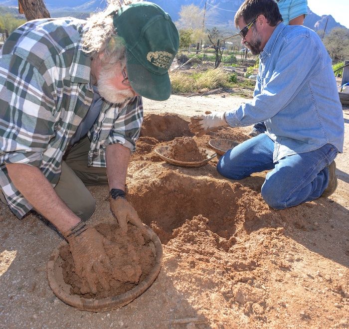 The southwest archaeologist has propelled his career by taking prehistoric technology into his hands and by learning from the past and teaching his students what life was like a thousand years ago. Denoyers passion for the past has taken many different forms, since junior high school, the self-taught flintknapper has created knifes, axes, spears, atlatls and now prehistoric pit houses. Archaeology Southwest, a local archaeology research firm, where Denoyer works, has long been responsible for expanding the prehistoric record by their survey of endangered sites and filling in the holes of existing knowledge about the folks who once lived here in the Sonoran Desert. So when Denoyer built his first pilot pit house, he was working from the knowledge gained from the past century of southwest archaeology and in partnership with the Town of Oro Valley and the Oro Valley Historical Society. In truth, most of what is known about the Hohokam pit house are the holes in the ground left behind by the wood uprights stuck in the ground centuries ago. The roofing, side and interior of these homes today are modeled on historic homes of the Hohokam descendents that today, are known as the Tohono O’odham and Pima people, of Southern Arizona.
When Hurricane Norbert dropped four inches of rain on Oro Valley last September, swelling washes to ten feet deep in places and requiring local fire and police to rescue motorists from swollen washes and flooded roadways. Loads of mud sloughed off Denoyers pit house completely filling it with water. That’s when the learning began for Archaeology Southwest who figured 40-50 percent of the mud was lost. Mud from the upper portions of the walls washed away or slumped in. The roof actually stayed relatively intact, with losses mostly confined to the edges. “But we don’t see this as a tragedy—in fact, we’re

Smoothing the mud produces a sheen that sheds the rain
 re-mudding they laid thatch mats over the new openings allowing air to circulate. Perhaps we need more thatching or interior support and possibly a different mixture of water and mud, to better combat the elements. Getting the moisture content of the earth just right is a real art, “I love the sound of the mud”, says Denoyer as he applies a rock to the wet surface smoothing it and creating a slick surface. “Floating the mud gives it a sheen and when the rain hits-it just rolls off.” “It really doesn’t take all that much work”, he says of pit house construction, “five or six people working together could finish in a couple of days”. “I love digging, screening earth, being out here all day. I’m so lucky so many people hate their work. At the end of the day, you can step back and appreciate what you accomplished.”
Archaeology Southwest has taken the next step to learn from the past, under the tutelage of Denoyer, the
research firm is offering several ongoing workshops, where participants will learn the basics of pit house  construction as archaeologists have learned from excavations. Denoyer will lead participants through the construction process, from excavation of the house pit to creating the superstructure, putting each student hands-on with traditional tools and materials. Through this work, Archaeology Southwest hopes to add detail to archaeological knowledge of how these structures were made by ancient people. Workshop sessions take place at Steam Pump Ranch in Oro Valley. Each session will last for three hours. Initial sessions will be dedicated to repairing rain-damages
  to the 2014 pit house. After that pit house is restored, participants will create small test pit houses that will enable us to compare how slightly different methods and materials respond to time and weather. Class Dates: Friday 3/6/15 from 9:00am-12:00pm – $40.00, Friday 3/13/15 from 9:00am-12:00pm, Friday 4/10/15 from 9:00am-12:00pm, Thursday 4/16/15 from 9:00am-12:00pm, Friday 4/24/15 from 9:00am-12:00pm -classes are for participants 18 years and older, there is a $40.00 charge.
ONE STUDENTS IMPRESSIONS ON THE HANDS-ON PIT HOUSE CLASS
Allen Denoyer explains the class to Terri and Dave Wallace while Joyce Holloway listens to the plan.

Terri Wallace re-enforces the pit house wall with Seep Willows as support.
Denoyer has based the pit houses his classes are building on homes found in Honey Bee Village, an Oro Valley
Hohokam site, the 32 acres excavated by Henry Wallace, in 1986, his study turned up more than 2000 features, including 100’s of pit houses, a large plaza and a small ball court which established Honeybee as the economic center of several villages situated along the Canada del Oro River. The ball court Wallace believes was based on the Mesoamerican ball game, played with a rubber ball batted around with paddles perhaps resembling those used today in ping pong. The ball game, Wallace believes, was an “integrative tool” to bring folks together and exchange goods creating a “large trade fair”, around 800 AD, in the village’s center plaza. The larger excavation of the Tortolita foothills was undertaken by Desert Archaeology because of the advancing bulldozers for the development of the 5000 acre Rancho Vistoso housing project that today has covered over or bull-dozed many other sites right off the face of the earth. Honeybee’s sister site the larger “Sleeping Snake”, where “not much is left” says Wallace of the site now covered by a golf course. So when Wallace got to Honey Bee, the archaeologist trenched the village core and conducted a systemic shed collection, learning a lot about the residents of the 100’s
 of homes characterized by large oblong holes in the ground encircled by holes left by the pole uprights supporting the pit house village. Wallace believes the life of a pit house was 15-20 years and believed Honey Bee which was a “great place of ak-chin farming” said Wallace of the wide flood plain along Big Wash.
 It never supported more than a 100 people at any given time, saying the village’s population was “between 40-90 people at any given time” and that Honey Bee” was not alone but part of something larger”. Denoyer points out supplies were limited and not everyone could build a pit house whenever they wanted. “They wouldn’t pull out the plants”. which grew along side of the Canada del Oro River which provided weep willows, for the necessary wall and roof support, for the Hohokam pit house, instead “they would cut the plant and it would grow back the next year” and more homes could then be built. Carbon 14 dating has placed some of the wood found around 1050 AD, and Wallace feels the wood was carried a great distance, climbing into the Catalina Mountains and carrying it many miles home. There was a lot of competition for building supplies, Honey Bee was far from alone along the CDO, notably the Romero Ruin now protected in Catalina State Park and Rooney Ranch site was bulldozed, and now is named after a shopping center. There were fifty pit houses and the bulldozers had entire pots rolling down the hillside, along with burials from between 700AD to 1380AD. One pit house had an altar at one end, where a bighorn sheep’s lower jaw was found buried shows a large populations lived along along this stream and visited the high country to hunt and possibly worship. Henry Wallace believes the Catalina high lands brought spirituality to the Hohokam people, “so it was important to bring a piece into your home,” speaking of the large ridge poles carried from the mountain.
Today, archaeologist study a rich rock art site, surrounding the “easiest path to high altitude” up the Catalina Sutherland Ridge. In November 1949, a hunter’s foot broke through the earth’s crust and Ray Romo peered into the past. The broken ground revealed a Hohokam pot cupped over another larger pot, inside were 25 copper bells and a 100,000 beads, Emil Haury and Carol Gifford speculated that the Romo Cache was an offering to insure the welfare of a village. The beads weighed 3.5 pounds, some are made of steatite or talc. These are black. Some are of a ferruginous aphanitic matrix containing quartz grains. These are red. Some are of chryosolla or turquoise. These are green and blue. A dozen are made from seashells. The black beads make up 40 per cent, the red beads 58 per cent, turquoise beads about 2 per cent. Some have marks, showing they were worn at one time. The bells were all made in Jalisco, more than 1200 miles south in Mexico. Someone carried them here and carefully hide them in these rocks, below you would have seen Honey Bee, the larger Sleeping Snake Village and the Romero village and many more villages laced along the running Canada del Oro stream. Who left it, we can’t say nor do we know why ? Maybe it begged God for his blessing ! After the Aspen fire, lots of pottery showed up, along the pathway up to the Catalinas. Excavations turned up one bell at the Rooney Ranch site, one more bell was found at Honeybee village–whatever the message the Romo cache begged, “in 950 AD, the Tucson villages fragmented”, people were moving away from Honey Bee’s Plaza, “they were moving out”, says Wallace. “There was a drastic and sudden change in 1150.” “Perhaps warefare or environmental change and social divisions created by a hierarchy of people with power living over people,” speculates Wallace. “Not long after this, they are all gone…”

Henry Wallace shows a tour of the Honey Bee Preserve the ballcourt.
“It’s very sad” Wallace says, “that east ridge is where all the Hohokam houses were–that’s where all those new houses are now.” A coalition of groups recognizing the prehistoric value of the Honey Bee Village proposed a preservation effort about a decade ago. In 2006, Oro Valley and Pima County, through a land donation from Steve Solomon, owner of Canada Vistas Homes, the development company that purchased the land, together created the Honey Bee Village Preserve.
The new preserve was established to protect the large Hohokam Indian community that occupied the site between 700 AD and 1200 AD, according to archeologists. Honey Bee Village is located just north of the intersection of Rancho Vistoso Boulevard and Moore Road. Archeologists have identified the locations of hundreds of pit houses, a ball court, a walled compound and a central compound on the relatively undisturbed site where developers once intended to build the town center for Oro Valley. Preservation of the 13-acre village was possible with the $8 million donation of real estate placed into public trust. “On one hand, we have 13 acres of highly valuable real estate, and on the other hand we have an invaluable prehistoric resource that would be plowed over and lost forever,” said Steve Solomon, owner of Canada Vistas Homes, the development company that had originally purchased the land and donated it.

Wallace shows off a pit house site in the Honey Bee Preserve.
Today the 13-acre core of Honey Bee Village is now preserved for future generations. The preserve

Honey Bee Preserve Map

Neglected after the depression tall grass and trash became an issue
HONEY BEE VILLAGE PRESERVE TOUR CLICK HERE…
For South West archaeologist, the ubiquitous pit house, clouded the prehistoric picture of ancient man. The Hohokam is now known to be the primary prehistoric agriculturalist of the Sonoran Desert. This ancient man surrounded himself with Mother Earth to protect his family from his harsh environment, like the sun and rain, that fell from the sky or the cold that surrounded them. The pit house has roots in prehistoric times in the arctic, the desert, the mountains, the plains and in woodland areas over a large part of North America west of the Mississippi River. The earth-covered frame house changed slowly in architecture, no two pit houses were exactly alike but their features are typical of homes found in northeast Asia, across the Bering Strait, throughout North America and deep into South America. From the earliest dates, the pit house changed very little, it’s shape evolved from a square, to a rectangular, eventually taking an elliptical shape over the centuries. The Hohokam evolved their oblong pit homes with rounded ends, the front and back wall were parallel and sized approximately 6 meters wide x 3 meters depth.

Hohokam Pit House Drawing Copyright by Rob Ciaccio
Archaeologist find pit homes of the Plains cultures as far East as the U.S. southeast in Arkansas, there historical earth lodges of the plains Indian seem identical to the type used by the prehistoric man. Typically the pit house had four central roof supports in early homes, the supports increased later with a side entrance composed of a covered passage-way, inclined from the floor. The floor of well plastered caliche, was built on native soil. The fire pit was a deep basin in the interior with a thick coating of caliche, the rim being flush with the floor. Cross beams, spaced at irregular intervals, held a thatch of twigs and grass, which was covered with caliche. The dirt covering the roof extended down onto the walls, they were plastered and renewed as the need arose.
Many were burned, perhaps as part of a funeral rite ?
Archaeologist believe most villages were economically related through exchange systems, typified by the trading of shell bracelets and jewelry from the Sea of Cortez for cotton textiles from the Salt/Gila canal systems. A larger widespread trade network is suggested by the trade of shell from the Gulf of California, parrots and macaws from Mesoamerica and turquoise from various Arizona locations.
Villages were small with houses centered around plazas. During the Colonial Period AD 775-975 homes are arranged in house clusters or courtyard groups archaeologist Dave Wilcox finds two to four houses arranged with entrances facing a common courtyard and sites generally contain one or more house clusters. Many archaeologist see this as a time of expansion-the Sedentary Period 975-1150 AD saw continued growth of existing settlements and new villages sprang up along rivers and in the open desert. Irrigation canals expanded in the Salt Gila and houses increased in size. Public architecture like ball courts occur now, public architecture including platform mounds became more elaborate, some larger sites had one or more ball courts as well as platform mounds. After 1300 AD everything starts to diminish and withdraw – platform mounds begin to be encircled by adobe walls, the Casa Grande great house was built during the late classical period. Walled terraces or cerro de trencheras, were constructed on steep hillsides, in the Tucson Basin. Extensive agricultural farms are expanded in the desert regions and agave farms are expanded. Bill Doelle and Henry Wallace have argued the Tucson Basin emerged as a regional center during the Classic period, they suggest that cerro del trencheras were defensive and indicate warfare or the threat of warfare between the Tucson Basin and the Salt-Gila Complex (Phoenix). Archaeologist find an increase in site hierarchy along the Salt-Gila and the Tucson basin during the Colonial period. Ball courts were first constructed along the Canada del Oro and served to integrate a number of associated smaller villages within the Hohokam community. By AD 1000, the Hohokam were using all parts of the Tucson Basin, they built their villages along streams and rivers and hunted and gathered in the foothills and mountains.
BECOME A MEMBER OF ARCHAEOLOGY SOUTHWEST….CLICK HERE

Experience the ancient art of flintknapping. Join Allen Denoyer for his Hands-On Archaeology class, “How Did People Make and Use Stone Tools?”. In each of these beginner classes, you will use ancient techniques and replica tools to create a stone projectile point. You will also learn more about how people made and used such points, and that points were just one component of a complete hunting technology. The class is for individuals 18 years of age and older and lasts approximately 3 hours. This class will meet at Steam Pump Ranch at 10901 North Oracle Road, Oro Valley, AZ 85737. If you are interested in registering a group of three or more participants, please contact Kathleen Bader by phone at (520) 882-6946 x26 or by email to reserve space for your entire group. Class is Friday 3/20/15 from 9:00am-12:00pm – $40.00

“I love to making Clovis points”, says Allen Denoyer who often demonstrates prehistoric technologies at Steam Pump Ranch on Saturday mornings.”They are my favorite thing to make.”
PREHISTORY PHOTO COLLECTION OF PHOTOS CLICK HERE
![]()
<a href=” SPANISH TRANSLATIONS:">CLICK HERE
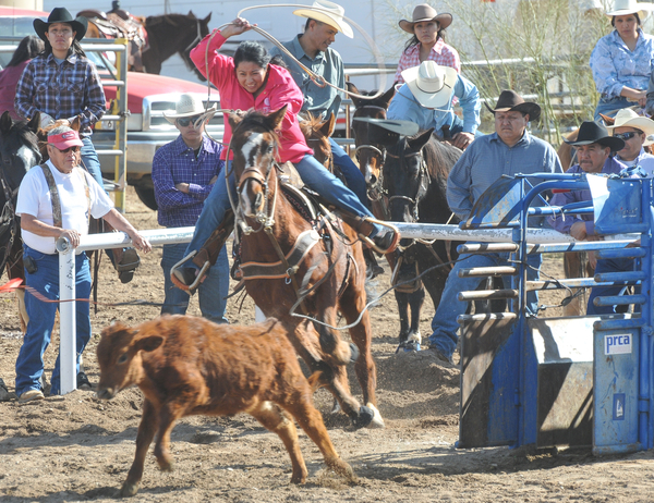
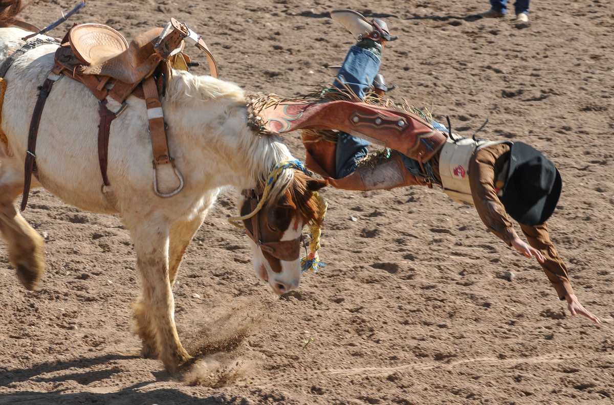
SELLS 75TH ALL INDIAN RODEO & FAIR, OLDEST IN THE UNITED STATES & BEST ENTERTAINMENT TICKET!


Yree Lepa
Celebrating the 75th year of the Tohono O’odham Nation Rodeo & Fair, the longest running All-Indian rodeo in the United States! The Rodeo & Fair is the biggest and most expansive event of the year. Bring the family out to enjoy the full experience there is sure to be something for everyone – rodeo competitions, traditional games, food, crafts, carnival rides, fun run, exhibits and performances. The U.S. longest-running American Indian rodeo has a Junior Rodeo which this year fielded 300 young ones, it has a powwow, carnival, parade, Wailia dances, and food/crafts at the Livestock Complex in Sells, 60 miles west of Tucson.  This year’s schedule ran from January 31 through February 3, 2013 at the Eugene P. Tashquinth Sr. Livestock Complex in Sells, Arizona. Named after the long-time voice of Tribal Rodeo’s, the Chu Chui resident (1929-2006) Eugene Tashquinth spent his days bringing order to chaos, heading up most of the events at the livestock area, so when they built the new one, they named it after Eugene Tashquinth. Equally proud is the Tohono O’odham Hedricks family whose matriarch Silas’s name blesses the Rodeo pavilion where he excelled in the arena, his grandson Chad Hedrick put the first score (6.3) on the clock with his bareback ride. Sells is a place of tradition and for the ten thousand residents of the third largest Indian reservation in the United States the annual rodeo and fair is a time of gathering, folks begin gathering before noon and the festivities go way into the night with the Wailia ending around l a.m.. The Rodeo and Pow Wow bring in native American competitors from all over the South West, particularly from Arizona tribes, like the Navajo, Hopi, San Carlos Apache, White Mountain Apache Tribe and their Tohono cousins: the Pima and Maricopa Tribes. Every year, is an old-home-town visit, with folks coming together to visit, catch-up, see who big all the cousins have gotten and to get new pictures of the kids.

 The mid-way is a beacon to all who love carnivals, greasy food, fast rides, regge music from Bob Marley, and tee shirts featuring heavy music idols and black goth signs. Visitors pay $8 for a wristband allowing all day access, for those over 55 years-of-age, the senior charge is $2. The annual Toka Tournament brings together the Tohono O’odham “Dream Teams”, like “Sun-Running-Women” who battle it out on a football sized field fighting over a wooden puck laced with leather and flung up-field with long sticks pulled from the ribs of the saguaro cactus. The start is much like the game lacrosse-another Indian game, it begins almost like a rugby scrum–and then off down field, very little is out of bound. These women celebrate this age old tradition all afternoon long with teams chasing each other up and down the playing field, the ebb and flow, the eventual goal and high-fives all around, losers too. The Pow Wow begins with the traditional Gourd Dance and breaks down into male, female, fancy, Plains categories featuring the finest in Pow Wow and Drum traditions. Just off the mid-way, the crowd not to photograph are the Yaqui Deer dancers nor can you record them with smartphones. The Yaqui Band features a combination of home-made instruments which accompany the dancers, one wears the head of a small deer atop the head, the main dancers each wore a mask to fill out the cast for their dance.

The Santa Rosa Shell Dancers
Earlier the Santa Rosa traditional dancers displayed their dance abilities, wearing their eye-catching shell-leg chaps, made from the shell carried from the Sea of Cortez by their ancestors who later traded the shell to Hohokam in the Salt-Gila River area for their cotton. The Tohono’s Hohokam ancestors valued the shell as a sign of rank, wealth, and much of it was fashioned into jewelry, like bracelets, necklaces, and leggings with shell leg tinklers for dancers The Tohono ancestors had a prehistoric salt trail across the vast waterless Sonoran Desert, across what is today’s US-MEXICO Border and into the blackened landscape of the Sierra de Pinacate lavafields, before crossing the enormous star sand dunes of the Grande Deserto for ten miles before reaching the Gulf of California where they harvested the precious salt and processed the shell, carrying home only what they needed to make jewelry to trade. Traditions have lasted thousands of years in the lands west of Tucson, they exist today and they will thrive tomorrow. The Tohono Tribe are gracious hosts and they welcome young and old, Indian or not as visitors to their Rodeo and Fair. It surprises me how few Tucsonans take advantage and visit the annual Tohono gathering, it surprises me more how few Tucson businesses sponsor, advertise or even acknowledge the tribe and its good work and its people of sterling, ageless character who have been our faithful neighbor for centuries.

SOUTHWEST PHOTOBANK GALLERY FOR MORE SELLS AZ RODEO PHOTOS CLICK HERE ….
2013 RODEO SCHEDULE…CLICK HERE
![]()
<a href=" SPANISH TRANSLATIONS:
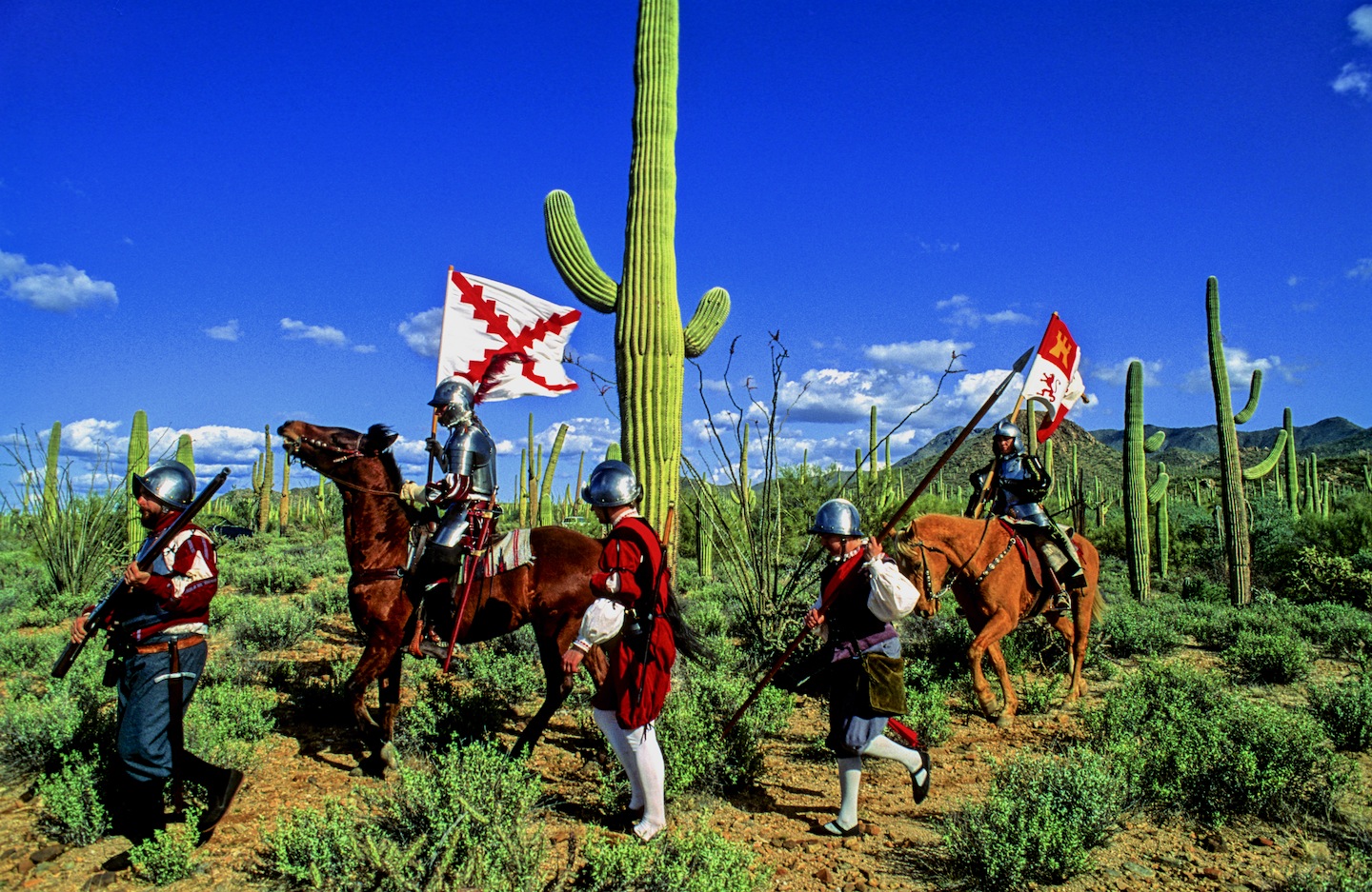
SPANISH ENTRADA SEARCHES FOR CITY OF GOLD, CORONADO FINDS AMERICAN SOUTH WEST, SEES LITTLE TO VALUE EVEN LESS TO CARRY OFF!


THE SPANISH ENTRADA AND CORONADO VISITED MANY OF THE RIO GRANDE PUEBLOS. THE TAOS PUEBLO (above) WAS VISITED BY OUT-RIDERS AFTER DEFEATING CIBOLA OR TODAY’S ZUNI PUEBLO IN NEW MEXICO.
Crossing into the US from Mexico at this spot in the San Rafael Valley, the Franciscan friar FRAY MARCUS de NIZA with his Moorish guide, Estevan, entered from Mexico at this spot in Arizona’s San Rafael Valley, where this concrete cross stands as a memorial of decades of Spanish rule in North America which was followed by a “tidal wave of white men”. De Niza’s journey ended South West prehistory and marked the beginning of written history.
Beside this dusty dirt road only a short distance north from Lochiel, Az, stands the 20 foot cross with a metal plaque that proclaims “On this spot FRAY MARCUS de NIZA entered this Valley of San Rafael, as Commissary of the Franciscan Order and a Delegate of the Viceroy of Mexico, de Niza entered Arizona the first European west of the Rockies on April 12, 1539. Here began the friar’s historic journey to explore the American Southwest, his journey ignited a decade of searching by conquistadors for the gold and riches they hoped to exist in the legendary “Seven Cities of Cibola”.[caption id="attachment_5114" align="aligncenter" width="950"] Marks de Niza Entry
Ironically, at the time of the march to Cibola (Zuni N.M.) and Quivira (Kansas) in 1541, Hernando de Soto’s army was probing west from Florida. In May of 1541, at the same time Coronado was in Texas and starting north to Kansas, de Soto was crossing to the west bank of the Mississippi River. The armies may have passed within some hundreds of miles of each other. While Coronado was in Kansas and marching back to the Albuquerque area, De Soto was probing west of the Mississippi, where he died on the Red River in April of 1542. If the two armies had met up, they might have considered their expeditions more successful.

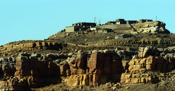
CONQUISTADORS CLIMBED INTO THE SKY CITY OF ACOMA, THEY WISHED THEY HADN’T.

NATURAL WATER CATCHMENTS ARRESTED RUNOFF ON THE MESA FLOOR

A POTTERY TRADITION EXISTS IN MOST PUEBLOS.

NORTH CENTRAL NEW MEXICO
De Niza’s visit to Arizona’s opened the door for Spanish exploration that defined the size, the people and the nature of today’s American West. FRAY MARCUS de NIZA, found himself about 15 miles east of what is today’s Nogales, Arizona and Sonora as their horses picked their trail through the rich Arizona grasslands. De Niza was guided by Estevan, an Moor slave who had survived the same decade of slavery and walking through Texas to Mexico after being ship-wrecked off the Florida coast with the Spanish mariner named Álvar Núñez Cabeza de Vaca who reported to the Viceroy of Mexico the riches of Cibola. The Viceroy sent the Friar de Niza and Estevan to learn the truth about “Cibola”, was it made from gold or wasn’t it? Estevan knew from his travels the Indian of the time perceived “Cibola” as the “greatest thing in the world”, so-the servant said. Survival had taught him how to excite the average Indian village, the large charismatic black man who wore tinkers and led a large entourage of slaves and women whom he had collected. Estevan had learned it was better to be the point of the spear ahead of the main expedition finding water and probing their path for guides and information, rather than playing the role of a slave. Estevan was charged to send back runners with crosses, if news was promising about riches ahead send a big cross, he had been told, if chances were poor, then send a small cross. Estevan decided to promote his own agenda sending back crosses that got progressively larger. Estevan was the original Kokopelli, he captivated the locals, wowed the maidens, had a few and moved on to the next village before the larger expedition arrived.

FIREARMS, HORSES AND CROSSBOWS TOOK A TOLL ON THE INDIAN
De Niza, upon his first return to Mexico City from Cibola, he had reported finding “good and prosperous lands” others soon twisted that translation into a new land of riches, equal to the wealth of gold, silver and gemstones, taken from the Aztec and Inca civilizations of Mexico and South America. Cibola was soon thought to be where “trees hung with golden bells and people whose pots and pans were beaten gold”, so with that promise of riches, finding soldiers and patrons to fund the journey became easy, everyone wanted a piece of the action. De Niza’s companion Estevan de Dorantes was killed at Cíbola, as de Niza watched from afar, but from that range the friar affirmed that the “grand city” report was true. The Friar’s report had inspired Francisco Vázquez de Coronado to make his famous expedition to Zuni Pueblo, using Fray Marcos as his guide; their journey had many hardships: thirst and hunger, many died and most were left penny-less. So it’s an understatement the expedition had a great disappointment, when they had finally saw Cibola for themselves, Coronado then sent Friar de Niza back to Mexico City for his own protection. Fray Marcos returned in shame and became the provincial superior of his order in Mexico and performed the highest office of the Franciscans Order in Mexico before dying in 1558.
In “Cities of Gold” by Doug Preston 1992 Simon/Schuster narrates the rich history of the American South West as the author retraces the Route of Coronado from the US-Mexico Border through a very rugged Arizona and into a waterless New Mexico. Preston and with his cowboy/photographer/artist/sidekick, Walter, with four horses found the trip, life-imperiling as well as life-changing. Another author, Paul Wellman wrote in his book; “Glory, God and Gold” that “Every Spaniard in the expedition” he wrote “would plunge his arms elbow-deep in gold ingots before he returned,” that’s why not a peso came from the King and each participant paid what they could. Captains paid $55,000 pesos, average guys paid $35,000 pesos and Coronado himself paid $85,000 pesos, taking a loan out on his wife’s estate. In preparation for this journey, Coronado had taken seven slaves four men and three women, others took their wives, children and companions.
Scholars say there were 2,000 in the expedition, with 67 plus European soldiers-45 fellas carried European metal helmets, 1300 natives were from central and western Mexico, some were servants, wranglers and herdsmen so writes Richard Flint in the Kiva article entitled “What they never told you about the Coronado Expedition”. He points out there were 19 crossbow, 25 arquebusiers and additional slaves to tend the 1,000 extra horses, 500 head of cattle, and more than 5,000 sheep was taken to feed the expedition. These folks were not trailblazers-they followed well established paths, each village they passed they would enlist guides to lead the way to the next water hole, to make introductions at the next village and to show the Spanish the road to the Seven Cities of Gold.
Just a few years earlier the chosen champion of the Cuban governor, Conquistador Hernando de Soto, who learned the Indian slave trade in South America. There the Spanish looted temples and ransacked graves for their mortuary offerings. Finally De Soto captured the Inca emperor who offered him a room 22′ by 17′ stacked 9′ to the ceiling with gold ornaments, vases, goblets and statues plus another smaller room filled twice over with silver for his freedom. De Soto accepted the gold and silver treasure, still killed the king and soon returned to Spain and became a favorite in the King’s court to whom he loaned money and soon was given the license to explore Florida. In return the King was to receive “one-fifth of all spoils of battle, one-fifth of any precious metal taken from the ground and one-tenth of everything taken from graves. De Soto was to finance the entire expedition, at its end he would received 50,000 acres of his choice and an annual salary of $60,000, in return he would pacify all the natives, and provide the necessary priests and friars needed to convert them.

DESOTO; Followed the footsteps of his heroes, Balboa and Ponce de Leon….

CORONADO: Freely joined the chase for gold and riches ….

EL MORRO NATIONAL MONUMENT STOOD OUT FROM THE FLAT LAND AND BECAME A BEACON FOR TRAVELERS. CORONADO DIDN’T LEAVE HIS JOHN HANCOCK, BUT HE DID VISIT

The native Americans believed the Spanish horses were supernatural creatures.
This rock art in southern Utah commemorates the first time the indian and the horse meet.
So eighty years before the Pilgrims landed at Plymouth Rock. Spanish Explorers visited Kansas: Francisco Vasquez de Coronado, seeking gold in New Mexico, was told of Quivera where “people’s pots and pans were beaten gold”. With 30 picked horsemen and a Franciscan Friar, Coronado marched “north by the needle” from the Texas panhandle until he reached Kansas. Here he found no gold, but a country he described as “the best I have ever seen for producing all the products of Spain.” The expedition entered present Kansas near Liberal and moved northeastward across the Arkansas River to what is now Rice and McPherson counties perhaps probing to present day Lawrence near the Kansas River before turning back. The guide, they called the Turk, confessed he had deceived the Spaniards and one night he went into his tent and the next morning when they broke camp he left only a dirt mound. He was strangled, buried and forgotten. For 25 days in the summer of 1541 the Turk had led Coronado among the grass-hut villages of the Quivira Indians, hoping to lose Coronado and men in the tall grass and waterless plains.

PECOS PUEBLO stood at the Cross Roads of the Great Plains and the Rio Grande Pueblo Communities.

Statue of the Conquistador Coronado stands next to a traffic circle in Liberal, Kansas near where the Spanish entered from Texas. JOHN MADSEN, BELOW
CORONADO AND QUIVIRA

The exact route that the Coronado Expedition took between Sonora and the Zuni Pueblos is currently unknown writes John Madsen, curator at the Arizona State Museum. He writes some have surmised that the trail led through Arizona, as far west as the Casa Grande Ruin, before turning northeast into the White Mountains region. Others, like historian Herbert E. Bolton, suggest a route along the San Pedro River, turning northeast below Benson, crossing the Gila River near Bylas, and passing near White River and Springerville before descending into the Zuni region. Madsen prefers the path similar to that proposed by archaeologist Carroll Riley. It traverses the country on what is now the Arizona–New Mexico state line, following the San Francisco River. Spanish accounts as early as 1747 reveal considerable use of the drainage by Zunis and Apaches. In 1795, Sonorans viewed the San Francisco River area as a potential trade route linking them with the Pueblo of Zuni and Santa Fe area pueblos like Pecos and Taos Pueblos.
Madsen teamed up with a Public Broadcast Station and launched a search for clues of where the Spanish had been targeting areas along their suspected route. Many historians and archaeologists along the route have tackled their piece of the mystery, many adding to the research, Madsen “had a hunch that the best source of information would come from the ranching communities along the Arizona–New Mexico border. These people know the land, and generations of family members have covered most of this dirt on horseback. The end result were 33 Spanish colonial period or Mexican historic artifacts like period spurs, coins, and horseshoes. Chain mail was take from a site in Kansas….more clues appeared.
Hartmann Map for Tracking the Expedition’s Route: Sleuthing for Clues and Artifacts

For over 100 years, the exact route of Coronado has been an American mystery. Generations of scholars have tried to retrace the steps of the army from their descriptions of villages, rivers, mountains, and native communities. National commissions have grappled with the problem of designating a “Coronado Trail” that tourists could follow, but clues were sparse, and politics raised its head when various factions tried to claim parts of the route for their state. Because we don’t know just where they were, it is tantalizingly hard to interpret the Coronado chronicles’ descriptions of native villages and other sites they visited.

GREENLEE COUNTY ARIZONA
Archaeologists William K.Hartmann, his wife Gayle and Richard Flint have worked tirelessly to sleuth out the route of the Coronado Expedition being guided by de Niza who the year before had seen Cibola from a distance. They found he might have followed the Rio Sonora to the river’s headwaters and then crossed the Cananea grasslands for four days past Arizape picking up the San Pedro River North turning east toward the Wilcox Playa North past present day Safford or the present day Sulfur Springs Valley crossing the Gila River cresting the Mogollon Rim past Point of Pines. William and Gayle Hartmann sees them moving east from the San Pedro, stopping at Turkey Creek in the Chiricahua’s then moving east through Apache Pass via Portal and into New Mexico and eventually into Texas. For more explanation visit their website….http://www.psi.edu/epo/coronado/coronadosjourney.html
WEST TURKEY CREEK, IN THE CHIRICAHUA MOUNTAIN RANGE, ONE PROPOSED STOP ALONG CORONADO’S ROUTE.
REPORTED DISCOVERY OF CHICHILTICALE The most exciting development is the apparent discovery of the long lost Coronado camp site at the Chichilticale New Mexican exploration geologist Nugent Brasher devoted several years to this problem. With brilliant deduction, mapping, and hard work, he began metal detecting surveys at several water-source sites he reported finding an iron cross bow point and other possible fragments from the Kuykendall ruin, a large pueblo ruin site at the foot of the Chiricahuas. The site appears definitely to be a the first Coronado camp site known in Arizona, and almost certainly is the Chichilticale ruin.
• ONGOING EXCAVATIONS AT CHICHILTICALE Brasher has set up a web site at www.chichilticale.com to record progress with the survey and excavations at the Chichilticale site. Excavations are continuing by Brasher and archaeologist Deni Seymour. Two more cross bow bolt heads have been shown on her web site that details excavation plans and progress, at http://www.seymourharlan.com/default.htm
• NEW BOOK FROM RICHARD FLINT In 2008, Richard Flint published a popular-level account of the expedition, “No Settlement No Conquest: A History of the Coronado Entrada,” a book that bids to replace Herbert Bolton’s volume as the best general account of the expedition.
• NEW BOOK FROM TONY HORWITZ In 2008, also, Pulitzer-prize winning journalist/writer Tony Horwitz dealt with the Coronado expedition as a major section of his book “A Voyage Long and Strange,” which is an account of the explorations in North America before the 1700s, adjusting and correcting some of the mythic tales that most American children learn about the initial European explorations of our continent.
Picked up by a local rancher In the 1960s and Little known for years, the Floydada gauntlet and some newly-found associated artifacts, such as odd-shaped metal arrow points, have recently been recognized as priceless relics of the Coronado army expedition.
THE JIMMY OWENS SITE IS LOCATED NEAR FLOYDADA ON THE TEXAS PANHANDLE SEE PICTURES OF COLONIAL SPANISH ARTIFACTS, SPURS, MESH GLOVE…
KIVA The Coronado Expedition to Tierra Nueva: The 1540–1542 Route across the Southwest by Richard Flint; Shirley Cushing Flint
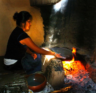
HOPI WOMEN have been making the ceremonial PIKI Bread for centuries in a special cooking space behind the main house

AFTERMATH of DE NIZA’S JOURNEY TO CIBOLA
Cultures, old as time, were attacked as pagan by the Catholic priests who accompanied the Conquistadors and who blessed their cruel attacks, in the name of saving pagan souls. The vanquished Indian was used as slaves, sold, slain or simply worked to death. The Cross, the symbol the Spanish brought the Indian and who adopted it, as pagans you can always use another God. Finally, the Spanish opened the West, the Conquistadors began the mapping of the West which became the United States of America’s quest for it’s “manifest destiny”. The American Indian, time and time again found himself in the way of the white man’s greed, the white men attacked the first Americans stealing their lands, their game and their lives, their homes, eventually they stole their children!
The facts show the journey of FRAY MARCUS de NIZA, a man of God, began an “era of extermination”, a period when approximately 20 million Indians inhabited this territory before the Conquest, and after just one century of Spanish rule there were only 1 million left! Many vanquished by Old World diseases brought to the New World with Europeans. The epidemics that broke out as well as the merciless workload imposed on the Indian dramatically diminished the Indian population. The scope of the epidemics over the years was tremendous, killing millions of people—in excess of 90% of the population in the hardest hit areas—and creating one of “the greatest human catastrophe in history, the most devastating disease was smallpox, but other deadly diseases included typhus, measles, influenza, bubonic plague, cholera, malaria, tuberculosis, mumps, yellow fever, and pertussis (whooping cough). The Americas also had a number of local diseases, such as tuberculosis and a type of syphilis, which soon went viral when taken back to the Old World.
“The moving multitude…darkened the whole plains,” wrote Lewis and Clark, who encountered a buffalo herd at South Dakota’s White River in 1806. With westward expansion of the American frontier, systematic reduction of the plains herds had began around 1830, when buffalo hunting became the chief industry of the plains, organized hunters killed buffalo for hides and meat, often killing 250 a day.

The White Man also almost exterminated the American Buffalo, herds said to be 20 miles wide and 20 miles deep, roaming the valleys they have always grazed, only a few small herds survive today. At that time, some white men sought to eradicate the buffalo to take away the Indian’s livelihood and well-being. Native American tribes depended on the buffalo’s meat and hides, and many still today believe the animal has special spiritual and healing powers, making it an important part of their culture. The railroads laying track across the plains further depleted the buffalo, as well as the Indian’s hunting grounds because hunting from train windows was widely advertised and passengers shot buffalo as they raced beside the trains. By 1883 both the northern and the southern herds had been destroyed. Less than 300 wild animals remained in the U.S. and Canada by the turn of the century out of the 30 to 75 million that was once thought to live there.
The Navajo “Long Walk” was the 1864 forced-deportation and some say attempted ethnic cleansing of the Navajo by the U.S. Government notes Wikipedia. The Navajos were forced to walk at gunpoint from their Arizona reservation to eastern New Mexico. Some 53 different forced marches occurred between August 1864 and the end of 1866. The “Trail of Tears” is a name given to the forced relocation and movement of Native American nations from southeastern parts of the United States Many of re-settled Indians suffered from exposure, disease and starvation on the way, many died, including 4,000 of the 15,000 relocated Cherokee. By 1837, 46,000 Native Americans from southeastern states had been removed from their homelands opening 25 million acres for predominantly white settlement.
SOUTHWESTPHOTOBANK’S PREHISTORY PHOTO GALLERIES CLICK HERE….
CONQUISTADOR ARMOUR BY ERIC THING
![]()
<a href=" SPANISH TRANSLATIONS:
SHAMANISM: Crack in the Rock divides US from our Spiritual Side

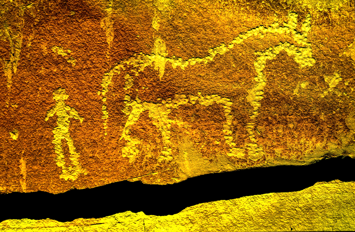
Rock art in North America is found deep into Mexico north into Utah-it can be quite old, in central Arizona it begins before Christ and around 1000 AD rock arts takes on human shapes. North to New Mexico’s Chaco Canyon, a rock wall has a series of lines in a single panel said to mark the summer equinox, a sun dagger is said to mark the coming and going of summer. Elsewhere in Chaco’s back country is a panel said to depict a 10th century Super Nova seen in the sky. Graphic shapes or counting seems to be one media but art does become more expressive, but nowhere is the javelina or wild-pig and mountain lion depicted in stone. They migrated late into our area only within the past two hundred years. This flute-playing Mountain Goat carved in rock is found at SAND ISLAND IN BLUFF UTAH in the midst of the NAVAJO Nation but is a remnant of the ANASAZI prehistoric culture. This isolated view represents perhaps 18 inches by maybe 30 inches sliced from a rock art panel on a 150’ cliff beside the San Juan River. Most of that 150 foot cliff is rock art, this is simply a paragraph.
It appeared to me as very cool having a Mountain Goat playing the flute, like Kokopelli, so I pulled this in with a 300mm lens and thought no more about it until one day when I visited Edgar Perry, a White Mountain Apache Medicine Man and described the panel to him from memory.
Is there a crack between the two groups of sheep? he asked. Yes, I said. “That line represent the real world (topside) and the supernatural world (beneath),” he said. Topside you see two sheep walking on all fours beneath the crack you see two sheep — one standing on two legs and playing a flute and the other on all fours with a bird (raven) appearing from its head the Navajos call this, skinwalkers or shape–shifting. The Medicine Man points out the White Sheep becoming a black Raven characterizes the battle between good and bad, right and wrong. Imagine if that much meaning can be taken from a fraction of the entire panel, imagine what else, we could learn everywhere.
THE COLORADO RIVER IS 2013’s “MOST ENDANGERED RIVER” ARE WATER BANKS AND RATIONING, OUR FUTURE?

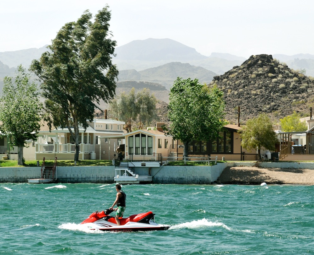
WILL THIS POPULAR ARIZONA, CALIFORNIA AND NEVADA PLAY GROUND RUN DRY?

THE CAP IN TAKES WATER BENEATH HOOVER DAM.
What happens next year? “Maybe we’ll have a wet year”, seems to the extent of the plan, it’s a lot like me buying lottery tickets for my retirement, its proactive, optimistic but nothing to take to the bank.
I visited the New York Times, the editorial page of the Salt Lake Tribune, the Las Vegas Headlight-Sun, the Los Angeles Times and the Arizona Republic to see how each spun the story about Lake Mead facing shortages. Perhaps the best story I found was a gardening column for the LA Times, complaining that they were getting mixed signals whether or not they should put in lawns. The Vegas spin was more sobering when you realize Sin City gets 90 percent of its drinking water from Mead. Vegas has two large siphons attached to the lake and a third under construction, they are scared–by the end of the year one siphon may be above Mead’s water level and worthless. The new siphon runs through the bottom of the lake and will be able to literally suck Lake Mead dry. Nobody believes that will happen-but the new siphon is nearing completion in spite of setbacks. The Southern Nevada Water Authority has begun pursuing permits necessary to build a $3.5 billion, 300-mile pipeline to shuttle water from the mountains in northern Nevada, many question the plan.
Southern California believes every time a sprinkler is turned on, choices are being made between lawns and their fisheries and still-no one believes anything will change until the courts start ordering changes. Already California water companies are trying to linkup with snow melt from the Northern High Sierra, just in case, they say. Lake Mead’s reservoirs have reached 1087 feet for the first time since 1956 when the lake dropped ten feet in order to fill Lake Powell. These twin reservoirs will require years of snow melt and runoff to make up the deficit and tree ring dating data frankly doesn’t support that optimism, it does suggest the droughts since 1990 frankly are nothing out of the ordinary and things could get worse. Utah has a $2billion “pie-in-the-sky” pipe line planned to bring more water from Lake Powell…water that might not be there. Kinda of reminds me of the Hohokam, all we really find of them are the water canals they built to bring water to the desert and therefore brought life itself.
In Phoenix, the Arizona Republic reports Lake Mead water levels determine drought status on the river under a set of guidelines adopted in 2007 by the seven Colorado River states: Arizona, California, Nevada, Utah, Wyoming, Colorado and New Mexico. If the lake reaches the first drought trigger, measured at an elevation of 1,075 feet above sea level, water deliveries below Lake Mead are reduced by a little more than 10 percent. Additional cutbacks would occur if the lake continued to drop. For Arizona, the stakes are high. Arizona absorbs 96 percent of any water rationing on the river under a decades-old agreement that ensured construction of the 336-mile CAP Canal. Nevada absorbs the other 4 percent under a separate deal with Arizona. Although rationing would affect some users on the river in western Arizona, most of the cuts would come from the canal, whose annual flow of 1.5 million acre-feet would be reduced in stages. (An acre-foot is 325,851 gallons, enough to serve two average families for one year.)
Farmers and users of excess water, such as underground-storage programs, would be affected first. It’s unlikely cities and business in Phoenix and Tucson would lose any water in the earliest stages.

IN SAN LUIS BAJA NORTE MEXICO THE RIVER IS DRY LESS THAN TEN MILES SOUTH OF THE BORDER
“It’s a clear warning,” said Tim Barnett, a scientist and Lake Mead expert from the Scripps Institution of Oceanography who sounded the alarm in 2008 that Mead had a 50% chance of running dry by 2021. “The thing that’s astounding to me is the head-in-the-sand attitude of the bureaucrats that we’ve talked to.” “The water situation in Southern California is serious,” he added, “But I don’t think it’s dire yet. Six months or a year from now, we might not be using ‘serious.’ ‘We might be using dire'”.
During the last decade the Southwest has loss snow pack, vegetation and endured serial wildfires and increased temperature and all the while the region has grown faster than any other part of the US. Study after study predict that climate change will reduce the banked snow pack from 6 to 45 percent over the next half century. Every year more water is drained than deposited with an annual deficit of 1.6 million acre-feet, still without a “full-fledged crisis” most folks won’t do anything. In Las Vegas, for instance”, the “Cash for Grass” program pays homeowners $1-per-square-foot to convert to desert landscaping.
In 2007 the Feds mandated an agreement between the seven US states sharing the rivers flow. The lowest reduction cuts deliveries by 333,000 acre-feet, about half of what Las Angeles consumes in a year. Should the lake’s surface fall another 12 feet to 1075 feet below sea level or about 33 percent capacity. some say this will happen next year. When the 28.5-million-acre-foot reservoir’s surface hits 1,050 feet, or about 26 percent capacity, deliveries get slashed by 417,000 acre-feet, Las Vegas shuts down one of its two intakes and Hoover Dam’s massive turbines lose the hydraulic pressure needed to generate electricity. The maximum cutback of 500,000 acre-feet kicks in when Mead surfaces hits 1,025 foot, or about 20 percent capacity.

YUMA WATER USERS
The mighty Colorado carries the lifeblood of the Southwest. It services the water needs of an area the size of France, in which live 40 million people. In its natural state, the river poured 15.7 million acre-feet of water into the Gulf of California each year. Today, twelve years of drought have reduced the flow to about 12 million acre-feet, and human demand siphons off every bit of it; at its mouth, the riverbed is nothing but dust.
The U.S. intelligence community understands what is happening, according to one report released last year, the global need for water will exceed the global supply of “current sustainable water supplies” by 40 percent by the year 2030…
SOUTHWEST DROUGHT ENDS LIFE 700 YEARS AGO … WILL TUCSON be the next CHACO

WATER is always a emotional topic in the Southwest United States. Talk of water rights and who owns the rights to Green Valley’s CAP allotment, can they sell it and who can use the Central Arizona Project will always be big news and the fights will just get bigger and more important as time goes by. The new CAP spur being built to Green Valley is said allow the new ROSEMONT MINE access to all the water they will need but what about LOS ANGELES and LAS VEGAS, I thought these U.S. cities got whatever water that was left over and wasn’t sent south to MEXICO and we owe MEXICO water by TREATY. Shall we assume since the mine will not have to pump ground water that its construction on the slopes of the Santa Rita Range is now a slam dunk. Better get used to the idea says Congresswomen Gabbie Giffords. According to Giffords, there has never been a Copper Mine not allowed to be built in ARIZONA because of the 1872 Mining Law, a law written, passed and enacted long before Global Warming

Abandoned due to drought which made farming impossible, fuel scarce and building supplies 50 miles away.


