
RAINBOW GOLD GROWTH ? ORO VALLEY AT THE TURNING POINT, SAVING THE SANTA CATALINA RANGE AND ORO VALLEY FROM ITSELF…


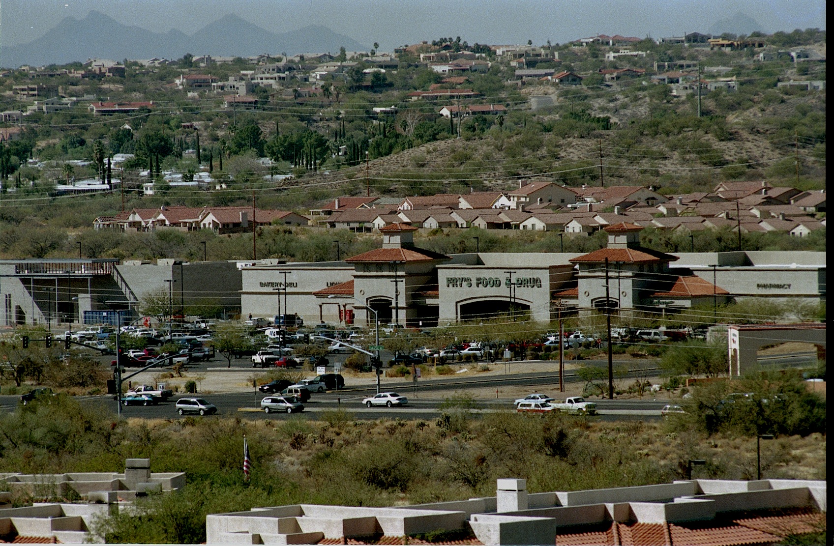
The Canon del Oro Valley is the gold at the end of the rainbow. The original Rancho Vistoso was a large Adobe ranch house located where the Walmart parking lot at Oro Valley’s Marketplace Plaza buzzes with activity as shoppers visit big box stores.
Life rarely gives us second-chances, but they do happen. Oro Valley Arizona has a second chance to decide what their Future should look like. Town residents have banded into two groups, recall elections are November 3rd, emotions have flared-assault charges and lawsuits filed and election signs vandalized and tossed into the bushes. The usual politics one finds in Small Town USA all over the country. Oro Valley’s problem: it’s one of the most beautiful places in the United States and finding the proper balance between preserving the Canon Del Oro Valley’s “Drop Dead Gorgeous” status and developing the town wanna be city so everybody is happy. Making everyone happy will be a tall order.

Walmart Shopping Center at MarketPlace

Same view as above 40 years earlier…
Mainly, because Oro Valley has become a developer’s paradise and any change there will be bumping heads with BIG bucks. Oracle Road, which is State Highway 77, which is the town’s main drag has been a 7 mile construction zone for so long know one can remember when it started. Much of this work is ramping up and adding another lane, taking two lanes to three, making room for future development. They are also building expensive wild life crossings, both over and under styles. In Colorado they have found predators just await their prey on the blind side of these crossings and just gobble till they are full. Speedtrap.org lists 80,000 bothersome speed revenue mills and knows Hwy 77.
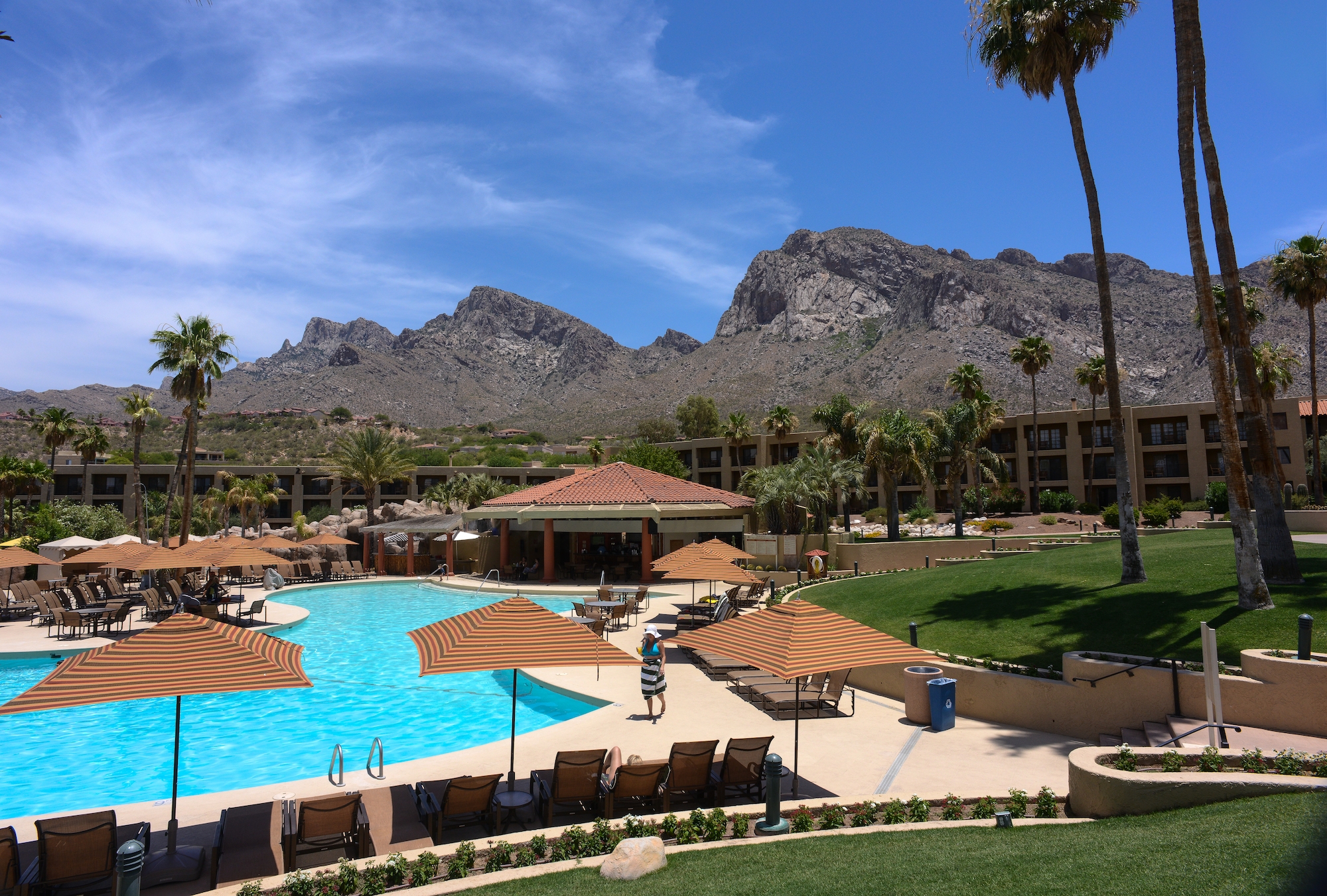
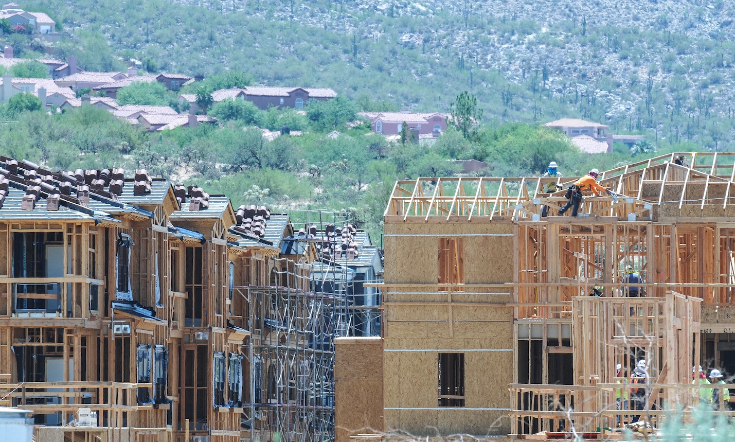
Developers in Oro Valley in recent years, have squeezed in 800 apartments, providing housing for Iowa farmers who want to get out of the snow. Sun Dorado, the next generation of Mark-Taylor Apts, has the prime spot nestled into the Santa Catalina range at 1st Ave and Oracle Road, featuring the “largest health center you have ever seen in a apartment complex”, dog-friendly and walking access to all the unique shopping nearby. Mountain views cost extra, it’s cheaper to stare at Oro Valley and Oracle Rd, for a one bedroom it’s $930 with a view, large kitchen and a closet but a three bedroom with a view tops out around $1650-but up to six people can sign the lease. No one bedrooms available now, but some might open up.

That boutique shopping experience as you leave San Dorado’s lighted gated community begins with CVS Drugs; store number 10,006 now found on most corners near you, the next shop is a FIRM mattress shop and everyone needs one, the next is a Nail Spa, also found everywhere. So the question facing the voters, what premium do you place on living in one of the most beautiful places in the U.S., or is growth-any growth worthwhile ? Some voters might argue that building all those apartments at the junction of lst Ave and Oracle Road and providing pads for businesses found on most every street corner in Tucson on a spot which was the community’s focal point of the Catalina Mountains might have been insensitive and might better have been a green space for the community to feed their souls and revel in the beauty that GOD has provided. That would not have made someone rich but it would have made the community richer.


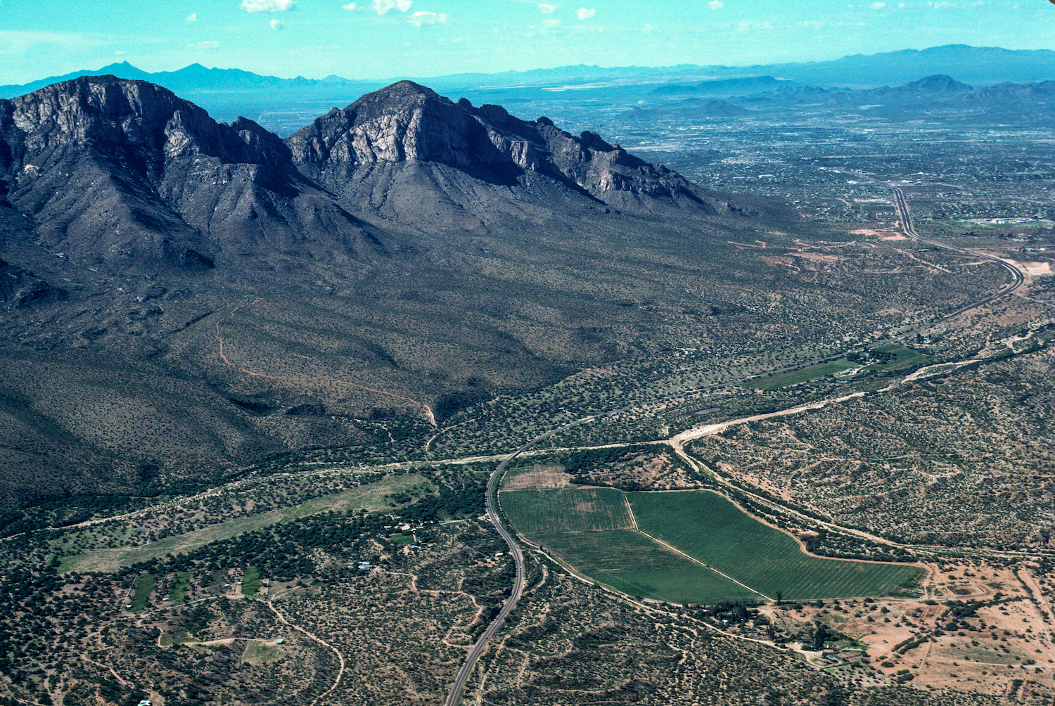
Catalina Arizona sits next to Oracle Road north of Sun CityRancho Vistoso just south of the Pima-Pinal County Line…in the distance stands the Santa Catalina Mountains
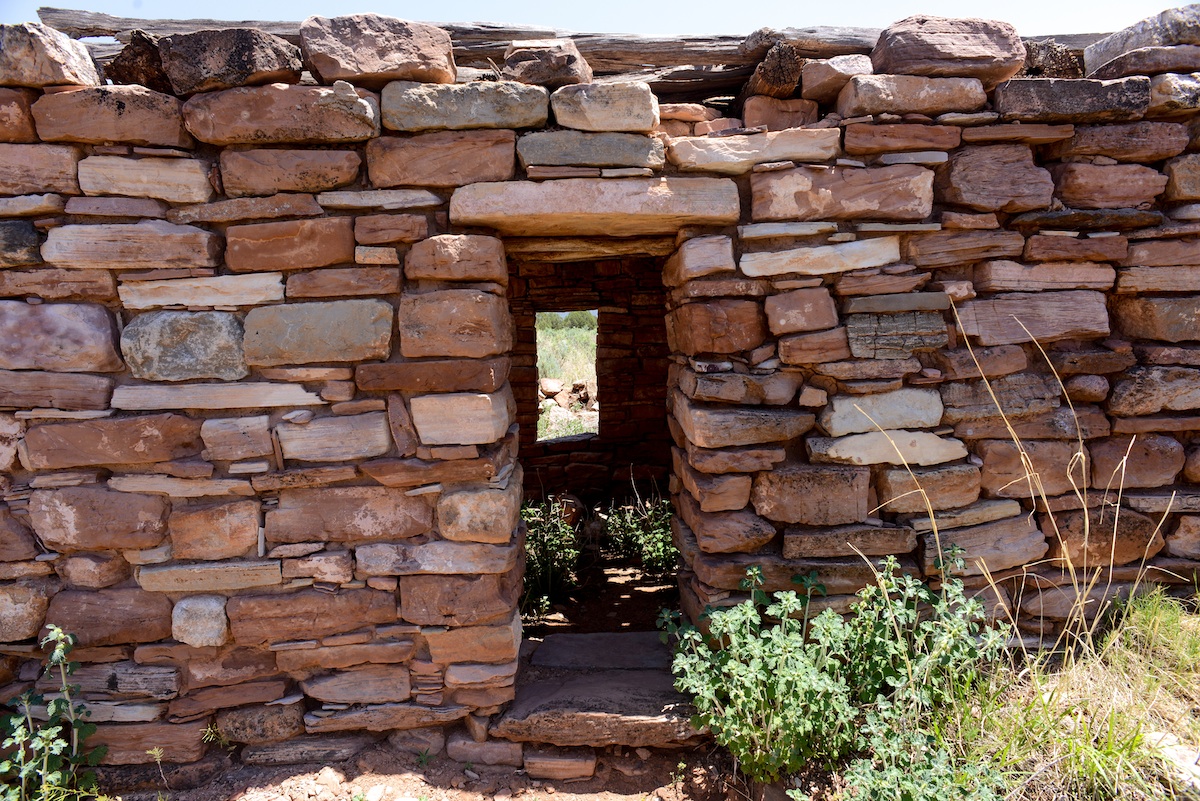
Oro Valley has some nice green spaces, along the (dry) riverbed–Steam Pump Ranch was a nice idea until it was squeezed in by gas stations and commercials strip malls, something was lost. Lunching on day at the amazing Saguaro Cafe in Oro Valley my dog engaged me in a conversation with two realtors who suggested Oro Valley’s real prosperity will come from commercial development along Tangerine Road. “It will be the next Speedway”, they agreed since it is a major I-10 to Oro Valley corridor.

Oro Valley No vote Council members meet with residents explaining how “dirty” actions from the Mayor and the other YES votes for the new City of Oro Valley Recreation Center compromised their vote with a rushed agenda. Councilman Mike Zinkin in the foreground, Councilen William Garner in RED, and Brendan Burns in blue behind.

Oro Valley residents listen to Councilmen opposed to the purchase of the Old Conquistador Country Club also stressed concerns about Golf dying as a business, water woes. In Phoenix several golf course are rebranding their communities, they are tearing out the fairways and adding boulevards. An uncertain future shadowed these concerns…
Now Oro Valley has a second chance to make the right decisions. It is my opinion the present mayor, will continue to fuel development since a large portion of his election campaign has been financed by the folks doing the building, that’s the way politics works. Mayor Satish Hiremath is running to hold onto his office in the Nov. 3 recall election along with town council members Lou Waters, Joe Hornat and Mary Snider. The recall was initiated by the Oro Valley Citizens for Open Government after the Town Council voted 4-3 in December to buy El Conquistador Country Club and increase the town’s sales tax to raise money to remodel the facility into a community and recreation center. The council members facing recall all voted in favor of the proposal. The facility was purchased for $1 million and includes 324 acres, 45 holes of golf, 31 tennis courts and two swimming pools. A 31,475 square-foot building that requires renovation will be paid for with a half cent sales tax that took effect in March.

Rancho Vistoso in 1975 today its someone’s front yard in the HoneyBee Reserve gated community…
Oro Valley was incorporated in 1974 and has grown from a shady Oasis to one of the more prosperous communities in Arizona with almost 130,000 people within seven miles, incomes averaging around $70,000, it has been voted Best Place to Raise Kids, Good Place to Retire because of the strong property values and low crime. Truth is, Oro Valley and the Tortolita Mts

Arizona Governor Bruce Babbit turns over the soil dedicating Catalina State Park and at the same moment he opens Rancho Vistoso Sun City for business.
for decades was everyone’s backyard. Quail Hunters reveled in the explosion of birds they found there, javalina hunters still tell tales of the hunt and folks like me, explored and hiked, searched for the wild herd of mustangs running free in those hills. After the land swap, when Governor Bruce Babbitt, created Catalina State Park and in return made possible Rancho Vistoso Sun City, locked gates started appearing–pushing long-time Tortolita Mountain lovers from their haunts. Thinking maybe when they are through building, I thought, but that is when the gated communities started popping up, so for most of us, it was goodbye to the Tortolitas. Growth has continued unabated, in 2008 when housing all over the U.S. died. Oro Valley barely skipped a beat sales slowed and inventory faded but not like the rest of the country.
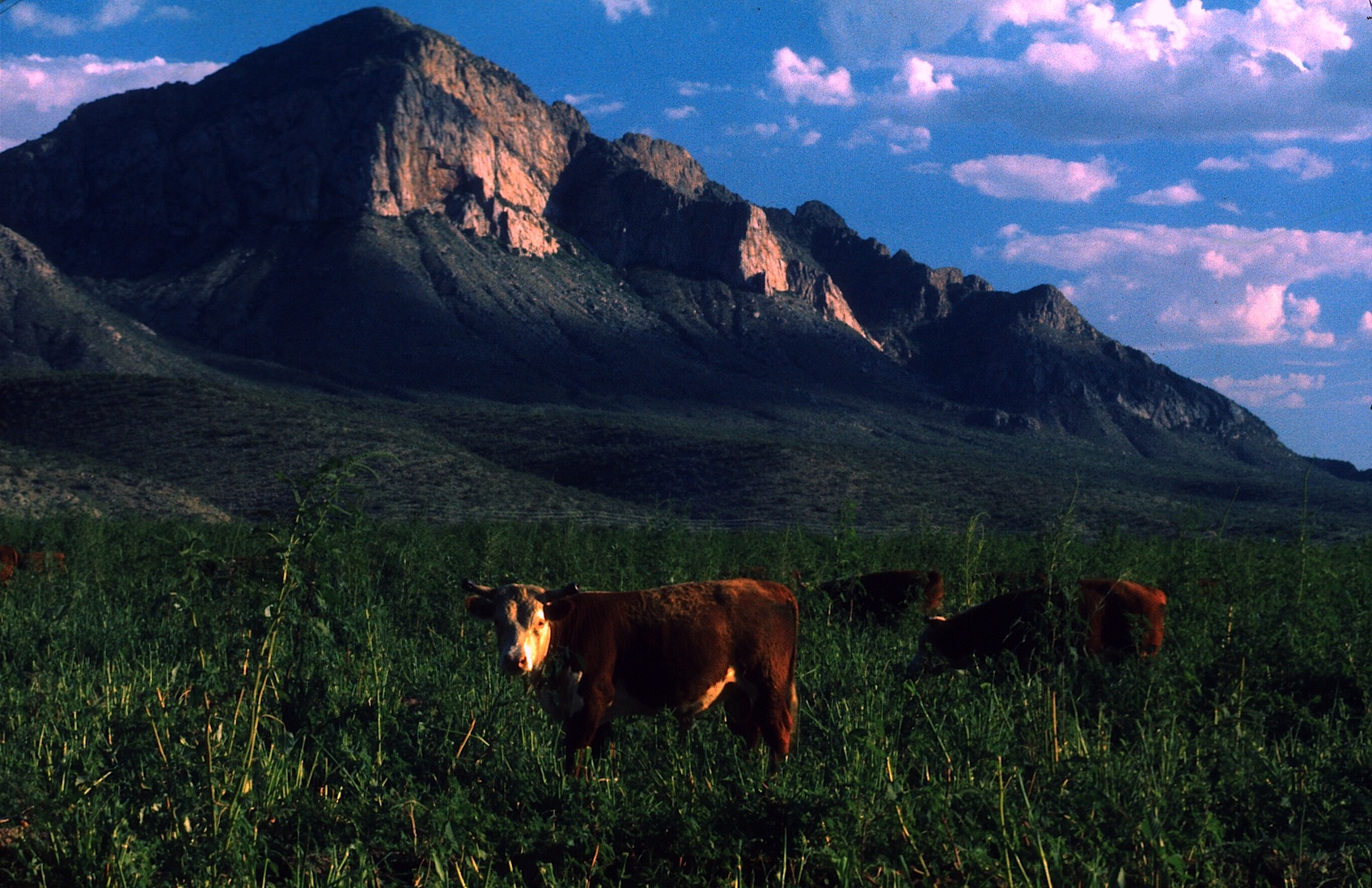
Cows on trust land equals tax break, the field feed the cows. A lean farm operation.
In the early 1970’s John Ratliff and his associates requested that Pima County rezone a 4,000-acre parcel of land lying east of Oracle Road, north of Tucson. The property known as Rancho Romero was located adjacent to the western slopes of the Coronado National Forest’s Santa Catalina Mountains. The proposed development included a variety of housing units that would accommodate 17,000 people, which would surround golf courses along the Canada de Oro and Sutherland Washes. When this rezoning request came before the Pima County Planning and Zoning Commission, there was so much opposition from the public that the proposed plan was put on hold. Tucson residents said they preferred the preservation of this area as open space, with developed recreational facilities, this was the beginning of Catalina State Park. But not the last attempt by developers to put subdivisions on the east side of Oracle Road.
Before Oro Valley, the grassy field is today’s Marketplace.
The Oro Valley Conquistador Hotel, the first construction on the east side of Oracle, has been on the auction block, off and on, last time was 2012. The 400 room structure began life as a Sheraton Hotel, then Hilton presently Premier Hospitality Management maintains the contract. Its restaurants were a big draw in the beginning but as growth came to Oro Valley more restaurants came in and greater variety made expensive Mexican food less interesting.

Desert Springs was one proposal recently turned down, Sabino Springs popped up in 1990 but developers will be back.


For me, the building East of Oracle Road is the most offensive. West of Oracle, growth will continue north until it hits Oracle Junction, nothing will change that. More than once, developers have attempted massive subdivisions featuring more than 500 homes, shops, condo and apartments east of Oracle Road where Tangerine Road intersects, Sabino Springs
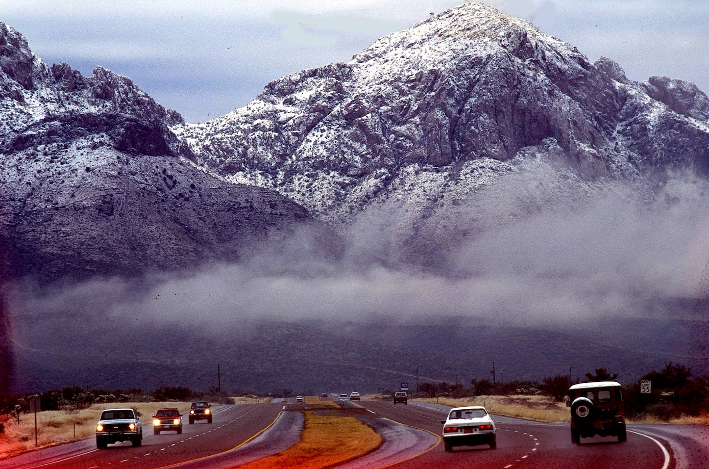
Oracle Road after a winter dusting of snow.
was one name, others will come and they will keep coming until they get their prize butted up against Catalina State Park. Folks will awake in the campground and stare into someone’s back yard. SunChase Holdings Inc. pledged “a high quality project” that would be tasteful and would fit in with the surroundings. Another attempt for this prize was fought off in 1990, with a progrowth Mayor, they will get the land and that will be the beginning of the end for the Catalina Mountain Range. Sunchase said they needed 85 acres with up to five homes per acre, 13 acre of five home per acre and up 11 acres of commercial and offices. In between they plan to weave hiking and biking trails, blending stores, offices and a mix of housing types. One caveat floated was the possibility of a Tram from Oro Valley to Mt Lemmon, making Oro Valley a must stop for all tourist blowing through Tucson. Much shorter ride than when it was first suggested from downtown Tucson decades ago.
Oro Valley’s First Avenue and Oracle Road has become downtown for the community…
With the new animal crossings on Oracle Road, any concern about “wildlife corridor” between the Catalina and the Tortolita Mountains pretty much go out the window, regardless of major habitat fragmentation.  A short while ago I listen to an Oro Valley resident wish she was living in SaddleBrook just up the road. She was simply amazed by all the wildlife those residents enjoy. After the bright lights of Oro Valley chased off the last of the Desert Bighorn living atop Pusch Ridge-the town adopted the Bighorn as a symbol of the community erecting several life-sized statues throughout the town. Today new bighorn have been transplanted atop the nearby ridge but disease and mountain lions have taken their toll.

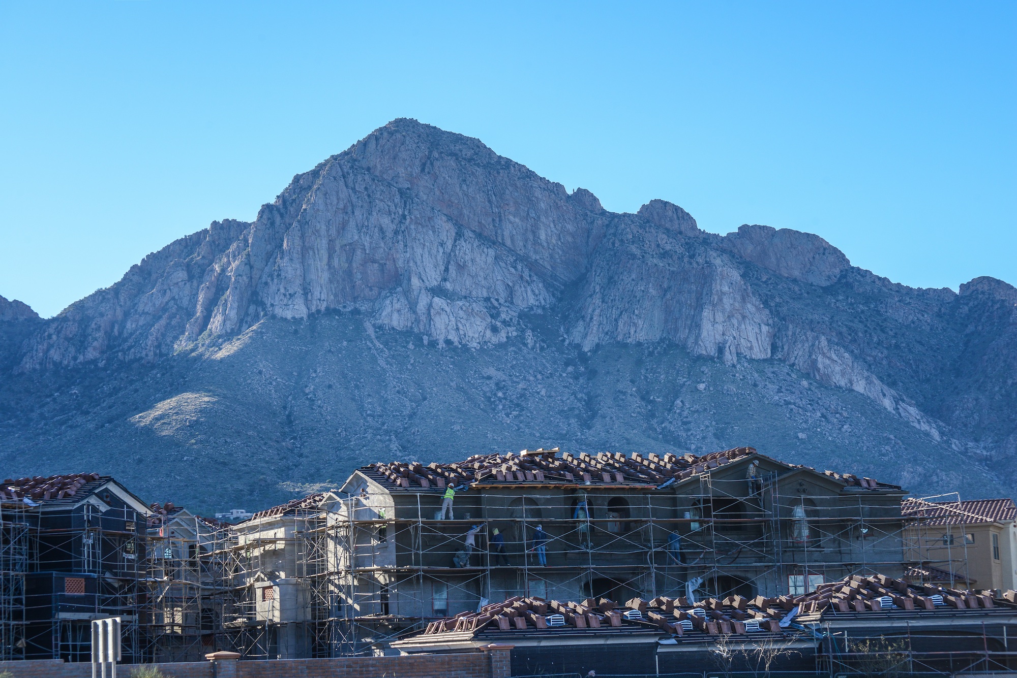
Many years ago, I was out-raged by the wall built to block the view across the Canon Del Oro Wash that eliminates out the most perfect view of the mountains. I was sure they just wanted to be sure everyone had their eye on the road (now they are texting) but after while I realized how wrong I was. That wall is a sound barrier for all the expensive homes that soon will be built above the road level and on top of the first foothills, most money gets the highest spot. No one will pay big bucks for the spectacular sunset views if the road noise from below drowns out the elevator music.

Sound Wall for the big bucks lots yet to come.
It is all going to change soon, unless it is stopped now. The Town of Oro Valley Special Recall Election will be held Tuesday November 3, 2015. A polling place election, voters may request an early mail ballot, for more information call the Pima County Recorder 520-724-4330…

I began this blog pointing out that Oro Valley’s problem is that it is one of the most beautiful places in the United States. What I haven’t said is when folks finally end their long journey on I-10 and the Catalina’s finally come into view, there is a sigh, and I know I’m home again. We all take their beauty for granted but try to imagine that skyline without those hills and take stock in what we have and the responsibility to leave this beauty for the children, our future-what will Oro Valley look like tomorrow.
ORO VALLEY CITIZENS FOR OPEN GOVERNMENT
PIMA COUNTY RECORDER-REGISTERING TO VOTE
![]()

<a href=” SPANISH TRANSLATIONS:">
THE GREAT FORT APACHE HERITAGE CELEBRATION or NDEE LA ADE’/ GATHERING OF THE PEOPLE WHOSE YOUTH ARE KEEPING THEIR TRADITIONS ALIVE !

ROCK CREEK ELEMENTARY SCHOOL CROWN DANCERS WAIT A TURN IN THE DANCE ….

DANCERS JOIN IN THE GRAND PROCESSIONAL
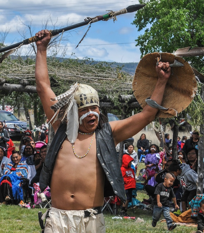
The White Mountain Apache celebrates the Tribe’s Youth, it’s language and traditions through song and dance each year at the Great Fort Apache Heritage Celebration. It is a time of competition, Crown Dancers turn out to out dance other Mountain Spirit groups. Singers show up to entertain and to flaunt the Apache Spirit and Apache life ways. Participants may come from different districts, but they are all Apache. This Celebration each years serves as a reunion for former students of the Theodore Roosevelt BIA School, as well as, Apache from all directions. Holding onto the Apache customs, once taught from birth like language now competes with English and TV, and the Heritage Celebration highlight their traditions and celebrates the Apache Language. There is a flashing of colors as all participants of the Grand Processional join together on the dance floor. Earlier Apache children took a seven mile walk called the Seven Miles for Seven Generation Walk. “Youth keeping the future alive with traditions and culture” is the theme of the day meanwhile that night at the school they held a oldies dance for High School Alums that featured an Elvis look-a-like dance. The War Drum rang out from Fort Apache in the Arizona’s White Mountains as dancers took to the war path at the bidding of President Obama’s White House. The White Mountain Apache Tribe, (WMAT) accepted Obama’s Gen I initiative, the challenge is a Indigenous Youth Project designed to support cultural strategies to improve the college-and-career readiness of Native children or to preserve a culture”s traditions. A young WMA, Jared Ivins-Massey took that challenge, and brought the WAR dance to the iconic Fort this year. During the traditional building of furious resolve Warriors danced and thrust with traditional spears, others drew their bows with arrow, still another flaunted a hunting rifle, another still drew his large butcher knife leaving no doubt he stood ready to use it. These fierce warriors ranged from retirement to elementary school age and all welcomed the President’s initiative to focus on the lives of Native American youth and to restore the cultural rituals lost to Indian community in the early 1900s when the United States government banned Native American ceremonial dances. President Obama announced the Generation Indigenous (Gen-I) Initiative. Through this initiative Native youth are encouraged to conduct a positive event in their community that focuses on health and wellness, cultural preservation, and youth well being. Massey’s Gen-I event focused on the cultural preservation of the Apache language and traditions. For 75 years, many Native American ceremonial dances ceased and those that did manage to continue did so in secrecy. In 1978, when the American Indian Religious Freedom Act was passed, many ceremonies and healing rituals were re-established amongst the Tribes. Some think these rituals have lost meaning for the younger Indian generation and, they will never again be quite the same, but others are working to restore the rituals of the past.
 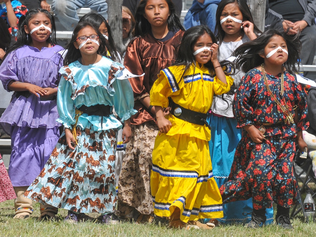 “The Great Fort Apache Heritage Celebration today provides an important opportunity for the White Mountain Apache community to come together to share the beauty and vitality of their Ndee heritage, and to shape a uniquely Apache present and future” writes Karl A. Hoerig, Ph.D. Director of Nohwike’ Bagowa Museum and Apache Cultural Center. Fort Apache for more than a century served as a military post and then as a boarding school for the White Mountain Apache Tribe. “The Theodore Roosevelt School National Historic Landmark campus was dedicated to the control of Apache people and the destruction of much of their heritage. Starting with the establishment of the first Apache Cultural Center at Fort Apache in 1969, and continuing with ever-expanding initiatives to re-establish the community’s sovereignty over the site–including this annual event–Fort Apache is becoming first and foremost an Apache place: a place for education, for the perpetuation of heritage, for economic development, for the community.”

WHITE MOUNTAIN APACHE RETURN TO THE WARPATH…
“This celebration is now truly by, for and of the White Mountain Apache Tribes citizenry” writes Jo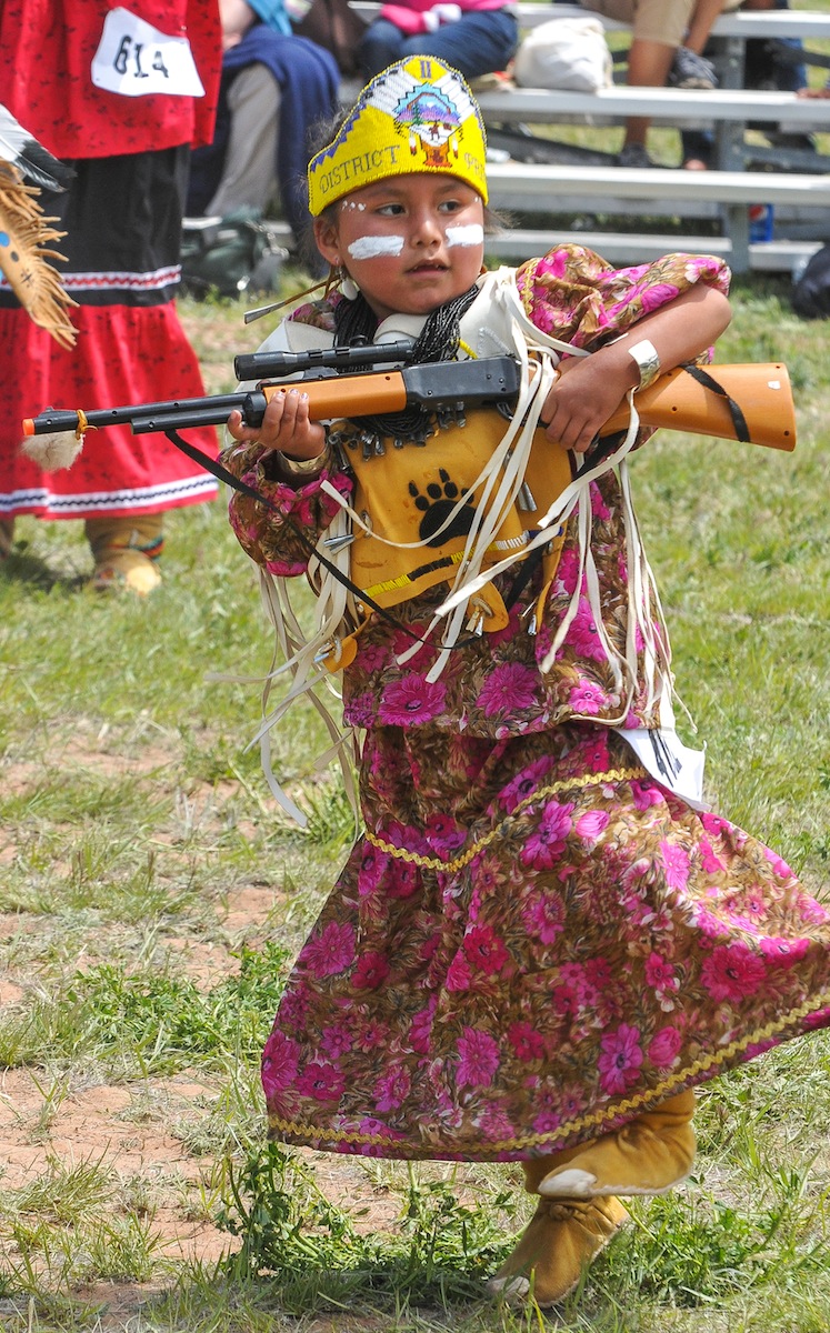 hn Welch, who produced the original 2001 event which has grown for the past 16 years into the event that now hosts Apache dance and singing each May when the tribe celebrates its annual gathering of the Apache People which now has grown into an “authentic expression of the communities interests and value.”
“Keeping the rituals of our ancestors alive”, say members of the Indian Club at Alchesay High School in Whiteriver. Their members who dance in the White Mountain Apache crown dance groups, find their roles “as Mountain Spirits who banish evil and bring good fortune”, culturally important. Some dancers come from Christian homes, go to church, and learn those traditions, and do not learn the Apache traditions. This is our heritage, and we have to keep it going.” teaches Rosalind Armstrong-Garcia, a group sponsor who believes the club fills a gap”. During this year’s Apache Heritage Celebration three school dance performed in the Gaan dance off which featured seven Apache Crown Dancers groups who delighted the crowd and competed among all the community dance groups.
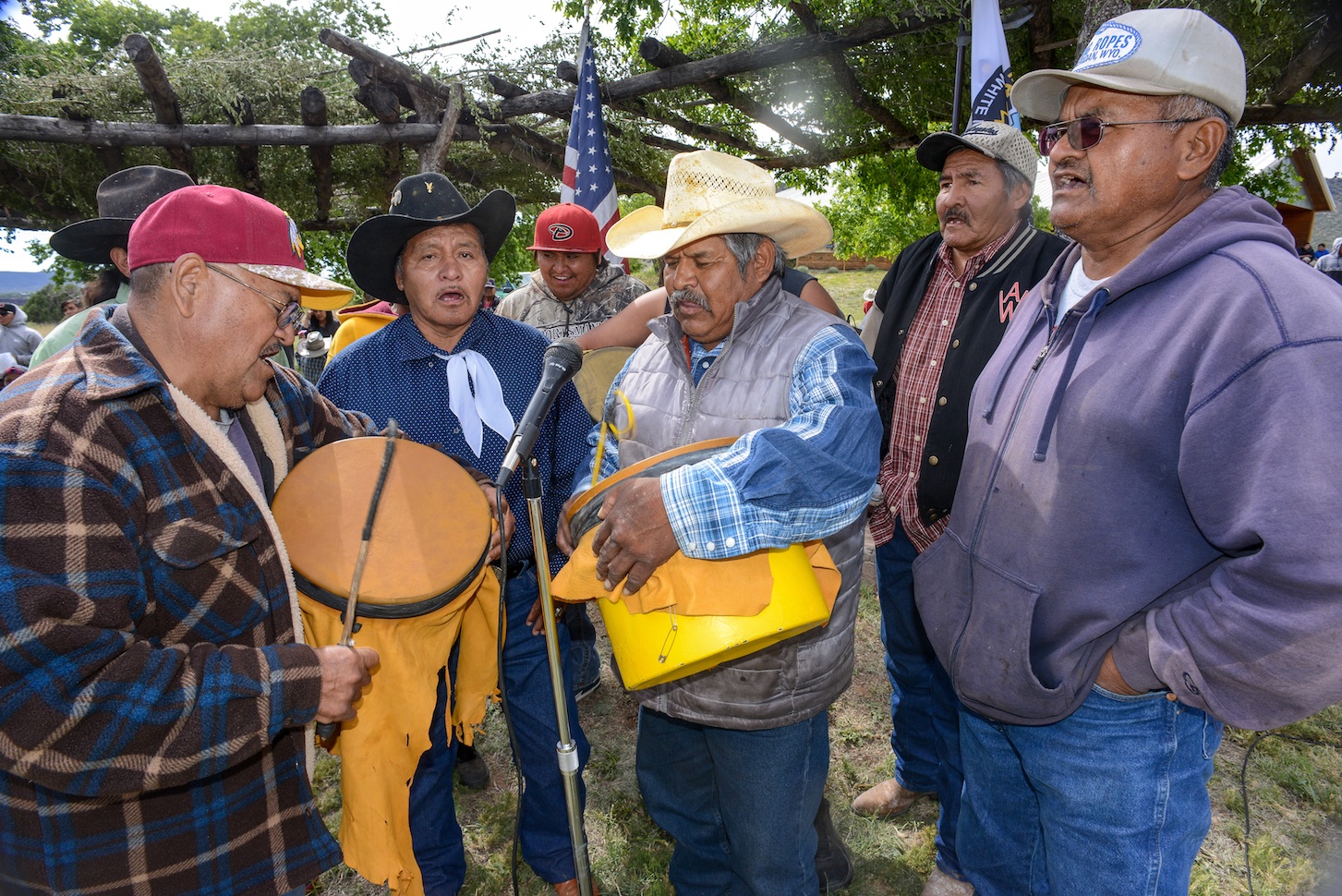

Manuel Cooley delights the crowd singing in Apache about the antics of a naughty little boy.

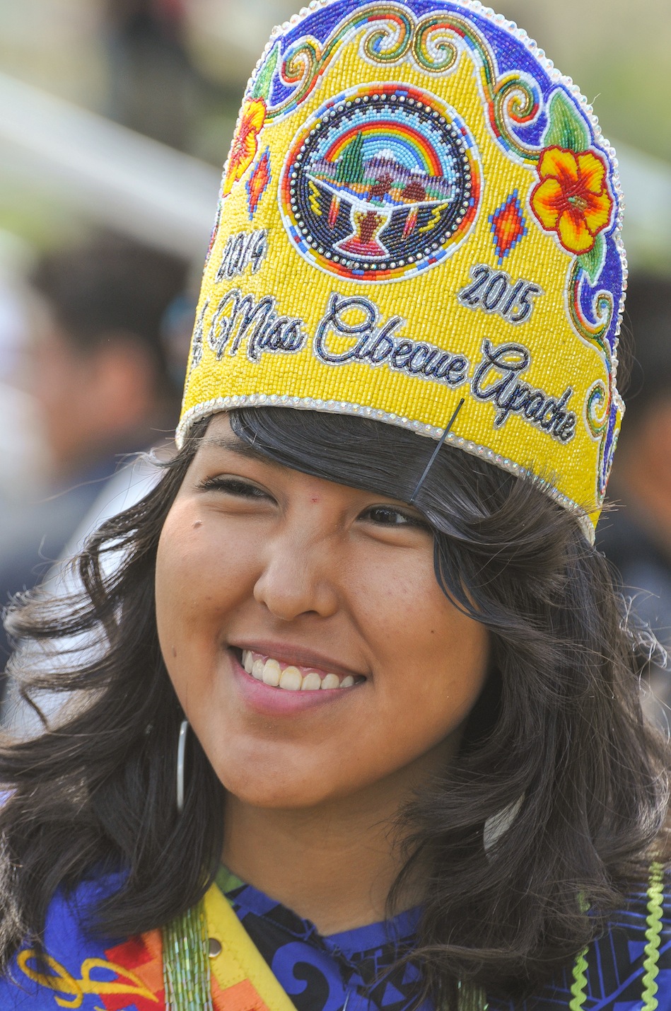
Second District Iola James
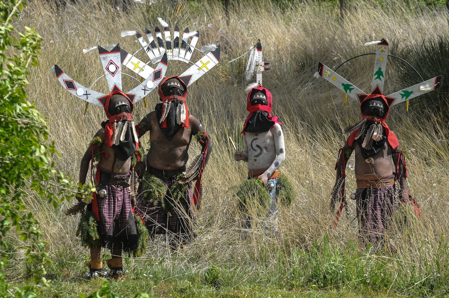
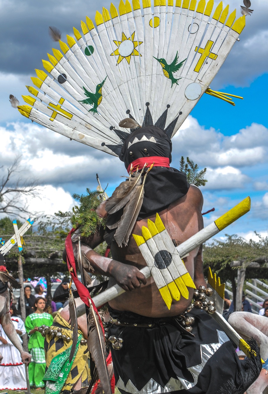
The Apache religion has been a fundamental part of the Apache lifestyle. Their worship for their God, Ussen, the Giver of Life and the Gaan or Mountain Spirits, who are represented in religious rites such as healing and puberty ceremonies. While the Crown Dancers who dress elaborately to impersonate the Mountain Spirits, wearing kilts, black masks, tall wooden-slat headdresses, and body paint and carrying wood swords have no supernatural powers they serve as a conduit for the Apache spinning their words into the heavens and assuring their prayers reach their God. “The mountain spirits have taught the Apaches to perform the Apache Crown Dance as a means of curing. The crown headdress is be-decked with eagle feathers; the teacher that flew the highest in the Heavens. The signs of lightning are sacred symbols of the Apaches which are placed on the bodies of the Apache Crown Dancers who are instructed by the mysterious mountain spirits to perform healing rituals for the Apaches. The crown dance is authentically performed today,” reported long-time Apache Tribal Chairman Ronnie Lupe in the Fort Apache Scout newspaper. 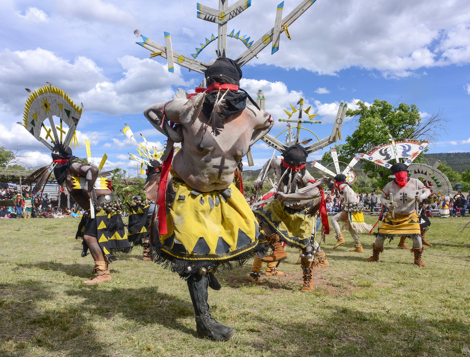 MOUNTAIN SPIRIT DANCERS COMPETITION

 FOOD FROLICS DELIGHTED THE CROWD OF ALL AGES….

Apache Royalty prepares to spread fruit out around on the dance floor for one of four fruit free-for-all-with all the thrills and excitement of an Easter egg hunt.
 Kaiden and Hayle DeClay torment their father, Chico, a Crown Dancer from the East Port Dance Group. Chico makes of point of
 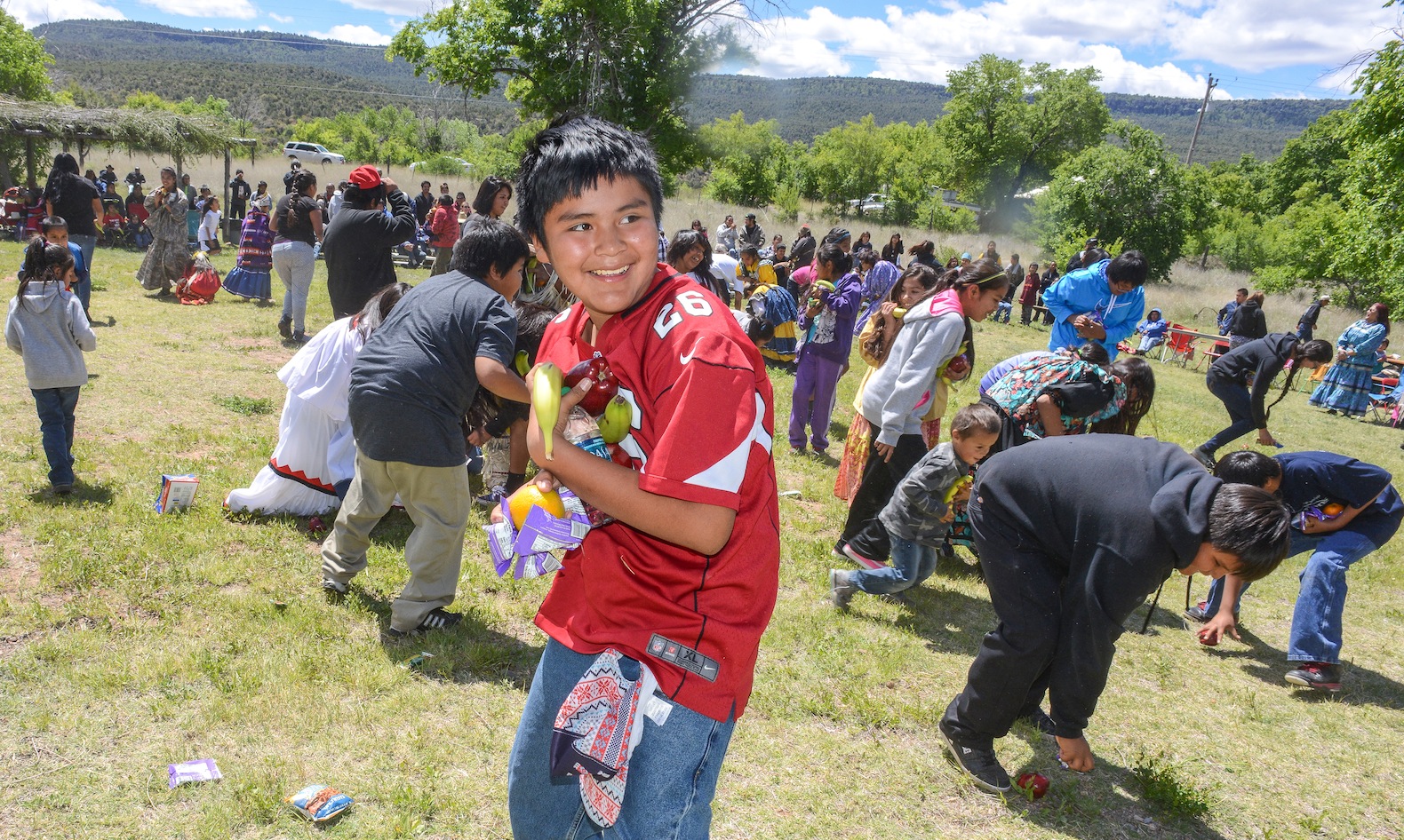 speaking Apache to his girls and they have learned to understand the language. Like many members of the White Mountain Apache People Chico and his wife Jenane believe their language and traditions is the key to holding onto the important rituals that make up the Apache traditions and ancient lifeways. In spite of the Batman, Superman and Star Wars t-shirts scattered throughout the crowd when the Cooley Mountain Singers Drum group begin beating out their songs. Apache youth began to sway to the Apache songs and the masked men they adore are Crown Dancers, whose color and sounds of bells bring them onto the dance floor as they try to copy their elders. White Mountain Apache Miss Indian Arizona Shasta Dazen tells the crowd “it’s a great day to experience

Linton Ethelbah Sr and Shannon

TANNER HENRY or “BEAR”
all the love that comes from our traditions and congratulations to everyone here for clinging to your culture.” Eleven month old Shannon Hope squirms from her daddy’s lap and begins dancing with the drum. Barely able to walk but she wants to dance. Her father Linton Ethelbah Sr. explains he speaks Apache to the toddler whenever he can and has noticed she appears to understand Apache and looks confused when his wife or other six kids speak English to her. Traditions are important to Linton whose medicine man grandfather, Thomas and his wife, Cecilia taught him the importance of the Apache way of life, I want her to understand Apache. His middle son is a graduate from McNary elementary school and just graduated from the Sherman B.I.A. Indian School in California. “He wanted to go elsewhere and learn to be independent. There’s nothing here right now, Ethelbah says, jobs are hard to find.” “Drugs and alcohol are problems here and in California he can learn to make a living…there are more opportunities there.”
 ROCK CREEK CROWN DANCERS BLESS THE YOUTH KEEPING ALIVE THE TRADITIONS FOR THE FUTURE GENERATION

Mylyle Ethelbah 3rd place
 “WHEN THEY GET THE CALLING…” Siting mesmerized the crowd just allows the music and dance take over. The Rock Creek Dancers, The Cooley Mountain Dancers, Diamond Creek Dancers were part of the dance off.
RAPTURED BY THE MUSIC AND THE DRUMS EVERYONE WAS ENJOYING THE DANCE… 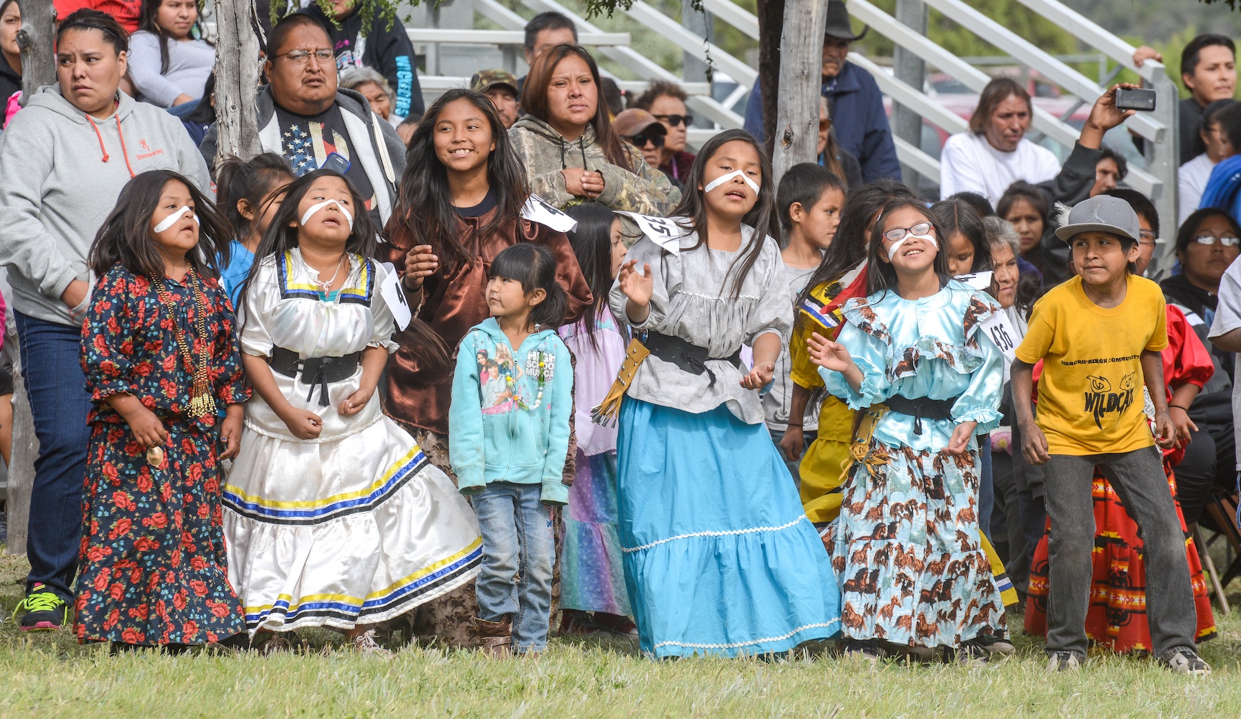
 ” APACHE KIDS ASK ME-ARE YOU AN INDIAN “YES I SAY AND SO ARE YOU…”

Monty Stover Sr. comes to the Heritage Celebration every year because he wants Apache to know what “their ancestors looked like”.
Monty Stover Sr. comes to the Heritage Celebration every year because he wants the White Mountain Apache new generation to know what their ancestors looked like. “Apache kids come up to me and ask if I’m an Indian. I am,” I say and “so are you”. No we’re not! they say to me! ” Their parents speak English too much,” Stover says. “When a young Apache child comes up to me and speaks Apache to me! That’s beautiful”, he said. “Those parents are teaching that child our traditions. So each year we have this Celebration so people can see where we came from and how our ancestors lived.” “We dance and sing, enjoy the prayers” says Kicker Z. “To keep our traditions strong to show our children who they are…” “When the drums begin the kids try to dance like the Crown Dancers says Jenane DeClay who is part Sioux and married to an Apache Crown Dancer. “They reach a certain age and get the calling, then they try to copy their father.”
 Today there are many different nations of Apache people, the present-day Apache people include the Jicarilla, Mescalero, Chiricahua, Western Apache, Lipan-Apache, and Plains-Apache. The White Mountain Apache Tribe now consists of approximately 15,000 members. Many live on Tribal lands, but others live and work all over the country and the world. The majority of the population lives in and around Whiteriver, the seat of Tribal government. In 2000 U.S. census about 57,000 people identified themselves as Apache only; another 40,000 people reported being part Apache. Many Apache live on reservations in Arizona and New Mexico. The complexity in the cultural division of Apache tribes can be can be seen by breaking down just one of these subgroups, the Western-Apache, the Apache people residing in east central Arizona are known as Western Apache. Most of these Native Americans live within reservations called the White Mountain, Fort Apache, San Carlos, Yavapai, Tonto, and Fort McDowell Mohave reservations.
 “The War Dance Generation Indigenous Event is focused on Cultural Preservation, to protect my Apache language and to see my culture continue. This event brings comfort knowing that this dance will continue for generations to come. Apache Warriors will dance into the next Seven Generations.”
MAKANALANI PIKE
 In the old days, the two day War Dance was divided into discrete parts and began shortly after dark. In the first phase, called “going to war” the warriors of each clan were called to dance and demonstrate how they will fight the enemy. Those with spears would pretend to lance; those with bows would draw them back to show how far they can draw; those with shields used them also. The second phase was termed “cowhide, picked up” and involved the singing of chants that described the stealing of enemy property. In the third phase labelled “invite by touching” women of all ages were encouraged to choose a male partner and engage in social dancing. The final phase was performed at dawn the following day. Twelve of the bravest and most experienced warriors stood in a line and, one after the other, sang a song about personal success in war. After the last song, the warriors staged mock attacks on several camps, showing how they intended to surprise and defeat the enemy. This ended the war dance, and shortly later the war party made ready to depart writes Glenville Goodwin in his notes edited into the book, “Western Apache Raiding and Warfare” by Keith Basso.
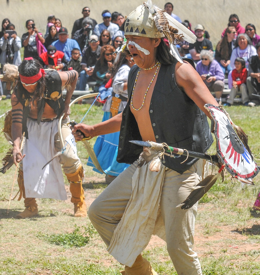
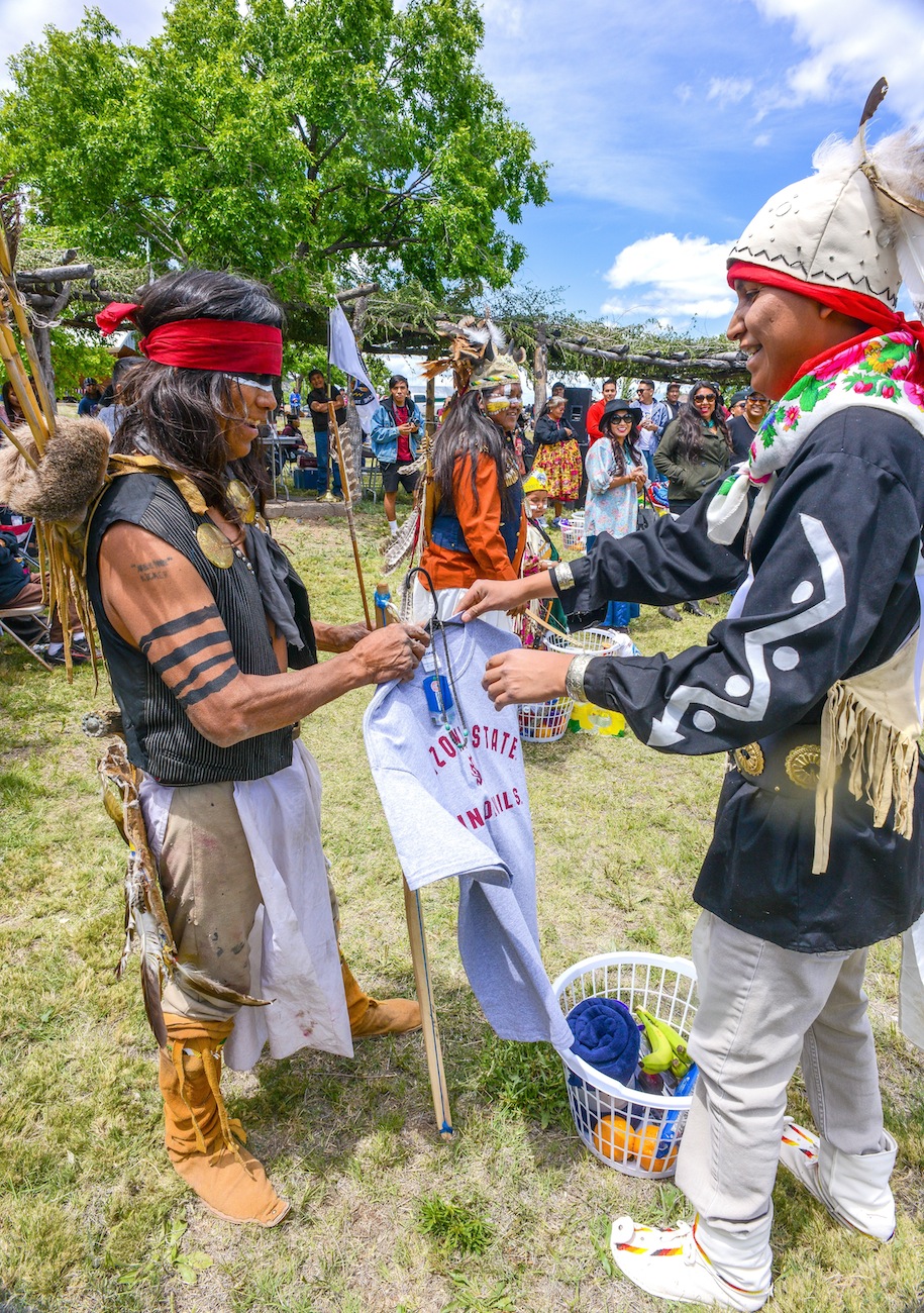
THIS YEAR’S SPECIAL WARPATH EVENT was a special White House Initiative to empower Native American Youth. The white house is launching Generation Indigenous or (Gen I), a Native youth initiative focused on removing the barriers that stand between Native youth and their opportunity to succeed. Jared Ivins-Massey, an ASU law student who produced a video of his community project showing the Heritage Celebration, the community initiative to restore past practices and traditions. Massey and others will share their stories online using #GenI …
13 year old Vernon Anderson says he loved the “War Dance” he got pretty excited thinking about things back in the day–“it was pretty cool” he said.

The Fort Apache Cultural Center called Nohwike’ Bágowa hosts exhibits, exhibitions, regularly scheduled Apache arts demonstrations. The museum houses the Tribe’s archival collection, including manuscripts, publications, and a large collection of historic photographs.

 Fort Apache is an icon of the Apache Wars and the American West and is now a monument to celebrate Apache Heritage. Fort Apache Historic Park
sits on the confluence of the north and east forks of the White River in the White Mountains, homeland of the White Mountain Apache people. The presence of the U.S. Cavalry was initially to help the Apache live peacefully on their lands and to stifle conflict among the Apache clans and then arriving white settlers. Today Fort Apache recalls both a period of conflict and a time of cooperation between the U.S. Cavalry and several tribes from the Western Apache. The U.S. military left in 1922 after many years of declining use. The Apache Scouts that had been employed by General Crook were transferred to Fort Huachuca on the U.S,-Mexican Border, where they continued to serve. The last three Scouts retired in 1947. The Fort was transferred to the Bureau of Indian Affairs to house the Theodore Roosevelt Indian Boarding School. First intended to serve Diné (Navajo) children, by the 1930s, a majority of students at the school were Apache. Theodore Roosevelt School continues today on the very spot to serve as a middle school with a school board selected by the Tribal Council. From the founding of Fort Apache in 1870 until the capture of Geronimo in 1886, this fort was involved in the Indian Wars and was first called Camp Ord, in honor of General O.C. Ord, Commander of Arizona when it was built in the spring; however, just a few months later, the name was changed to Camp Mogollon in August, then Camp Thomas in September. The post was finally designated as Camp Apache on February 2, 1871 as a token of friendship to the Indians, the fort soldiers would spend many years fighting and trying to exterminate. The fort’s initial purpose was to guard the nearby White Mountain Reservation. Situated at the end of a military road on the White Mountain Reservation, which adjoined the San Carlos Reservation, the fort guarded the White Mountain Indian Agency, while Fort Thomas watched over the San Carlos Agency. However, both reservations became the focus of Apache unrest, especially after troops moved the Chiricahua Apache in 1876 from Fort Bowie to the White Mountain Reservation. On April 5, 1879, Camp Apache was renamed Fort Apache.

BUILT IN 1871, GENERAL CROOKS CABIN HOUSES A GLIMPSE OF THE MILITARY LIFESTYLE IN ARIZONA
Today, twenty-seven historic buildings make up the 288 acre National Register Historic District. Following maps available at the Museum, visitors can explore the district at their own pace. Interpretive signs located throughout the district explain the construction and use of the historic buildings and spaces, and allow visitors to immerse themselves in the history of what many consider the best surviving example of an Apache Wars-era military post. The Fort Apache Cemetery is 1/4 mile east of the main fort grounds and is accessible

The grave of an Apache Scout, one of many who served with the U.S. Cavalry during the Indian Wars .
by walking trail or road. Visitors interested in more adventure can hike the Historic Park ’s recreational trails, including a 1.4 mile loop through the East Fork canyon that passes the site of a historic Apache Scout camp. General Crook’s Cabin, built in 1871 and the oldest structure left on the fort today provides visitors with maps, historic photographs and murals allowing an historic overview of the fort and its impact on the Apache people. One room offers a glimpse into the lifestyle of army officers and their families living on a remote outpost in the wilds of the western frontier. The Fort Apache post office occupies the adobe adjutant’s building. The stone officers’ quarters, are today the residences of teachers and other Bureau of Indian Affairs employees. The sutler’s store and commissary building, cavalry barns, and guard house have not been significantly altered. One of the original four barracks, an adobe building in bad disrepair, houses the farm shop for the school. The parade ground provides a recreational area. The cemetery no longer contains dead soldiers, but does contain the bodies of Indian scouts. The fort is located five miles south of Whiteriver, Az, from Globe, take US 60 northeast 66 miles; turn east on State 73 and drive about 27 miles to Fort Apache.
FORT APACHE BIA INDIAN SCHOOL WOMEN DORMS
The White Mountain Apache Tribe is located in the east central region of Arizona, 194 miles northeast of Phoenix. This Tribe manages the popular Sunrise Park Ski Resort, Fort Apache Timber Company and the popular Hondah Casino near Show Low.

Located in the Fort Apache Historic Park, Nohwike’ Bágowa (House of Our Footprints) is the place to experience Apache history and culture.
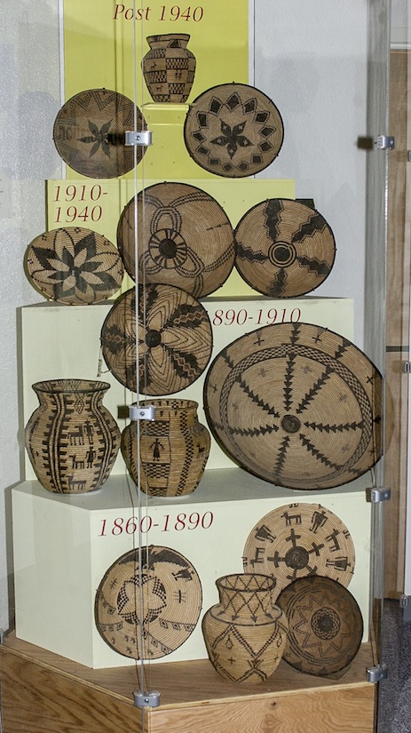 Nohwike’ Bágowa, the White Mountain Apache Cultural Center and Museum, is housed in a modern facility constructed to reflect a gowa, the Apache traditional holy home, the cultural center and museum is committed to the celebration and perpetuation of the Apache heritage. Nohwike’ Bágowa hosts long term exhibits, temporary exhibitions, regularly scheduled Apache arts demonstrations, and other special events. The museum also houses the Tribe’s growing archival collection, including manuscripts, publications, and a large collection of historic photographs. The museum shop offers a wide selection of the best Apache basketry, beadwork, and other arts, in addition to books, music, and Fort Apache and Tribal mementos.

PREHISTORIC KINISHBA RUIN
 The death of Nochaydelklinne,”The Dreamer” at Cibecue Creek and the Apache attack on Fort Apache two days later is often considered the final battle between the Apache and the U.S. Cavalry at the fort. The Apache repeatedly attacked the fort at long range, firing vollleys and scoring. The U.S. cavalry and native allies fought back but the Apache remained at the end of their rifle range during the entire fight. Two days later, reinforcements arrived but by this time the Apaches had already retreated into hiding. Only three American soldiers were wounded and Apache casualties are unknown. The two separate engagements at Cibecue Creek and Fort Apache helped ignite another Apache war that would end with the surrender of Geronimo in 1886. But the last Apache attack on the U.S. at Fort Apache was led by Apache Lawyers who took the United States all the way to the Supreme Court and won $12 million. In 2003 the Supreme Court of the United States held in a 5-4 decision that when the federal government used land or property held in trust for an Indian tribe, it had the duty to maintain that land or property and was liable for any damages for a breach of that duty.
CAVALRY BARRACKS
The case involved Fort Apache, the collection of buildings on the reservation which were transferred to the tribe by the U.S. Congress in 1960. Although the tribe owned the Fort Apache buildings, they were held in trust and used exclusively by the federal government for an Indian school. This was a continuation of the building’s use from when the federal government retained title. As more schools were built at other Indian reservations, attendance dropped at the Fort Apache school. The tribe began to plan for use of the buildings and sought designation as a historic site. When the federal government wanted to turn the property over to the tribe for use, the tribe found that the property had deteriorated and sued for damages to the property. The Supreme Court affirmed the appellate court, holding that the federal government used the property it held in trust, and that it therefore had a duty to maintain the property. The loss led the government to settle with the tribe for $12 million. The buildings are managed by the Fort Apache Heritage Foundation and the case, helps to define the Indian Trust Doctrine. The case has been widely discussed in legal literature and books.
Jared Ivins-Massey gives Kicker-Z first place in War Dance
 President Obama launched the Gen-I Initiative at the White House Tribal Nations Conference to ensure all young Native people can reach their full potential. The Gen-I Initiative calls for Native Youth Community Projects, like the first White House Tribal Youth Gathering this summer that will engage hundreds of Native youth in a day-long convention. The Native Youth Report acknowledges past failures of federal policy, explores the challenges facing Native children, and creates a path forward.
 The Gen-I Native Youth Challenge is part of the process of establishing the National Native Youth Network. Native youth are invited to take part in the Gen-I Challenge. This call to action creates a network of people interested in the issues facing Native youth and creating an information platform about opportunities and highlight their voices and positive contributions. Jared Ivins-Massey, is an enrolled member of the White Mountain Apache Tribe of Arizona. He was born and raised on the Fort Apache Indian Reservation in Northeastern Arizona. Massey is one of seventeen Native Youth selected to create a steering committee for the upcoming White House Tribal Youth Gathering this summer that will engage hundreds of Native youth in a day-long convention. Jared is the son of Leo and Rolinda Massey of Fort Apache, Arizona and hails from the community of Seven Mile and Cibecue, Arizona. Jared is a proud graduate of Alchesay High School where he was elected student body president and elected the White Mountain Apache Youth Council Male Co-President. Currently Jared is a double major studying political science and justice studies. Jared currently resides at the Arizona State University Polytechnic Campus in Chandler, Arizona. Jared states, “With no Vision youth cannot prosper but with the guidance of our elders, a Vision is in our sight.” Jared is a traditional dancer and hopes to one day return to the White Mountain Apache Reservation and serve as a tribal attorney. I’m excited to share my Gen-I Native Youth Challenge! he shares on Facebook. My Generation Indigenous (Gen-I) Challenge Event focuses on Cultural Preservation. “In conjunction with the 2015 Fort Apache Heritage Celebration & Festivities, my family and I will be holding the “Jared Ivins-Massey Apache War Dance Special” This dance was done in times of victory and through the event I hope Apache youth will learn this powerful dance. In addition, I ask that all participants submit a half page essay on “What it means to be an Apache Warrior.” The reason for my Generation Indigenous (Gen-I) Event, is to ensure that my Apache language and culture continues. This event brings comfort knowing that this dance will continue for generations to come. These Apache Warriors will dance into the next Seven Generations. I see you Apache Youth! he writes. The National Congress of American Indians (NCAI) in Sacramento, CA. elected White Mountain Apache tribal member Jared Massey National NCAI Youth Commission Co-President. During his term Massey will work closely with tribal leaders in Indian country on BIA funding, healthcare, Indian Health Services, Indian Reservation Roads funding and gaming. NCAI is a national organization that advocates, lobbies and addresses issues throughout Indian country. “We are extremely proud of Jared. He is an excellent role model and ambassador of the White Mountain Apache Tribe. The National Congress of American Indians is a great organization that works for the betterment and well-being of Indian people. NCAI will be a great experience for Jared to further develop his leadership skills and solidify his future’s foundation with education, culture and experience,” stated Harrisen DeClay, WMAT Education Director.
 Jerad Massey hopes by providing insight and assistance to White House staff in planning the 2015 Tribal Youth Summit, he hopes challenges that youth face today on reservations will be addressed. Coming from the Fort Apache Indian Reservation, Massey has seen first-hand the struggles of reservation life and tribal youth. “I personally have experienced so many social issues that plague our youth and challenge our youth from breaking so many cycles with suicide, drugs, alcohol, poverty, sexual abuse and domestic violence. I am excited to work with the White House, because this personal testimony and experience is not just part of my past and my roots as a young Apache man, but they are the real-life and day-to-day things that face our youth. We need to use these issues to deliver messages to our youth empowering them to overcome these social issues and that we will survive to create an even better and more promising futures for our children.”

FOR MORE SOUTHWESTPHOTOBANK PHOTO GALLERIES ON RELATED TOPICS:
CLICK THE BELOW LINKS
MUL-CHU-THA RODEO and FAIR: IS A FOOT RACE TO A BETTER LIFE ! PEE POSH AND AKIMEL O’ODHAM TRIBES TAG TEAM COMMUNITY PROGRESS WITH GATHERINGS

TIME TO UPDATE FAMILY PHOTOS
Historically the Pee Posh and Akimel O’Odham Tribes have lived together in the Gila River Valley, farming and channeling water from the river to provide food, employment and cooling refreshment in one of the hottest places in the United States. Legend tells us the Gila River Indian Community dates back to the Hohokam who farmed Southern Arizona around 300 B.C. Following in their ancestors footsteps the Akimel O’Odham (Pima tribe) and the Pee Posh (Maricopa) now makeup the 372,000 acre reservation that is divided there into seven districts.
The Mul-Chu-Tha Fair, was born over lunch as tribal employees ate together and shared experiences from their youth. One hot day, they reminisced about the fun they enjoyed swimming in the water canals to cool off. The group decided a swimming pool was needed. The pool complex would give kids a place to have fun and to have activities, the community liked the idea of bringing their youth together and folks want to encourage the Pima family so they held a community fair to raise funds and invited the whole valley to come to the Gila River Indian Community in 1962 and celebrate with their people.


DARRELL HILL DANCES JUNIOR BOYS DANCE GRASS FREESTYLE
In naming the fair and the Tribes wanted a traditional name so “Mul-Chu-Tha,” which means foot races in Pima, was selected. The foot-race historically, Pima runners would hustle from village-to-village or district-to-district and races became a tribal way of sharing entertainment, news and tribal events.

THE “WE CHILDREN” DANCE GROUP IS MADE UP OF DANCERS FROM EACH VILLAGE OF THE 6TH DISTRICT
HAYES RAISED A LARGE FLAG FROM A BATTLE SHIP SO EVERYONE ON THE ISLAND COULD SEE

LATE FEBURARY THE ENTIRE COMMUNITY CELEBRATE THE LIFE OF ONE FAVORITE SON, “IRA HAYES”

This unique community has a symbionic relationship between the Akimel O’Odham and Maricopa people, both Piman People, like their cousins the Tohono O’Odham, who live southwest of Tucson and into Mexico. In fact, the southern Piman People are said to live as far south of Mexico’s Rio Yaqui below Guaymas, Sonora. Chicken Scratch or Waila Music is a kind of dance music developed by the Tohono O’Odham people says wickipedia.com who says the genre evolved out of acoustic fiddle bands in the Sonoran desert. The term waila comes from Spanish bailar, meaning to dance. Chicken scratch is a traditional Tohono O’odham dance, which involves kicking the heels high in the air, which supposedly bears a resemblance to a chicken scratching. Chicken scratch, however, is at its root, an interpretation of norteño music, which is itself a Mexican adaptation of polka. Many chicken scratch bands play polka songs with a distinctive flourish, and may also play the waltz. “Chicken scratch” dance is the “walking two step or the walking polka with smooth gliding movements and is always performed counterclockwise”.

CHICKEN SCRATCH DANCERS ARE NOVEL TO SOUTHERN ARIZONA

PERFORMING FOR THE CROWD THIS BAND HAD DANCERS ALL AFTERNOON

CROWD ENJOYING THE WAILA EXPRESS BAND
Since building their Swimming Pool, Senior Citizen’s Center and Headstart School for more than fifty one years these two tribal communities have pulled together like family and carved a life for their themselves and friends along the Gila River in Central Arizona. This year the Mul-Chu-Tha was held March 16-18, 2013 and like all years started with a Junior Rodeo on Friday morning featuring hundreds of future cowboys and cowgirls who struggled with the stock to rise to score.

DANCERS FROM THE 5TH DISTRICT

Traditionally, Miss Gila River Community, is crowned and she and her court go out to other Indian communities and represent the Gila River Indian Community throughout the South West. The Miss Gila River Pageant was established and girls were chose by their districts to compete for the title of Miss Gila River.
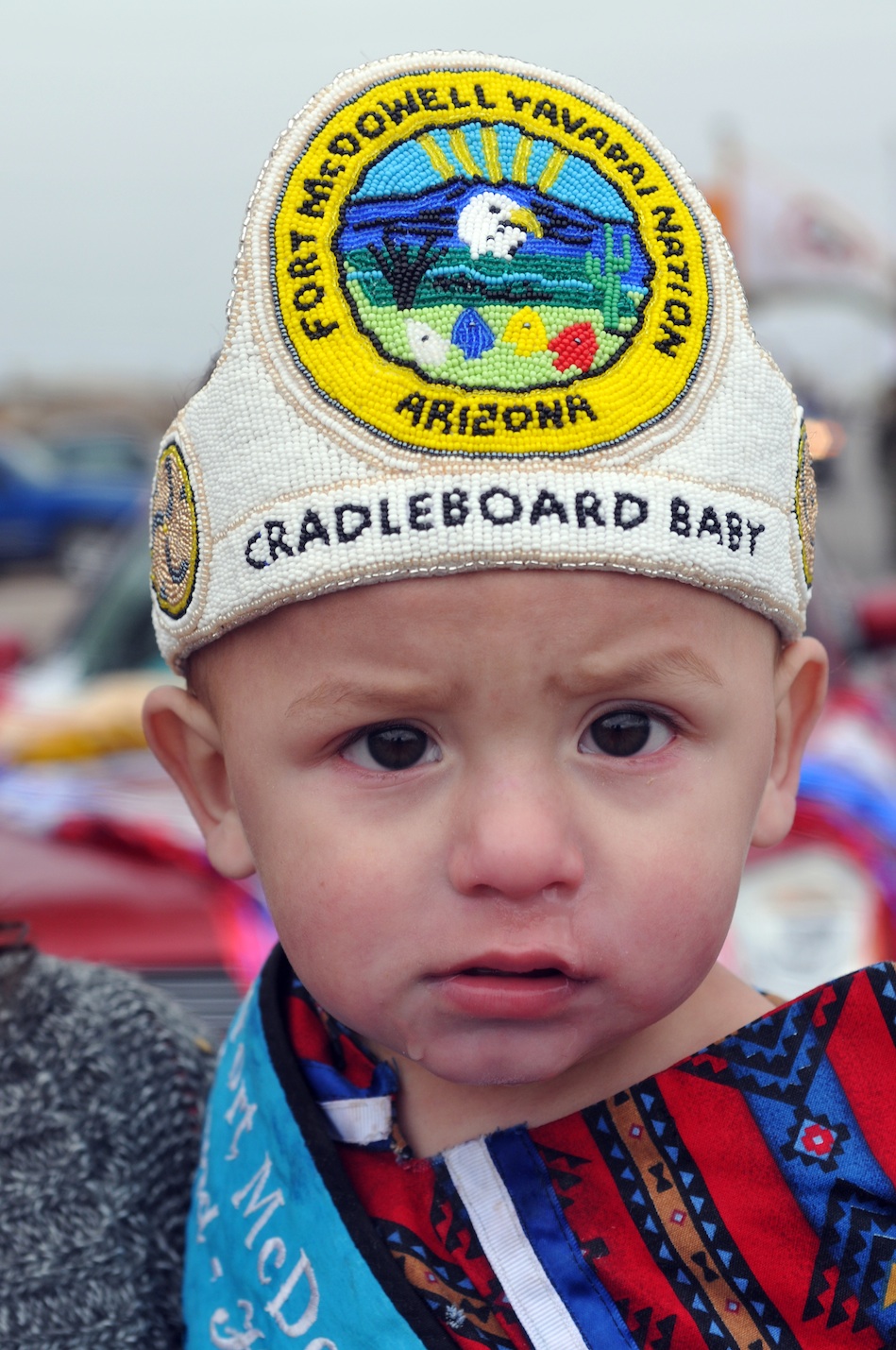
CRADLEBOARD BABY

TRIBAL ROYALITY
Saturday morning started with the parade downtown and featured many prizes for the participants.
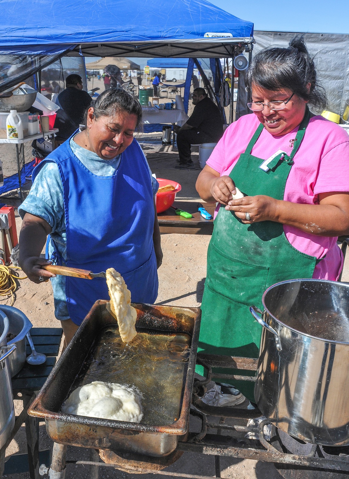
LETICA GARCIA AND SHERRY MARK CONJURE UP SOME FRY BREAD FOR THEIR FOOD BOOTH. SATURDAY MORNING THERE WAS A FRY BREAD COOKOFF.

BIRD SING AND DANCE COMPETITION IS HELD SATURDAY AT NOON
The most interesting part of the first fair was that they held the traditional O’Odham game of “toka,” which today could be considered as similiar to lacrosse. Another big draw in those days, were the matachina dancers. Over the decades, the Mul-Chu-Tha Fair has supported and helped to promote unity within the Community. This fair continues to grow since that simple beginning with few who wanted to find a way to make their Community a better place and provide a little fun for everyone. They succeeded!

Tohono O’Odham women for centuries have played this lacrosse style stick game.
The Fair continues in celebrating their people, their families, their friends, all together in “Honoring Our Ancestors”.
Top Parade Winners featured Salt River Steppers as the best Dance band, the District Five Jujudom won top honors in Chair Volleyball. The Chicken Scratch Battle of the Bands honored the Papago Warriors. Ira Hayes School won the best float for a school club while second place went to Baboquivari High School Road Warriors and third place went to Indian Oasis Elementary Cheer Squad and Gu Achi Cowgirls took fourth.

Andy Jackson (center) hugs his little brother Anthony (right) and Gavin Antone’ this trio were big fans of the midway…
Over the weekend, there was a Men’s Basketball Tournament where the Last Reds took the top bracket followed by the Da Spurs, the Komatke Kings and the Lake Powell Bombers. The Women’s Basketball Tournament honored top honors to Team Arizona, followed by the Hot Shots, Rez Gals and Lady Hoops.
ROBIN LITTLE CLOUD, has her own footrace to run. Little Cloud is the president of COYOTE KETTLE CORN, FOOD and CAKE SALES who along with family, a dozen of her children, grandchildren and five more working from the extended family they create popovers, burritos and cakes featuring their Chocolate, Strawberry, Lemon and Pineapple Upside Down Cakes. With the help of family, Little Cloud has been able to cover all the bases. Letica Garcia is the only outsider helping out with Coyote Kettle, she and Little Cloud’s daughter Sherry Mark met as students at Northern Arizona University. Garcia, is Tohono O’Odham from south of Sells, and helps out for the big events when they need people sweating over hot flames. Like Garcia, the Tohono O’Odham Tribe, also a Piman people and first cousins to the Akimel O’Odham Tribe is usually not far off, and always willing to participate in the Gila River Indian Community events because that’s what family does and the Southern Arizona Tribes for centuries have been partners in carving a better way of life from the Sonoran Desert.
CLICK HERE FOR MORE MULCHUTHA 2013 PHOTOS…..
CLICK HERE FOR earlier MUL+CHU_THA in SouthwestPhotoBank Galleries….
CLICK HERE to see photos from Sells, Az and the Tohono O’odham 75th Rodeo and Fair 2012
CLICK HERE to view photos from 2011 Tohono Rodeo and Fair..
![]()
<a href=" SPANISH TRANSLATIONS:
SELLS 75TH ALL INDIAN RODEO & FAIR, OLDEST IN THE UNITED STATES & BEST ENTERTAINMENT TICKET!


Yree Lepa
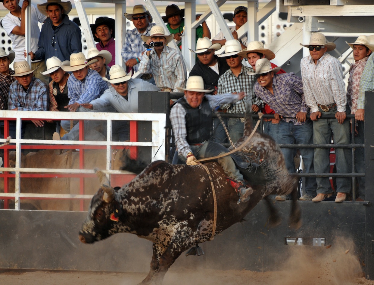
Celebrating the 75th year of the Tohono O’odham Nation Rodeo & Fair, the longest running All-Indian rodeo in the United States! The Rodeo & Fair is the biggest and most expansive event of the year. Bring the family out to enjoy the full experience there is sure to be something for everyone – rodeo competitions, traditional games, food, crafts, carnival rides, fun run, exhibits and performances. The U.S. longest-running American Indian rodeo has a Junior Rodeo which this year fielded 300 young ones, it has a powwow, carnival, parade, Wailia dances, and food/crafts at the Livestock Complex in Sells, 60 miles west of Tucson.  This year’s schedule ran from January 31 through February 3, 2013 at the Eugene P. Tashquinth Sr. Livestock Complex in Sells, Arizona. Named after the long-time voice of Tribal Rodeo’s, the Chu Chui resident (1929-2006) Eugene Tashquinth spent his days bringing order to chaos, heading up most of the events at the livestock area, so when they built the new one, they named it after Eugene Tashquinth. Equally proud is the Tohono O’odham Hedricks family whose matriarch Silas’s name blesses the Rodeo pavilion where he excelled in the arena, his grandson Chad Hedrick put the first score (6.3) on the clock with his bareback ride. Sells is a place of tradition and for the ten thousand residents of the third largest Indian reservation in the United States the annual rodeo and fair is a time of gathering, folks begin gathering before noon and the festivities go way into the night with the Wailia ending around l a.m.. The Rodeo and Pow Wow bring in native American competitors from all over the South West, particularly from Arizona tribes, like the Navajo, Hopi, San Carlos Apache, White Mountain Apache Tribe and their Tohono cousins: the Pima and Maricopa Tribes. Every year, is an old-home-town visit, with folks coming together to visit, catch-up, see who big all the cousins have gotten and to get new pictures of the kids.

 The mid-way is a beacon to all who love carnivals, greasy food, fast rides, regge music from Bob Marley, and tee shirts featuring heavy music idols and black goth signs. Visitors pay $8 for a wristband allowing all day access, for those over 55 years-of-age, the senior charge is $2. The annual Toka Tournament brings together the Tohono O’odham “Dream Teams”, like “Sun-Running-Women” who battle it out on a football sized field fighting over a wooden puck laced with leather and flung up-field with long sticks pulled from the ribs of the saguaro cactus. The start is much like the game lacrosse-another Indian game, it begins almost like a rugby scrum–and then off down field, very little is out of bound. These women celebrate this age old tradition all afternoon long with teams chasing each other up and down the playing field, the ebb and flow, the eventual goal and high-fives all around, losers too. The Pow Wow begins with the traditional Gourd Dance and breaks down into male, female, fancy, Plains categories featuring the finest in Pow Wow and Drum traditions. Just off the mid-way, the crowd not to photograph are the Yaqui Deer dancers nor can you record them with smartphones. The Yaqui Band features a combination of home-made instruments which accompany the dancers, one wears the head of a small deer atop the head, the main dancers each wore a mask to fill out the cast for their dance.

The Santa Rosa Shell Dancers
Earlier the Santa Rosa traditional dancers displayed their dance abilities, wearing their eye-catching shell-leg chaps, made from the shell carried from the Sea of Cortez by their ancestors who later traded the shell to Hohokam in the Salt-Gila River area for their cotton. The Tohono’s Hohokam ancestors valued the shell as a sign of rank, wealth, and much of it was fashioned into jewelry, like bracelets, necklaces, and leggings with shell leg tinklers for dancers The Tohono ancestors had a prehistoric salt trail across the vast waterless Sonoran Desert, across what is today’s US-MEXICO Border and into the blackened landscape of the Sierra de Pinacate lavafields, before crossing the enormous star sand dunes of the Grande Deserto for ten miles before reaching the Gulf of California where they harvested the precious salt and processed the shell, carrying home only what they needed to make jewelry to trade. Traditions have lasted thousands of years in the lands west of Tucson, they exist today and they will thrive tomorrow. The Tohono Tribe are gracious hosts and they welcome young and old, Indian or not as visitors to their Rodeo and Fair. It surprises me how few Tucsonans take advantage and visit the annual Tohono gathering, it surprises me more how few Tucson businesses sponsor, advertise or even acknowledge the tribe and its good work and its people of sterling, ageless character who have been our faithful neighbor for centuries.

SOUTHWEST PHOTOBANK GALLERY FOR MORE SELLS AZ RODEO PHOTOS CLICK HERE ….
2013 RODEO SCHEDULE…CLICK HERE
![]()
<a href=" SPANISH TRANSLATIONS:
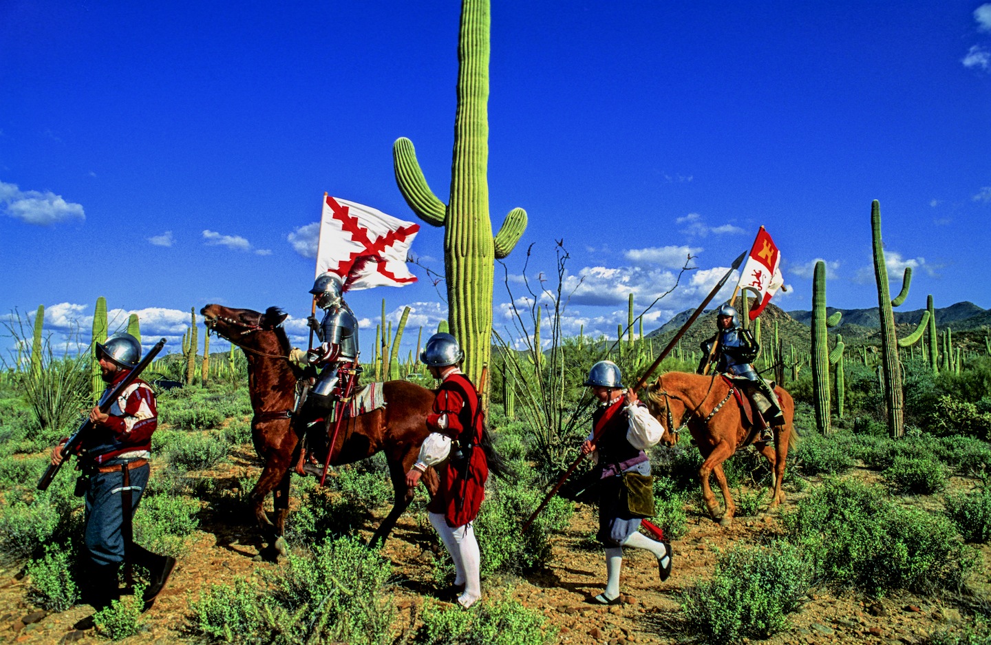
SPANISH ENTRADA SEARCHES FOR CITY OF GOLD, CORONADO FINDS AMERICAN SOUTH WEST, SEES LITTLE TO VALUE EVEN LESS TO CARRY OFF!


THE SPANISH ENTRADA AND CORONADO VISITED MANY OF THE RIO GRANDE PUEBLOS. THE TAOS PUEBLO (above) WAS VISITED BY OUT-RIDERS AFTER DEFEATING CIBOLA OR TODAY’S ZUNI PUEBLO IN NEW MEXICO.
Crossing into the US from Mexico at this spot in the San Rafael Valley, the Franciscan friar FRAY MARCUS de NIZA with his Moorish guide, Estevan, entered from Mexico at this spot in Arizona’s San Rafael Valley, where this concrete cross stands as a memorial of decades of Spanish rule in North America which was followed by a “tidal wave of white men”. De Niza’s journey ended South West prehistory and marked the beginning of written history.
Beside this dusty dirt road only a short distance north from Lochiel, Az, stands the 20 foot cross with a metal plaque that proclaims “On this spot FRAY MARCUS de NIZA entered this Valley of San Rafael, as Commissary of the Franciscan Order and a Delegate of the Viceroy of Mexico, de Niza entered Arizona the first European west of the Rockies on April 12, 1539. Here began the friar’s historic journey to explore the American Southwest, his journey ignited a decade of searching by conquistadors for the gold and riches they hoped to exist in the legendary “Seven Cities of Cibola”.[caption id="attachment_5114" align="aligncenter" width="950"] Marks de Niza Entry
Ironically, at the time of the march to Cibola (Zuni N.M.) and Quivira (Kansas) in 1541, Hernando de Soto’s army was probing west from Florida. In May of 1541, at the same time Coronado was in Texas and starting north to Kansas, de Soto was crossing to the west bank of the Mississippi River. The armies may have passed within some hundreds of miles of each other. While Coronado was in Kansas and marching back to the Albuquerque area, De Soto was probing west of the Mississippi, where he died on the Red River in April of 1542. If the two armies had met up, they might have considered their expeditions more successful.

CONQUISTADORS CLIMBED INTO THE SKY CITY OF ACOMA, THEY WISHED THEY HADN’T.

NATURAL WATER CATCHMENTS ARRESTED RUNOFF ON THE MESA FLOOR

A POTTERY TRADITION EXISTS IN MOST PUEBLOS.

NORTH CENTRAL NEW MEXICO
De Niza’s visit to Arizona’s opened the door for Spanish exploration that defined the size, the people and the nature of today’s American West. FRAY MARCUS de NIZA, found himself about 15 miles east of what is today’s Nogales, Arizona and Sonora as their horses picked their trail through the rich Arizona grasslands. De Niza was guided by Estevan, an Moor slave who had survived the same decade of slavery and walking through Texas to Mexico after being ship-wrecked off the Florida coast with the Spanish mariner named Álvar Núñez Cabeza de Vaca who reported to the Viceroy of Mexico the riches of Cibola. The Viceroy sent the Friar de Niza and Estevan to learn the truth about “Cibola”, was it made from gold or wasn’t it? Estevan knew from his travels the Indian of the time perceived “Cibola” as the “greatest thing in the world”, so-the servant said. Survival had taught him how to excite the average Indian village, the large charismatic black man who wore tinkers and led a large entourage of slaves and women whom he had collected. Estevan had learned it was better to be the point of the spear ahead of the main expedition finding water and probing their path for guides and information, rather than playing the role of a slave. Estevan was charged to send back runners with crosses, if news was promising about riches ahead send a big cross, he had been told, if chances were poor, then send a small cross. Estevan decided to promote his own agenda sending back crosses that got progressively larger. Estevan was the original Kokopelli, he captivated the locals, wowed the maidens, had a few and moved on to the next village before the larger expedition arrived.

FIREARMS, HORSES AND CROSSBOWS TOOK A TOLL ON THE INDIAN
De Niza, upon his first return to Mexico City from Cibola, he had reported finding “good and prosperous lands” others soon twisted that translation into a new land of riches, equal to the wealth of gold, silver and gemstones, taken from the Aztec and Inca civilizations of Mexico and South America. Cibola was soon thought to be where “trees hung with golden bells and people whose pots and pans were beaten gold”, so with that promise of riches, finding soldiers and patrons to fund the journey became easy, everyone wanted a piece of the action. De Niza’s companion Estevan de Dorantes was killed at Cíbola, as de Niza watched from afar, but from that range the friar affirmed that the “grand city” report was true. The Friar’s report had inspired Francisco Vázquez de Coronado to make his famous expedition to Zuni Pueblo, using Fray Marcos as his guide; their journey had many hardships: thirst and hunger, many died and most were left penny-less. So it’s an understatement the expedition had a great disappointment, when they had finally saw Cibola for themselves, Coronado then sent Friar de Niza back to Mexico City for his own protection. Fray Marcos returned in shame and became the provincial superior of his order in Mexico and performed the highest office of the Franciscans Order in Mexico before dying in 1558.
In “Cities of Gold” by Doug Preston 1992 Simon/Schuster narrates the rich history of the American South West as the author retraces the Route of Coronado from the US-Mexico Border through a very rugged Arizona and into a waterless New Mexico. Preston and with his cowboy/photographer/artist/sidekick, Walter, with four horses found the trip, life-imperiling as well as life-changing. Another author, Paul Wellman wrote in his book; “Glory, God and Gold” that “Every Spaniard in the expedition” he wrote “would plunge his arms elbow-deep in gold ingots before he returned,” that’s why not a peso came from the King and each participant paid what they could. Captains paid $55,000 pesos, average guys paid $35,000 pesos and Coronado himself paid $85,000 pesos, taking a loan out on his wife’s estate. In preparation for this journey, Coronado had taken seven slaves four men and three women, others took their wives, children and companions.
Scholars say there were 2,000 in the expedition, with 67 plus European soldiers-45 fellas carried European metal helmets, 1300 natives were from central and western Mexico, some were servants, wranglers and herdsmen so writes Richard Flint in the Kiva article entitled “What they never told you about the Coronado Expedition”. He points out there were 19 crossbow, 25 arquebusiers and additional slaves to tend the 1,000 extra horses, 500 head of cattle, and more than 5,000 sheep was taken to feed the expedition. These folks were not trailblazers-they followed well established paths, each village they passed they would enlist guides to lead the way to the next water hole, to make introductions at the next village and to show the Spanish the road to the Seven Cities of Gold.
Just a few years earlier the chosen champion of the Cuban governor, Conquistador Hernando de Soto, who learned the Indian slave trade in South America. There the Spanish looted temples and ransacked graves for their mortuary offerings. Finally De Soto captured the Inca emperor who offered him a room 22′ by 17′ stacked 9′ to the ceiling with gold ornaments, vases, goblets and statues plus another smaller room filled twice over with silver for his freedom. De Soto accepted the gold and silver treasure, still killed the king and soon returned to Spain and became a favorite in the King’s court to whom he loaned money and soon was given the license to explore Florida. In return the King was to receive “one-fifth of all spoils of battle, one-fifth of any precious metal taken from the ground and one-tenth of everything taken from graves. De Soto was to finance the entire expedition, at its end he would received 50,000 acres of his choice and an annual salary of $60,000, in return he would pacify all the natives, and provide the necessary priests and friars needed to convert them.

DESOTO; Followed the footsteps of his heroes, Balboa and Ponce de Leon….

CORONADO: Freely joined the chase for gold and riches ….

EL MORRO NATIONAL MONUMENT STOOD OUT FROM THE FLAT LAND AND BECAME A BEACON FOR TRAVELERS. CORONADO DIDN’T LEAVE HIS JOHN HANCOCK, BUT HE DID VISIT

The native Americans believed the Spanish horses were supernatural creatures.
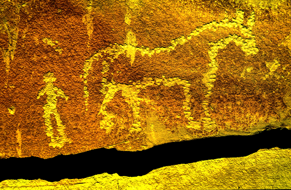
This rock art in southern Utah commemorates the first time the indian and the horse meet.
So eighty years before the Pilgrims landed at Plymouth Rock. Spanish Explorers visited Kansas: Francisco Vasquez de Coronado, seeking gold in New Mexico, was told of Quivera where “people’s pots and pans were beaten gold”. With 30 picked horsemen and a Franciscan Friar, Coronado marched “north by the needle” from the Texas panhandle until he reached Kansas. Here he found no gold, but a country he described as “the best I have ever seen for producing all the products of Spain.” The expedition entered present Kansas near Liberal and moved northeastward across the Arkansas River to what is now Rice and McPherson counties perhaps probing to present day Lawrence near the Kansas River before turning back. The guide, they called the Turk, confessed he had deceived the Spaniards and one night he went into his tent and the next morning when they broke camp he left only a dirt mound. He was strangled, buried and forgotten. For 25 days in the summer of 1541 the Turk had led Coronado among the grass-hut villages of the Quivira Indians, hoping to lose Coronado and men in the tall grass and waterless plains.

PECOS PUEBLO stood at the Cross Roads of the Great Plains and the Rio Grande Pueblo Communities.

Statue of the Conquistador Coronado stands next to a traffic circle in Liberal, Kansas near where the Spanish entered from Texas. JOHN MADSEN, BELOW
CORONADO AND QUIVIRA

The exact route that the Coronado Expedition took between Sonora and the Zuni Pueblos is currently unknown writes John Madsen, curator at the Arizona State Museum. He writes some have surmised that the trail led through Arizona, as far west as the Casa Grande Ruin, before turning northeast into the White Mountains region. Others, like historian Herbert E. Bolton, suggest a route along the San Pedro River, turning northeast below Benson, crossing the Gila River near Bylas, and passing near White River and Springerville before descending into the Zuni region. Madsen prefers the path similar to that proposed by archaeologist Carroll Riley. It traverses the country on what is now the Arizona–New Mexico state line, following the San Francisco River. Spanish accounts as early as 1747 reveal considerable use of the drainage by Zunis and Apaches. In 1795, Sonorans viewed the San Francisco River area as a potential trade route linking them with the Pueblo of Zuni and Santa Fe area pueblos like Pecos and Taos Pueblos.
Madsen teamed up with a Public Broadcast Station and launched a search for clues of where the Spanish had been targeting areas along their suspected route. Many historians and archaeologists along the route have tackled their piece of the mystery, many adding to the research, Madsen “had a hunch that the best source of information would come from the ranching communities along the Arizona–New Mexico border. These people know the land, and generations of family members have covered most of this dirt on horseback. The end result were 33 Spanish colonial period or Mexican historic artifacts like period spurs, coins, and horseshoes. Chain mail was take from a site in Kansas….more clues appeared.
Hartmann Map for Tracking the Expedition’s Route: Sleuthing for Clues and Artifacts

For over 100 years, the exact route of Coronado has been an American mystery. Generations of scholars have tried to retrace the steps of the army from their descriptions of villages, rivers, mountains, and native communities. National commissions have grappled with the problem of designating a “Coronado Trail” that tourists could follow, but clues were sparse, and politics raised its head when various factions tried to claim parts of the route for their state. Because we don’t know just where they were, it is tantalizingly hard to interpret the Coronado chronicles’ descriptions of native villages and other sites they visited.

GREENLEE COUNTY ARIZONA
Archaeologists William K.Hartmann, his wife Gayle and Richard Flint have worked tirelessly to sleuth out the route of the Coronado Expedition being guided by de Niza who the year before had seen Cibola from a distance. They found he might have followed the Rio Sonora to the river’s headwaters and then crossed the Cananea grasslands for four days past Arizape picking up the San Pedro River North turning east toward the Wilcox Playa North past present day Safford or the present day Sulfur Springs Valley crossing the Gila River cresting the Mogollon Rim past Point of Pines. William and Gayle Hartmann sees them moving east from the San Pedro, stopping at Turkey Creek in the Chiricahua’s then moving east through Apache Pass via Portal and into New Mexico and eventually into Texas. For more explanation visit their website….http://www.psi.edu/epo/coronado/coronadosjourney.html
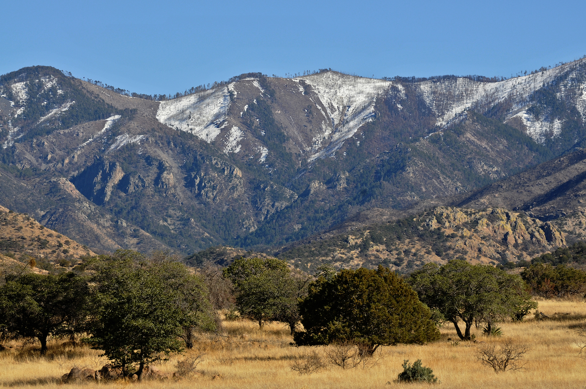
WEST TURKEY CREEK, IN THE CHIRICAHUA MOUNTAIN RANGE, ONE PROPOSED STOP ALONG CORONADO’S ROUTE.
REPORTED DISCOVERY OF CHICHILTICALE The most exciting development is the apparent discovery of the long lost Coronado camp site at the Chichilticale New Mexican exploration geologist Nugent Brasher devoted several years to this problem. With brilliant deduction, mapping, and hard work, he began metal detecting surveys at several water-source sites he reported finding an iron cross bow point and other possible fragments from the Kuykendall ruin, a large pueblo ruin site at the foot of the Chiricahuas. The site appears definitely to be a the first Coronado camp site known in Arizona, and almost certainly is the Chichilticale ruin.
• ONGOING EXCAVATIONS AT CHICHILTICALE Brasher has set up a web site at www.chichilticale.com to record progress with the survey and excavations at the Chichilticale site. Excavations are continuing by Brasher and archaeologist Deni Seymour. Two more cross bow bolt heads have been shown on her web site that details excavation plans and progress, at http://www.seymourharlan.com/default.htm
• NEW BOOK FROM RICHARD FLINT In 2008, Richard Flint published a popular-level account of the expedition, “No Settlement No Conquest: A History of the Coronado Entrada,” a book that bids to replace Herbert Bolton’s volume as the best general account of the expedition.
• NEW BOOK FROM TONY HORWITZ In 2008, also, Pulitzer-prize winning journalist/writer Tony Horwitz dealt with the Coronado expedition as a major section of his book “A Voyage Long and Strange,” which is an account of the explorations in North America before the 1700s, adjusting and correcting some of the mythic tales that most American children learn about the initial European explorations of our continent.
Picked up by a local rancher In the 1960s and Little known for years, the Floydada gauntlet and some newly-found associated artifacts, such as odd-shaped metal arrow points, have recently been recognized as priceless relics of the Coronado army expedition.
THE JIMMY OWENS SITE IS LOCATED NEAR FLOYDADA ON THE TEXAS PANHANDLE SEE PICTURES OF COLONIAL SPANISH ARTIFACTS, SPURS, MESH GLOVE…
KIVA The Coronado Expedition to Tierra Nueva: The 1540–1542 Route across the Southwest by Richard Flint; Shirley Cushing Flint
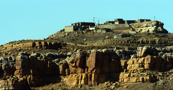
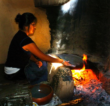
HOPI WOMEN have been making the ceremonial PIKI Bread for centuries in a special cooking space behind the main house

AFTERMATH of DE NIZA’S JOURNEY TO CIBOLA
Cultures, old as time, were attacked as pagan by the Catholic priests who accompanied the Conquistadors and who blessed their cruel attacks, in the name of saving pagan souls. The vanquished Indian was used as slaves, sold, slain or simply worked to death. The Cross, the symbol the Spanish brought the Indian and who adopted it, as pagans you can always use another God. Finally, the Spanish opened the West, the Conquistadors began the mapping of the West which became the United States of America’s quest for it’s “manifest destiny”. The American Indian, time and time again found himself in the way of the white man’s greed, the white men attacked the first Americans stealing their lands, their game and their lives, their homes, eventually they stole their children!
The facts show the journey of FRAY MARCUS de NIZA, a man of God, began an “era of extermination”, a period when approximately 20 million Indians inhabited this territory before the Conquest, and after just one century of Spanish rule there were only 1 million left! Many vanquished by Old World diseases brought to the New World with Europeans. The epidemics that broke out as well as the merciless workload imposed on the Indian dramatically diminished the Indian population. The scope of the epidemics over the years was tremendous, killing millions of people—in excess of 90% of the population in the hardest hit areas—and creating one of “the greatest human catastrophe in history, the most devastating disease was smallpox, but other deadly diseases included typhus, measles, influenza, bubonic plague, cholera, malaria, tuberculosis, mumps, yellow fever, and pertussis (whooping cough). The Americas also had a number of local diseases, such as tuberculosis and a type of syphilis, which soon went viral when taken back to the Old World.
“The moving multitude…darkened the whole plains,” wrote Lewis and Clark, who encountered a buffalo herd at South Dakota’s White River in 1806. With westward expansion of the American frontier, systematic reduction of the plains herds had began around 1830, when buffalo hunting became the chief industry of the plains, organized hunters killed buffalo for hides and meat, often killing 250 a day.

The White Man also almost exterminated the American Buffalo, herds said to be 20 miles wide and 20 miles deep, roaming the valleys they have always grazed, only a few small herds survive today. At that time, some white men sought to eradicate the buffalo to take away the Indian’s livelihood and well-being. Native American tribes depended on the buffalo’s meat and hides, and many still today believe the animal has special spiritual and healing powers, making it an important part of their culture. The railroads laying track across the plains further depleted the buffalo, as well as the Indian’s hunting grounds because hunting from train windows was widely advertised and passengers shot buffalo as they raced beside the trains. By 1883 both the northern and the southern herds had been destroyed. Less than 300 wild animals remained in the U.S. and Canada by the turn of the century out of the 30 to 75 million that was once thought to live there.
The Navajo “Long Walk” was the 1864 forced-deportation and some say attempted ethnic cleansing of the Navajo by the U.S. Government notes Wikipedia. The Navajos were forced to walk at gunpoint from their Arizona reservation to eastern New Mexico. Some 53 different forced marches occurred between August 1864 and the end of 1866. The “Trail of Tears” is a name given to the forced relocation and movement of Native American nations from southeastern parts of the United States Many of re-settled Indians suffered from exposure, disease and starvation on the way, many died, including 4,000 of the 15,000 relocated Cherokee. By 1837, 46,000 Native Americans from southeastern states had been removed from their homelands opening 25 million acres for predominantly white settlement.
SOUTHWESTPHOTOBANK’S PREHISTORY PHOTO GALLERIES CLICK HERE….
CONQUISTADOR ARMOUR BY ERIC THING
![]()
<a href=" SPANISH TRANSLATIONS:
FALL COMES TO ARIZONA HIGHLANDS

An INDIAN SUMMER is gracing the Arizona highlands with shirt-sleeve days and low evening temperatures. Late rains have knocked the leaves from many of the Aspens in Flagstaff, Arizona but the annual pilgrimage of geese and ducks headed south from their cooler climes start each day at sunrise with loud honking and a spirited lift-off.


