Just another stunning WordPress.com site

PHOTOGRAPHY of the SOUTH WEST by PK WEIS

PHOTO JOURNAL of the AMERICAN SOUTHWEST

Latest

HALF CENTURY AFTER MAN FIRST STEPPED ON THE MOON IS MINING SPACE, COLONIZATION OF THE MOON AND MARS THE NEXT STEP ?

“The surface is fine and powdery” said Neil Armstrong the first man to step on the Moon, on July 21st, 1969. Armstrong descended Apollo 11’s ladder and stepped upon lunar soil. He remarked ”It has a stark beauty all its own”, speaking as he moved across the surface collecting samples to take back to earth.

“Houston, this is Tranquillity Base!  The Eagle has landed! “

Armstrong’s first step on the Moon’s soft surface called Tranquility Base was broadcast on live TV to a worldwide audience.

American Hero Neil Armstrong placed his left foot upon the moon at 10:56 AM Eastern Daylight Time…

Tucsonan Stan Shupe remembers sitting in Connie Mack Stadium in Philadelphia attending his first major league baseball game when it was announced that Neil Armstrong, a US Astronaut, just stepped on the moon.

Stan says everyone in the stadium immediately jumped to their feet and spontaneously sang “God Bless America” before the game could continue.

Apollo 11 effectively ended the space race against the Russians and fulfilled a challenge in 1961 by President John F. Kennedy: “Before this decade is out, landing a man on the Moon and returning him safely to the Earth…!”   

APOLLO 11 VIDEO FEED…

Leave your memories in the comment section at the bottom of the blog.

I was nineteen years old living in my father’s house and eating my mother’s cooking. I was raised in the center of the country in a small Missouri community where our corn fed the rest of the country.  The Moon seemed very far away. That night when the telecast came on TV I grabbed my 35mm Argus C-3 and tried to capture key moments using black and white film photographing a black and white television as Buzz Aldrin and Neil Armstrong floated around the landing site on Mare Tranquillitatis where the open panorama is from the thin flow of lava that covers the region.

51 hours 49 minutes – The time it took Apollo 11 to get from Earth to lunar orbit…

Often overlooked are the 400,000 workers who made the impossible possible, men and women working mathematical equations without computers to land Eagle upon the moon.  Neil Armstrong’s four words, “The Eagle has landed!” gave the United States ambitious expedition success and fruition placing this pioneer effort as the new bar of success for everyone else on earth to shoot for.

VISIT WITH THE PEOPLE OF APOLLO…

People made the same pictures all over the world, off the TV screen. I always felt bad that they left a Hasselblad camera on the moon, nice lenses. Once you run out of film, what are you going to do?

APOLLO 11 MOVIE TRAILER

The dark and grainy pictures of Armstrong stepping upon lunar soil, saying; “One small step for man, one giant leap for Mankind!” still linger. Today we see the incredible images taken by those astronauts on that day and they still fill us with pride to be the first country to have landed a man on the Moon. Today there have been many spacewalks, moonwalks and successful landings. The entire Apollo series had US Astronauts dancing, driving and walking on the moon.

The Moon landing swelled our national conscience and “all things seemed possible” after sling-shooting our astronauts into outer space and getting them home again. Doing all this without computers, men and women sitting at desks working mathematical calculations to bring home the astronauts. Something we had never done before or even thought about doing. We did not know if it could be done.

CELEBRATION EVENTS AT THE US SPACE AND ROCKET CENTER

The following events are taking place at the U.S. Space & Rocket Center.

July 13- 20, 2019
Location: Apollo Courtyard
Included with museum general admission Rockets on Parade is a way to note our city’s ongoing contributions to the American space program with designs specific to the Rocket City, the monumental achievements of the Apollo program, the future of space travel or through unique artistic expression. The rockets will be judged based on impact, creativity, subject matter and historical storytelling and be on display throughout the Apollo 11 50th Anniversary Celebration.Learn More »


Daily
Location: Saturn V Hall
Included with museum general admission Come join us as we relive the thrilling mission of Apollo 11 in a reenactment of the moon landing. Come join us as we relive the thrilling mission of Apollo 11 in a reenactment of the moon landing inside the Saturn V Hall in the Davidson Center for Space Exploration. Saturday, July 20, 10 a.m., 11 a.m., 1 p.m., 2 p.m., 3 p.m.

Two images complete the picture above of Man walking on the Moon.

Arizona Science Center is celebrating one of the greatest human achievements in science ­– the 50th anniversary of human’s first steps on the moon!  That’s right, July 16, is exactly 50 years after the launch of the Saturn V rocket that carried astronauts Armstrong, Edwin “Buzz” Aldrin, and Michael Collins on the first manned lunar landing. All month long, the Science Center will be commemorating the historic mission with events and space-themed programming. And, leading to the BIGGEST Apollo 11 50th celebration in Arizona.

On Saturday, July 20, join us for an out-of-this-world celebration of man’s first steps on the moon on that monumental day in 1969 as part of NASA’s Apollo 11 lunar mission!

Today, the White House is concerned that international and commercial space activities and robotic spacecraft could cause considerable damage to Lunar Heritage Sites and artifacts. Including landing on top of or too close to Apollo Heritage Landing Sites, perhaps even “sand-blasting” away footprints.

Other international interests could see our preservation efforts as a ploy “to plant the flag” and claim a bigger piece of the moon and are suspicious of any new international protections. One Apollo 11 Lunar Heritage site includes the plaque that the United States Astronauts left behind, it said,

“We came in peace for all Mankind”, July 1969.

At the time of landing, the moon was in a crescent waxing phase as seen from Earth. Planned to aid the Astronauts planners hoped the sun would rise over Eagles landing site and “believed the long morning’s shadows would aid in identifying landmarks”.

When Armstrong was descending to the Moon he noted that the auto-landing system was guiding Eagle toward the boulder-strewn floor of one crater the size of a football field. Armstrong took manual control and skimmed over the crater, landing in a flat plain beyond. “Eagle had only about 30 seconds’ worth of fuel left at touchdown”.

Photo made by Michael Collins when the Eagle lander began to drop down on the Moon.  His job was to go home without them if they didn’t come back. Photographers observe that every one alive and dead is included in that picture except Michael Collins.

According to Wikipedia after launch by the Saturn V’s third stage, whose thrust propelled their spacecraft to more than 25,000 miles per hour. The lunar lander was tucked safely into the top of the third stage, where the astronauts rode in the Apollo command module atop the stack. After the Apollo 11 astronauts separated from the Saturn 5 traveling for three days to reach their lunar orbit.

THE MOON OR BUST…

Preparing to descend Armstrong and Aldrin then moved into Eagle and landed in the Sea of Tranquillity. The astronauts used Eagle’s ascent stage to lift off from the lunar surface and rejoin Michael Collins in the orbiting command module. They jettisoned Eagle before maneuvering out of lunar orbit onto a trajectory home to Earth.

Returning to Earth and splashing down in the Pacific Ocean on July 24 after more than eight days in space, fifty years ago this year (2019)…

Before man stepped upon the moon, NASA first had to launch robots to learn what we did not know about the surface, for instance, would the moon landers simply disappear from sight sinking into centuries of moon dust caused by billions of years of meteor impacts? Little was known other than what could be seen from telescopes.

SPEND THE DAY AT THE KENNEDY SPACE CENTER

$61 DOLLARS FOR A TEN HOUR DAY…

When the astronauts returned to Earth, they were quarantined for two weeks with several white mice. If the Astronauts survived, that was good. If the mice died, they were in a lot of trouble. Thankfully the mice lived.

http://WHY THE RUSSIAN FAILED TO PUT A MAN ON THE MOON

In the beginning, the first probes to reach the Moon were Russian. Luna 2 impacted the surface in 1959, and the moon was photographed from orbit by another Soviet robot later that year. The U.S. flew a series of impactor probes called Ranger; the first success of that program was Ranger 7, which returned 4,300 images of increasing resolution during the final 17 minutes of flight in 1964. The USSR scored another coup when it made the first soft landing and took the first low-resolution photos of the moon’s surface, in February 1966. The Lunar Orbiter photographed the moon from orbit in 1966 and 1967. But it was Surveyors that scouted the rugged surface for Apollo, the first of a series of landers that touched down successfully.

Image of Surveyor 1’s shadow against the lunar surface in the late lunar afternoon. Surveyor 1, the first of the Surveyor missions to make a successful soft landing, proved the spacecraft design and landing technique. In addition to transmitting over 11,000 pictures, it sent information on the bearing strength of the lunar soil, the radar reflectivity, and temperature, Surveyor 1 landed on the moon on June 2, 1966.

The first Surveyors were tasked with reaching the lunar surface successfully via a soft landing, then investigating the physical properties of the nearby landscape to understand the risks and challenges to landing astronauts there. But that first successful landing was far from assured. NASA had accomplished flybys of Venus and Mars they had never attempted a landing on anything.

HUBBLE SPACE TELESCOPE PHOTOS ARE OUT OF THIS WORLD

The leap from impactors and airbag landings to a controlled landing was a big one, and required new, never-before-attempted techniques in guidance, navigation, robotics and imaging. Surveyor was the first spacecraft of its kind it had been sent on a direct trajectory — it would not enter lunar orbit prior to landing, but instead would hurl directly towards the surface at 6,000 mph. Thrusters had to fire at precisely the right moment to maintain perfect orientation in order to communicate with Earth, all the way down.

Several Ranger spacecraft failed en route to the moon, the success of the first Surveyor landing was an incredible relief. William Pickering, the director of JPL from 1954 through 1976, recalled in a 1978 Caltech interview that he had some concerns about the television networks’ request to carry the landing live on what he thought was to be national coverage: “We finally ended up by agreeing to let them do it, and we kept our fingers crossed and hoped it was going to be all right. But the thing that startled me was that about a half an hour before it was due to land, one of the network people said, ‘Oh, by the way, we’re live all over the world,’ that really shook me. Fortunately, it worked, and in fact, sometime later a friend of mine told me that he was in Paris, and he just idly turned on the television set and there was Surveyor 1 landing on the moon.”

By the end of Surveyor 1’s mission six months after it landed on the moon, 11,240 images had been returned, allowing for the creation of dozens of wide panoramas and allowing the examination of details as small as .04 inches in diameter.

Images of the three-foot-pads demonstrated that not only was landing on the moon possible, but lander had not sunk into deep moon dust – as feared by some – but had landed on a firm surface. Surveyor3 had a scoop attached to one arm that allowed scientist to study the texture and hardness of the lunar soil.

Ham the Astrochimp did things that no monkey ever did, he was the first Chimpanzee sent into space. This was a test for NASA to see if they could send a man into space, would he survive in 1961.

By the time Surveyor 7 completed operations on the moon in February 1968 — just 10 months before Apollo 8 orbited the moon — the pathway for the first crewed lunar landing of Apollo 11 on July 20, 1969, was open.

Buzz Aldrin (left) Neil Armstrong (center) & Michael Collins (right)  Below Michael Collins speaks with Tucson visitors at Cape Kennedy prior to the Endeavor Shuttle Launch

Mission Commander Neil A. Armstrong was born Aug. 5, 1930, in Wapakoneta, Ohio. Armstrong became interested in flight while still a child. In 1950, Armstrong flew combat missions for the U.S. Navy. He became an astronaut in 1962 commanding Gemini VIII in 1966. In 2012 Armstrong died and in 2014 Kennedy Space Center’s Operations and Checkout Building was renamed in honor of Armstrong, Astronauts orbiting 260 miles above Earth participated in the ceremony.

The Kennedy Operations and Checkout Building now named for Neil Armstrong played a vital role in NASA’s space flight history. It was used during the Apollo program to process and test the command, service and lunar modules. Today, the facility is being used to process and assemble NASA’s Orion spacecraft, which the agency will use to send astronauts to an asteroid in the 2020s and Mars in the 2030s.

Lunar Module Pilot Edwin E. “Buzz” Aldrin Jr.(below right) born Jan. 20, 1930, in Montclair, New Jersey. Aldrin got his nickname “Buzz” as a child. Aldrin flew combat missions for the U.S. Air Force in the Korean War. He became an astronaut in 1963 and piloted Gemini XII in 1966.

Video Tour of the Moonhttps://www.space.com/40274-nasa-moon-in-4k-video-tour.html

APOLLO 11 INFOGRAPHIC   https://www.youtube.com/watch?v=Zfer0eYqBrk
Apollo 11 Infographic

APOLLO 11 MOON LANDING https://www.space.com/17411-apollo-11-moon-landing-explained-infographic.html

https://www.nasa.gov/

NASA.gov features videos and historic images, audio clips that highlight the Apollo 11 50th Anniversary, and the future of space

https://youtu.be/xc1SzgGhMKc

THE COMPLETE DECENT

https://youtu.be/OCjhCL2iqlQ

ANNOINATED VOYAGE

WHAT MICHAEL COLLINS FEARING MOST


http://www.nasa.gov/apollo45

NASA TV STREAMING video, downlink & scheduling: http://www.nasa.gov/nasatv http://www.nasa.gov/exploration

Command Module Pilot Michael Collins (above left) was born Oct.. 30, 1930, in Rome. Collins became a pilot of jet fighters and experimental planes for the U.S. Air Force. He became an astronaut in 1963 and piloted Gemini X in 1966.

Apollo 11 https://www.youtube.com/watch?v=lRwKUScppvQ Apollo 15 https://www.youtube.com/watch?v=SQyVQxui2Q8

NASA APOLLO STORIES FROM THE GUY NEXT DOOR…. WHERE WERE YOU WHEN MAN FIRST WALKED ON THE MOON   https://www.nasa.gov/apollostories

Suggested questions to answer yourself or ask others?

What does exploration mean to you?

What do you think it would be like to see humans walk on the Moon again? Think of the Moon, what comes to mind?
What do you want to know about the Moon?

If you remember the Apollo program

Where were you when humans walked on the Moon for the first time? Describe who you were with, what you were thinking, the atmosphere and how you were feeling.
What was your life like in 1969?
Do you remember learning about space in school?

If you have memories of the First Moon Walks and wish to share your story by using the comment area to respond.

APOLLO MOON SHOT

FIRST SEASON OF SIX EPISODES ON UTUBE BY SMITHSONIAN CHANNEL

SEVEN THINGS LEFT ON THE MOON

IN ORDER TO MAKE ROOM FOR MOON ROCKS GEAR WAS LEFT BEHIND MORE THAN 850 POUNDS OF MOON ROCKS CAME HOME WITH APOLLO FLIGHTS

Click on this photo of a lava tube in Mexico’s Pinacate Biosphere which helps demonstrate how colonist on the Moon and Mars might live within and thrive underground with protection there from the atmosphere as discussed in INVERSE MAGAZINE…

In this undated artist’s concept drawing provided by John Frassanito and Associates NASA’s new Crew Exploration Vehicle and lander are shown on the moon. NASA may be going to the same old moon but the space agency said it’s going to do something dramatically different this time: Stay there. To get to the moon, NASA will use two vehicles _ the Orion exploration vehicle and an attached all-purpose lunar lander (shown) that could touch down anywhere and be the beginnings a base camp, said exploration chief Scott Horowitz. (AP Photo/John Frassanito and Associates, NASA)

WILL THESE COUNTRIES BE COMPETITORS OR PARTNERS IN EXPLORING SPACE ?

China’s space program is directed by the country’s National Space Administration called CNSA. China had a rudimentary ballistic missile program for years their first crewed space program began decades later. Their achievement placed China as the third country to send humans into space independently. They are now planning to launch their fifth space flight costing about $6.27 billion. In the year 2020, CNSA plans to develop a permanent space station and with crewed expeditions to Mars and to the moon.

Chinese state television reported in January that China’s landing on the dark side of the moon was successful, using lunar craft Chang’e 4 touching down at 10:26am on January 3rd 2019. It marks the first time man has landed on the far side of the moon. This is the side that faces away from the earth. A huge achievement for China, and for space exploration in general.

SLS = NASA SPACE LAUNCH SYSTEM featuring the most powerful rocket ever built.

The U.S. backed lunar Gateway program will allow NASA to offer Germany and others in Europe to stake a claim to a program designing and developing a small spaceship that will orbit the Moon and serve as a temporary home for astronauts as a base for working on the moon’s surface and, later missions to Mars. NASA aimed to finish Gateway by 2026, now Washington is aiming to put humans back on the Moon by 2024, which could accelerate the schedule. The Lunar Orbital Platform – Gateway is a future space station in lunar orbit intended to serve as a solar-powered communications hub, science laboratory, short-term habitation module, and holding area for rovers and other robots.

India’s prime minister, Manmohan Singh, made speeches asserting, besides constructing giant solar collectors in orbit and on the moon, the world’s largest democracy intends to mine He3 from the lunar surface. Simultaneously, Japan and Germany are also making noises about launching their own moon missions.

The Israel Space Agency is part of the country’s Ministry of Science and Technology. The agency established in 1983 coordinates all space research programs in the country. Some space agency resource goes to the current Venus Project, with a $6 million budget, a fraction of the $70 million budget.

Iran has been launching satellites and space flights since the year 2005. The country has been active in the Asian space race. Their first launch was the joint Iranian-Russian Sinah-1 project, which cost them $15 million. In the year 2008, Iran joined research with Thailand and China, launching a satellite named Long March 2C, which cost around $6.5 million. Iran’s second satellite was actually placed in an orbit in the year 2009. This satellite was designed for research and telecommunications.

South Korea, together with China and Japan, is one of Asia’s leading countries when it comes to launching space missions. Today they have launched three space flights. The first one was the Naro-1 and it was sent outside the planet three times. The total cost of the first three launches was over $450 million and the third launch was the most successful among the three.

Japan is one of Asia’s leading countries in terms of space flights and missions. Japan always has the latest satellite and rocket capabilities for different purposes. They have also conducted manned space activities and other science-related missions and explorations. Their first launch was the Hayabusa that cost the country $138 million. Japan launched the Hayabusa 2 in the year 2014, which had an estimated cost of $150-400 million.

Russia was the first country to have ever launched a space mission. They actually had plenty of firsts: Russia was the first country to have ever launched a space mission. Russia actually had plenty of firsts: intercontinental ballistic missile, satellite launches, first man and woman in space and Earth orbit, put the first animal in space, moon impact and spacewalk, race rover, interplanetary probe, photo of the side of the moon, space station, and unmanned lunar soft landing. Russia’s first space flight was the Vostok program. The flight made Yuri Gagarin one of the most famous people back then since he was the first man to have ever journeyed outside the planet. The government had a federal space budget of $2.4 billion in the year 2009. In 2011, the government spent about $3.8 billion for their space programs. The budget for the year 2013 was $5.6 billion.

THE NINE-MONTH JOURNEY TO MARS, FROTH WITH COSMIC RADIATION AND UNKOWN UNKOWNS IN

COLONIALIZATION WILL BE LEARNING-ON-THE-JOB, PUTTING OUT FIRES AS THEY FLARE UP! FIRST THINGS FIRST WHERE TO LAND ???

Europe has the European Space Agency (ESA), which is dedicated to the exploration of natural occurrences outside the planet. The agency was established in 1975 and is now based in Paris. France’s space programs include human spaceflight and other unmanned exploration missions to other planets. They plan to launch a new space balloon, with a budget of $10 million for the construction and the flight itself. The agency already spent about $5.3 billion for their space flight missions in the year 2012.

The Indians in exploring more about space. Dr. Vikram Sarabhai founded the Physical Research Laboratory, which is a great leap that catapulted India into one of the leading countries in terms of space presence. India’s biggest success was the launching of its first satellite into space. India has provided a hefty budget for space programs to widen their knowledge of space. India has spent $1.6 billion on past launches and plans to spend about $1.34 billion total.

The United Kingdom recently established their own space agency. It was inaugurated in April 2010, and has taken over the responsibilities for government policy and budget for space explorations. The UK, together with the European Space Agency, has spent about $155 million for the delivery of astronomical data and the launch of sub-orbital rockets. They are budgeting around $16 to $31 million for the development of their intermediate missions.

Although the United States was not the first country to explore the universe, America has the most space missions out of Earth. Their first space flight was under the Mercury Program that operated five years and cost $277 million. The second one was the Gemini program, with a lifespan of six years and cost of $1.3 billion. The most famous space mission that the country has done was Apollo. The program cost $20.4 billion, which had a lifespan of fifteen years, the United States has spent $486 billion over 57 years on human space flights alone.  On average, the US spends $8.3 billion on space missions, a year.

Germany is Europe’s economic powerhouse and the world’s fourth-largest economy. Germany had the seventh-largest national space budget in 2018, an estimated $1.1 billion, just over half the amount generated by fifth-placed France. Some companies are considering moving to Luxembourg, where recently enacted laws to limit liabilities and ease restrictions on mining operations in Space. This new legislation would limit financial and legal liabilities of private accidents that occur in orbit, it set standards for space operations and offer incentives for new projects, the German economy ministry told Reuters it has a $112 million investment fund for Space projects. A figure, dwarfed by the United States, the largest spender on space at $40 billion.

https://www.space.com/31659-spaceport-tucson-world-view-balloon-tourism.html

The moon by numbers

384,400 km – The moon’s average distance from Earth

3 – The number of new missions to the moon set to launch in 2019

29.5 Earth days – The length of the moon’s day

2.5 seconds – The time to wait for a reply when video-chatting to someone on the moon

-233°C and 123°C – Temperatures measured at the coldest and hottest points on the moon

12 – Number of people who have walked on the moon, all between 1969 and 1972

4.5 billion years – The age of the moon

5.5 km – Base to peak height of the moon’s tallest mountain, Mons Huygens

6 – The number of rovers that have trundled across the lunar surface

382 kg – The mass of moon rocks returned to Earth

187,000 kg – Estimated mass of rubbish left on the moon

75 hours 49 minutes – The time it took Apollo 11 to get from Earth to lunar orbit

100 HOURS-NEIL ARMSTRONG AND BUZZ ALDRIN PLANT THE US FLAG ON THE MOON


Tucson’s Moon Tree was planted at the University of Arizona’s Campus, the planted seed went first to the Moon and then was planted in Tucson.

World View is developing a balloon-based system that will take passengers up to an altitude of 100,000 feet (30,000 meters) or so in a pressurized capsule, allowing them to see the curvature of the Earth and the blackness of space. The ride will be gentle and relatively lengthy, lasting 5 to 6 hours from liftoff to touchdown. Tickets aboard the six-passenger capsule (which accommodates two crew) currently sell for $75,000 apiece, and the first commercial crewed flights were scheduled to begin in 2017…

Tucson’s Pima County’s Board of Supervisors voted 4-1 in favor of setting up Spaceport Tucson, which the county will own but World View will operate. The vote authorized a bond sale of $15 million to build all of these facilities.

World View will construct a headquarters building next to the spaceport, to serve as a tenant of the new Pima County Aerospace, Defense and Technology Business & Research Park.

Editors Note: Tucson’s biggest shot in the arm to grow and flourish came with World War II, the world needed pilots and flyers and Tucson had air fields, Davis Montana AFB and flying weather. After the war folks who came here to train came back and brought everyone with them….Tucson grew by 100,000 people in one decade. The point to be made, Tucson’s airfields had what the Air Force needed, when it was needed. World View has critics, particularly tax payers who wonder why they should pay for World’s View playground.

Hopefully like airfields, space ports will become needed for new access to Space and Tucson will become the Gateway to the Stars…

Tucson Moon Tree on the University of Arizona’s Campus, the seed went to the Moon and was planted here.

VECTOR ROCKETS BUILT IN TUCSON

Vector Rockets wants to provide launch services with two rockets, the smaller Vector-R, and the larger Vector-H. Both rockets use a single engine for their second stage and a cluster of engines (three in the Vector-R and six in the Vector-H) for their first stage, all of which use liquid oxygen and propylene as propellants.

The 45-foot-tall, two-stage Vector-R is designed to carry payloads up to about 140 lbs to low-Earth orbit at a cost of $1.5 million. Less than half Rocket Lab’s larger Electron rocket cost, whose debut test flight was held in New Zealand.

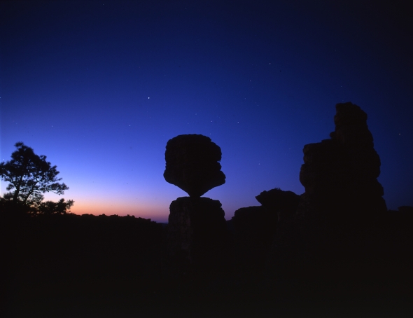
Lunar Eclipse seen at sunset within Saguaro National Monument West

An optional third-stage electric motor on a Vector-R can deliver a satellite up to 500 miles above Earth for an additional $500,000. The larger Vector-H version sells for about $3 million. The rockets are simple, with no pumps, and fewer components than the competition. The Vector’s first stage, for example, has just 15 parts. Launches are presently held on the East coast in Florida. One launch was planned from Kodiak Island in Alaska.

The original idea behind Vector was to build a satellite-based system that would allow customers to use software to operate sensors, using a constellation of satellites as “virtual machines.” Galactic Sky, as that concept is being developed as Vector perfects its launch business, a billion-dollar business by itself. Vector plans a 70,000-square-foot rocket factory in Tucson after securing a lease with Pima County for the county’s Aerospace, Defense and Technology Business & Research Park. The company, which has about 25 employees now, plans to add 40 to 80 people, mainly engineers and skilled workers like machinists, early and hopes to hire 200 employees in Tucson in a few years. Besides Tucson, the company has operations in Orange County and San Jose, California. The lease deal came after a successful test of the new rocket engine Vector is developing with NASA. Vector already has more than 100 launch contracts in hand.

FRANK BORMAN TUCSON SPECIAL SON…

Frank Frederick Borman II (born March 14, 1928), Col. USAF, Ret.), is a retired United States Air Force Pilot, aeronautical engineer, test pilot and NASA astronaut, best remembered as the Commander of Apollo 8, the first mission to fly around the Moon making him, along with crew mates Jim Lovell and Bill Anders, the first of only 24 humans to do so before flying on Apollo, Norman set a fourteen-day spaceflight endurance record on Gemini 7, and also served on the NASA review board which investigated the Apollo One fire. After leaving NASA, he was the CEO of Eastern Airlines from 1975 to 1986.

Borman received the Congressional Space Medal of Honor.

Borman was born on March 14, 1928, in Gary, Indiana, where the Frank Borman Expressway is named after him. He is of German descent, born as the first and only child to parents Edwin and Marjorie Borman. Because he suffered from sinus problems in the cold and damp weather, his father packed up the family and moved to the better climate of Tucson, Arizona, which Borman considers his hometown.

Borman started to fly at the age of 15, later he graduated from Tucson High School in 1946.

Borman later received a BS degree from the United States Military Academy at West Point, in 1950, where he served as an Army Football Manager, and along with part of his graduating class, he entered the United States Air Force (USAF) and became a fighter pilot. He received his Masters of Science degree in Aeronautical Engineering from the California Institute of Technology in 1957. Later, Borman was selected for the Aero Space Research Pilot School and became a test pilot.

MORE PHOTOS SOUTHWEST PHOTOBANK GALLERY…..


TOHONO OoODAM 79TH RODEO & FAIR BRINGS FAMILY, FRIENDS, RIVALS TOGETHER TO CELEBRATE AND COMPETE

sells-rodeo-2017-4270

THE 2017 SELLS INDIAN RODEO, FAIR AND POW WOW FEATURES A RECORD NUMBER OF FEMALE PERFORMERS WHO TOOK THEIR SHARE OF THE WINNINGS.

sells-rodeo-2017-4167

sells-rodeo-2017-9068

SATURDAY MORNING THE TOHONO OODHAM ENJOY A LONG PARADE, FOLLOWED BY MIDWAY RIDES, FOOD BOOTHS, ALL-INDIAN RODEO, POW-WOW AND THE TOKA TOURNAMENT WHICH PITS MANY ALL-WOMEN TEAMS AGAINST RIVAL VILLAGES

sells-rodeo-2017-4318

2017 SELLS RODEO PHOTOS FROM THE  79TH CELEBRATION OF THE OLDEST INDIAN RODEO IN THE UNITED STATES

http://pkweis.photoshelter.com/gallery/2017-O0DAM-RODEO-FAIR/G0000Kg0p3lWK56A

2017 SELLS TOKA TOURNAMENT

http://pkweis.photoshelter.com/gallery/2017-TOKA-TOURNAMENT/G0000XnktmLN9H.w

2017 SELLS POW WOW & FAIR

http://pkweis.photoshelter.com/gallery/2017-TOHONO-OoDHAM-COMMUNITY-FAIR/G0000NzTGxQgWrk8

sells-rodeo-2017-9001

PREVIOUS YEARS GALLERYS AVAILABLE ON SOUTHWESTPHOTOBANK.COM

76TH SELLS RODEO AND FAIR

http://pkweis.photoshelter.com/gallery/76th-SELLS-RODEO-and-FAIR/G000080DxSIeac8c/C0000UdyzM4tuhfo

75TH SELLS RODEO AND FAIR

http://pkweis.photoshelter.com/gallery/SELLS-75th-RODEO-FAIR-2013/G0000kghXFgV8Ha8/C0000UdyzM4tuhfo

sells-rodeo-2017-4224sells-rodeo-2017-4219

2015 SELLS RODEO AND FAIR

http://pkweis.photoshelter.com/gallery/2015-SELLS-RODEO-and-TOKA-TOURNAMENT/G0000qF9rEDnbBEk

2012 SELLS RODEO AND FAIR

http://pkweis.photoshelter.com/gallery/TOHONO-OoODHAM-2012-FAIR-and-RODEO/G0000YabpiAFNnT4/C0000UdyzM4tuhfo

≈MORE TOKA COVERAGE

http://pkweis.photoshelter.com/gallery/TOKATOURNAMENT/G00002ZeCGdfpGGM/C0000UdyzM4tuhfo

sells-rodeo-2017-9018-1

RIDERS OFTEN FELT CHALLENGED BY LIVESTOCK OR GRAVITY TO STAY ON THEIR RIDE

sells-rodeo-2017-9043sells-rodeo-2017-4241

sells-rodeo-2017-3974

SELLS TOKA TOURNAMENT FEATURES WOMEN ONLY FOR THEIR STICK GAME

SELLS POWWOW_9102

SELLS TOHONO OoDHAM POWWOW

sells-rodeo-2017-4183-1

sells-rodeo-2017-8971

ALL AGE GROUP PARTICIPATE, INCLUDING A NEW UNDER 12 LEAGUE

This slideshow requires JavaScript.

Join me on PhotoShelter

Graph Paper Press minimalist WordPress themes for photographers and designers

BUILDING A “WONDERFUL” WALL AROUND THE LAND OF TRUMP! WORK TO BEGIN IMMEDIATELY TO STOP CRISIS ON MEXICO-U.S. BORDER…

grate5830The 45th President Donald Trump has brightened his Oval Office with new gold curtains and he is working hard pushing paper behind the Resolute Desk. President Trump said “a nation without borders is not a nation. Beginning today America gets it borders back.” The President’s first 100 days will have a honeymoon period where he will be allowed to accomplish almost anything he wants…President Trump wants a wall, “a wonderful wall” on which he can place his name. Trump believes he can crush “the crisis on America’s Southern Border”, for just $9 million a mile.

While public polling showed that 47 percent of Arizona residents think the wall proposal is a “waste of money,” Trump is pressing ahead on building a “great wall” the discussion has grown and lots of folks have weighed in with their point of views.  A couple of high-ranking Border Patrol supervisors have said independently,  that they need to see what is coming and another said they need two walls so they can defend the second wall, patrolling between them. Others will say, it is a great idea if you want to sell 19’ ladders!

copsonpatrol5760

New Border Fence in Nogales, Arizona-Sonora, is buried deep.

Many interesting ideas, some find the 14 century solution unimaginative, why spend billions just to keep folks out when we could change life as we know it along the US-Mexico Border. For others, the word “wall”, means drones and fences. Either way, it won’t be a “great” wall, even if it covered the entire American land mass, it would only span 2,000 miles, the Great Wall of China covers 5,501 miles by one count and 13,171 if you include trenches, hills, other natural barriers. Either way the efforts of the Ming Dynasty dwarfs the Big Guys plan for the U.S.-Mexico and some critics say this is a “14th Century solution” when a 22nd Century answer is needed, we need today’s technology to make a really “great” wall!

aneyeonmexico7186

Keeping an Eye on Mexico, was once the job of the National Guard, will that begin again?

The promised great Wall of the 2016 Election was designed to keep out the criminals, drug dealers and rapists and will fast become a gauge of President’s Trump’s veracity. Some cement salesmen have contacted the “DON” and told him, they are able and ready to go go go !   Their version of the Great Wall of Trump, will cost you and me between $15-25, other say $40 Billion, and will require just 250,000 truckloads of cement. 

President Trump has insisted his “great, great wall” will be paid for by Mexico. But when Trump met Enrique Peña Nieto, parachuting into Mexic0 City during the election, the Mexican President emphasized his country would not pay for the 1000 mile long, forty foot high abomination and El Jefe’ took to Twitter to make sure everyone knew it and continues to say Mexico will never pay for such an insult to their country.

General John Kelly new secretary of Homeland Security views new Border Wall...

General John Kelly (left) Trump’s new Secretary of Homeland Security views new Border Wall model…

U.S. Republican presidential candidate Donald Trump holds a sign supporting his plan to build a wall between the United States and Mexico that he borrowed from a member of the audience at his campaign rally in Fayetteville, North Carolina March 9, 2016. Trump was interrupted repeatedly by demonstrators during his rally. U.S. Republican presidential candidate Donald Trump holds a sign supporting his plan to build a wall between the United States and Mexico that he borrowed from the audience at a campaign rally in Fayetteville North Carolina REUTERS/Jonathan Drake

U.S. Republican presidential candidate Donald Trump holds a sign supporting his plan to build a wall between the United States and Mexico that he borrowed from a member of the audience at his campaign rally in Fayetteville, North Carolina March 9, 2016. Trump was interrupted repeatedly by demonstrators during his rally. REUTERS/Jonathan Drake

For year, residents along the southern  border have lived with 650 miles of 18 foot metal fences supplemented with traffic barriers that stretched out from Texas, across New Mexico, into Arizona and ending on the California coast.

Brownsville resident Bonnie Elbert, told Rick Jervis of USA TODAY, “The one (fence) we have doesn’t really work. “What makes them think a new one will?”

During the election Trump received a big endorsement from the Border Patrol union because of his ideas on immigration and homeland security.  Chris Cabrera, a border patrol agent and vice president of the local National Border Patrol Council. says the idea of building a bigger wall without increased manpower and technology, is ill-informed, he said.

“If you’re in the business of selling ladders, it’s a good idea,” Cabrera said. “If you build a bigger wall, they’re going to come with bigger ladders.” He added: “If they’re thinking of putting up a wall as a be-all, end-all …  they’re looking in the wrong place.”

A fence may seem less grandiose than a wall, but it’s more practical. If the wall is opaque, agents can’t see who’s trying to cross. More importantly, they can’t identify potential threats.

face5815

Arizona Border Patrol Agents have cage bars on windows to protect agents from rocks.

In the days before the 2016 election, The Huffington Post took a tour of the border around Nogales, Arizona, with John Lawson, a veteran Border Patrol agent. Lawson said when he started out, the primitive fence was opaque. That was a liability for agents, and sometimes a hazard. In some instances, he said, attackers  would scale the wall and try to drop cinder blocks on the agents’ vehicles as they passed below. “You need to make a fence you can see through,” Lawson said.

sonoracops5693

While construction was underway Mexico had police at the fence for security.

Ranking Border Patrol Agents have said a wall will not work, because you can only protect one side of it.  They say you need two walls, one to protect the other, so I can see the fencing continuing to protect the “Great Wall”, conceding more of the U.S. to battle the hordes from the South. When the Berlin Wall was torn down 25 years ago, says Elisabeth Vallet, of Quebec University, there were 16 border fences around the world. The United Kingdom’s Daily Mail has pointed out Globalization is supposed to tear down barriers, but security fears and the refusal to help migrants and refugees have built 65 walls today, which are either completed or under construction.

nogalesborder

NOGALES, ARIZONA (left) NOGALES, SONORA (right)

nogales5845

‘The one thing all these walls have in common is that their main function is theatre,’ said Marcello Di Cintio, author of ‘Walls: Travels Along the Barricades’.

51ngtaiz3tl-_sx331_bo1204203200_‘You can’t dismiss that illusion, it’s important to people, but they provide the sense of security, not real security.’ Even the fearsome Berlin Wall with its trigger-happy sentries still leaked thousands of refugees even in its most forbidding years. Supporters of walls say a few leaks are better than a flood. But, author Di Cintio says consider the psychological price.

He points out Southern Arizona’s Tohono O’odham tribe, whose elders started to die off in apparent grief when the Mexican border fence cut them off from their ceremonial sites. The Tohono story suggests ‘wall disease’ diagnosed by Berlin psychologist Dietfried Muller-Hegemann in the 1970s after he found heightened levels of depression, alcoholism and domestic abuse among those living in the shadow of the barricade. Di Cintio also talked to Bangladeshi farmers suddenly cut off from their neighbors when India erected a simple barbed-wire fence between them.  Within a few months, he said, they had started expressing distrust and dislike for ‘those people’ on the other side.

facesxx7988

This March 29th, 2010 memorial service for long-time Douglas, Arizona area rancher Robert Krentz who was found about 1,000 feet from where the shooting occurred, dead in his ATV. The ATV still had its lights on and the engine running. There were spin out marks in the dirt, leading investigators to believe that he was trying to get away from the shooter. Investigators believe the shooter was headed south toward the border after the encounter. Law enforcement tracked a single set of footprints — believed to be the shooter’s — for 20 miles to the U.S.-Mexico border.

prayerfordeadrancherxx7980

One great idea suggested networking solar cells on the wall to the power grid and producing enough electric power to fuel all the Border Cities from Tucson, Phoenix, to Mexicali and to run desalination plants in San Diego.  Another suggests building a border interstate, exit North to the U.S or exit South to Mexico, solar cells would fuel solar chargers, solar light rail it would be a U.S-Mexico “Panama Canal”, moving people and trade across the entire continent

Technological advances such as ground radar to detect movement, hundreds of high-tech cameras with night-vision lenses and drones flying overhead have drastically transformed border security and now a Bristol County sheriff in New England wants to send a 10 man chain gang to help build the Wall.  The sheriff says other county mounties want to throw in with him and get the job done. I would be afraid the chain-gang might disappear one day through a hole in the fence, leaving their guard, tied up with the TV control back at the motel.

dawn6939

Sheriff Thomas Hodgson said however he could “think of no other project that would have such a positive impact on our inmates and our country than building this wall. “Aside from learning and perfecting construction skills, the symbolism of these inmates building a wall to prevent crime in communities around the country, and to preserve jobs and work opportunities for them and other Americans upon release can be very powerful,” he said.

Instead of finding new reasons to hate our neighbors, I suggest $40 Billion allows us to build anything under the sun and we should find new reasons for working with Mexico to build a better world for citizens of both countries.  My dream is one day, the bulldozing of critical animal habitat along the U.S.-MEXICO Border might be used as the first step in building a Bi-National BorderLand Highway with 10-12 lanes patrolled by Mexican Police to the south and by the U.S. to the north. Using the $40 plus billion Homeland Security budget would build a solar powered light rail system, perhaps a subway train built beneath of the roadway, wi-fi, driverless-car lanes, solar-powered electric car recharging systems, propane and gasoline and diesel in island stations featuring restaurants, motels and the Mexican rescue teams the Green Angels would be everywhere they are needed. It would move thousands of people, families, buses and trucks and it would be built by companies and workers from both countries and it would represent the best that Mexico and the U.S. have to offer. It could change the equation for both Worlds, empowering both countries to greatness working together to make a better world.

copter7075

Yes, that would be very expensive.  But it is something Mexico might actually support and offer to partner with the U.S..  There would be places the highway would plot out on the landscape better than actually along the U.S.-Mexico Border, so some flexibility may be required.  We might have to give Mexico some of our land in exchange for some of Mexico.  I was thinking it could be helpful to both nations, it would be a huge windfall for Arizona, if the U.S. partnered with Mexico, at Puerto Penasco, making it an international port with U.S. Customs and a straight route from seaports on the Gulf of California to the American Heartland.  Perhaps Arizona’s Altar Valley, which today is the one main entrance into the U.S., for Mexican and South American illegal crossers, would fall into U.S. hands. Who would be better suited to clean up that nest of vipers. Drug cartels own and operate those small communities butting up against the U.S., without Mexico’s corruption to shore them up.  The Border rip-off gangs, smugglers and crossers would have no base of operations.  That land is also part of the American Indian Nation of the Tohono O’odham people whose territorial lands were split in two by the border, this would make them whole again.

bpatrol6960

Yes, I can see the argument that this is madness.  But then I read Poet, novelist and environmentalist Homero Aridjis idea of “building solar plants along vast stretches of the almost 2,000-mile U.S.-Mexico border on the Mexican side, a new high-voltage direct-current (HVDC) grid could be set up to transmit energy efficiently from that long, snaking array to population centers along the border.  Cities that could immediately benefit include San Diego, Tijuana, Mexicali, Tucson, Phoenix, El Paso, Ciudad Juarez, San Antonio and Monterrey, Aridjis writes suggesting “a Border of Solar Panels.” If one were to construct the equivalent of a strip of arrays south of the U.S.-Mexico border, wider in some areas and narrower in others, with a wide berth allowed for populated areas and stretches of rugged terrain, sufficient energy might be produced to also supply Los Angeles, Las Vegas, Albuquerque, Dallas and Houston. For the U.S. cities, it would be a way to obtain cheaper and cleaner energy. In Mexico, the solar border would create a New Deal-like source of high-tech construction and technology jobs all along the border, which could absorb a significant number of would-be migrant workers on their way to cross illegally into the U.S..

trapppxx3918

What would we give to Mexico?  Why not parts of Texas, south of the Alamo, of course, but enough to insure everyone gets a fair shake. Advertising for tourism to visit Texas, say “it’s like a whole other country.” Texas has been saying for years they would not mind seceding from the U.S. and this would give everyone a shot at a better way of life.

New York Rep. Chris Collins said that American taxpayers will front the cost for the wall but that he was confident Trump could negotiate getting the money back from Mexico.

“When you understand that Mexico’s economy is dependent upon US consumers, Donald Trump has all the cards he needs to play,” Collins, congressional liaison for the Trump transition team, told CNN’s Alisyn Camerota on “New Day.” “On the trade negotiation side, I don’t think it’s that difficult for Donald Trump to convince Mexico that it’s in their best interest to reimburse us for building the wall.” “There’s no way that could happen,” Mexican Finance Minister Videgaray said on Mexican television .  “There are no circumstances…not even the best possible trade deal would justify  “violating the dignity of Mexicans citizens”.
 mexpickersxxx

Of the 1.1 million farm workers in the U.S., 71 percent are foreign-born, according to the U.S. Department of Labor. Nearly half are illegal. Roughly 325,000 workers in California do the back breaking jobs that farmers say nobody else will do, according to the U.S. Bureau lettuce279of Labor Statistics. Manuel Cunha Jr., president of the Nisei Farmers League farming association, estimates 85 percent of California farm workers live in the United States illegally.

Farmers for years have scrambled under a shrinking labor pool. Mexico’s improving economy has slowed the flow of migrant workers. The dangerous border, controlled by drug cartels and human traffickers, keeps away others. The Department of Homeland Security’s says the total undocumented population peaked at 12 million in 2008, and has fallen since then. The number of apprehensions at the border is at its lowest since 1973, according to the Pew Research Center, the overall flow of Mexican immigrants is the smallest since the 1990s.

mexico-coming-to-america

A review by The New York Times of thousands of court records and internal agency documents showed that over the last 10 years, 200 employees and contract workers of the Department of Homeland Security have taken nearly $15 million in bribes while being paid to protect the nation’s borders and enforce immigration laws. These employees have looked the other way as tons of drugs and thousands of undocumented immigrants were smuggled into the United States, the records show. They have illegally sold green cards and other immigration documents, have entered law enforcement databases and given sensitive information to drug cartels. Records show that the bribing of Homeland Security employees persists. In 2016, 15 were arrested, convicted of or sentenced on charges of bribery.

This slideshow requires JavaScript.

WILL THE “LAND OF STANDING-UP ROCKS”, BECOME AMERICA’S SIXITH PARK, THE CHIRICAHUA NATIONAL PARK IN SOUTHEAST ARIZONA, IS “A WONDER LAND OF ROCKS”

ECHO CANYON LOOP CHIRICAHUA Natl Monument-

The view from Massai Point

One of Arizona’s Crown Jewels has been tapped to be the next American National Park, the hoodoo paradise, of the Chiricahua National Monument has long been one of Southeastern Arizona’s best kept secrets…today that secret is out!

Echo Canyon Loop

Echo Canyon Loop Nature Trail is eight tenths of a mile long.

The Chiricahua National Monument is under consideration to become the 60th U.S. National Park.  Few who visit would argue that the pinnacles, columns, spires and balanced rocks of this place ‘The Land of Standing-Up Rocks’, a befitting name given by the Apache to this extraordinary rock garden. In the late 1800s pioneers lobbied and  persuaded Congress to protect this ‘Wonderland of Rocks’, and in 1924 the Chiricahua National Monument was created.

COCHISEHED

Cochise Head Mountain overlooks the Heart of Rocks Trail

The proposal on the table makes the 12,000 acres monument, designated since 1928, a Federal Park featuring the eight mile Bonita Drive weaving through the volcanic features with hoodoos reaching toward the sky.  It is a photographer wonderland from the moment the sun breaks the horizon and spotlights the amazing black ridge lines.

PunchnJudy SAZ
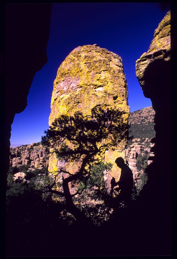
The Monument’s, Echo Canyon Loop Nature Trail, is perfect for short distance legs, folks who want to stretch their legs after a long drive but don’t want to break out the water bottles and packs—it is less than a mile long. Topside you greet the sun and wander the summit enjoying the different points of view.  For some this is just the beginning, since this is the trailhead for the Heart-of-Rocks trail which is a downhill stroll for eleven miles back to the front entrance to the Monuments visitor’s center. A shuttle is available early Saturday mornings at the visitor center.

SW RESEARCH STATION-

South West Research facility in Portal, Az offers some cabins, but usually is in demand.

The SouthWest History that swirls around the twenty mile by forty mile Chiricahua’s enriches the choice and makes some wish for additional units to preserve spots like Fort Bowie, Johnny Ringo’s Gravesite or Skeleton Canyon where Geronimo surrendered, many of these on private land today. The dirt road over the Chiricahua Mountain summit, Pinery Canyon Road, allows access to Rustler’s Park and many ridge line hiking trails. Dropping down the mountain into Cave Creek and nearby Rodeo, New Mexico, the tourist is now in primetime bird-watching territory.

The Monument features the volcanic wastes from an immense explosion 27 million years ago and is now found 36 miles southeast of Wilcox, Arizona.

Chiricahua

The eruption that shook thi region spewing thick white-hot ash from the Turkey Creek Caldrea later cooled and hardened into rhyolitic tuff, laying down almost two thousand feet of dark volcanic ash and pumice. The highly silic hoodoos eventually eroded into the natural features that we see today.

In 2008, the Chiricahua National Monument was listed on the National Register of Historic Places. The Faraway Ranch was once owned by immigrants, Neil and Emma Erickson from Sweden.  In 1976, Congress decided to further preserve the land, designating 87% of the monument as Wilderness.

Cave Creek_

Cave Creek near Portal Arizona a short distance from Rodeo New Mexico

 As well as the geological aspects of this park, the monument is host to a biological crossroads, a place where four different ecological regions all come together, the Chiricahua Mountains, the Sonoran and Chihuahuan deserts, the Rocky Mountains and Sierra Madre ranges all meet. The convergence of these four areas bring richness in both floral and faunal diversity, like the Rocky Mountain representatives such as the Ponderosa pine and Engelmann spruce co-exist beside the Soap tree yucca from the Chihuahuan desert. Stately Arizona sycamore and various types of oak dot the well-watered canyons. Apache pine grows here at the most northern end of the Sierra Madre range. Chihuahua pine is found, as are Douglas and White fir, Arizona cypress, Cane cholla, Prickly pear and several species of ferns, mushrooms, and fungi. There are five major drainages within the monument, several with intermittent creeks that support a mixture of deciduous and evergreen woodlands. The heavily forested canyons provide habitat for numerous wildlife, including coatimundi, white-tailed deer, javalina, and many species of birds; over three hundred bird species are found in the Chiricahua Mountains, some of whom have migrated north from Mexico. 

CHIRICAHUASUNSET

Chiricahua Mushroom Rock  WildernessofRocks1939  copy
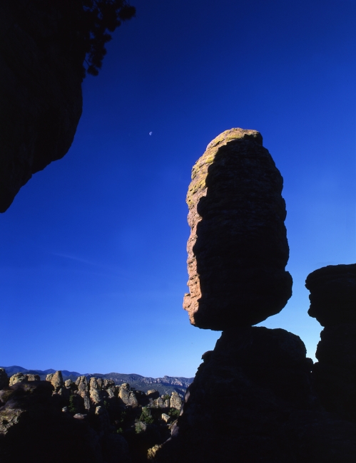
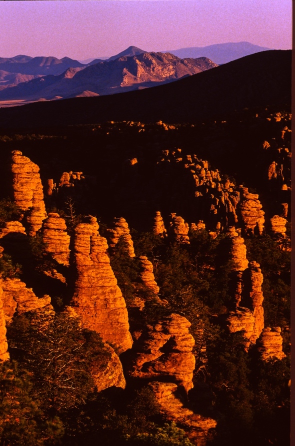
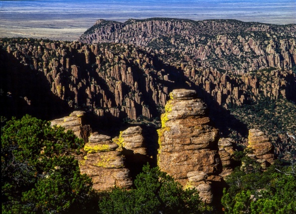
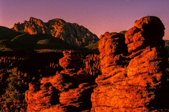
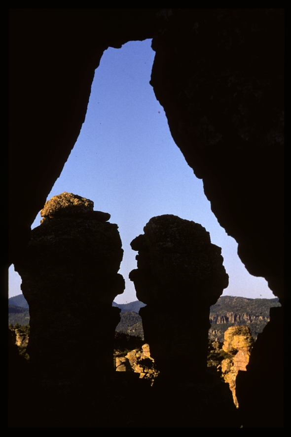
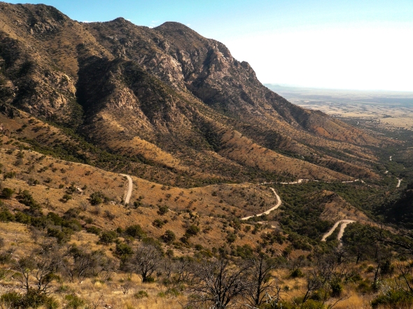
The Chiricahua Mountains are part of a collection of forty neighboring mountain groups that lie between the Colorado Plateau and the Sierra Madre Occidental. Named the Madrean Archipelago, because it resembles an oceanic archipelago – a sea dotted with islands – only here the sea is hot desert grassland. These isolated mountain ranges are called ‘sky islands’.

Chances for the proposed Chiricahua National park, Tucson representative Martha McSally has championed the choice and financially, it seems a wash, for the U.S. Park Service.  There is little difference between being a national park and a monument, they are managed and funded exactly the same.  This push for National Park status boils down to an attempt to increase attendance which in turns provides increased funding.  There is no change in the present boundaries expected.

Some one familiar with the proposal says people who are unfamiliar with an area and depend on guide books tend to believe national parks are more splendid, grand than mere monuments, even though that’s not necessarily true.  But that’s what the public generally believes, so making it a park will bring more people to visit and therefore generate more revenue to manage it.

shootin5585-2

TOMBSTONE AZ-
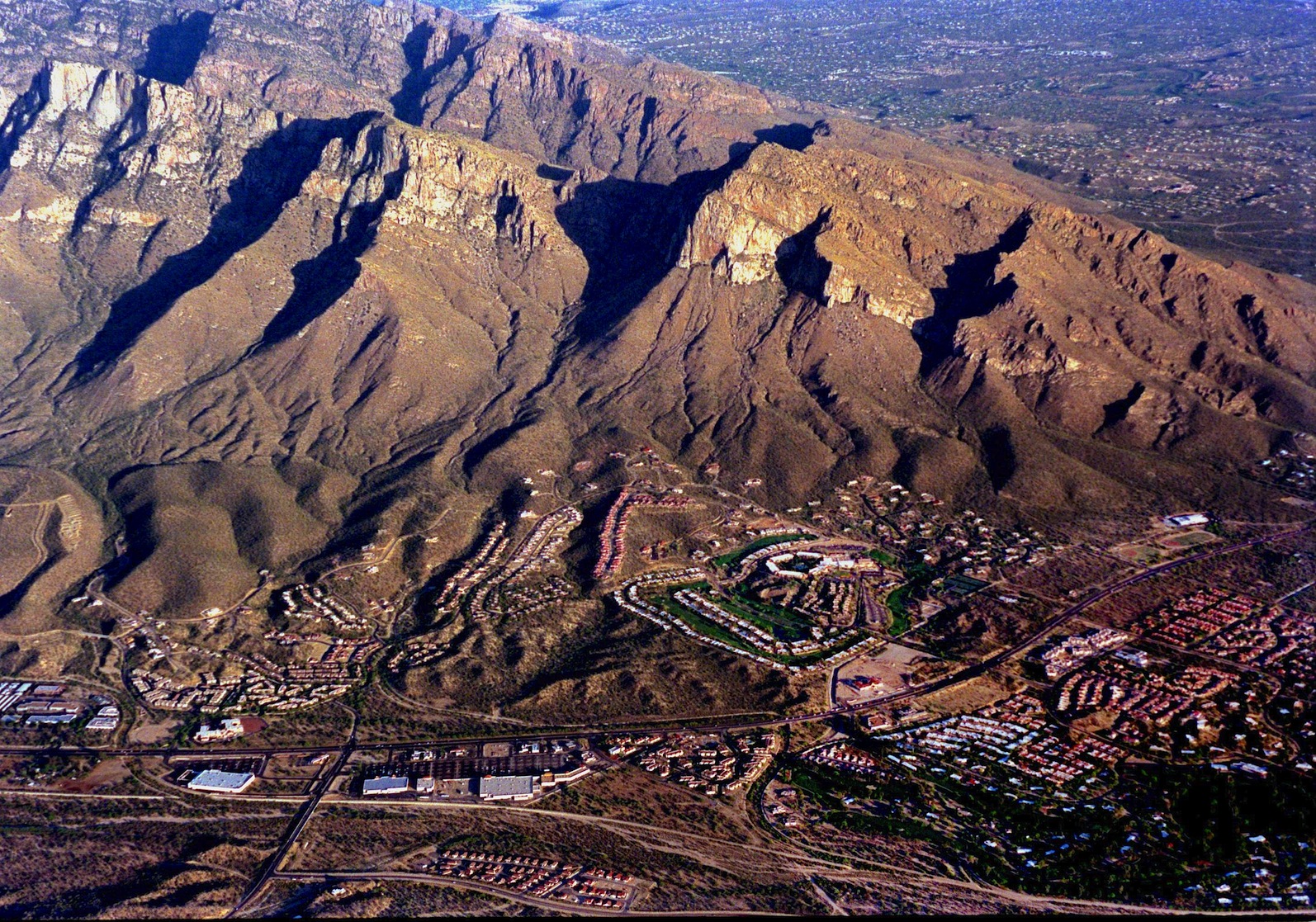
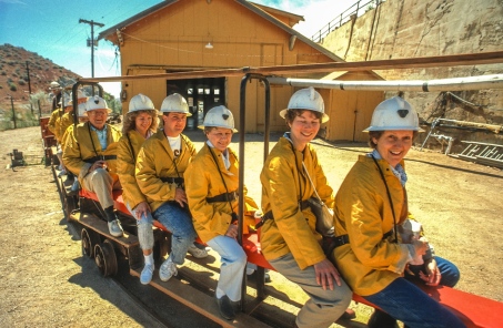
The gold pan of Arizona, SouthEast Arizona, home to Tombstone, a huge icon for all of the wild west that spilled over the landscape will get a huge shot in the arm if Congress acts on the proposal to make the Chiricahua National Monument the 60th U.S. National Park. Statistically, national parks get ten times more tourism, than do national monuments. So the new park who might see 50,000 annual visitors today could begin drawing in close to a half million tourists each year who may require meals, hotel rooms and gasoline.

BISBEE1

Often linked with the Apache Indian War Fort Bowie and the Coronado National Park combined the new park could attract up to 200,000 annual visitors that moves the needle up toward two million potential new visitors to Cochise County where a huge economic

BISBEECOPPERQUEEN

Bisbee tourists take the Queen Mine Tour Underground…

could make a big difference in the once Copper rich county.  Today National Parks strive to bring increased economic value to their surroundings and in particular to communities of color, like Benson, Douglas, Bisbee and Wilcox, making the Chiricahua National Park a good fit for the goals of the U.S. National Park Service.


MONTEZUMA PASS-1050808

Montezuma Pass (above) provides access for the US-Mexico Border as well as for Coronado National Monument commemorating the spot where Conquistadors first crossed into the U.S. from Mexico.

The competition to become the nation’s 60th U.S. National Park is very strong.  Mount Hood, Portland, Oregon’s premier tourist spot is in the running. Stronghold Table in the south Unit of Badlands National Park, has been recommended to be the nation’s first Tribal National Park in partnership with the Oglala Sioux Tribe and would expand recreation and visitation and, the prospect of a Tribal National Park, could be impactful.

BrokenWagonWheel lostdreams-1 (dragged)In 1963 the Colorado River was dammed and allowed to back up 186 miles through Glen Canyon forming Lake Powell. Built originally to provide a water supply to the arid Southwest, today the dam undermines that very objective and it has caused damage across the Colorado River Basin. Before the dam, Glen Canyon was the biological heart of the Colorado River, with more than 79 species of plants, 189 species of birds, and 34 species of mammals; and a cultural treasure, with more than 3,000 ancient ruins. All of that was lost!

The Glen Canyon Institute says it is no longer viable to maintain two half-empty reservoirs — Lake Powell and Lake Mead. The practical alternative would be to drain most of the water in Lake Powell into Lake Mead, and turn Glen Canyon into a National Park.

599

Johnny Ringo’s Grave not ten feet from the tree where the low life shot himself in the head after his horse ran off with his boots  still in the stirup

Lots of politics wrapped up in Glen Canyon, in a time of state’s rights, is it really smart to take the Crown jewel of the Portland tourist trade making it a federal park when a state park would send all the money back into the community?  My money rides with the Chiricahua National Park, National Park Status would bring in tourist dollars and pesos, federal infrastructure cash, good salary jobs, an steady infusion into a dull economy.  Lots of history surrounding the present Chiricahua National Monument. Scene of struggles between the Apache war chief Geronimo, Apache War fort, Fort Bowie, a short distance from the present Chiricahua National Monument Visitor Center, down the road a pieces is  Johnny Ringo’s Grave, Turkey Creek Camping and Rucker Lake offers both hunting and fishing…Tombstone and Bisbee both would benefit from additional spending in the borderlands of Arizona called Cochise County.

Balanced w Pinnacle Rock lrez


CAMPAIGN FOR CHIRICAHUA NATIONAL PARK

EXCELLENT READ ON THE WORK TO MAKE A NEW PARK

EVERYONE’S FAVORITE NATIONAL PARKS

PROPOSED NATIONAL PARKS

LIST OF U.S. NATIONAL MONUMENTS

LIST OF U.S. NATIONAL PARKS

CHIRICAHUA NATIONAL MONUMENT


PERSEIDS METEOR SHOWER LIGHTS UP PHOTOGRAPHER’S LANDSCAPES CAPTURING THE SOUTHWEST NIGHT’S SKY ADDNG SPARKLE TO MOAB ‘S ARCH COUNTRY

blog_broken arch THIS ONE CC_SL_0738

BROKEN ARCH

Milky Way Landscape Photography and the Perseid Meteor Shower by Eugene Louie

This was my first attempt photographing The Milky Way galaxy so I drove to Arches National Park, one of the darkest night skies in the country, to capture the galaxy hovering above the dramatic rock formations. This is Broken Arch. I used it to provide a reference point that even the most amazing Hubble Telescope pictures do not. I wanted to inspire my audience by creating a “scene setter,” which gives the viewer a feeling this scene could exist on another planet. Utah’s stark Moab desert was a perfect backdrop. Scientists studying what the likely conditions of a manned voyage to Mars use the red rocks of Utah to emulate condition on Mars for a possible manned mission to the red planet.

Capturing the Milky Way galaxy over Broken Arch was my original goal, but the experiment became enhanced by an accidental meteor streaking toward earth, probably part of the Perseus meteor shower. The Perseid meteor shower is the most famous, dependable annual meteor shower, producing on average between 60 to 90 meteors per hour, at peak observation times. The real show doesn’t start until after midnight, but meteors can be seen earlier staring around 10pm, a couple hours before the moonsets; the crescendo does not start until hours after midnight when the skies get darker as night turns into day. The prime viewing dates are: Aug. 10th, 11th, and 12th. Fortunately in 2016 observers will enjoy a longer viewing period as the moon is cooperating, setting earlier as it will be in a waning gibbous moon phase.

Visibility will be best for folks living in the mid Northern Hemisphere. All you need do is find the darkest spot possible, as far away from city light pollution, set up a comfy adjustable lawn chair, kick back and make sure you have a wide open sky above you, as meteors will come from every direction. If you are an intrepid meteor watcher be prepared to pull an all nighter.

double cluster casiopeia

Where Do These Meteors Come From?

The Perseid meteor shower look like they come from the constellation Perseus. The Perseid “shooting stars” are bits of space debris made of debris from the Comet Swift-Tuttle. Each piece ranges in size from a tiny piece of dust to about 10 meters. They are called meteoroids when traveling in outer space. They become meteors upon entering earth’s atmosphere, and if the meteor strikes the earth, and remains intact, it is called a meteorite. If these pieces of comet are larger than 10 meters they are called asteroids. The Comet Swift-Tuttle was discovered in 1862 and takes 133 years to make one trip around the sun. Astronomers use the term “radiant,” to describe the line that leads back to where the visible meteor seems to originate. The last time Swift Tuttle reached perihelion, the closest point to the sun, was December1992. It will do so again in 2126.


Smart Phone Apps to Locate the Perseus Constellation:

To locate the Perseus Constellation iPhone users can download “Sky Guide,” a free app available through the Apple Store and Android phone owners can use “Photo Pills,” which
cost about $10. Both are excellent and easy to use to locate The Milky Way, deep space objects constellations, nebulae, planets and more. I prefer “Sky Guide” because if you touch an object on the screen information about the object appears in an info box. This satisfies my need for immediate gratification. Sky Guide provides both scientific and the origin of the mythology behind the naming of the objects.


Technical Info About the Making of this Milky Way Landscape:

The newest camera technology allows photographers to use higher ISO settings in combination with exposures 30 seconds or less, just long enough to record points of starlight before the stars begin to leave light trails. If you enlarge the photo you can see stars, located in the upper corner of the frame, begin to leave evidence of light trails as they move across the sky even with a 17 mm wide-angle lens.IMG_0932

I used a 15 – 35 mm f/2.8 Canon zoom lens with the focal length set at 16 mm, ISO was 16,000, exposure 12 seconds long with the aperture set at f/2.8. Color temperature manually set to 3900 degrees kelvin. I prefer a bluer night sky and from trial and error discovered that 3900 degrees kelvin is my sweet spot to begin photographing. As the Milky Way moves across the sky and it gets closer to dawn I will raise the color temperature. Generally, I do not go higher than 6400 degrees kelvin, and only when the night passes closer to dawn. 6400 degrees kelvin produces a warmer sky. The color temperature is all personal preference so experiment to determine what degree of cool and warmth works for your sky. The camera was mounted on a carbon fiber Gitzo tripod with a Really Right Stuff ball head. At the bottom of the tripod’s center column, I installed a metal hook and hang my backpack on it to steady the camera during the 12-second exposure.

radiant perseusI stood behind my tripod making exposure after exposure. By luck I watched a bright streak of light appear above me while the camera shutter was open and was delighted to find the meteor trail recorded on the preview screen. My initial intention was to capture our Milky Way galaxy with an unearthly object, but I got the bonus meteor because the picture was made during the prolific Perseid Meteor Shower. In August the most dependable meteor watching nights occur during a moonless night. There is no way to predict if it will be a terrific or boring display.

I forgot to bring a cable release. Instead I used my finger to gently trip the shutter with the camera’s self-timer set for a two-second delay to eliminate mirror slap. Capturing a 40,000-mile per hour streaking meteor moving across the heavens is honestly a game of chance. Many Milky Way photographers will use an intervalometer attaching to a digital camera, resembling a cable release, and allow the camera to be placed on autopilot. The intervalometer will open and close your camera’s shutter automatically as well as start the next exposure, according to the parameters you decide. To ask questions about this blog please send an email to this address. I will respond as quickly as possible.

Canon and Nikon manufacture their own brand of intervalometer but are expensive. A less expensive work around I used was buying the Vello brand, a third party timer, which works very well and is less expensive.

IMG_0011

STAR PHOTOGRAPHER EUGENE LOUIE


American Photographer Magazine nominated Eugene Louie as a “New Face” in photojournalism when he was just 26 years old. That same year, Louie’s photographs helped Washington’s Longview Daily News win a staff Pulitzer Prize for covering the eruption of Mount St. Helens on May 18, 1980. The volcanic eruption, equivalent to 400 million tons of TNT, toppled 20 square miles of forest in six minutes. Louie’s prize-winning images were horrifying and stark. Gritty ash covered most of Washington and neighboring states. The rooftops of multi-story houses became the new high ground. Previously gentle Cowlitz River overflowed with icebergs the size of cars that had broken from melting glaciers and sped down streams.

The San Jose Mercury News recruited Louie during the after-glow of Pulitzer Prize fame, when he also won a bronze medal in the Photographer of the Year Pacific Northwest competition. Fast forward to 1989; Louie’s photography contributed to a second Pulitzer Prize win, this time for The San Jose Mercury News’ coverage of the Loma Prieta Earthquake and the aftermath.

“The Ansel Adams Yosemite Summer Workshop gave me the privilege to learn the famous landscape photographer’s “Zone System,” which in simplistic terms, gives photographers a way to communicate visual and technical issues with each other,” Louie said. For Louie, this skill was filed away to pursue a public service career in photojournalism.

Louie set out to become a psychologist and during his senior year completing a bachelor’s degree in psychology decided to pursue photojournalism, in the tradition of Life Magazine photographer W. Eugene Smith, which became Louie’s photographic hero. The late start at California State University Long Beach makes Louie’s rapid rise all the more notable. He didn’t have a degree in journalism, and competed with hungry photographers in a competitive field. “If you are meant to accomplish a specific goal, I believe, you will find a way, “ said Louie.

In 2010, during his first winter to Yosemite National Park, Louie experienced an epiphany. “Winter’s misty fog drifted around granite cathedrals altering the color, intensity and direction of light, in ways I never saw during the summer, Louie said. “That Yosemite winter quieted my mind like no experience before. Photography became a meditation. I realized the purpose of my second career is to photograph the natural world, with the same passion I felt for journalism. Today I look back to the Ansel Adams workshop for renewed inspiration. As Robert Frost is so often paraphrased, I have returned to “the road not taken.”


Perseiid Meteor Shower: NASA meteor shower, Animation; 2015:

How to Photograph the Milky Way Galaxy, Photography Tips: Photograph the Milky Way in 12 Steps;


Arches National Park: Broken Arch Loop Trail:

Kelvin Light Color Temperature Explained:Lowell EDU:


ARIZONA-SONORA DESERT MUSEUM EDUCATES AND ENTERTAINS BOTH YOUNG AND OLD PUTS BOTH IN TOUCH WITH THE DESERT-OUCH!

BIGHORN-ARIZONA-SONORA DESERT MUSEUM--4

Many of these photos have been made over the years and do not necessarily show critters now housed at the Arizona-Sonora Desert Museum. The magnificent ram above in 1987 was killed by man who wanted to hang his trophy horns in his living room. This senseless killing shocked the entire facility, as well as, the Tucson community. The ram had lived at the museum much of it’s six years, originally from the Chocolate Mountains in California. It had two offspring and a 38 year old California man was arrested for killing the ram after the rack was found during a traffic stop. The man was sentenced to five-years in prison and received a $8000 fine.

Walking the dusty desert trail, chirping from a Cactus Wren chirps fill the air. In the distance, I hear the thunderous sound of the Javelina running about in the morning chill, the slightly overcast skies silhouette a passenger jet crossing over the Tucson Mountains

headed for TIA, the engine thunders as they slow for landing. Enjoying these sounds and resting on a bench Fred Fisher from San Jose, Ca says he comes every year for the Gem and Mineral show and now extends his visit each year to spend four or five days visiting the Desert Museum. “We come as often as we can–when we are here, it is so exceptional. “Spectacular”, he says, “this quiet solitude, the magnificent wildlife and birds.  We’ve been coming to Tucson for 12 years now. We started spending a few hours here and now we spend whole days. Monday was a modest crowd he said. Tuesday was completely jammed ! I thought we were going to get trampled.”
ASDESERTMUSEUM-2441

Some ideas hit the ground running, grow, embellish and over-take their mentors before anyone knew what happened.  Folks say they are no-brainers, but it takes courage for the first and unsteady steps that leads to such success—Tucson’s Arizona-Sonora Desert Museum is one example. VISITORS TUCSON AZ-SON DESERTMUSUM-5728 Called “one of the ten best museums in the world” that title might be argued, however, it’s success is without doubt. Tucson residents might be guilty of taking such a treasure for granted, visiting on birthdays or when relatives come to town, but ASDM can be busy as a beehive during Southern Arizona’s cooler months, thousands of visitors come to town, rent motels, eat in Tucson restaurants and spend their entire day surrounded by the incredible beauty of the Sonoran Desert.Saguaro090***

The parking lot fills up daily and stays full all day long with license plates from 30-35 different states including 2-3 Canadian providences each day.  When things slow with the approach of the summer months, ASDM opens earlier, so visitors can beat the heat and enjoy the Museum’s wildlife, before they bed down away from the sun’s heat. Throughout the year, special events are held after dark, when the critters once again come out, so a world-class wildlife experience, is available anytime of the year. The biggest contribution to ASDM success is the fact that it has grown with the times and has expanded over the years.

JAGUAR-ARIZONA-SONORA DESERT MUSEUM--7

After these Jaguars died, this exhibit was discontinued for decades and funding for a planned a new  1.5 acre exhibit, “Coasts to Canyons” recently failed a voter referendum.

When the Museum first opened its doors in 1952, cages where laid out in the desert and folks walked around the critters behind bars. Today, new techniques and technology, the museum has engineered fake rocks constructed to contain their critters and allowing them to live in settings designed for their comfort and in habitat typical of where they would live in the wild.  Jaguar-ARIZONA-SONORA DESERT MUSEUM-Back in the day, the Jaguar, was the last cat to live behind bars because of it’s ability to escape and resourcefulness, after that cat’s death, ASDM decided cages were no longer true to the Museum mission and the species went dark for decades.  Today plans are on the drawing board for a new 1.5 acre exhibit called “Coasts to Canyons”, perhaps the most ambitious and expensive habitat, ever envisioned for the facility. Its completion would greatly increase visitors and no doubt bring out the locals to see the new digs and blow away visitors with the new air-conditioned exhibit. While this exhibit was part of Proposition 427, a $99 Million bond designed to improve roads, water control making Tucson a better place to live, it was defeated by a 39% voter turnout most of which were Republicans who felt an additional $18 a year would break their backs. Lots of private funds have been donated to ASDM and those monies alone will open the new “Winged Wonders of the South West” in 2015 and the million dollar “Midden Project” in 2017 where visitors will be greeted by a 75’ Diamondback Rattlesnake which they can choose to climb through.

VISITORS TUCSON AZ-SON DESERTMUSUM-5792

Cabo Pulmo, the only coral reef in the Sea of Cortez, is highlighted in the Museum’s most recent Exhibit featuring 14 aquarium of fresh water and saltwater residents.

In 2013,VISITORS TUCSON AZ-SON DESERTMUSUM-5787 the Desert Museum opened it’s first major exhibit in a decade. The aquarium exhibition, called “Rivers to the Sea,” highlights the role of the rivers, including the Colorado and the Gulf of California. The 1,100-square-foot aquarium exhibit, housed in one of the historical structures built in 1937, includes many now-endangered species of freshwater fish, as well as several dozen species of fresh and saltwater creatures found to be at home in the brackish waters near the Sonoran coast, and the Sea of Cortez. That $1.3 Million project was opened with private donations.

VISITORS TUCSON AZ-SON DESERTMUSUM-5797
Some might complain that $20 a visit might be a stiff ticket to buy, but ASDM basic membership costs $55 for a year and includes two guest tickets for the following year, allowing a year and a half of access, and that should be affordable for most.

OWL TUCSON AZ-SON DESERTMUSUM-8480

Raptor Flight brings out the photographers and Snowbirds alike….

Lots of snowbirds que up at the Raptor Free Flight. Two kids fidget as they await the Docents that remove the ropes allowing the crowd to filter into the performance staging area. The two boys, each carrying a stuffed lion, have the white pasty legs of folks living back east who have not seen the sun for months. The large crowd gathers 25 minutes before the start of the Raptor Free Flight, where about a 100 people stand at the entrance and there is standing room only, water bottles stick out of purses.

This slideshow requires JavaScript.

Three Desert Museum docents walk down to the crowd, they ask the crowd not to move until they finish their count to ten and one docent “who drew the short straw” has to take down the chain … that lets the Raptor Free Flight Crowd advance. “Please keep to the rails”, they ask. “You folks talk funny”, notes one docent, “flex your knees and steady yourselves,” another docent tells the crowd.

HAWKTUCSON AZ-SON DESERTMUSUM-8566

Trainer Wally Hestermann welcomes the crowd and gives a quick run down on the birds he will be working with for the 10 am show, first comes the Chihuahua Raven and the magnificent Great Horned Owl who came to the Desert Museum from a top shelf in the Oro Valley Home Depot. The Prairie Falcon–drinks no water, says Hestermann, “they get all their water from their prey”. The Ferruginous Hawk used to thrive here on Prairie dogs”, he says “but since those critters are now extinct, we don’t see this hawk around here anymore.”

HARRISHAWK RAPTORFLIGHT-2412

“Red-tail Hawks in the wild, often die in the first year, reports the trainer “they know they have it good here, we take care of them, they can take the day off if they want.” “We want these birds to look natural, so they wear no equipment, this soaring behavior took six months to learn and they respond to visual signals from 2500.” Redtails can live 7-10 years in the wild or 10-25 years in captivity and one holds the record for 65 years. They eat farm raised mice and quail or “tissue meat”. “Our birds are orphans from rehab”, but these social birds often hunt and play in family groups of five to seven birds.

OWL-RAPTORFLIGHT-2325

Arizona has four owls, three falcons and 7 different hawks and the Golden Eagle. The 2 pm Raptor Flight performance is different from the earlier show and features different avian residents of the desert.

OWL TUCSON AZ-SON DESERTMUSUM-8463

One Phoenix photographer, Stu Glenn told me he often comes down to Tucson spends the night and both days at the Museum’s “Raptor Flight” a very popular performance during the cooler months. “It’s quite spectacular,” he says killing time at the Big Horn enclosure. I didn’t come down here for pictures of the rear end of a ram, he says, yesterday I got the “most excellent Harris Hawk images”, he coos.

VISITORS TUCSON AZ-SON DESERTMUSUM-5770

Crowd awaits Docents to lower the chain and allow them into the Raptor Flight performance area. This lineup begins an half hour before the show.

While birds have little issue with the desert heat, non-desert-dwelling spectators have been known to drop like flies, and before the show concludes in April the Museum places “spotters” in the crowd looking for tourists who frequently collapse from the warm days and harsh sun.  Regardless, “Raptor Flight” is a huge draw for spectators and photographers alike, in spite of the size of the crowds, there is not a bad seat in the show. Photographers should hang to the fringes or outside of the crowd, the birds which have been trained to feed on the branches surrounding the large group move all around and everyone gets a front row seat.  I would have said it impossible if I had not seen it for myself. Some birds receive an audio signal from their trainers and perform accordingly, no bird is a prisoner, they jump at the chance to show off for treats. Photographers should be using their fastest shutter speeds to stop the flapping of these birds wings, an amazing photo opportunity.

Photo opportunities do not stop there.  Early morning will find coyotes, black bear, otters, Javelina and Mexican wolves or “Lobos” all out to delight your camera. “That coyote, doesn’t seem as big as the ones in my neighborhood—they are probably controlling his diet–he probably doesn’t get a tabby cat every night, said one visitor. The coyote called “God’s Dog” by the Navajo is often “the trickster in Native American legends has an evasive and puzzling role as the fool or demigod in Native American traditions.

Bitchin the Ranks 235

Coyotes complaining about their Museum diet, rather than a nice “Tabby” from time to time

LOBO99

Mexican Wolf or Lobo

The Mexican Grey Wolf, has a sign in front of its enclosure that says there are 50 now living in the wild but recent headlines have said its population has doubled reaching 100, a South West success story.

DESERTMUSEUM BABY-3131The amazing Hummingbird enclosure, full of lots of species who nest and buzz about the visitors and their cameras. Their eggs look like gum drops, the hummers are going so fast, one visitor jumps back, a baby cries, camera shutters click, big cameras and cell phones alike. One parent tries but can’t pull one kid away from his cell phone. “I hear the hummingbird!  He’s way up there,” attempting to get his picture. “See the hummingbird?” says another dad, “brace yourself with that long lens,” he coaches.

VISITORS TUCSON AZ-SON DESERTMUSUM-8660The Museum developed this enclosure and garden while and in doing so it developed new understandings of what attracted these fast-moving birds and what it took to keep them happy and alive.  They wrote the book on Hummingbird gardens.

While scientific understanding has been expanded in the decades of working with the animal and plant species living in the Sonoran Desert.  Spring can often brings great delight, this year’s second week of April, produced two baby Big Horn Sheep, an ewe and a small ram both now are on display with their moms and their magnificent father.

DESERTMUSEUM BABY-3043

Learning the ropes, Big Horn are noted for their sure-footedness, and this little guy born just a week ago is being schooled in the art of not falling off the mountain.

Further west of the Big Horn exhibit, is the Black-tailed Prairie Dog exhibit has a bunch of new pups, who enjoy wrestling and running, delighting crowds every hour of the day.

DESERTMUSEUM BABY-3099

BABY PRAIRIE DOGS RUN, WRESTLE AND SCAMPER FOR FOOD AND FUN (BELOW) SHOWS THE OLD ENCLOSURE WHICH ALLOWED VISITORS TO ACCESS TO THE PRAIRE DOGS AND THE NEW ENCLOSURE HAVE VISITORS BEHIND CLEAR PLEXIGLASS.

PRAIREDOGS-ARIZONA-SONORA DESERT MUSEUM-

The Desert Museum has perhaps the most incredible settings found anywhere in Southern Arizona, the only spot in the United States where the giant cactus, the Saguaro, is found to grow. The smallest detail in this lush desert is found to have the most delicate beauty. The mid-March wildflowers season is followed in early May with cactus blossoms that bring yellows from the Prickly pear, purples from the Hedge-hog, yellows and reds from the Cholla and get a ladder for the white bloom on the Saguaro. Finally the two species of Palo Verde drape the entire desert with brilliant yellow blooms, finally yielding to the Ironwood trees purple coat. The Desert Museum also features more exotic species found in the nooks and crannies of the Sonoran Desert, one like the Boojum, found in north central Baja.

VISITORS TUCSON AZ-SON DESERTMUSUM-8339

Not all visitors to the Desert Museum are people.  One photographer I know was amazed by a scene he captured between a wayward rattlesnake trailside and an impromptu ground squirrel.  He saw a women making pictures with her smart phone and he moved in tight with his Nikon and “got some amazing images” but he had never considered that rattlers might be found trailside, regardless of signs, warning folks to be alert to the possibility.

Years ago, I setup a camera on a tripod behind the Desert Museum about 2am hoping to photograph a meteor shower.  As I stared into the brilliant sky alive with stars and meteors streaking across the huge expanse I was rattled into self-awareness when something behind me let loose with a loud terrifying growl. In less than ten seconds, the tripod was down and I was pulling away from my pullout on the McCain loop. The shivers up my spine had been rooted in primal concern for my very existence, the only cat in the Sonoran Desert capable of launching such a roar, was a Jaguar, who no doubt was just another visitor to the Arizona-Sonora Desert Museum.

Wandering the grounds of the Desert Museum and listening to comments from visitors from all over the world gives one an appreciation for the rarity and the uncommon value found here at this popular visitor spot.

PIGS

MOST YOUNG VISITORS CAN NOT RESIST THE BRONZE STATUARY SCATTERED ALL AROUND THE GROUNDS. THESE JAVELINA AT THE ENTRANCE ARE SHINEY FROM WEAR.

“Look it is a hedgehog cactus!”, says one visitor pointing to a prickly pear cactus. “This cactus has ears” says another. “Deer?”  “I can see deer at home” says one!  “I don’t see the parrot? “ You can see the wolf, he’s behind the agave.” “Wild turkey, heh!  “Excellent, I could use a little wild turkey about now, says one noontime visitor. “Can you seem ’em ?”

VISITORS TUCSON AZ-SON DESERTMUSUM-8648

“Let’s see the big turtles”, upon their return, “did you see your turtle?” “Nope–he’s hidden now-shall we see if the tortoises are around?” “I don’t think they hibernate in the desert”, said another. “I didn’t see any terrapin.” ”We saw nothing, I don’t know where they are!”

“This would be a cool scavenger hunt, bring a bunch of kids and see how many animals they see, offers one visitors. “I see something moving but I can’t tell what it is-a black something” (Coatimundi).

“You can see the roadrunner.” “Is anyone else being co-operative?” “Possibly not, but you have to look, like in the Gray Fox enclosure there are two sleeping beneath the ledge.”

VISITORS TUCSON AZ-SON DESERTMUSUM-8394

“The beaver’s down this way, we’re on the right road. I want to jump in and cool off with that Beaver.” “Look, there’s fish in the water, 1-2-3-4-5-6-there’s the beaver.”

Beaver-ARIZONA-SONORA DESERT MUSEUM-

“Has every one seen enough of the desert?”

“What do you think about the Sonoran desert?” “It’s okay!” said one burned out Asian visitor. “Just look at this beautiful place” says another. “Now that Bighorn, I’d like to see him climb out,” says a woman with a leopard-skill umbrella shading her head from the sun.

The direct Desert sun can be harsh on folks who rarely see it, even on a day when temps top out at 79. “When we are all sunned out-we can go into the air-conditioning-there is a pop machine there and we can refill our water bottles.”

Critters from the Sonoran desert learned from birth, like the Bobcats sleeping under their ledge, that an afternoon siesta, is the best way to handle the heat. Because of that the Museum does feature indoor air-conditioned exhibits like the new reef display featuring 14 aquariums, or the beaver exhibit, snakes or spiders, cave underground or geology exploration or the shaded Aviary, so when visitors finally decide they don’t want to go back out in the sun they can go see the Hummingbird enclosure or explore any number of cooler options.

KIT FOXS-ARIZONA-SONORA DESERT MUSEUM-

Two older women, stooped over, and barely moving up the grade, says “we’re pretending we’re kids. Running past these enthusiastic visitors must be 30 kids all wearing red-t-shirts which mark them from the same school, making it easier for their tenders, to know which kids to roundup or push along and to take home a day’s end.

DESERTMUSEUM BABY-3147

The 98 acres of the Museum continue to be owned by Pima County and leased to the Museum. ASDM is governed by an independent Board of 24 members.


The Desert Museum is ranked on TripAdvisor.com as one of the Top 10 Museums in the country and the #1 Tucson attraction. Unlike most museums, about 85% of the experience JAVELINA TUCSON AZ-SON DESERTMUSUM-8569is outdoors! The 98 acre Desert Museum is a diverse experience: featuring a zoo, botanical garden, art gallery, natural history museum, and aquarium. The 21 interpreted acres has two miles of walking paths through various desert habitats, housing 230 animal species, 1,200 types of plants with 70,000 individual specimens. It houses one of the world’s most comprehensive regional mineral collections. Beyond merely an attraction, the Museum’s conservation and research programs are providing important information to help conserve the Sonoran Desert region. The Desert Museum’s Art Institute inspires conservation through art education and gallery exhibits. The Museum’s publishing division, ASDM Press, has produced over 40 books and guides on the natural and cultural history of the Sonoran Desert.

owl4540

The Desert Museum is recognized as one of the finest docent corps in existence today, it began in the fall of 1972. The genesis was a small group of volunteers trained to take school children on tours of the grounds, but now the docents are stationed around the grounds to provide live interpretation to all who visit. These docents, who undergo a rigorous 15-week training program, are now devoted to giving demonstrations on the grounds, and contribute today more than 75,000 hours annually to do this.

SNAKE-ARIZONA-SONORA DESERT MUSEUM-

Hal Gras 1977

Hal Gras 1977

The Museum’s other education programs developed over the years, most notably by Hal Graswho created a program to take live animals to schools and other venues. His program, begun in 1955,  dubbed “The Desert Ark”, touched tens of thousands of people. Even though Gras retired from the Museum in 1985, many people today recall being inspired to learn about the desert from Gras and his Desert Ark.

VISITORS TUCSON AZ-SON DESERTMUSUM-8700

ARIZONA-SONORA DESERT MUSEUM

JOIN THE ARIZONA-SONORA DESERT MUSEUM

EVENTS CALENDARS FOR ASDM


ARIZONA-SONORA DESERT MUSEUM WEBSITE

MORE PHOTOS FROM ASDM AT SOUTHWESTPHOTOBANK.COM

SOUTHWESTPHOTOBANK SONORA PHOTO GALLERY

SEA of CORTEZ


This slideshow requires JavaScript.


Join me on PhotoShelter

Graph Paper Press minimalist WordPress themes for photographers and designers

<a href=” SPANISH TRANSLATION


MARANA’S WESTERN HERITAGE ARENA: WHERE EVERYONE IS A RODEO LEGEND OR WILL BE !

MARANA BARREL RACERS-2068

The wild West lives today, in the hearts and minds of its fans and historians.  But in Marana, the spirit of  western culture, lives on in a dusty corral next to Interstate 10 which routes horse-lovers there from all over Arizona.  The Marana Western Heritage Arena sets the stage for cowboys and cowgirls of all ages to grow up Western and realize their ambitions and goals.

BULLRIDERS-3356

Most weeks folks converge there to barrel race and ride bulls.  Every friday night, kids come and “to hang out” watching family and friends perform in the arena.  Bull riding starts at 7pm and varies whether you have experienced riders or someone new trying on the sport for the first time.  Why would someone climb onto the back of a huge bull, knowing it would eventually launch them skyward?

JACKPOT Barrel Racing-8380

“A passion for animals and the adrenaline for life,” says Jessica Reyna whose teenage son, Benaiah has decided he would ride a bull tonight, his first, but not his last.  “He’s a bull-rider now!,” comes the voice from the speakers, “Welcome to the family!” as Benaiah picks himself up, dusts off and climbs out of the arena.  Some fridays, dozens of younger kids show up for “mutton-busting”.  Climbing on top of huge sheep, grabbing the rope, and letting go. The kids love it and for many, it is just a question of time, before they trade sheep for bulls.  It’s not all guys who climb onto the unridable, two girls, who come most Friday because their friends are here say if they had the cash they would go for it.  They felt sure, that in the beginning, they might “come off pretty early” at first, but eventually they could get a good ride. Their day is coming they say…

Tonight, behind the chutes, four or five friends are stretching, talking, laughing and getting ready.  Wives and girlfriends stand near talking but watching as the guys get ready. Many of these riders are active Air Force, airmen who had to get their CO’s permission before they could ride bulls. Most have been here before, Mike Fuentes has been riding for about a year and wants to improve his ranking and get his PRCA card, maybe win some cash.  He is real impressed with the arena and folks who attend, it’s like family he says, when I first came out here I had no gear just wanted to ride.  Folks pulled together enough gear for him to get thrown off, since then, he keeps come back for more. “It’s like family here”, he says.

When the riders are queued and ready for the gate to open.  Most wearing face mask, chest protection and rubber mouth guards, they suck it up as the g-forces grab them.  Everyone has their smartphones out filming and capturing the ride to be dissected later for fun and training, either way, they want a record for their ride tonight.  Who would believe it otherwise ?

MARANA SW HERITAGE ARENA-1449

John Schmidt is a one-man rodeo, he’s is master-of-ceremonies and announcer, he helps load bulls and picks up cowpokes off the ground. He doesn’t ride bulls anymore, after 15 years he wants to pass his skills on to others, while keeping the arena running safely. While Schmidt gets much of the credit for the friday night bull adventure pitting 160 pound cowboys against 2400 pound bulls, he is the first to pass the credit on down the line.  “Dan idea for the arena”, he deflects, “was to create a place where folks could bring their families, to visit and play together”.  Ten years ago Dan Post built the arena, bull chutes and corrals, most nights he is the fella on top of the tractor who smooths out the soil in the performance area and gets it ready for the next group of riders.

JACKPOT Barrel Racing-8354 (1)

Then he does it again, and again, all night long. “This is my service” says Dan Post, with the humility of a guy who doesn’t want the limelight.  Fact is, Dan’s service extends to the Marana School Board, where he has served ten terms, helped build all of Marana’s Schools and knows all the employees who have been hired in their public schools for the past forty years.  He’s running again this year for the school board, “Because they need my experience!” he says.  Post’s experience is unparalleled, he’s lived in Marana over 50 years and while he misses the old days and “hates seeing all the farmland go away”.  As President of the Town of Marana Western Heritage Committee, whose mission is to promote a Western way of life, allowing opportunities for people wanting an equestrian experience. Post’s prominent role on the school board, may be the reason, the arena was built on high school land. 

MARANA GYMKANA-1807

Either way, it fills up most weeks for the varying events, some with jackpots, bull riders for $50 can get into the money if they stay on for eight seconds.  Some nights they might win $500, but eight seconds can feel like eternity, so some don’t. Jackpot Barrel racing, open to both Cowboys and Cowgirls, on the first Wednesday of each month, might bring out 50-60 riders who could win $150-$200 with some style and a quick ride.

Saturday can often bring hundred’s of youngsters and horses out for Horse Gymkana’s that run the kids and their critters through the paces, pillons or barrels. Four-H groups from all over southern Arizona and Tucson turn out to await their turn as they navigate the obstacle course. They learn valuable lessons in caring for animals and meet kids they will grow up with, each taking their place in the competition’s rankings.

MARANA GYMKANA-1842

Lots of energy goes into making up Marana’s Western Heritage Arena, covering the

JACKPOT Barrel Racing-3204

Shayse Riera lays one on Maverick

events, coaching the kids, organizing the livestock, watering down the dust that fills the air and might drift onto I-10 if Dan Post wasn’t driving the water truck around and dampening it down, nailing down all the loose soil in the area.

Because the Marana Arena is such a class act, the Grand Canyon Rodeo Association, often has a rodeo there on the grounds bringing in top ranked cowboys and cowgirls to compete for bigger money and eventually getting into the big money which makes Rodeo a full-time job for lots of cowpokes.  It is something you have to love because many suffer lots of broken bones, cuts, scrapes and dislocations, whatever, they all go back for more because they love to Rodeo…

MARANA SW HERITAGE AREN-1678

MARANA SW HERITAGE ARENA-1420

Bull Riding Practice Every Friday 7 PM Sharp

Mutton Busting, Calf Riding, Steer Riding, Jr. Bulls and Bulls $5 admission adults, Children 12 & under free

Mutton Busters must weigh under 70lbs $5 fee Steer Riding $10, Bulls $20

First time Bull riders are welcome equipment available at the arena rope, helmet, vest

JACKPOT Barrel Racing32

Directions to Arena

I-10 exit 236 take eastbound frontage at Chevron 1/2 mile east at Postvale Rd.

For more info call 520-248-1736

MARANA BARREL RACERS-1915

MARANA WESTERN HERITAGE EVENT CALENDAR

SOUTHWEST PHOTOBANK MARANA WESTERN HERITAGE PHOTO GALLERY

COWBOYLIFESTYLENETWORK.COM

MARANA BARREL RACERS-1902

This slideshow requires JavaScript.

Join me on PhotoShelter

Graph Paper Press minimalist WordPress themes for photographers and designers

<a href=” SPANISH TRANSLATION


“WHERE THE CREATOR TOUCHED THE LAND” APACHE EFFORTS TO SAVE OAK FLAT FROM “GREEDY” AND MEAN-SPIRITED POLITICIANS

The lush Oak Flat campground, once a quiet island of green in Central Arizona, is known to the nearby San Carlos Apache as “where the Creator touched the land”. Its lush canopy of trees and streams surrounded by the brown Sonoran Desert leaves  little doubt this small gem is worth the fight looming in its future. It is the classic battle of good, fighting corporate greed aided by “political corruption”, against a Native American tribe that historically has been pushed to the end of their Earth.

APACHE MARCH-ONE YEAR-7618

Apache babies once hung in cradleboards from these Oaks as their mothers, aunties and grandmothers and all their older brothers and daughters scampered about picking acorns.


The Apache, disconnected from their lands and culture, were taken prisoners-of-war and were victims of genocide. Still they endured, survived and have taken up their battle for holy land to the highest court in the land, their creator! Ussen, placed them on this earth and made them stewards of the land from the day they are born to the day they die it is inherent to the Apache to protect the land their ancestors died fighting for, today it is their fight.

APACHE MARCH ON OAK FLAT--8143

During both marches, young and old, have stepped up to the challenge of Saving Oak Flat.

More than a year ago, few knew of Oak Flat, for many, it’s the top-of-the-world-a high spot where one can see forever. Roughly a hundred miles southeast of Phoenix and a long way from all the green golf courses, resorts of Scottsdale where folks sip light beer poolside. More than 200 San Carlos Apache marched on a crowded curving roadway, backed up by vans of elderly. They marched 50 miles to Oak Flat from the Tribal headquarters in San Carlos some walking and others running across some of the hottest, inhospitable land in the United States.

APACHE MARCH-ONE YEAR-2661Today, one year plus and counting, activists are marching for Oak Flat in Honolulu, Seattle and Sacramento and protests are being held elsewhere in the U.S. The San Carlos Apache began their 2016 anniversary march in February from “Old San Carlos”, 13 miles from present day tribal headquarters, when Coolidge Dam was built it plugged the Gila River. As the water rose the historic, painful and criminal San Carlos Indian Agency was lost to the waters, as well as, 400 Indian graves.

Vernelda Granttribal historic preservation officer for the San Carlos Apache Tribe

We have mixed feelings, mixed feelings because, you know, we have the water here now, we have the fish here and these beautiful birds, and the water to us is life, but underneath it all is a lost history. This water covers a painful part of our lives from the past. I think it soothes that pain. For the Apaches, the waters help conceal a painful past. Old San Carlos was a powerful launchpad and an emotional sendoff for the almost 200 marchers and runners who churned through the 50 miles march ending up at Oak Flat for the blessing of the holy land by the Apache Crown Dancers.

APACHE MARCH-ONE YEAR-2632

Aztec Indians dance to the “Earth’s Heartbeat” and bless this Holy Ground. “We came today to bring our prayers here-to the spirits here and within us”

Since then,  the campground has been occupied, as the Apache continue their protective watch. Meanwhile, forces are at work to turn around the “land swap” that John McCain snuck into the behemoth national defense spending bill that was passed.

Everyone now, has heard of Oak Flat ! The unjust midnight move one year ago by John McCain, bypassing due process, so a foreign copper company could steal land that serves as part of the San Carlos Apache lifestyle and culture. After a decade of successful tribal legal intervention, McCain slipped the rider into the 2015 National Defense (must pass) Bill overnight and passed it the next day, bypassing any public transparency. Today, a goggle search for Oak Flat brings back, hundreds, if not, thousands of hits. From photo spreads in GARZA the French News Magazine to an Op/Ed piece in the New York Times calling McCain and Jeff Flakes bill, “a new low in congressional corruption”, written by Lydia Millet, who says ”the rider should be repealed.” Millet suggests “laws can be reversed by new legislative language.APACHE AT OAK FLAT8162

Tucson representative Raul Grivaljva and presidential candidate and Vermont Senator both have filed legislative action to scuttle the McCain-Flake rider in favor of the San Carlos Apache Indian Tribe.

Jane Sanders visits and speaks at Oak Flat

“Oak Flat is an important cultural and religious area that is vital to the traditions of our Native American brothers and sisters – it deserves our strongest protections,” said Rep. Raul Grijalva, D-Tucson.

APACHE MARCH-ONE YEAR-7645The Save Oak Flat Act, authored by  Tucson Rep. Raul Grijalva and cosponsored by presidential Democratic candidate Sen. Bernie Sanders, Rep. Ruben Gallego and Sen. Tammy Baldwin, would repeal this amendment to the National Defense Authorization Act, thereby disallowing mining in this area. According to the Save Oak Flat Act, the establishment of a mine would result in, “the physical destruction of tribal sacred areas and deprive American Indians from practicing their religions, ceremonies, and other traditional practices.” Furthermore, the Act considers the potential environmental degradation due to mining waste.

John Welch, an archaeologist, long-time resident of Fort Apache and a professor at Simon Fraser University in Canada, says Oak Flat, “Is the best set of Apache archaeological sites ever documented, period, full stop.” Oak Flat and Ga’an Canyon are “where the spiritual beings that represent healing live.”

“We demand entitlement to our land and reservation, says Nosie, “through prayer, we are going to win!” “We are bringing down the barriers imposed upon us and today we breakout, the abuse from the people outside (the reservation), ends here today.”

So spoke, Wendsler Nosie, one year ago speaking in one voice for Tribal leaders from all over Arizona and Native Americans everywhere, Nosie announced Thursday February Fourth, 2015, to be “a historic day as the Apache once again took the field once again against the United States of America”.  4f34b001070f1-preview-300Nosie then led his people on a  march to Apache Leap Mountain towering over the mining community of Superior where Resolution Copper plans to use robots working deep underground to collapse the mountain beneath itself imploding the Apache sacred ceremonial grounds where their ancestors are buried, where their daughter’s held Sunrise Ceremonies, where their parents wakes and funerals were enshrined—a holy place for every chapter of Apache Life.

APACHE MARCH-ONE YEAR-2667

“Ladies and Gentlemen, the San Carlos Brave’s Basketball Team today has won the State Championship this a very afternoon.” Applause breaks out as community members celebrate their children bringing home the top prize from the state tournament. Apache are a very proud people and their children are the center of their universe.

APACHE MARCH-ONE YEAR-7647

Apache, activist await the arrival of the Crown Dancers who would bless this holy ground…

Apache Leap Mountain gets its name from the Pinal Apache Band who lived in those hills and valley, those rocks still carry rock art left from their dreams of successful hunts for deer and mountain sheep, game that filled their stomachs and fueled their children’s futures. That band of 40 died leaping from the ragged mountain edge as they were surrounded by the U. S. Cavalry who demanded a return to San Carlos, or die by their sabers. The Pinal Apache chose to leap knowing their God knew best how they should live and die. Today the Apache fight for their children.

apacheleap2401

APACHE LEAP MOUNTAIN

For decades, the Apaches fought and raided encroaching Mexican and American immigrants. In the 1870s, the U.S. government forced them onto camps or reservations, like San Carlos. “HELL’S 40 ACRES” was the nickname for San Carlos Indian Agency for the deplorable living conditions found there in 1870-80’s according to wikipedia, there it reports the U.S. Army showed both animosity toward the Indians and disdain for their civilian Indian agents. Soldiers and officers Wikipedia reports “sometimes brutally tortured or killed the Indians for sport…”

APACHE MARCH-ONE YEAR-7633

“We were pushed here”! says Wensler Nosie, former Chairman of the San Carlos Apache people and spiritual leader of the Save Ash Flat Movement. APACHE MARCH ON OAK FLAT-NOSIE-5287We used to roam the entire South West, but we were told to stay at San Carlos and extermination was the response when we didn’t. The white man killed our ancestors, my great grandparents, when they tried to continue their nomadic lifestyle. My mother told me, stay on the reservation-don’t bother those white people outside or they will rain down hurt upon you and our people! That was a sickness pressed upon our people by the U.S. government, that ends today,  “Today we pray to our God and through God we will win!”

Councilman Fred Ferreiria from the San Carlos Peridot district says “they gave us this land because no one wanted it — they found minerals — and they took it. If we don’t stop it now, bit by bit, they will take it all away again.” We learned the laws and how things are done, we were doing that and the government broke the rules, we must continue this fight, we are here today for our children.”

APACHE AT OAK FLAT5538

APACHE AT OAK FLAT8210

“We have champions in Congress and they will help us “Repeal the Law” said Ed Norris, chairman of the Tohono Oodham (above)

God blesses the world–he put us here to protect the land and as long as we put God first–he will fight for us. Apache people were taught to pray and only through prayer will we win. The white man came to America in search of religious freedom but still they deprive the Apache of what is his religious right.” “We are still prisoners-of-war” said Wally Davis, chairman of the Tonto Apache speaking of people forced marched to the San Carlos Indian Reservation. “This is a message to all Native Americans.” “San Carlos is still a prison, ” Davis said. In March 1875, the government closed the Yavapai-Apache Camp Verde Reservation and the Army marched the residents 180 miles to the San Carlos Apache Indian Reservation. More than 100 Yavapai died during the winter trek. After Geronimo’s capture in 1886, and the Chiricahua Band were shipped to Florida, San Carlos was then used to contain all the rest of the Apachean-speaking people until the 1900’s.

tailingsite2279

RESOLUTION MINE PLANS TO STACK TAILINGS FROM PICKETPOST MOUNTAIN (above) TO FLORENCE JUNCTION ALONG THE SIDE OF HIGHWAY 60, FOR 20 MILES ,THE PILES WILL BE STACKED BETWEEN 500′ TO PERHAPS 2000′ TOWARD THE END OF THE MINING PROJECT.

“This is Apache territory and Oak Flat belongs to the Apache—they took it away from us and we must take it back says Apache Chairman Terry Rambler. shafts283“I’m very proud of my ancestor’s “Apache Pride” we were supposed to be exterminated but we are here today, let’s take over Oak Flat, this is our time to be involved! Apache were slaughtered and killed here—we will fight for the blood of our ancestors. The chairman said the San Carlos Tribal council voted against any copper mines being built upon their land.”

“The white people came to this land searching for religious freedom, fleeing persecution, they wanted “ to have the ability to pray, we want the same freedom”. Some people have to visualize something, like a church, a structure to express their love of God, Oak Flat is our church, it is no different today. Today is about religious freedom, we need to keep our connection to our God.”

It is a little known fact, that the largest, most-amazing copper deposit in Arizona, lies beneath the city of Mesa. So imagine, if you will, the Mesa Arizona Temple – The Church of Jesus Christ of Latter-day Saints, gets a federal notice that the church is off-limits and will be demolished in order for China to have all the copper they want to sell back to us. That’s Oak Flat, in an nutshell, the church of the San Carlos Apache is threaten by a copper mine and since environmental studies have been ruled unnecessary, the San Carlos people fear for their water and their spirituality.

In addition to the destruction of this place of worship, the Land Exchange will threaten the water quality and water supply of the region. The Tonto National Forest was established in 1905 principally to protect the region’s watershed. However, the Land Exchange will effectively eliminate these protections. Under current plans, the mining operation will require an unsustainable amount of water to operate and leave behind contaminated water affecting the Tribe and local communities for generations to come. The resulting hole will be two miles across and resemble “Meteor Crater” near Winslow, Az.

Meanwhile the 1978 American Indian Religious Act forbids government to denying Native Americans access to sites or to interfere with religious practices and customs where such use conflicts with  federal regulations according to  President Jimmy Carter this act stops that. Both Presidents Nixon and Eisenhower signed bills setting aside Oak Flat from mining and development.  It was established as a green space for Americans to enjoy.

APACHE AT OAK FLAT5523

APACHE MARCH ON OAK FLAT8136

A few months ago, the National Museum of the American Indian contacted the SouthWest PhotoJournal to acquire “images for their upcoming classroom lesson plan their Education Department was developing, a lesson plan about American Indian Removal, for teachers and students K-12. The web-based module titled “Many Trails of Tears.” would be a teaching tool to understand the impact and complexity of U.S. Removal Policies, with a wide variety of stories and outcomes. One part of the lesson was to focus on Oak Flat. They asked students to look at Oak Flat and determine whether mining on a sacred site is an example of removal today says Erin Beasley, visual researcher for the National Museum.

“Just recently the web lesson plan went through a review process Beasley reported a couple months later, and “the education team has informed me they had to drop the Oak Flat story in the lesson plan for the immediate future”. “It may come back at some point, but for now I’m very sorry to say we won’t be using the Oak Flat images. Oak Flat is such an important story, I’m sure it will come into another project, or become a growth of this educational project, in the future.”

I frankly had expected the change because the battle over Oak Flat is growing very contentious and workers at the National Museum are subject to the will of Congress and to be calling Oak Flat, an example of forced relocation, while Republicans are saying never mind, this campground is no consequence or no major importance, could cost a job.

APACHE MARCH ON OAK FLAT--5369

Sides have been chosen and battle lines drawn both Reps. Paul Gosar, R-Prescott, and Ann Kirkpatrick, D-Flagstaff, asked the National Park Service to withdraw the Oak Flat application to the National Register of Historic Places, saying it was confusing and vaguely worded in an attempt to undermine the proposed Resolution Copper mine. They noted, among other things, that the application did not cite “Oak Flat,” as the area is commonly known, but called it the “Chi’chil Bildagoteel Historic District,” according to the Cronkite News Service.

“We are concerned that the use of the phrase ‘Chi’chil Bildagoteel Historic District’ and a lack of geographic information is an attempt by these opponents to limit transparency and public comments from constituents that disagree with this nomination, and an attempt to undermine our bipartisan bill” the lawmakers’ letter said.

In the March 10th edition of the Tucson Weekly Republican Congressman Paul Gosar goes nuclear at news that Oak Flat will remain listed in the National Register of Historic Places, despite attempts by himself and U.S. Rep. Ann Kirkpatrick, a Democrat who alleges to stand by Native Americans, to withdraw the site from historic consideration.

In a press release, Gosar alleges Oak Flat has never been a sacred site. According to a letter by former chairman of the San Carlos Apache Nation and organizer of the group Apache Stronghold Wendsler Nosie, Sr., Gosar is pressuring the National Forest Service to kick out members of the Apache Stronghold, as well as allies, who have occupied the area since the site was sold out to the mining company.

“Oak Flat deserves our strongest protections,” said Rep. Raul Grijalva, D-Tucson. “As someone who has fought to safeguard this treasure for years, I fully support designating the land as a historic property listed on the National Register of Historic Places and encourage the National Park Service to evaluate the proposal based on its merits.” 

APACHE MARCH ON OAK FLAT-NOSIE-5391 (1)
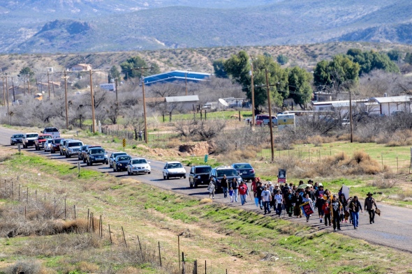
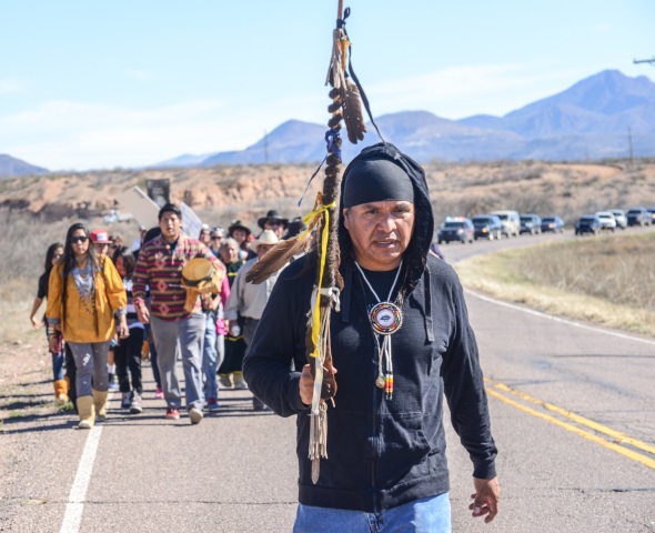
Wendsler Nosie Sr. marching to Oak Flat

“Today eagle feathers arrived here on foot, this is a spiritual gathering. The idea is to get here so the blessing can be given by God. We have arrived so God will have blessed us…we are all brothers and sisters here. Together we will protect our water so we can continue to live as human beings.The Apache need to be afforded the same protection as all U.S. citizens—we Apache want the same rights afforded everyone else. This is a gift from God to help save the world may we all be blessed from this day forward.”   Wendsler Nosie Sr. 

APACHE MARCH-ONE YEAR-2593

APACHE MARCH ON OAK FLAT-TERRY RAMBLER-5254

San Carlos Apache Chairman Terry Rambler, Wendsler Nosie behind.

One year ago  Wendsler Nosie ,  spiritual leader of the San Carlos Apache, said a movement had begun and his tribe had “once again taken the field against the United States of America.” Since then members have occupied Oak Flat and continued their lifestyle using the campgrounds and canyon and valleys of Oak Flat, as the scene for weddings, funerals and the Apache Sunrise Ceremonies, the three day ceremony that celebrates Apache women coming of age. This fine stand of Emory Oaks for centuries have brought the Apache here to pick and fill their containers with acorns, to make a long time favorite Apache meal, Acorn Stew, as well as enjoying the acorn itself. Tisha Black says her 84 year old father “loves to pick acorns” at Oak Flat and the former tribal policeman, baliff and jailer stopped picking acorns there a few years ago, after a Highway Patrolman told him he couldn’t pick the nuts at Oak Flat anymore.

Since the required environmental impact studies for the proposed Resolution Mine were rendered pointless by the McCain bill, the tribe and other central Arizona residents, will have no protection for their groundwater and the mine will not be libel if water is spoiled.

9-10-shafts-2361

Soon, if Resolution Copper gets access to the Copper beneath Oak Flat, the Superior Az community Easter campouts will cease at the campground and everything that has happened at Oak Flat before will cease to exist or occur. Eventually, the campgrounds, canyons and “world class” climbing rock will be place off limits as robots a mile beneath the surface collapse this mountain and ship the ore overseas.

APACHE MARCH-ONE YEAR-2539

Pomono Tribe from California does a “Pomono Two-step”

“We have to stand up and fight Congress, laws can be made and laws can be changed!  John McCain made a big mistake doing this to us said Terry Rambler, Chairman of the San Carlos Tribe. These politicians aided Resolution Mine, the Canadian Copper Mine that wants to collapse Apache Leap Mountain and ship the copper ore overseas. Leaving the Apache, the hole and a contaminated water source. “What was a struggle to protect our most sacred site is now a battle. Their angry words leave no doubt that “greedy politicians” like Sen. John McCain, Sen. Jeff Flake, Anne Kirkpatrick and Rep. Paul Gosar, have worn out their welcome in Indian Country.

“The rape of Indian land stops today on this historic day”, Nosie continues. ” Oak Flat was a gift from God to the Apache people, may we all be blessed from this day forward,” Nosie tells the crowd. “We are spiritually guided here–indigenous people from all over the world are watching our fight”! If America is the World’s Policeman, and this under-handed maneuver is how they treat their native peoples, then what hope do native souls have anywhere?

CENSORED NEWS: OAK FLAT FROM THE SAN CARLOS PERSPECTIVE ! 

Earlier Blog on the First March to Oak Flat

APACHE STRONGHOLD

SAVE OAK FLAT

CONTACT YOUR REPRESENTATIVE


This slideshow requires JavaScript.


Join me on PhotoShelter

Graph Paper Press minimalist WordPress themes for photographers and designers

<a href=” SPANISH TRANSLATION


SOUTHWEST PHOTO JOURNAL 2015

TAOS Pueblo NM

TAOS PUEBLO….one of the “oldest places” in the United States and this ancient pueblo greeted Coronado men when they penetrated into  southwestern America

Crunching 2015 SouthWestPhotoJournal.Com blog numbers for the year

The SouthWest Photo Journal began life as a sister site to South West Photo Bank, both .coms, showcase my photography which usually features the American South West.  When the sites started my plan was to develop tools I as a photographer would use to display my photos and tell the kind of stories I have enjoyed working on all my life.  After almost 50 years of working with cameras it is in the blood.  My life as a photojournalist has exposed me to many of the cultures that make up the rich tapestry of life I have found here in the Southwest.  This past year, my blog has reflected life in Arizona on four separate reservations found in Sells, Sacaton, San Carlos and Whiteriver.  Each blog reflects on the rich communities on the Tohono O’odham, Gila River Tribes, San Carlos Apache and the White Mountain Apache reservations.  I have alway thought that life-long Arizonans miss out on so much by failing to learn more about their neighbors.  These blogs attempt to share the rich customs and traditions found throughout our state.  Closer to home, my blogs on the Pow Wow, Mescal Movie Set and the A-Mountain Cross carry reflects smaller communities within communities, people of one mind and tradition.  The Tucson Rugby Community was a great blog and a wonderful experience, these folks play their hearts out, and deserve greater community  support.  Archaeology is a great pull on my curiosity and the Oro Valley Pit House blog features the background behind the people who lived in the Oro Valley area 800 years ago.  The Mule Creek Salado Pueblo built by Archaeology SouthWest’s Allen Denoyear, as was the Oro Valley Pit House, these communities are long gone but interest in what they accomplished during their time on earth continues.  A few epic blogs on the Grand Canyon, the Spanish Entrada into the South West and another on Spanish Missions tend to pick up traffic as time goes by.  Blogs on Cuba, Nepal and Alaska usually have a news peg like Cuba opening up after a half century, Nepal suffering crippling earthquakes and Alaska because I finally got those photos scanned and rooted into the South West Photo Bank.  Below is WordPress.Com annual review of the stats from the South West Photo Journal and thought you might enjoy.

Thanks for making this all possible…

The concert hall at the Sydney Opera House holds 2,700 people. This blog was viewed about 51,000 times in 2015. If it were a concert at Sydney Opera House, it would take about 19 sold-out performances for that many people to see it. There were 637 pictures uploaded, taking up a total of 507 MB. That’s about 2 pictures per day. The busiest day of the year was June 17th with 4,382 views. The most popular post that day was SAN CARLOS APACHE MARCH TO OCCUPY OAK FLAT PROMISE A FIGHT TO SAVE THEIR HOLY GROUND FROM THE GREED OF McCAIN, KIRKPATRICK, FLAKE, GOSAR AND THE RESOLUTION COPPER MINE !.

APACHE MARCH ON OAK FLAT-NOSIE-5391

That blog eventually had 23,817 views and 20 comments.  Many of those hits came to SouthWestPhotoJournal.Com from a Facebook connection from a New York Times OP/ED which called this land swap, “political corruption” following McCain slipping a rider in the “must-pass” National Defense Bill for which McCain sits on the Chairmanship of the most powerful of committees.  Outrage was the tone of the comments.

In 2015, there were 15 new posts, growing the total archive of this blog to 135 posts.  That’s 141 countries in all who visited the site! Most visitors came from The United States. Canada & France were not far behind.

2015 ANNUAL REPORT

Attractions in 2015

These are the posts that got the most views in 2015. You can see all of the year’s most-viewed posts in your Site Stats.

CROWN3DANCERSsScrp

“SAN CARLOS APACHE MARCH TO OCCUPY OAK FLAT PROMISE A FIGHT TO SAVE HOLY GROUND FROM THE GREED OF McCAIN KIRKPATRICK FLAKE GOSAR AND THE RESOLUTION COPPER MINE …..23,817 views!”

Home page / Archives 8712 views

OLD TUCSON’S MESCAL CHANNELS THE OLD WEST’, IT’S PRICELESS, BUT MOVIE SETS ARE NOT BUILT TO LAST ONLY FILM MAGIC LIVES ON ! …….1612 views

HONEY BEE PIT HOUSE CONSTRUCTION MAPS OUT THE HOHOKAM’S LIFE WAYS AT STEAM PUMP RANCH IN ORO VALLEY EXPANDING THE PREHISTORIC RECORD ! …….776 views
APACHE SUNRISE CEREMONY … A COMING OF AGE DANCE FOR APACHE WOMEN …..615 views

THE LANGUAGE ON THE ROCKS : WAS THE FLUTE-PLAYING KOKOPELLI, A TRADER, DIPLOMAT, TEACHER OR WITCH ? DID ROCK DRAWINGS REVEAL THE SECRETS OF THE COSMOS AND THE FACE OF EARLY MAN? ……454 views

THE GREAT FORT APACHE HERITAGE CELEBRATION or NDEE LA ADE’/ GATHERING OF THE PEOPLE WHOSE YOUTH ARE KEEPING THEIR TRADITIONS ALIVE !…412 views

WMA HERITAGE CELEBRATION-0582

GREAT FORT APACHE HERITAGE DAY VIDEO/CROWN DANCERS

SPANISH ENTRADA SEARCHES FOR CITY OF GOLD, CORONADO FINDS AMERICAN SOUTH WEST, SEES LITTLE TO VALUE EVEN LESS TO CARRY OFF! ….400  views

PISTOLERO JOHNNY RINGO A LOWLIFE NO GOOD BACKSHOOTIN SCUMSUCKER IS BURIED IN WEST TURKEY CREEK ….380  views

TUCSON’S NEW SKATE BOARD GENERATION CATCHES WAVE TOWARD THE NATIONS BEST SKATESCAPE …364  views

GREEN VALLEY’S ASARCO DISCOVERY MINE TOUR SHOWS THE BEST AND WORST OF COPPER MINES AND THE ART OF HARDROCK MINING362

Annetta Koruh "Nita" bakes Piki Bread for her godson's Naming ceremony and to feed the Kachinas that come to dance at 3rd Mesa.    The baker dips their hand in a mixture of cornmeal, crisco, and sheep brains plies the mixture thinly upon a flagstone rock which bakes the bread.
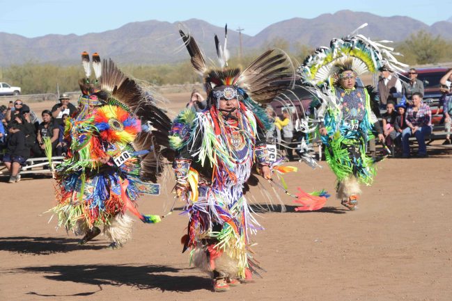
Annetta Koruh “Nita” bakes Piki Bread for her godson’s Naming ceremony and to feed the Kachinas that come to dance at 3rd Mesa.
The baker dips their hand in a mixture of cornmeal, crisco, and sheep brains plies the mixture thinly upon a flagstone rock which bakes the bread.

Newspapers flying off to Dodo Island …356  views

VIVA! PROCLAIMS ELOY ARIZONA UPHOLDING A TRADITION OF FAMILY AS MEXICAN INDEPENDENCE DAY SEPTEMBER 16 SENDS RIPPLES WORLD-WIDE…..299  views

INDIAN RODEOS ARE WHERE YOU FIND THE ACTION and TRIBAL FAIRS OFFER A RICH VIEW OF TRADITIONAL LIFE ….293  views

LITTLE PICACHO WILDERNESS OPENS DOOR TO CALIFORNIA CHOCOLATE MOUNTAINS AND WINTER ADVENTURE …285  views

THE POW WOW PATH LEADS TO FAMILY & FRIENDS DANCE COMPETITIONS BUILDS NATIVE AMERICAN PRIDE WITH TRADITIONS LINKING TO THEIR PAST !……264  views

SELLS RODEO, FAIR, TOKA TOURNEY-7879

TOHONO O’ODHAM TOKA TOURNAMENT IS A TOAST TO THE PAST AND REVIVAL OF OLD SOCIAL GAMES …262  views

SOUTHWEST SPANISH MISSIONS BROUGHT THE “GOSPEL’S LIGHT TO THE RIM OF CHRISTENDOM HELPED THE NATIVES CARVE A LIVELIHOOD FROM THE LAND AND WRITTEN HISTORY BEGAN !”….238  views

A GATHERING OF WARRIORS;   IRA HAYES WELCOMES HOME TRIBAL PATRIOTS TO SACATON TO CELEBRATE THE WARRIORS’S FIGHTING SPIRIT !……217 views

SUPERIOR COPPER MINE TO USE ROBOTS ON WORLD-CLASS ORE BODY, SAN CARLOS APACHE VOW FIGHT TO SAVE RESERVATION WATER FROM IRANIANS…..215 views

Kateri TekakwithaKATERI TEKAKWITHA BATHS HER LOVE LIGHT ON THE WHITE DOVE OF THE DESERT ! SAN XAVIER MISSION…..203 views

URANIUM MINING in the SOUTH WEST: A LEGACY THAT POISONS THE LAND … AND ” IT WILL NEVER GO AWAY’!…..200 views

MUL-CHA-THA BRINGS GILA RIVER INDIAN TRIBES TOGETHER FOR FUN WITH FAMILY AND FRIENDS ! 30 YEAR STUDY OF PIMA BLOOD MAY CURE DIABETES…..191 views

MUL-CHU-THA RODEO and FAIR: IS A FOOT RACE TO A BETTER LIFE ! PEE POSH AND AKIMEL O’ODHAM TRIBES TAG TEAM COMMUNITY PROGRESS WITH GATHERINGS188AMERICAN SOUTHWEST LANDSCAPE…..186 views

“ALL WE NEED IS A SPARK! SEVERE FIRE SEASON PREDICTED IN U.S. SOUTH WEST: A FOREST OF “TORCHED TOOTHPICKS” WILL BE OUR LEGACY”……180 views

BEARIZONA! ENTER at YOUR OWN RISK!   South West BLACK BEAR Preserve Productive Stop for Photographer…..174 views

TUCSON RUGBY -8944

TUCSON RUGBY: “THE LONGEST 40 MINUTES IN YOUR LIFE-YOU WANT OUT-BUT ARE AFRAID SOMEONE WILL LAUGH AT YOU RUCKING AND MAULING IS TEAMWORK”…..173 views

AMISH FALL ENDS MID-MISSOURI SEASONAL CYCLE HARD WORK BEGINS ANEW BEFORE THE SNOW FLYS…..161 views More Amish Photos

Most popular photo on the SouthWestPhotoBank.Com keeps getting traffic from the Amish of Missouri.

Most popular photo on the SouthWestPhotoBank.Com keeps getting traffic from the Amish of Missouri.

“THAT SPOT IS NOT THAT SCENIC! BUILDING ROSEMONT MINE: EARNING THE PUBLIC TRUST! SELLING  ARIZONA’S NEXT OPEN PIT MINE”…..159 views

SELLS RODEO, FAIR, TOKA TOURNEY-7783

2015 was Wet and Wild for the annual Sells Rodeo, Fair, Pow Wow and Toka Tournament

TOHONO O’oDHAM 76TH RODEO and FAIR BRINGS FAMILY AND FRIENDS TOGETHER TO CELEBRATE…..150 views

SELLS 75TH ALL INDIAN RODEO & FAIR, OLDEST IN THE UNITED STATES & BEST ENTERTAINMENT TICKET!…..140 views

CONFEDERATES SCARE OFF YANKEES PICACHO PEAK PARK SALUTES 150th ANNIVERSARY OF ARIZONA VICTORY…..138 views

Civil War in the SouthWest video………

CIVIL WAR IN THE SOUTHWEST-3674

“TREE TIME THE SINGLE GREATEST CONTRIBUTION TO AMERICAN ARCHAEOLOGY THE STUDY OF TREE RINGS or THE DAY SOUTH WEST PREHISTORY STOOD STILL …”…..134 views

THE DRIEST & HOTTEST YEAR IN 500 YEARS !   THE RELENTLESS SOUTHWESTERN DROUGHT: EXPERTS SAY ‘GET USED TO IT’…WILL ARIZONANS BE THE NEXT ‘CLIMATE REFUGEES’ ?……133 views

BORDER SECURITY   FACT or FICTION ? MORE BOOTS ON THE BORDER NOW THAN EVER BEFORE ! SOME CALL FOR MILITIA, MARSHALL LAW TO STOP THE INVASION !…..131 views

TOHONO O’ODHAM SLAP STICK IS A COMPETITIVE BATTLE IN SELLS, NOT FOR THE WEAK-KNEED, NOR FOR THE FAIR WEATHER VISITOR…129 views
The TOHONO O’ODHAM :   A DESERT PEOPLE …..126  views

TwoAPACHEGirlsLaughing

BIRDING IN THE SOUTHWEST, TAKE YOUR SCOPE ! NO MATTER WHERE YOU ARE IN ARIZONA THERE IS A HOT BIRDING PARADISE AT A WETLAND NEAR YOU ! …..122 views

END OF THE WORLD COMING ON SOLSTICE ? WHITE BUFFALO WOMEN SAYS LOVE THE WORLD AND EACH OTHER LOVE WILL RETURN BALANCE TO OUR WORLD !…..120 views

GET YOUR KICKS ON ROUTE 66 HISTORIC ROAD WEST DEFINES AMERICA REMAINS A TREASURE TO BE NURTURED AND APPRECIATED…120 views

AFRO-CUBAN SANTERIA RIVERSIDE DANCE IN HAVANA…120,000 views

HAVANAPARK415

CUBAN SANTERIA RIVERSIDE CELEBRATION…..105 views

WYATT EARP NO SHOW FOR TOMBSTONE’S EARP DAYS LETHARGY SWEEPS MEMORIAL DAY EVENT……101 views

ARIZONA’S CROWN JEWELS …..98 views

SACATON JR RODEO-5302
COWBOY UP ! COWBOY DOWN…SACATON JUNIOR RODEO A BOOT CAMP FOR ARIZONA’S NEXT RODEO STARS…..98  views

URANIUM MINING in the SOUTH WEST: NAVAJOS TRAPPED BY TAILING and DECADES OF INACTION……90 views

IN TOUCH WITH THE MIMBRES, MOGOLLON, SALADO PROBLEM IN MULE CREEK NEW MEXICO, SOUTHWEST ARCHAEOLOGY FIELD SCHOOL PROBES FOR ANSWERS…..83 views

PECOS CONFERENCE OPENS WINDOW TO THE VIRGIN ANASAZI’S ARIZONA STRIP FARMERS AND TIMELINE…77  views

“ONLY THE GODS CAN SEE THEM ANCIENT MAN PETITIONS SKY PILOTS”76TUCSON SUNSET ECLIPSE ALL ABOUT SAGUAROS, THE RING OF FIRE STRETCHES FROM ASIA TO NEW MEXICO…..61  views

MEXICO’S ONLY CORAL REEF, CABO PULMO ON BAJA’S EAST CAPE, NEEDS PROTECTION FROM GREEDY DEVELOPERS WHOSE LUST FOR 23,000 NEW ROOMS WILL KILL THIS PARADISE !,=…..60  views

NOW CUBA IS OPEN TO THE U.S., WHERE TO STAY IN HAVANA? TRY A BED AND BREAKFAST, LIVE DOWNTOWN AND PARTY WITH THE LOCALS ! ……59  views

A HAVANA CUBA VIDEO VISIT…..50 views

SOUTH WEST PHOTO BANK GALLERYS…..49 views

TUCSON’S DOWNTOWN NEW STREET CAR SYSTEM ROLL OUT OVERWHELMINGLY RECEIVED BY 60,000 RIDERS EMBRACING THE NEW RIDE…..57  views

HAYDEN’S SMELTER TURNS 100 YEARS, POLLUTION ISSUES WORRY RESIDENTS BUT QUIET LIFE, GOOD JOB, A BIG PLUS56THE COLORADO RIVER WATERS THE AMERICAN SOUTHWEST…..53 views

WHATEVER HAPPENED TO McCORMICK & DEERING ?…..51 views

ROCK ART RANCH TAKES   VISITORS BACK IN TIME !   EXPERTS MARVEL AT “BIRTHING SCENE A GLIMPSE OF SOUTH WEST PREHISTORIC LIFE ON PECOS 2013 TOUR”…..48 views
ROCKARTRANCH (1 of 1)
TUCSON’S DAY OF THE DEAD PROCESSION 2010…..48  views

BIG SHOW JUST AROUND THE CORNER, ANNUAL FALL LEAVES STARTING EARLY IN FLAGSTAFF, WHITE MOUNTAINS LEAVES ON SCHEDULE BUT LATER…..47 views

Civil War in the SouthWest video………47 views

DESERT WILDFLOWERS, JUST THE ICING ON THE CAKE FOR HIKERS, PHOTOGRAPHERS

AND LOVERS OF THE SOUTH WEST BACK ROADS AND SCENERY…44 views

CUBA’S LOVE – HATE RELATIONS WITH AMERICAN CARS LEFT IN A 1950’S TIME WARP – EVERYONE MAKES DO !…….44 views

FALL COMES TO ARIZONA HIGHLANDS……42  views

pks monkey photo

EXPLORING NEPAL : A   SEARCH FOR PREHISTORIC MAN IN THE TIMELESS HINDU KINGDOM…..41  views

PK

PK with the Prehistoric Man he sought

SPRING IS BUSTING OUT ALL OVER, CACTUS ARE BLOOMING NOW AND BIRDS ARE NESTING, COLOR ABOUNDS IN ARIZONA’S SONORAN DESERT…..40  views

TUCSON’s 2011 DAY of the DEAD PROCESSION : A NEVER-ENDING LESSON in LIFE and LOVE !……39  views

VIDEO FEATURING 25 YEARS OF THE TUCSON DAY OF THE DEAD PROCESSION


This slideshow requires JavaScript.


Join me on PhotoShelter

Graph Paper Press minimalist WordPress themes for photographers and designers

.........">CLICK HERE FOR SPANISH TRANSLATION


THE ALASKA RAILROAD’S TALKEETNA-TO-HURRICANE RUN OFFERS GREAT SCENERY– AND WHERE ELSE CAN YOU FLAG DOWN A TRAIN ?

ALASKA RR-20-2222

TALKEETNA, Alaska -This is a train trip that can hardly rival the Siberian Railway, the Orient Express or any of the world’s other great rail journeys. After all, this is a trip that’s only 54.7 miles long.

But incredible scenery is the attraction on the Alaska Railroad’s local flag stop service that will carry people, luggage, camping supplies, building materials and most anything else you can haul aboard through some of this nation’s most isolated, rugged and beautiful land.ALASKA TALKEETNA-38-

Alaska’s flag stop service is the only one in the country. Tell the engineer where you want to get off, and he’ll stop there – anywhere. Flag him down with a white cloth and he’ll pick you up on the return trip. It’s more like an intracity bus than a train.

But for people living in this area of Alaska, where there are no roads, no trails, no flat spots big enough to land a plane, it’s the only way in or out.

MOOSE-1

Tourists are welcome, but the flag stop service is mostly for locals and visitors who want to get completely away from it all for a few days. Ask conductor Gary Knutson if there will be any narration along the way, and he says, ”Once in a while someone will yell, ‘Bear!’ but that’s about it.”

breaktime

ALASKA TALKEETNA-36-The route starts in Talkeetna, a SHOE-1funky town of about 600 people (think Bisbee hauled about 2,900 miles north) that is the jumping-off spot for climbers determined to scale Mount McKinley, the highest peak in North America. The train turns around less than 60 miles north at Hurricane, nothing more than a train maintenance building.

ALASKA-42-3

The flag stop train is a one-car, self-contained, selfpropelled unit – a combination locomotive, passenger and baggage car in one.

Three-quarters of the trip parallels the broad Susitna River, which provides unlimited opportunities for hiking, camping and fishing.

Many of the visitors that ride the flag stop, hauling aboard enough stuff to equip a good-size sporting goods store, don’t really know where they want to go. ”They’ll ask us to drop them off at a good spot for fishing or whatever, and we usually have some suggestions,” said Knutson.

ALASKA-3High school ROTC students  disembark  to live off the land.

On this trip, a squadron of Junior ROTC cadets from a high school in Hawaii were aboard with their leader, heading for a five-day wilderness experience. The leader had some idea where he wanted to go, and engineer Pete Hackenberger accommodated their request, stopping the train in what appeared to be the middle of nowhere as the cadets unloaded their gear and hiked into the thick forest growing right up to the tracks.


ALASKA-10

Hunter and guide Gary Prichard watches Alaska slip by the window as his dog Ginger enjoys the dry ride. Dropped off in the middle of nowhere, two Alaskan schoolkids (below) prepare to float 40 miles down the Susenta River to Talkeetna.

ALASKA-80-6

Despite ominous signs warning of federal laws forbidding passengers from entering the engineer’s compartment, operation of the flag stop train is pretty casual. Hackenberger usually runs the train in a ”uniform” of T-shirt and shorts during the summer, frequently bringing his dog, Bear, with him for company.

ALASKA-97-

Hackenberger and Knutson know everyone who lives along the Talkeetna-Hurricane route. Several people who have built cabins far from any sign of civilization have used the train and another larger freight that plies the same tracks to haul in their homes, piece by piece.

ALASKA-2Engineer Pete Hackenberger says the Talkeetna-to-Hurricane run is the best job on Alaska’s rails.

At one point along this run, Hackenberger slowed the train and sounded the whistle. A man emerged from the underbrush and Hackenberger waved and tossed him a pack of cigarettes as he went by, fulfilling a request from the day before.

ALASKA- (1)

”People are really nice along here,” Knutson said. ”You really get to know them. One guy flagged us down and gave us a covered skillet. It was filled with blueberry pie. So we ate the pie and dropped off the skillet on the next trip.”

On the way back to Talkeetna, three fishermen with their dog flagged down the train for a lift back to town. Hackenberger and Knutson climbed down to help them lift their equipment into the train.

ALASKA-80-7

‘No fish and you still have beer?” Hackenberger asked as he lifted a heavy cooler. ”You didn’t read the manual. We might not let you on.”

ALASKA-

It is not unusual to see eagles, bear and other wildlife. On this trip, a large moose and her two calves bounded away from the tracks as the train approached. If the weather is good, there are spectacular views of Mount McKinley from the train.

”There certainly are worse jobs,” said Hackenberger. ”I think this is some of the most specular scenery anywhere.”

by MARK KIMBLE


This slideshow requires JavaScript.


MORE ALASKA PHOTOS … SOUTHWESTPHOTOBANK ALASKA GALLERY

TALKEETNA, ALASKA TO HURRICANE GULCH

THE BEST WAY TO SEE ALASKA – IS BY ALASKA RAILROAD…

Flag Stop Service Schedule: During the summer, the train runs Thursday, Friday, Saturday and Sunday. Runs are far less frequent during the winter. The train leaves Talkeetna about noon and returns about 6 p.m.

Fares: The Talkeetna-Hurricane  55 mile route is $100 for adults roundtrip  More info: 1 (800) 544-0552 or 907-277-4321 for trip planning expert


ALASKA-4

ARIZONA’S GRAND CANYON: “A ONCE IN A LIFETIME EXPERIENCE….” A SENSATION OF FEELING ALIVE WASHES OVER YOU !

FROM THE NORTH RIM TO THE SOUTH, EAST RIM TO THE WEST THE CANYON IS BEING LOVED TO DEATH AND SQUEEZED FOR EVERY DOLLAR IT CAN PRODUCE…NORTH RIM onedge6026“Leave it as it is. Man cannot improve on it; not a bit. The ages have been at work on it and man can only mar it.”
GrandCanyonColoradoRiverLFTndX“Leave it as it is. I hope you will not have a building of any kind, not a summer cottage, a hotel or anything else to mar the wonderful grandeur, the sublimity, the loneliness and beauty of the canyon.”

President Teddy Roosevelt’s first visit to Arizona in May 1903

GRAND CANYON-7188

Arizona’s World Heritage Site, The Grand Canyon, the one spot in the World everyone really needs to see because it is one of the World’s Seven Natural Wonders. It stands out as the number one tourist stop of the American South West attracting up to five million visitors each year. Ninety percent visit the Canyon’s South Rim, others drive to the North Rim and a growing amount of the Las Vegas traffic is crowding onto the Haulapai West Rim, featuring “the SkyWalk” the Tribe’s key piece of a larger tourism development the tribe plans to build along their canyon’s rim, cashing in on the world attraction. Air traffic visiting the Grand Canyon must fall into “air corridors” and fly a counter-clock wise tour of specific features finishing spinning out of the washing machine tour, which is filled with as much air traffic, as most large municipal airports handling hundreds of flights daily. On the canyon’s East Rim at the confluence of the Little Colorado River and the Colorado, the place of emergence for the people of many southwest Indian Tribes, Navajo Tribal members debate over building a tramway to their planned riverside restaurant allowing everyone to visit the inner canyon. Outside money wants to build a 2000 home development in Tusayan AZ, taping the region’s fragile water aquifer, and straining existing supplies. Every corner of the canyon has outside pressure that compromises the Canyon’s “Wilderness” status but for five decades pontoon rafts powered with gas motors have cruised right down the middle of the tall cliffs and those motors alone (and the U.S. Congress) have kept America’s most Iconic Wild Place, the Grand Canyon, from it’s richly deserved and needed “Wilderness” status. Without the motors, the almost 20,000 raft visitors on the Colorado would shrink to 8-9,000 and frankly, “that would be unAmerican and totally unsatisfactory”. Meanwhile, many of theseGRAND CANYON VIEW-3RAFTING COLORADO RIVER- pressures could be mitigated with a “Wilderness” status not to mention new pressures to open old uranium claims and at the same time open new sources of mine waste pollution to Canyon waterways, creeks and streams, some of which are already unsafe for drinking. More than a half million unstable mine tailing ponds, shafts stand ready to drain into western water tables, as well as the Colorado River, a water source for 28 million people scattered across deserts from Tucson to LA.

The Golden Goose fable of our youth preaches that ‘Greed loses all by striving all to gain’! How many times have you circled a South Rim pullout looking for a parking spot ? How many “hard metal” spills in to the Colorado River will be okay, until we realize we are poisoning ourselves ? If you build a 2200 home development next to the Grand Canyon, it just becomes a “big ditch”! There are a lot of reasons for the situations facing the Grand Canyon many sadly are special interests …. One very obvious special interest is that National Park Service funds generated by the wildly successful “Grand Canyon” is funneled off to less successful parks while its own needs suffer. Some Navajos argue jobs are more important than preserving the traditions and sacred lands of the Navajo. Others say without the customs, beliefs and land, nothing else matters. Mining in the region has a history of irresponsibility and negligence, there is more than one superfund cleanup sites looking for funding. The River Runners Assoc. points to a solar-powered boat motor being developed and so all this should fade if the motor sound and emissions disappear. Then there would be no obstacle to the needed “Wilderness” Status. For many years as Republican budgets have strangled NPS funds to repair and rebuild infrastructure often pushing arguments for privatizing Parks, “Coca Cola’s Grand Canyon”, is often suggested as where such actions would led.

GRAND CANYON LOOKOUT-GRAND CANYON SHEEPXXXX-Motorist entering the Grand Canyon’s South Entrance is entering one of the NPS busiest gates any where in the United States, four lanes of traffic, bringing in annually 5-6,000 visitors daily. Today lane four is closed and traffic is backed up 13-15 cars deep in lanes one thru three, “Lane four was worn down to the bare dirt, it was really bad–they had to close it. “Just worn out”! Driving through the park the first signs you see ask the public not to approach wildlife or feed it, deer frequently graze on the roadsides and close contact with motorist is always possible. Almost two dozen deer were destroyed in Indian Gardens after becoming addicted to junk food and were slowly starving to death after campers had pampered the deer with handouts that destroyed their wild constitutions.

GRAND CANYON-7112

I pull into the Desert View Point, the first view of the Grand Canyon seen GRAND CANYON-37by visitors arriving from the East Entrance Gate, making my way to the Lookout I start getting the idea English may not be the first language ofTooShorttoSeeGrandCanyon1701 
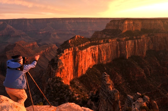
choice, but the common denominator is the Grand Canyon, everyone wants to see it.  Sunset is approaching and the building crowd is drifting toward the point jutting out from the South Rim’s iconic Historic Tower. As the sun lowers folks begin to debate whether this is the BEST viewpoint to photograph the Sunset, for many visiting the Grand Canyon is a once in a Lifetime happening, so photographers want to make the most of the moment. GRAND CANYON-7222 Tourist begin squeezing toward the furthest spot to get their iconic photo of their visit to the “big ditch” a photograph destined for a lifetime in a frame.  Four English-speaking Ukrainian women take their turn when a GRAND CANYON --3Greek man pushes to the viewpoint moments before the sun sinks into the horizon.  “We made it”, he proclaims spinning taking in the whole 360 degree panarama, he pulls out his five week old chichuaha pup and hoists the dog above his head giving Marianna the ultimate viewpoint. “She goes everywhere with me, he says  I’ve been trying to get here since I was in the fifth grade, he whoops. “We made it” he repeats asking the Ukrainian women to take his picture passing his phone only to have it returned. Dead battery!
The Ukrainian women pull out their iphones and produce the needed pictures and exchanged email addresses.  Then the Greek wants one more picture.  Pushing Marianna to the women, he faces into the abyass, thrusts his arms into the air and throws his head back like in a rockyesque goal-line celebration or was it more like one does in the bow of a ship as it breaks through the waves and a great sensation of being alive washes over you! “Take the picture”, he asks realizing his lifetime goal. For many people a trip to the Grand Canyon is the trip of a lifetime.

GRAND CANYON-47

As old as time itself the Grand Canyon has been loved and appreciated almost to death.  Four and a half Million Tourists come each year to view the Canyon about the size of Delaware, 277 miles in length and averages about ten miles across.  While the Grand Canyon is one of the biggest CANYON CROWDS12-12money makers in the National Park portfolio, it was Jan Brewer,Governor of the State of Arizona who paid to keep the Canyon open when Republicans shut down the US Government.  The tourist dollars fallout from a Canyon visit for the State of Arizona is enormous.  It is so beneficial that places like Las Vegas, keeps trying to sell it as Nevada’s Grand Canyon, selling flights to the Canyon including flyovers and ground visits via buses or the popular Pink Jeep Tours. Not long ago I heard a NPR broadcaster speaking about Utah’s Grand Canyon and that I can sort of understand.  Utah’s still sore because Arizona stole Monument Valley and could be looking for payback…

GRAND CANYON-7050

More than 30 Helicopter fly out of Grand Canyon Airport many more leave daily from Phoenix, Sedona, Flagstaff, Salt Lake and Las Vegas, Nevada. Some fly solo flight missions, others off load passengers for ground transport, while other packages include the Sky Walk or inner gorge visits.

GRAND CANYON-7064

For most Americans, visiting the Grand Canyon, is on their “Bucket List”. For some it is a once-in-a-lifetime experience, for many seeing all its grandeur, and how it is experienced, depends upon your abilities. For some hiking in, while others pullout hop along the rim, some raft through and other fly. Grand Canyon Airport daily handles the flight load of major cities airports, and built a new $9M 120′ flight tower for the only airport owned by the State of Arizona. In addition to the 300 flights originating at GCA daily, the tower sees incoming flights all day from Las Vegas, Sedona, Phoenix, Salt Lake, not to mention cross country jets. Like the two that collided over the Canyon June 30, 1956.

The 1956 Grand Canyon mid-air collision occurred at 10:30 am when a United Airlines Douglas DC-7 struck a Trans World Airlines Lockheed L-1049 Super Constellation over the within the boundaries of Grand Canyon National Park, resulting in the crash of both airliners. All 128 on board both flights perished. It was the first commercial airline crash to result in more than 100 deaths, and led to sweeping changes in the control of flights in the United States. The location of the crash has been designated a National Historic Landmark.

GRAND CANYON2-7099

gc_uranium_mapClaimsGarrett Paulsen writes in the SWAviator.Com Blog NPS Special Flight Routes ….flying into the Grand Canyon still allows for sightseeing even though pilots “are operating within certain constraints”. “Flying in the Canyon is no longer a free-for-all”, Paulsen reports.
Then there are the money people !  The Grand Canyon when on hard times and Republican Administrations we have frequently heard the need for Corporate sponsors so America’s Coca Cola Company could have a chunk of the Canyon, placing their logo on signs and no doubt advertising, privatization is not too far off on that path.  The Sierra Club recently proclaimed the Canyon “the most endangered park” due to wear and tear, new Uranium mine claims and needs for modernization for the safety of the millions who visit Arizona’s Grand Canyon.  As I enter the popular SouthWest Park Entrance and flash my ID and fabulous Senior Park Pass, the friendly Ranger says this entrance sees between 5,000-6,000 people a day and is one of the busiest NPS gates in America.  Lane Four was coned off and workmen were scrapping off the old roadway and were preparing to lay down a new surface.Cars begin to stack up ten-thirteen vehicles are politely waiting, after all, we are all on vacation. GRAND CANYON-7207 I move on to the Canyon’s edge. “I’m on the edge of the World”, shrieks a eight year old, his arms spread as wings cast long shadows as the Canyon light moves lower in the West. As old as it is, fans and new technologies, still bring fresh perspectives to the timeless Grand Canyon.  Selfies are what the Grand Canyon is all about.  Gone are the days of everyone passing their phones or cameras so everyone had a view in their phone gallery. GRAND CANYON-53Today the “Selfie Sticks” and “Selfie Apps” which allow you to view your camera’s viewfinder in your phone’s monitor allowing for ease in composition, gone are the “Hail Mary” composition where you just pray you included everyone in the photograph. Couples now just hold out their camera or phone on a extension stick replace the middle man.GRAND CANYON-7157Like Marianna and endless number of others had pleasant exchanges with people from all over the world in that simple moment when they turned to a strangers and universally ask them to make their picture, technology often loses the human part of life in its rush to make our world better. GRAND CANYON-7169GRAND CANYON --6 
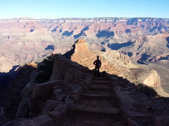
Whether you have seen the Grand Canyon from the North, East, West or South Rim, from a raft or kayak on the Colorado River or by sitting atop a mule or walking in to Indian Gardens or Phantom Ranch and climbingGRAND CANYON-29-2 back out. Everyone enjoys the Canyon at their own pace, some never get enough, there is a large number of folks who walk from atop the South Rim down to Phantom Ranch, cross the Colorado River by bridge, climb up to the North Rim, turn around and go back to the South Rim in one day.  Who does that ?  A surprising enough number of people who love the challenges the Canyon throws at them and finds the challenge fills their inner soul as well as pushing their bodies to overcome natures obstacles. Rather than being punished on the trail-some want to experience the Canyon on the back of a mule and are willing to pay $550 for one or $960 for two to overnight at Phantom Ranch.  But first, riders must be at least 4 feet 7 inches in height and must speak and understand English, must be in good physical condition, should not be afraid of heights or large animals, and cannot be pregnant. Finally must weigh less than $200 full dressed.

GRAND CANYON --28

Mule rides from the South Rim can be reserved through: Xanterra Parks & Resorts.   Call (303) 297-2757 or toll free (888) 297-2757
Xanterra Parks & Resorts, 6312 S Fiddlers Green Circle, Suite 600 N, Greenwood Village, CO 80111 Visit: www.grandcanyonlodges.com
For Day Before waiting list information, call (928) 638-2631 or contact the Bright Angel Lodge transportation desk inside the park.

GRAND CANYON-7105

I have come here to see the Grand Canyon of Arizona, because in that canyon Arizona has a natural wonder, which, so far as I know, is in kindnorthrim5808 absolutely unparalleled throughout the rest of the world. I shall not attempt to describe it, because I cannot. I could not choose words that would convey or that could convey to any outsider what that canyon is. I want to ask you to do one thing in connection with it in your own interest and in the interest of the country–to keep this great wonder of nature as it now is. I was delighted to learn of the wisdom of the Santa Fe railroad people in deciding not to build their hotel on the brink of the canyon. I hope you will not have a building of any kind, not a summer cottage, a hotel or anything else to mar the wonderful grandeur, the sublimity, the loneliness and beauty of the canyon.GRAND CANYON-32El Tovar Grand Canyon first opened for service in 1905. The premier hotel and restaurant at the Grand Canyon was originally operated by the FredCANYON CROWDS2-2 Harvey company. The El Tovar is been the most sought after lodging for over 100 years. In 2005, the Park celebrated the 100th anniversary for this classic historic National Park lodge. It was originally built to accommodate those distinguished passengers who arrived on the Sante Fe Railway. You can make the El Tovar a part of your Grand Canyon vacation if you plan far enough in advance. If you desire to stay at the El Tovar, we recommend that you call Xanterra Parks and Resorts at 1-888-297-2757 at least 18 months in advance.

ABOUT XANTERRA PARKS & RESORTS   Open all year, Xanterra South Rim, L.L.C. offers the largest provider of ”in-the-park lodging.” We are authorized by the National Park Service to provide many visitor services within the park: Six distinctive lodges – all lodges are within walking distance of the South Rim! All provide Fine and casual dining, retail shops in unique, historic buildings and the world famous Grand Canyon mule ride, as well as, motorcoach tours of the park.

THUNDERRIVER3“THUNDER RIVER”, Arizona Senator Barry Goldwater once said was his favorite spot in all of Arizona.  He was mesmerized by a river appearing wild in the wall of a rock cliff and watching it tumbled down the rock and create Deer Creek, a trusted water source.

grand grand canyonOne late afternoon sitting alone at a random roadside pullout a car full of tourists pulled into the drive and out jumped one nice Asian lady who did a quick left to right scan with her video camera and jumped back into the crowded car and spun off.  I figured she was the trip photographer and they were running late so she jumped out to record the vista and would share her video with her companions at trips end.  It is also possible that some find one vista of the Grand Canyon looks a lot like the last, hopefully not! I would like to think others share my love for the beauty of the American SouthWest and no place is more iconic of America’s grandeur and exceptionalism and its beauty changes constantly with the light.

GRAND CANYON-7194Activist say the Grand Canyon is facing the most serious threat in its 95-year history. It would alter the natural beauty of the canyon and encroach on its borders. Secondly, a major housing and commercial development, jeopardizes the fragile ecology and water supply on the arid South Rim. The Tusayan development would add 2,200 homes and 3 million square feet of commercial space to a town two blocks long. Park officials say existing development around the park and the scarcity of water have already stressed the park’s ability to handle visitors and new projects will only make matters worse.

GRAND CANYON DEER CREEK5-3LA Times reports water is already so precious in the park’s resident elk herd have figured how to operate the Grand Canyon’s new water faucets

GRAND CANYON-7135and began serving themselves. A young elk defending his water fountain began chasing away all who would drink. The park imports all water for its South Rim hotels, restaurants and amenities from springs on the north side of the canyon. An antiquated aluminum pipeline threads 13 miles though the serpentine fissures on the canyon floor, then up a mile of sheer rock on the South Rim. The pipeline regularly breaks down, requiring helicopters and burros to ferry crews at a cost of $25,000 per service call.

The park would like to replace the water system, but the price tag — as much as $150 million — is more than twice the yearly construction budget for all 400 parks in the National Park Service system.

Park rangers in Grand Canyon National Park in 1995 had to kill off two dozen mule deer that were hooked on junk food left by visitors. The deer had become addicted to Cheetos, Fritos and candy that tourists picked up from a nearby ranch. Once hooked, the deer lost their natural ability to digest vegetation, ranger David Haskell said. “They’ve become in extremely poor health, almost starving.” Haskell called junk food the “crack cocaine of the deer world.”

20151125_102538

Only the South Kaibab, Bright Angel, and North Kaibab Trails (known as the Corridor Trails) are maintained and patrolled on a regular basis. These three trails meet at the bottom near the only bridges that span the Colorado River. Together, they create a popular cross-canyon “corridor”. The Corridor Trails offer expansive views, reliable water sources, great camping, and the opportunity for hiking in and out on different trails. Backcountry rangers highly recommend this area, especially for your first Grand Canyon adventure.

Gary Olson recently made the hike into the depths of the Canyon from the South Rim to Phantom Ranch. “Yeah, it was my 14th time to the bottom, probably my last hiking it. Just too tough humping it out, although I did it in just under 6 hours, always a benchmark time for me. This trip was with 11 other members of the Southern Arizona Hiking Club, all but 3 of them older than me. I finished the trips in and out at least an hour and a half faster than many.”

GRAND CANYON BATHING 2-

“Last time I hiked the Canyon was at least 8 years ago. Few things change other than the trail and those hiking it. The South Kaibab Trail was in terrible shape, worst I’ve seen it. Huge holes from the mule hooves, which makes for awkward hiking at best and very tiring. One in our group misjudged a hole, tumbled on his face and had to turn back.”GRAND CANYON-18

“I passed a drover with his pack train going in and asked about his animals kicking holes in the trail. He said it was rain water causing the holes, which, of course, was bullshit. We discussed it some at the bottom. One contended the park service fills the holes twice a year and we were just early for the latest repair efforts. I don’t know about that, but the constant pressure from the animals certainly exacts a toll on the trail and the hikers for the sake of profits. The Bright Angel was much more user friendly as usual but very slushy the last half mile.”

“Everyone in our group remarked at the number of French people on the trail, noteworthy given recent events in Paris. Lots of Asians, and a good sprinkling of Middle Eastern-looking types.”

“Usual mix of Americans, just younger (or am I just older?). More teens than I’ve seen before, bopping along the trail with no packs and light to inadequate footwear, passing me like I was standing still; they seemed oblivious to the potential for problems. Even toddlers and babes in arms making their way down Bright Angel. I hiked out hopscotching with a group of 6 with a very talkative guide, who sounded like a blowhard from my knowledge about the Canyon. An old guy like me and 5 relatives from 20s to 40s. Strange thing was they were equally divided, half from Maine, half from Hawaii.”        Gary Olson

For Info on Camping and Backpacking in the Grand Canyon…click here

GRAND CANYON --25

HIKING THE GRAND CANYON BACKCOUNTRY …. CLICK HERE

Hikers can walk down the three most popular trails — Bright Angel and South Kaibab from the South Rim, and North Kaibab from the North Rim — as far as they’d like, although the National Park Service discourages trips to the Colorado River and back in a single day. Each of the three proposals for revising the backcountry management plan would institute a day-use permit for hiking more than 5 miles on those trails and at least a $5 fee. Park officials say it’s meant to cut down on overcrowding farther below and improve the experience for hikers. The park would reserve the right to limit group sizes and set daily caps.

TELL THE PARK WHAT YOU THINK

The three options for backcountry management took years to develop. GRAND CANYON-26Each has a different focus from balancing recreation with resource protection, to solitude to expanding recreation activities. Another option would leave things as is. The public has 90 days to comment. Park officials are trying to get a better handle on how many people head into the canyon and to the most primitive areas with recent proposals to manage the backcountry. They say the trails are too congested and hikers complain of noise, trash along the trailss and long lines for toilets. The park says it will be a year or more before a final decision is made.

For more information, go to www.parkplanning.nps.gov/grca

The park also wants to monitor relatively new activities like rim-to-rim excursions, canyoneering, climbing and short rafting trips on the Colorado River to get backpackers to the other side. The proposals aim to reduce conflicts among outdoor groups seeking the solitude of the backcountry and to ensure the park’s resources are protected. Between 30,000 and 35,000 people a year spend the night in the backcountry, according to park officials.

GrandCanyon1693

WHAT IS THE BACKCOUNTRY?

Anything below the rim of the Grand Canyon is considered the backcountry. Much of it has been managed as a wilderness area since 1980, which means motorized travel, power drilling to place bolts into rocks and helicopters largely are prohibited. The backcountry is divided into four zones that range from having developed campsites and lodging, water faucets and well-maintained trails to absolutely no amenities and only natural water sources. Overnight stays in the inner canyon require a backcountry permit.

20151123_085926

Havasupai means people of the blue-green waters. The spectacular waterfalls and isolated community within the Havasupai Indian CANYON CROWDS6-6Reservation attract thousands of visitors each year. The Havasupai are intimately connected to the water and the land. This blue- green water is sacred to the Havasupai. It flows not only across the land, but also through each tribal member. When you enter their land, you enter their home, their place of origin.

Frequently Asked Questions about the Grand Canyon…click here

GRAND CANYON -5-6

Each year, over 20,000 visitors hike, ride horses, or fly by helicopter the last 8 miles into the canyon where the Havasupai Indians live. Tourists from around the world come to Havasupai to see this remote Indian village tucked away in the Grand Canyon, to see the last U.S. mail mule train in the country, to see the turquoise blue water and travertine pools of Cateract Creek, and to see the beauty of Navajo, Havasu and Mooney Waterfalls, and to camp, swim and play in this unbelievable setting. Visitors to Havasu Canyon assume all risks while in the canyon and should come prepared. Be aware! Havasu Canyon is a fragile environment and is subject to flash floods as are all canyons in the region.

LAS VEGAS GRAND CANYON TOURS….CLICK HERE

GRAND CANYON --35Supai village, is located in Havasu Canyon, a large tributary on the south side of the Colorado River, is not accessible by road. The Havasupai Tribe administers the land, which lies outside the boundary and jurisdiction of Grand Canyon National Park. Approximate driving time from Grand Canyon Village (South Rim) is four hours. West from Williams on I-40 to Seligman, turn off on U.S. 66. Look for Indian Highway 18.

GRAND CANYON SPRINGS--2

Please note, if you do not have a reservation, and just show up – you will be billed at twice the amount of the regular price. That’s $114 plus tax per person not $57. According to the tribal website the Havasupai Reservation is largely dependent on tourism as the primary revenue generator of the Havasupai Tribe and individual tribal members.Operation Supai began in 1995 when the Northern Arizona Marine Corps League requested a squadron to deliver goods to the Havasupai. HMM-764 was selected for the mission, and the squadron has delivered goods every year for 17 years to the tribe which consists of around 300 people. HMM-764 partners with the local Marine Toys for Tots program based in Flagstaff and St. Mary’s Food Bank every year to bring 150 bags of toys to over 100 children and 100 boxes of food and turkeys to the small, remote tribe. Their CH-46 helicopters allow them to deliver the goods down into the Grand Canyon where the Havasupai live. The Grand Canyon airport serves as a staging area to load goods and personnel and refuel the helicopters. The Havasupai Reservation is remotely near the southwest corner of the Grand Canyon National Park outside of the main park. The Havasupai Tribe is a primary source of employment for the Havasupai tribal members. Tourism provides revenues for the Havasupai Reservation and the Havasupai Tribe is actively engaged in the tourism business.The Havasupai has four tribal enterprises: Havasupai Tourism, the 24-room Havasupai Lodg, Havasupai Cafe, and Havasupai Trading Post. The four tribal enterprises are primary generators of revenue for the Havasupai Tribe and its members. Contact Information: Tel: 928 448 2111 or 928 448 2201 Email: lodge@havasupai-nsn-gov   The Tourism Office (the Camping Office) is the point of contact for all reservations except for the Lodge. You must call the lodge directly to make a reservation or inquiry about a room.

Example Camping Fees:  Note these charges double if you don’t have a reservation…For Party of 4: 2 adults, 2 children ages 14 & 10 Hiking in and camping for 2 nights

QTY
DESCRIPTION
AMOUNT
TOTAL
4
Entrance Fees
$35.00
$140.00
8
Per night Camping Fees
$17.00
$136.00
4
Environmental Fees
$5.00
20.00
Subtotal
$296
10% Tax
$29.60
Total
$325.60

“We have no reservation but here we are anyways “ Camping Fees are doubled ! $651.20 now not $325.60 !

For camping reservations, please call:1-928-448-2141 or 1-928-448-2121 or 1-928-448-2174 or or 1-928-448-2180 If lines are busy, keep trying! They try to answer all calls. The Camp office needs to know your Desired dates and Number of people in your party and Number of nights of camping (This is NOT an overnight adventure 3 days is best…)

GRAND CANYON- SPRINGS-

HIKINGtheCANYON-

The Grand Canyon Skywalk is located, not in Grand Canyon National Park, but at Grand Canyon West, on the Hualapai Indian Reservation, approximately halfway between Las Vegas and Grand Canyon’s South Rim. It is a three-hour drive from Las Vegas by way of Hoover Dam, a six-hour drive from Phoenix through Wickenburg and Kingman, or a five-hour drive from the Grand Canyon’s South Rim. The other side of the canyon can be seen three miles away. The Skywalk is not directly above the main canyon, or Granite Gorge, which contains the Colorado River. Rather, it instead extends out over a side canyon.  No more than 120 persons are permitted on the structure at one time, cameras, cellphones and all personal belongings must be checked and everyone’s shoes are covered with cloth booties to avoid scuffing the glass view of the canyon.

Famed astronaut, Buzz Aldrin, the Apollo lunar explorer lead the first walkers onto the Grand Canyon Glass Skywalk in a private ceremony on March 20, 2007. The Skywalk is the cornerstone of a larger plan by the Hualapai tribe, which hopes the structure will be the catalyst for a 9,000-acre development called Grand Canyon West. Future plans call for a museum, movie theater, VIP lounge, gift shop, restaurants and a golf course. There are plans for a high-end restaurant called The Skywalk Café, where visitors will be able to dine outdoors at the canyon rim. There would be cable cars to ferry visitors from the canyon rim to the Colorado River, which has been previously inaccessible, except by helicopter.

The SKYWALK Legacy Gold Package Includes:
– Entrance Fee to the Hualapai Tribal Lands
– Skywalk ticket to walk on the glass bridge over the Grand Canyon.
– Meal at viewpoint of your choice.
– Photo opportunities with Hualapai Members
– Hop-on-Hop-off shuttle to all 3 viewpoints

Skywalk 143435

Tourists walk on the glass-bottomed Skywalk that extends 70 feet over the edge of Grand Canyon West’s Eagle Point, Wednesday, March 28, 2007, in northwestern Arizona. The Grand Canyon Skywalk opened to the public on the Hualapai Indian Reservation. (Arizona Republic Rob Schumacher)

Gold Package
$80.94 Per Person: Be sure to allow 3 to 4 hours for your visit
Skywalk ticket to walk on the glass bridge over the Grand Canyon
Meal at viewpoint of your choice and photo ops with Hualapai Members
Hop-on-Hop-off Shuttle to All 3 Viewpoints: Eagle Point, Guano Point, Hualapai RanchGRAND CANYON 6-
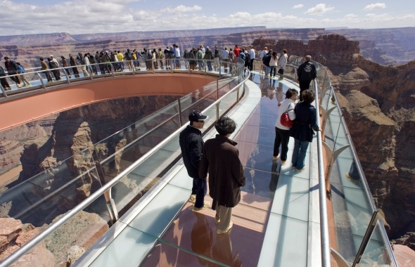
Visitors may purchase professional photographs of their visit to the Skywalk in the gift shop. Personal cameras -OR- Cell Phones are NOT allowed on the Skywalk itself; along with other personal property, all must be stored in a locker before entering the Skywalk. Grand Canyon West is located on the Hualapai’s Tribal lands, and the National Park Passes and other Entrance Fee’s DO NOT apply at Grand Canyon West. Info&Reser:   1-888-868-9378     Email:reservations@grandcanyonresort.com

GCE-On-The-Rim-Development-Sites

Looking eastward from the popular South Rim, visitors could soon see a construction as workers build restaurants, hotels and shops on a distant mesa on the Navajo Indian reservation. The developers also plan a gondola ride from those attractions to whisk tourists to the canyon floor, where they would stroll along an elevated riverside walkway to a restaurant at the confluence of the Colorado and Little Colorado rivers.

The question before the Navajo Tribe being argued “Is it the best thing to do to sacrifice this nationally important, internationally important resource, the Grand Canyon, and the confluence of the Colorado and Little Colorado rivers in the name of economic development?” The confluence of the Colorado and Little Colorado River is a sacred place to many Navajo, to the Hopi, to the Zuni and to other tribes, and it’s an internationally important place as well.

“There should be some places that you just do not mine.  Uranium is a special concern because it is both a toxic heavy metal and a source of radiation. I worry about uranium escaping into the local water, and about its effect on fish in the Colorado River at the bottom of the gorge, and on the bald eagles, California condors and bighorn sheep that depend on the Canyon’s seeps and springs. More than a third of the Canyon’s species would be affected if water quality suffered.”

— Steve Martin, former Grand Canyon National Park Superintendent

Permanently polluted land and water are a direct result of federal programs that encouraged uranium prospecting on public lands beginning in the 1950s. That mining and milling boom in the Four Corners area lasted for about three decades before going bust. When the bottom dropped out of the uranium market, the industry went belly-up, leaving thousands of poisonous surface sites and deadly groundwater plumes.

In 1979, an earthen dam breached, releasing 1,100 tons of radioactive mill wastes and 90 million gallons of contaminated water into a tributary of the Little Colorado River. In 1984, a flash flood washed tons of high-grade uranium ore from Hack Canyon Mine into Kanab Creek, which drains into Grand Canyon. Located within the Park’s south rim, the Orphan Mine continues to contaminate creeks, prompting the National Park Service to warn backpackers along the Tonto Trail not to use water from two drainages.

GRAND CANYON -5-3

Today, the NPS advises against “drinking and bathing” in the Little Colorado River, Kanab Creek, and other Grand Canyon waters where “excessive radionuclides” have been found. Although it is difficult to attribute this contamination to any specific activity, there can be little doubt that the cumulative effects of mining, milling, and transporting radioactive materials are causing long-term, adverse effects on people, water and other resource values in the Grand Canyon region.

Beginning in 2006, the price for uranium began to rise. Thousands of new claims have been filed within watersheds that drain directly into Grand Canyon National Park and the Colorado River.  A Canadian-owned company reopened the White Mesa Mill in Blanding, Utah, and began processing uranium for powering nuclear reactors in South Korea and France. Without requiring any revisions to outdated environmental assessments, the BLM automatically allowed the same company to begin opening mines that were abandoned by its previous owners in the 1980s.

“This is bad news for protecting Grand Canyon and tribal sacred sites,” said Roger Clark of the Grand Canyon Trust. “Over the last two decades, we’ve learned how uranium mining can pollute aquifers that feed canyon springs and Havasu Falls. But the Forest Service has ignored that information and failed to require Energy Fuels to take reasonable steps to prevent contamination of water, sacred sites and public lands.”

“This is bad news for protecting Grand Canyon and tribal sacred sites,” said Roger Clark of the Grand Canyon Trust. “Over the last two decades, we’ve learned how uranium mining can pollute aquifers that feed canyon springs and Havasu Falls. But the Forest Service has ignored that information and failed to require Energy Fuels to take reasonable steps to prevent contamination of water, sacred sites and public lands.”

The Forest Service first approved the Canyon mining plan in 1986, despite a challenge from the Havasupai tribe. Uranium prices plummeted shortly thereafter and the mine closed in 1990 before producing any uranium. The Forest Service allowed the Canyon Mine to reopen in 2012 without a plan update or environmental assessment to reflect the extensive changed circumstances since the original review and approval. These changes include the 2010 designation of the Red Butte traditional cultural property, reintroduction of the endangered California condor in the vicinity of the Canyon Mine, and the 2012 decision to ban new uranium mining across 1 million acres near the Grand Canyon.

“This uranium project could haunt the Grand Canyon region for decades to come,” said Katie Davis with the Center for Biological Diversity. “Uranium mining leaves a highly toxic legacy that endangers human health, wildlife and the streams and aquifers that feed the Grand Canyon. It’s disappointing to see the Forest Service prioritizing the extraction industry over the long-term protection of a place as iconic as the Grand Canyon.”

Geologists have warned that uranium mining could deplete and contaminate aquifers that discharge into Grand Canyon and that cleaning them up would be next to impossible. A 2010 U.S. Geological Survey study found elevated uranium levels in soil and water sources associated with past uranium mining.

This summer U.S. District Judge David Campbell denied a moritorium to halt uranium mining at the Canyon Uranium Mine.  Only six miles from the Canyon’s south rim, The Havasupai Tribe and several conservation groups had challenged the U.S. Forest Service to reopen the mine without consulting with the Havasupai or completing an environmental review.  Opponents fear the mine endangers wildlife, endangered species, Tribal Cultural values and the risk of toxic uranium waste contaminating the aquifers and streams in the Grand Canyon feeding the Colorado River.

“We will continue to fight to protect Grand Canyon, its waters and its watershed,” said Sandy Bahr, director of Sierra Club’s Grand Canyon Chapter. “The Forest Service should consider the harm this mine could cause to the groundwater and ultimately the waters in Grand Canyon National Park. We are extremely disappointed in the judge’s failure to recognize that.”

GRAND CANYON -

Leave it as it is. Man cannot improve on it; not a bit. The ages have been at work on it and man can only mar it. What you can do is to keep it for your children and your children’s children and for all who come after you, as one of the great sights which every American, if he can travel at all, should see. “Keep the Grand Canyon of Arizona as it is!” concluded President Teddy Roosevelt during his first visit to Arizona on Wednesday, May 6, 1903, 112 years ago…

 
GRAND CANYON ITALIAN SOUTH ENTRANCE DEVELOPMENT ON HOLD FOR NOW

SIGN THE PETITION FOR OBAMA TO CREATE A GRAND CANYON MONUMENT

SIGN PETITION TO STOP GRAND CANYON PROJECTS

GOPRO VIEW OF GRAND CANYON SKYWALK…A HUNDRED DOLLAR VALUE

WALL STREET JOURNAL … A SELF GUIDED RAFT TRIP THROUGH THE GRAND CANYON

LINE UP YOUR GRAND CANYON AIR TOUR…

GRAND CANYON SKYWALK

VISIT THE SOUTH RIM OF THE GRAND CANYON
VISIT THE NORTH RIM OF THE GRAND CANYON
VISIT THE EAST RIM OF THE GRAND CANYON
VISIT THE WEST RIM OF THE GRAND CANYON

This slideshow requires JavaScript.

MORE GRAND CANYON PHOTOS CLICK HERE FOR SOUTHWESTPHOTOBANK PHOTO GALLERY…..

Join me on PhotoShelter

Graph Paper Press minimalist WordPress themes for photographers and designers

<a href=” SPANISH TRANSLATIONS:">

RAINBOW GOLD GROWTH ? ORO VALLEY AT THE TURNING POINT, SAVING THE SANTA CATALINA RANGE AND ORO VALLEY FROM ITSELF…

The original Rancho Vistoso was a large Adobe ranch house located where today Walmart parking lot at Oro Valley's Marketplace Plaza.

The Canon del Oro Valley is the gold at the end of the rainbow. The original Rancho Vistoso was a large Adobe ranch house located where the Walmart parking lot at Oro Valley’s Marketplace Plaza buzzes with activity as shoppers visit big box stores.

Life rarely gives us second-chances, but they do happen. Oro Valley Arizona has a second chance to decide what their Future should look like.  Town residents have banded into two groups, recall elections are November 3rd, emotions have flared-assault charges and lawsuits filed and election signs vandalized and tossed into the bushes. The usual politics one finds in Small Town USA all over the country. Oro Valley’s problem:  it’s one of the most beautiful places in the United States and finding the proper balance between preserving the Canon Del Oro Valley’s “Drop Dead Gorgeous” status and developing the town wanna be city so everybody is happy. Making everyone happy will be a tall order.

Walmart Shopping Center at MarketPlace

Walmart Shopping Center at MarketPlace

RanchoVistos 072

Same view as above 40 years earlier…

Mainly, because Oro Valley has become a developer’s paradise and any change there will be bumping heads with BIG bucks. Oracle Road, which is State Highway 77, which is the town’s main drag has been a 7 mile construction zone for so long know one can remember when it started. Much of this work is ramping up and adding another lane, taking two lanes to three, making room for future development. They are also building expensive wild life crossings, both over and under styles. In Colorado they have found predators just await their prey on the blind side of these crossings and just gobble till they are full. Speedtrap.org lists 80,000 bothersome speed revenue mills and knows Hwy 77.

Developers in Oro Valley in recent years, have squeezed in 800 apartments, providing housing for Iowa farmers who want to get out of the snow.  Sun Dorado, the next generation of Mark-Taylor Apts, has the prime spot nestled into the Santa Catalina range at 1st Ave and Oracle Road, featuring the “largest health center you have ever seen in a apartment complex”, dog-friendly and walking access to all the unique shopping nearby. Mountain views cost extra, it’s cheaper to stare at Oro Valley and Oracle Rd, for a one bedroom it’s $930 with a view, large kitchen and a closet but a three bedroom with a view tops out around $1650-but up to six people  can sign the lease.  No one bedrooms available now, but some might open up.

CatalinasMts

That boutique shopping experience as you leave San Dorado’s lighted gated community begins with CVS Drugs; store number 10,006 now found on most corners near you, the next shop is a FIRM mattress shop and everyone needs one, the next is a Nail Spa, also found everywhere. So the question facing the voters, what premium do you place on living in one of the most beautiful places in the U.S., or is growth-any growth worthwhile ?  Some voters might argue that building all those apartments at the junction of lst Ave and Oracle Road and providing pads for businesses found on most every street corner in Tucson on a spot which was the community’s focal point of the Catalina Mountains might have been insensitive and might better have been a green space for the community to feed their souls and revel in the beauty that GOD has provided.  That would not have made someone rich but it would have made the community richer.

oro valley copy

Catalina Arizona sits next to Oracle Road north of Sun CityRancho Vistoso just south of the Pima-Pinal County Line...in the distance stands the Santa Catalina Mountains

Catalina Arizona sits next to Oracle Road north of Sun CityRancho Vistoso just south of the Pima-Pinal County Line…in the distance stands the Santa Catalina Mountains

Oro Valley has some nice green spaces, along the (dry) riverbed–Steam Pump Ranch was a nice idea until it was squeezed in by gas stations and commercials strip malls, something was lost. Lunching on day at the amazing Saguaro Cafe in Oro Valley my dog engaged me in a conversation with two realtors who suggested Oro Valley’s real prosperity will come from commercial development along Tangerine Road. “It will be the next Speedway”, they agreed since it is a major I-10 to Oro Valley corridor.

Oro Valley Council members meet with residents explaining how

Oro Valley No vote Council members meet with residents explaining how “dirty” actions from the Mayor and the other YES votes for the new City of Oro Valley Recreation Center compromised  their vote with a rushed agenda. Councilman Mike Zinkin in the foreground, Councilen William Garner in RED, and Brendan Burns in blue behind.

Oro Valley residents listen to Councilmen opposed to the new rec center

Oro Valley residents listen to Councilmen opposed to the purchase of the Old Conquistador Country Club also stressed concerns about Golf dying as a business, water woes.  In Phoenix several golf course are rebranding their communities,  they are tearing out the fairways and adding boulevards. An uncertain future shadowed these concerns…

Now Oro Valley has a second chance to make the right decisions.  It is my opinion the present mayor, will continue to fuel development since a large portion of his election campaign has been financed by the folks doing the building, that’s the way politics works. Mayor Satish Hiremath is running to hold onto his office in the Nov. 3 recall election along with town council members Lou Waters, Joe Hornat and Mary SniderThe recall was initiated by the Oro Valley Citizens for Open Government after the Town Council voted 4-3 in December to buy El Conquistador Country Club and increase the town’s sales tax to raise money to remodel the facility into a community and recreation center. The council members facing recall all voted in favor of the proposal. The facility was purchased for $1 million and includes 324 acres, 45 holes of golf, 31 tennis courts and two swimming pools. A 31,475 square-foot building that requires renovation will be paid for with a half cent sales tax that took effect in March.

Rancho Vistoso in 1975, today this view is some one's front yard inside the HoneyBee Reserve gated community...

Rancho Vistoso in 1975 today its someone’s front yard in the HoneyBee Reserve gated community…

Oro Valley was incorporated in 1974 and has grown from a shady Oasis to one of the more prosperous communities in Arizona with almost 130,000 people within seven miles, incomes averaging around $70,000, it has been voted Best Place to Raise Kids, Good Place to Retire because of the strong property values and low crime. Truth is, Oro Valley and the Tortolita Mts

Arizona Governor Bruce Babbit turns over the soil dedicating Catalina State Park and at the same moment he opens Rancho Vistoso Sun City for business.

Arizona Governor Bruce Babbit turns over the soil dedicating Catalina State Park and at the same moment he opens Rancho Vistoso Sun City for business.

for decades was everyone’s backyard.  Quail Hunters reveled in the explosion of birds they found there, javalina hunters still tell tales of the hunt and folks like me, explored and hiked, searched for the wild herd of mustangs running free in those hills. After the land swap, when Governor Bruce Babbitt, created Catalina State Park and in return made possible Rancho Vistoso Sun City, locked gates started appearing–pushing long-time Tortolita Mountain lovers from their haunts. Thinking maybe when they are through building, I thought, but that is when the gated communities started popping up, so for most of us, it was goodbye to the Tortolitas. Growth has continued unabated, in 2008 when housing all over the U.S. died. Oro Valley barely skipped a beat sales slowed and inventory faded but not like the rest of the country.

Cows on trust land equals tax break, the field feed the cows. A lean farm operation.

Cows on trust land equals tax break, the field feed the cows. A lean farm operation.

In the early 1970’s John Ratliff and his associates requested that Pima County rezone a 4,000-acre parcel of land lying east of Oracle Road, north of Tucson. The property known as Rancho Romero was located adjacent to the western slopes of the Coronado National Forest’s Santa Catalina Mountains. The proposed development included a variety of housing units that would accommodate 17,000 people, which would surround golf courses along the Canada de Oro and Sutherland Washes. When this rezoning request came before the Pima County Planning and Zoning Commission, there was so much opposition from the public that the proposed plan was put on hold. Tucson residents said they preferred the preservation of this area as open space, with developed recreational facilities, this was the beginning of Catalina State Park. But not the last attempt by developers to put subdivisions on the east side of Oracle Road.

Before Oro Valley, the grassy field is today's Marketplace.

Before Oro Valley, the grassy field is today’s Marketplace.

Hilton Conquistador 1028

The Oro Valley Conquistador Hotel, the first construction on the east side of Oracle, has been on the auction block, off and on, last time was 2012. The 400 room structure began life as a Sheraton Hotel, then Hilton  presently Premier Hospitality Management maintains the contract. Its restaurants were a big draw in the beginning but as growth came to Oro Valley more restaurants came in and greater variety made expensive Mexican food less interesting.

Desert Springs was one proposal recently turned down, Sabino Springs popped up in 1990 but developers will be back.

Desert Springs was one proposal recently turned down, Sabino Springs popped up in 1990 but developers will be back.

ORO VALLEY-5413ORO VALLEY-5435ORO Valley-4092PKW_1419

For me, the building East of Oracle Road is the most offensive.  West of Oracle, growth will continue north until it hits Oracle Junction, nothing will change that.  More than once, developers have attempted massive subdivisions featuring more than 500 homes, shops, condo and apartments east of Oracle Road where Tangerine Road intersects, Sabino Springs

Oracle Road after a winter dusting of snow.

Oracle Road after a winter dusting of snow.

was one name, others will come and they will keep coming until they get their prize butted up against Catalina State Park. Folks will awake in the campground and stare into someone’s back yard. SunChase Holdings Inc. pledged “a high quality project” that would be tasteful and would fit in with the surroundings. Another attempt for this prize was fought off in 1990, with a progrowth Mayor, they will get the land and that will be the beginning of the end for the Catalina Mountain Range.  Sunchase said they needed 85 acres with up to five homes per acre, 13 acre of five home per acre and up 11 acres of commercial and offices.  In between they plan to weave hiking and biking trails, blending stores, offices and a mix of housing types.  One caveat floated was the possibility of a Tram from Oro Valley to Mt Lemmon, making Oro Valley a must stop for all tourist blowing through Tucson.  Much shorter ride than when it was first suggested from downtown Tucson decades ago.

Oro Valley's First Avenue and Oracle Road has become downtown for the community...

Oro Valley’s First Avenue and Oracle Road has become downtown for the community…

With the new animal crossings on Oracle Road, any concern about “wildlife corridor” between the Catalina and the Tortolita Mountains pretty much go out the window, regardless of major habitat fragmentation. Big Horn statue A short while ago I listen to an Oro Valley resident wish she was living in SaddleBrook just up the road.  She was simply amazed by all the wildlife those residents enjoy. After the bright lights of Oro Valley chased off the last of the Desert Bighorn living atop Pusch Ridge-the town adopted the Bighorn as a symbol of the community erecting several life-sized statues throughout the town. Today new bighorn have been transplanted atop the nearby ridge but disease and mountain lions have taken their toll.

ORO VALLEY GROWTH-6730 ORO VALLEY-6328

Many years ago, I was out-raged by the wall built to block the view across the Canon Del Oro Wash that eliminates out the most perfect view of the mountains.  I was sure they just wanted to be sure everyone had their eye on the road (now they are texting) but after while I realized how wrong I was.  That wall is a sound barrier for all the expensive homes that soon will be built above the road level and on top of the first foothills, most money gets the highest spot. No one will pay big bucks for the spectacular sunset views if the road noise from below drowns out the elevator music.

Sound Wall for the big bucks lots yet to come.

Sound Wall for the big bucks lots yet to come.

It is all going to change soon, unless it is stopped now. The Town of Oro Valley Special Recall Election will be held Tuesday November 3, 2015.  A polling place election, voters may request an early mail ballot, for more information call the Pima County Recorder 520-724-4330…

This slideshow requires JavaScript.

NW Overview

I began this blog pointing out that Oro Valley’s problem is that it is one of the most beautiful places in the United States. What I haven’t said is when folks finally end their long journey on I-10 and the Catalina’s finally come into view, there is a sigh, and I know I’m home again. We all take their beauty for granted but try to imagine that skyline without those hills and take stock in what we have and the responsibility to leave this beauty for the children, our future-what will Oro Valley look like tomorrow.

ORO VALLEY CITIZENS FOR OPEN GOVERNMENT

CITY OF ORO VALLEY

PIMA COUNTY RECORDER-REGISTERING TO VOTE

Join me on PhotoShelter

Graph Paper Press minimalist WordPress themes for photographers and designers

<a href=” SPANISH TRANSLATIONS:">