
PUSCH RIDGES’S MANY MOODS: CROWN JEWEL of the SANTA CATALINA MOUNTAIN RANGE

PUSCH RIDGE DRESSES UP THE ENTIRE NORTHWEST SIDE OF TUCSON AND MAKES IT THE FASHIONABLE SIDE OF TOWN. I’m closing out my 4th decade in TUCSON and most of that time I have lived in one spot in the shadow of PUSCH RIDGE. Early on, I set up a ladder and never moved it, eventually the vines grew over the ladder and now it can never move but nightly I will find myself on my roof watching the interplay of lite and color as both bounce off PUSCH RIDGE. It can be particularly rewarding this time of the year when clouds appear and give the sky contrast and color at sunset, the storms and lightening add a completely different component, each photographer has to decide how much of that he can handle. I frankly get off the roof when the sky is crackling, the tree in my front yard was recently reduced to a hedge by an explosive lightening strike. So take my advise, keep your head down and find a good, solid plastic tripod. Today I am posting a new slide show on SouthWestPhotoBank.Com which will show a portion of my collection of my PUSCH RIDGE Collection and hope you find them fun in the real-time of a slideshow and remember in actuality each reflects a day, or 24 hours, in changing weather and time spent. I have driven all over the AMERICAN SOUTHWEST and BAJA and few places I have visited have had the class and beauty that PUSCH RIDGE lends TUCSON. Its always fun when driving in, after a long trip, to finally spy my view of the ridge and finally know, I’M HOME ! There is PUSCH RIDGE to prove it. HOPE YOU ENJOY…
BARREL CACTUS TIME

Landscape photography requires the photographer to have a link with the land, he must be attuned to the weather, the time of year, the movements of the moon and sun, blooms and fall-all things natural, but often out of sight and out of mind, not something city-dwellers easily track. Therefore the challenge, Ansel Adams described the landscape photograph as often the source of great hope and often the source of severe disappointment, it’s hard to keep it all together and be there when great things happen, unfold and become a lasting digital moment. That doesn’t mean that untold numbers of photographers won’t strive to accomplish what Ansel Adams did, with every breath they take. His record selling “Moonrise Hernandez New Mexico” was one of those “drove into the ditch, threw up the tripod, slammed in a film holder into his camera, pulled the slide, guessed the exposure, made the exposure, light faded. Then he pulled a light meter and made his readings and developed according. Hernandez New Mexico print sold recently for $609,600, more recently, the Adam’s photo “Winter Storm clearing” has sold for $722,000.00 bypassing all other Adam’s photos for a price paid. I asked Ansel about “Winter Storm clearing” once he said that he often visited that view and some times there was a photo but often nothing and he drove on. So luck, has a lot to do with Ansel Adams “luck” but his diligence and tenacity always the deciding factor, he was out there working and checking out ideas that may bear fruit, but maybe not today, keep checking. Years ago I decided that Landscape work needed total devotion and tried to devise ways of improving my chances, without living in the desert the rest of the year. A few tricks that help, the moon calendar on this website’s blog roll, tells you when the full moon will present itself, it also shows you the dark of the moon, for night shots. The AZ Highways scenic drive and monthly event calender gives you ideas of pretty drives that can dove-tail with up-coming events like the Fort Verde Days October 8 thru 10, lots of living history, drilling, posing for tourists. Maybe enroute or on the way home you decide to visit wet Beaver Creek, the road travels across several one-lane bridges and a country boarding school to the V-Bar-V Heritage Site, where after a short half-mile hike, visitors can see more than 1,300 petroglyphs depicting everything from snakes to humans with walking sticks. A nice diversion, breaks up a long drive and a good thing to shoot mid-day and gives you some variety and more bang for your buck.<!–
SW SPRINGPK WeisI have a habit of picking up rocks along the way and over the years I find myself with a huge rock garden and in the nooks and crannies of these rock, cactus adorn and bloom annually right in my backyard. Frequently cactus blooms at home fill in the blanks when I need a particular bloom but better still it keeps me in touch with the desert and when I notice the blooms in my garden I realize things are heating up out in the Sonoran Desert and I might do well to take a look.

WATCH YOUR STEP !


UPDATE: New signs unlike the sign above have replaced the one below and some say its because of the election and the need to show greater control of the border. The Pinal Sheriff said it was all politics but the sign below was placed in an area where he held a four day smuggling sting in northwest Pima/southwest Pinal to justify his request for a million-day anti-smuggling team. Investigative leads have brought in outside agencies to investigate a Pinal Deputy’s shooting allegedly tracking smugglers. Governor Candidate Jan Brewer stood in front of a sign like below and told Washington to “do its job” ranting about “heads in the desert” and some might say that all could be called politics. “I’m 80 miles away from the border and only 30 miles away from Arizona’s capital. This is an outrage. Washington says our border is as safe as it’s ever been. Does this look safe to you?” she asked. Still reports say Americans must take care driving Sonora in 2010 and to stick to the main roads or join organized tours who do business there regularly….end of update…
There was time when I would throw my camping gear in the car and take off and camp where ever the wind blew me.
Today I find myself questioning whether or not camping along the US-Mexico Border is as safe as it once was. I find myself considering whether a person alone carrying expensive camera gear is as safe as I once always thought. The Robert Krenz shooting in the SouthEast corner of Arizona says no. Shit happens, people say, until it happens to them. I have always known that crossers were honest hard working people crossing into Arizona’s Sonoran Desert are not the problem. I have seen dozens and know they simply wish to fade in the texture of the desert and reappear close to their goal and awaiting friends and family. God Bless them—I wish them well.
Having said all that, I still find myself thinking twice about venturing out and carefully considering my destination. I used to drive the border road between Nogales and the Coronado National Monument south of Sierra Vista, I frequently camped along it, heard occasionally things going bump in the night but never had a problem. I often camped in the riparian region called Sycamore Canyon west of I-19 along the Ruby Road south of the fantastic Tumacacori Highlands, no more.
The picture above was taken at the west end of Avra Valley Road–west of Marana–north of the Tucson Mountain chain but south of the magnificent Silverbell Range. That opening leads into the Tohono Oodham Reservation which is frequently used by smugglers. Violence in Mexico trinkles down to the little guy, the mules, the folks carrying the loads and if they lose their cargo, they too may lose and so, in the days of trickle-down economics, so may you. Daylight brings some safety and fewer issues arise with the sun but with nightfall, so comes Trouble. And everyone knows “Trouble rides a fast horse”, so be smart and safe. Get an early start home by dark, always carry spare water in case you find someone in trouble, but take care not to place yourself and loved ones in a compromised situation.

UPDATE: Two Mexican immigrants have been found shot to death in Pinal County 500 yards from a migrant camp, each with a single AK-47 round, the shootings occurred an area known as Antelope Pass, not far from where a Pinal County Sheriff Deputy was shot by smugglers five weeks earlier. One of the victims may have reported the shootings with a cellphone prior to dying from his injuries, when helped arrived, both were dead. A rifle was found with the victims and question whether or not, the victims were out were hunting or perhaps had been smuggling themselves.
FURTHER UPDATE: The Arizona DPS reports "militia groups" operating in the open desert with the intent to deter smuggling and capture illegal crossers. Many different points of view are represented in these groups and care should be taken around any group of heavily armed individuals. Pinal County Sheriff Paul Babeu blasted the federal government during an Oct. 10 tea-party rally in Tucson for putting up the signs in English “instead of in Spanish, facing south, saying, ‘Stay out.’ “
THE COLORADO RIVER IS 2013’s “MOST ENDANGERED RIVER” ARE WATER BANKS AND RATIONING, OUR FUTURE?

WILL THIS POPULAR ARIZONA, CALIFORNIA AND NEVADA PLAY GROUND RUN DRY?

THE CAP IN TAKES WATER BENEATH HOOVER DAM.
What happens next year? “Maybe we’ll have a wet year”, seems to the extent of the plan, it’s a lot like me buying lottery tickets for my retirement, its proactive, optimistic but nothing to take to the bank.
I visited the New York Times, the editorial page of the Salt Lake Tribune, the Las Vegas Headlight-Sun, the Los Angeles Times and the Arizona Republic to see how each spun the story about Lake Mead facing shortages. Perhaps the best story I found was a gardening column for the LA Times, complaining that they were getting mixed signals whether or not they should put in lawns. The Vegas spin was more sobering when you realize Sin City gets 90 percent of its drinking water from Mead. Vegas has two large siphons attached to the lake and a third under construction, they are scared–by the end of the year one siphon may be above Mead’s water level and worthless. The new siphon runs through the bottom of the lake and will be able to literally suck Lake Mead dry. Nobody believes that will happen-but the new siphon is nearing completion in spite of setbacks. The Southern Nevada Water Authority has begun pursuing permits necessary to build a $3.5 billion, 300-mile pipeline to shuttle water from the mountains in northern Nevada, many question the plan.
Southern California believes every time a sprinkler is turned on, choices are being made between lawns and their fisheries and still-no one believes anything will change until the courts start ordering changes. Already California water companies are trying to linkup with snow melt from the Northern High Sierra, just in case, they say. Lake Mead’s reservoirs have reached 1087 feet for the first time since 1956 when the lake dropped ten feet in order to fill Lake Powell. These twin reservoirs will require years of snow melt and runoff to make up the deficit and tree ring dating data frankly doesn’t support that optimism, it does suggest the droughts since 1990 frankly are nothing out of the ordinary and things could get worse. Utah has a $2billion “pie-in-the-sky” pipe line planned to bring more water from Lake Powell…water that might not be there. Kinda of reminds me of the Hohokam, all we really find of them are the water canals they built to bring water to the desert and therefore brought life itself.
In Phoenix, the Arizona Republic reports Lake Mead water levels determine drought status on the river under a set of guidelines adopted in 2007 by the seven Colorado River states: Arizona, California, Nevada, Utah, Wyoming, Colorado and New Mexico. If the lake reaches the first drought trigger, measured at an elevation of 1,075 feet above sea level, water deliveries below Lake Mead are reduced by a little more than 10 percent. Additional cutbacks would occur if the lake continued to drop. For Arizona, the stakes are high. Arizona absorbs 96 percent of any water rationing on the river under a decades-old agreement that ensured construction of the 336-mile CAP Canal. Nevada absorbs the other 4 percent under a separate deal with Arizona. Although rationing would affect some users on the river in western Arizona, most of the cuts would come from the canal, whose annual flow of 1.5 million acre-feet would be reduced in stages. (An acre-foot is 325,851 gallons, enough to serve two average families for one year.)
Farmers and users of excess water, such as underground-storage programs, would be affected first. It’s unlikely cities and business in Phoenix and Tucson would lose any water in the earliest stages.

IN SAN LUIS BAJA NORTE MEXICO THE RIVER IS DRY LESS THAN TEN MILES SOUTH OF THE BORDER
“It’s a clear warning,” said Tim Barnett, a scientist and Lake Mead expert from the Scripps Institution of Oceanography who sounded the alarm in 2008 that Mead had a 50% chance of running dry by 2021. “The thing that’s astounding to me is the head-in-the-sand attitude of the bureaucrats that we’ve talked to.” “The water situation in Southern California is serious,” he added, “But I don’t think it’s dire yet. Six months or a year from now, we might not be using ‘serious.’ ‘We might be using dire'”.
During the last decade the Southwest has loss snow pack, vegetation and endured serial wildfires and increased temperature and all the while the region has grown faster than any other part of the US. Study after study predict that climate change will reduce the banked snow pack from 6 to 45 percent over the next half century. Every year more water is drained than deposited with an annual deficit of 1.6 million acre-feet, still without a “full-fledged crisis” most folks won’t do anything. In Las Vegas, for instance”, the “Cash for Grass” program pays homeowners $1-per-square-foot to convert to desert landscaping.
In 2007 the Feds mandated an agreement between the seven US states sharing the rivers flow. The lowest reduction cuts deliveries by 333,000 acre-feet, about half of what Las Angeles consumes in a year. Should the lake’s surface fall another 12 feet to 1075 feet below sea level or about 33 percent capacity. some say this will happen next year. When the 28.5-million-acre-foot reservoir’s surface hits 1,050 feet, or about 26 percent capacity, deliveries get slashed by 417,000 acre-feet, Las Vegas shuts down one of its two intakes and Hoover Dam’s massive turbines lose the hydraulic pressure needed to generate electricity. The maximum cutback of 500,000 acre-feet kicks in when Mead surfaces hits 1,025 foot, or about 20 percent capacity.

YUMA WATER USERS
The mighty Colorado carries the lifeblood of the Southwest. It services the water needs of an area the size of France, in which live 40 million people. In its natural state, the river poured 15.7 million acre-feet of water into the Gulf of California each year. Today, twelve years of drought have reduced the flow to about 12 million acre-feet, and human demand siphons off every bit of it; at its mouth, the riverbed is nothing but dust.
The U.S. intelligence community understands what is happening, according to one report released last year, the global need for water will exceed the global supply of “current sustainable water supplies” by 40 percent by the year 2030…
SUENO THE HARRIS HAWK

HAWKS are meat eating machines and they are the homeowners friend, pack rats are a favorite meal says Kathie Schroeder a Arizona Wildlife rehabilatator who raised Sueno the Harris Hawk from birth. The State and Federally licensed wildlife advocate says her Hawk prefers “Jackrabbit” when they can get it, but occasionally, a Yorkie or Daschund, will do in a pinch. Schroeder says the birds live and feed in family groups and often one will land to flush out a jackrabbitt from a bush so the others can nail it with their razor-sharp talons. She said a UA study showed 75% of the annual birth may die through electrocution, so Tucson and Electric Power Company, has developed a Raptor Protection Program which reacts when customers report raptors nesting or perching near energized wires. Hawks mate for life says Schroeder but infidelities have been reported but if lucky, a hawk, may live twelve years. Schroeder said the Oro Valley Country Club grounds is a big feeding place for raptors and several nests have been reported around Oracle Junction and further north along the Pinal Parkway others reports a golden eagle has been seen in the Pima Canyon area. The Horned Owl is the only real predator of the Harris Hawk, she says, owls do not build nests and will often land there, eat the Harris Hawk’s young and leave their young in the newly vacated nests. The Harris Hawk is said to often return the favor, resettling the nest and starting over after snacking on baby Horned Owls. To report nesting raptors near energized wire call 623-7711<img src=" ” alt=”schroederwsueno” />
OFF TO A GOOD START

Every morning about an hour before sunrise Chester and I head out for our walk. Its quiet and the coolest it’s going to be for the rest of the day. Now days the humidity has dropped our walk down to about 2 miles but it takes about the same time due to Chester’s slowing pace–the monsoon humidity really heats things up quickly and he slows.
Regardless, it’s the act of doing, being there, getting the exercise, awaking to the day on the walk, watching the sun flirt with the rim of Pusch Ridge and finally getting home just as the sun peaks over the ridge and into my valley. Things are going to get hot and its time to head for the house, maybe some quick yard work and then slaving away on the computer. It is the morning walk that gets the blood pumping, allows for meditation and mapping out the day and assures we’re up and ready for the morning.
Many of my neighbors, meet me out there everyday–same time and same place and we always reflect on the weather and in Tucson, that makes for a short conversation.
Maybe another month, perhaps five weeks, and our best weather of the year will be upon us and our walks become blessed and full of anticipation. I should be able to sleep-in a bit and have less pressure to beat the sun. Chester is always excited about our early start and it his joy and how he savors and relish his morning outing that fuels my walking the most and why I don’t sleep in when I would rather crawl slowly from the bed. In the final exam, my doctor and vet, both believe the morning jaunt does us both a lot of good and when it comes to my doc, anything I can do to make him happy is important, he finds so little. And I owe all of it to Chester, my faithful walking companion.<img src="http:// ” alt=”walkingthedawg3512.jpg” />
SOUTHWEST DROUGHT ENDS LIFE 700 YEARS AGO … WILL TUCSON be the next CHACO

WATER is always a emotional topic in the Southwest United States. Talk of water rights and who owns the rights to Green Valley’s CAP allotment, can they sell it and who can use the Central Arizona Project will always be big news and the fights will just get bigger and more important as time goes by. The new CAP spur being built to Green Valley is said allow the new ROSEMONT MINE access to all the water they will need but what about LOS ANGELES and LAS VEGAS, I thought these U.S. cities got whatever water that was left over and wasn’t sent south to MEXICO and we owe MEXICO water by TREATY. Shall we assume since the mine will not have to pump ground water that its construction on the slopes of the Santa Rita Range is now a slam dunk. Better get used to the idea says Congresswomen Gabbie Giffords. According to Giffords, there has never been a Copper Mine not allowed to be built in ARIZONA because of the 1872 Mining Law, a law written, passed and enacted long before Global Warming

Abandoned due to drought which made farming impossible, fuel scarce and building supplies 50 miles away.
PETERMANN GLACIER, WE BARELY KNEW YOU !

Satellite images of the Petermann Glacier in Greenland before and after breaking off
Monday, August 9, 2010 – 20:39

On the 5th of August we reported that a massive chunk of the Petermann Glacier broke off in Greenland, this was the biggest chunk of ice to break from the Petermann Glacier in a long time. Nasa recorded satellite images of the ice after and before it broke off so we can easily compare the two and see just how big this chunk of ice was.
According to NASA:
On August 5, 2010, an enormous chunk of ice, roughly 97 square miles (251 square kilometers) in size, broke off the Petermann Glacier, along the northwestern coast of Greenland. The Canadian Ice Service detected the remote event within hours in near real-time data from the Moderate Resolution Imaging Spectroradiometer (MODIS) on NASA’s Aqua satellite. The Peterman Glacier lost about one-quarter of its 70-kilometer (40-mile) long floating ice shelf, said researchers who analyzed the satellite data at the University of Delaware.
The Moderate Resolution Imaging Spectroradiometer (MODIS) on NASA’s Terra satellite captured these natural-color images of Petermann Glacier 18:05 UTC on August 5, 2010 (top), and 17:15 UTC on July 28, 2010 (bottom). The Terra image of the Petermann Glacier on August 5 was acquired almost 10 hours after the Aqua observation that first recorded the event. By the time Terra took this image, skies were less cloudy than they had been earlier in the day, and the oblong iceberg had broken free of the glacier and moved a short distance down the fjord.
Icebergs calving off the Petermann Glacier are not unusual. Petermann Glacier’s floating ice tongue is the Northern Hemisphere’s largest, and it has occasionally calved large icebergs. The recently calved iceberg is the largest to form in the Arctic since 1962, said the University of Delaware.
UPDATE: STOCKHOLM — An island of ice more than four times the size of Manhattan is drifting across the Arctic Ocean after breaking off from a glacier in Greenland. Potentially in the path of this unstoppable giant are oil platforms and shipping lanes – and any collision could do untold damage. In a worst case scenario, large chunks could reach the heavily trafficked waters where another Greenland iceberg sank the Titanic in 1912. It’s been a summer of near biblical climatic havoc across the planet, with wildfires, heat and smog in Russia and killer floods in Asia. But the moment the Petermann glacier cracked last week – creating the biggest Arctic ice island in half a century – may symbolize a warming world like no other.
“It’s so big that you can’t prevent it from drifting. You can’t stop it,” said Jon-Ove Methlie Hagen, a glaciologist at the University of Oslo.Few images can capture the world’s climate fears like a 100-square- mile (260-sqare-kilometer) chunk of ice breaking off Greenland’s vast ice sheet, a reservoir of freshwater that if it collapsed would raise global sea levels by a devastating 20 feet (6 meters).
The world’s newest ice island already is being used as a powerful emblem in the global warming debate, with U.S. Rep. Edward Markey of Massachusetts suggesting it could serve as a home for climate change skeptics.Researchers are in a scramble to plot the trajectory of the floating ice shelf, which is moving toward the Nares Strait separating Greenland’s northwestern coast and Canada’s Ellsemere Island. If it makes it into the strait before the winter freeze – due to start next month – it would likely be carried south by ocean currents, hugging Canada’s east coast until it enters waters busy with oil activities and shipping off Newfoundland.”That’s where it starts to become dangerous,” said Mark Drinkwater, of the European Space Agency.
Update by Karl Ritter/AP
DRAMA IS NEVER FAR AWAY !

Many of us believe our lives will be just one quiet moment to the next. Some call it boredom, others realize if you step in the middle of i-10 life gets different real fast, because of that, many of us have decided not to become Indy Car drivers or Border Patrol, instead there are leagues of insurance agents, salespersons and education positions usually come with a roof and four walls. What if you were sitting at home, enjoying Oprah, eating bom-boms and instantly the roof disappears and then all four walls…….
A tornado was caught on camera destroying a farmhouse this Video shot by a storm chaser shows the tornado touching down near the house in Wilkin County, Minnesota, and debris flying into the air as the funnel tears into the building. As the tornado moves away, the home appears shredded, with part of its roof missing. Tornados were reported on Saturday evening near Tyler, North Dakota, Tenney, Minnesota, and Fergus Falls, Minnesota. 8/8/2010
Imagine you are running down field on a soccer play one moment, and the next, you are running for your life.
HISPANICS RISE UP OVER SB10-70

 Maybe three hundred protesters closed Tucson Streets Thursday to show their displeasure in the new law many believe will cut severely into their civil rights particularly in Arizona. Hispanics fear walking out the front door and being deported to Mexico, insponse Hispanic have risen up all over the United Sates. Cities and States all across the United States have taken sides on the controversial law, many feel it is needed because of the lack of enforcement by the Feds, many residents fear they will no longer be free of the stigma of being a Hispanic.
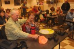
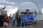
MOUNT LEMMON SKY CENTER COOL ESCAPE

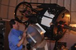
Summer’s in Tucson are suffered by those without the funds to spend those months at the beach in California. That said, after three hot months, folks in Tucson tend to get a wee bit crazed and that’s when they have to get out…but where to go, its hot, too hot to even leave the house. So when the Mount Lemmon Sky Center offered an evening of looking at the stars through a world class telescope, it seemed almost too good to be true. Many of the astronomical photographs being produced today are taken by Adam Block at UA’s Mount Lemmon Sky Center using a 24-inch RC Optical Instruments telescope, the same scope visitors get to use. From that 24 inch scope Astrophotographer Adam Block captured this image with the telescope at the Mount Lemmon SkyCenter showing two galaxies on a collision path, earlier he had captured the huge appetite of a black hole 50 million light years away.
[ Our guide to the heavens Mike Terenzoni lectured and guided us to a 9100 foot view of the sunset. Later, dinner was served–as was some liquid nitrogen dished up to demonstrate the adverse temps in outer space. A great opportunity is coming up with the August 11 | Perseid Meteor Shower which should be perfectly viewed from Tucson on Mt. Lemmon The University of Arizona’s SkyCenter is sold out for this annual event but for other evenings it costs, $70 adults, $35 youth (under 18), reservations required 4:45 pm, 520-626-8122 or http://skycenter.arizona.edu


-

- Mike Terenzoni show folks around the viewing area
LINK to HUBBLE’S Ultra Deep Field Photo encompasses 800 exposures totaling ONE MILLION SECONDS..said to look back past the BIG BANG
DIA de MUERTOS Mexicans celebrate DEATH
Contrasts Tucson’s Day of the Dead celebration and procession (see video) with the age old Mexican practice seen on both sides of the border to visit the graves of their loved ones on All Souls and All Saints Day. This visit took place in Nogales Sonora in Northern Mexico only a hour drive south of Tucson. Mexicans turn out in large numbers to clean, repaint and repair the graves for another year. Lots of folks turn out to help, the painters and yard workers, plus pizza salesmen and musicians.


