

Park rangers in Grand Canyon National Park in 1995 had to kill off two dozen mule deer that were hooked on junk food left by visitors. The deer had become addicted to Cheetos, Fritos and candy that tourists picked up from a nearby ranch. Once hooked, the deer lost their natural ability to digest vegetation, ranger David Haskell said. “They’ve become in extremely poor health, almost starving.” Haskell called junk food the “crack cocaine of the deer world.”
PERSEIDS METEOR SHOWER LIGHTS UP PHOTOGRAPHER’S LANDSCAPES CAPTURING THE SOUTHWEST NIGHT’S SKY ADDNG SPARKLE TO MOAB ‘S ARCH COUNTRY


BROKEN ARCH
Milky Way Landscape Photography and the Perseid Meteor Shower by Eugene Louie
This was my first attempt photographing The Milky Way galaxy so I drove to Arches National Park, one of the darkest night skies in the country, to capture the galaxy hovering above the dramatic rock formations. This is Broken Arch. I used it to provide a reference point that even the most amazing Hubble Telescope pictures do not. I wanted to inspire my audience by creating a “scene setter,” which gives the viewer a feeling this scene could exist on another planet. Utah’s stark Moab desert was a perfect backdrop. Scientists studying what the likely conditions of a manned voyage to Mars use the red rocks of Utah to emulate condition on Mars for a possible manned mission to the red planet.
Capturing the Milky Way galaxy over Broken Arch was my original goal, but the experiment became enhanced by an accidental meteor streaking toward earth, probably part of the Perseus meteor shower. The Perseid meteor shower is the most famous, dependable annual meteor shower, producing on average between 60 to 90 meteors per hour, at peak observation times. The real show doesn’t start until after midnight, but meteors can be seen earlier staring around 10pm, a couple hours before the moonsets; the crescendo does not start until hours after midnight when the skies get darker as night turns into day. The prime viewing dates are: Aug. 10th, 11th, and 12th. Fortunately in 2016 observers will enjoy a longer viewing period as the moon is cooperating, setting earlier as it will be in a waning gibbous moon phase.
Visibility will be best for folks living in the mid Northern Hemisphere. All you need do is find the darkest spot possible, as far away from city light pollution, set up a comfy adjustable lawn chair, kick back and make sure you have a wide open sky above you, as meteors will come from every direction. If you are an intrepid meteor watcher be prepared to pull an all nighter.

Where Do These Meteors Come From?
The Perseid meteor shower look like they come from the constellation Perseus. The Perseid “shooting stars” are bits of space debris made of debris from the Comet Swift-Tuttle. Each piece ranges in size from a tiny piece of dust to about 10 meters. They are called meteoroids when traveling in outer space. They become meteors upon entering earth’s atmosphere, and if the meteor strikes the earth, and remains intact, it is called a meteorite. If these pieces of comet are larger than 10 meters they are called asteroids. The Comet Swift-Tuttle was discovered in 1862 and takes 133 years to make one trip around the sun. Astronomers use the term “radiant,” to describe the line that leads back to where the visible meteor seems to originate. The last time Swift Tuttle reached perihelion, the closest point to the sun, was December1992. It will do so again in 2126.
Smart Phone Apps to Locate the Perseus Constellation:
To locate the Perseus Constellation iPhone users can download “Sky Guide,” a free app available through the Apple Store and Android phone owners can use “Photo Pills,” which
cost about $10. Both are excellent and easy to use to locate The Milky Way, deep space objects constellations, nebulae, planets and more. I prefer “Sky Guide” because if you touch an object on the screen information about the object appears in an info box. This satisfies my need for immediate gratification. Sky Guide provides both scientific and the origin of the mythology behind the naming of the objects.
Technical Info About the Making of this Milky Way Landscape:
The newest camera technology allows photographers to use higher ISO settings in combination with exposures 30 seconds or less, just long enough to record points of starlight before the stars begin to leave light trails. If you enlarge the photo you can see stars, located in the upper corner of the frame, begin to leave evidence of light trails as they move across the sky even with a 17 mm wide-angle lens.
I used a 15 – 35 mm f/2.8 Canon zoom lens with the focal length set at 16 mm, ISO was 16,000, exposure 12 seconds long with the aperture set at f/2.8. Color temperature manually set to 3900 degrees kelvin. I prefer a bluer night sky and from trial and error discovered that 3900 degrees kelvin is my sweet spot to begin photographing. As the Milky Way moves across the sky and it gets closer to dawn I will raise the color temperature. Generally, I do not go higher than 6400 degrees kelvin, and only when the night passes closer to dawn. 6400 degrees kelvin produces a warmer sky. The color temperature is all personal preference so experiment to determine what degree of cool and warmth works for your sky. The camera was mounted on a carbon fiber Gitzo tripod with a Really Right Stuff ball head. At the bottom of the tripod’s center column, I installed a metal hook and hang my backpack on it to steady the camera during the 12-second exposure.
 I stood behind my tripod making exposure after exposure. By luck I watched a bright streak of light appear above me while the camera shutter was open and was delighted to find the meteor trail recorded on the preview screen. My initial intention was to capture our Milky Way galaxy with an unearthly object, but I got the bonus meteor because the picture was made during the prolific Perseid Meteor Shower. In August the most dependable meteor watching nights occur during a moonless night. There is no way to predict if it will be a terrific or boring display.
I forgot to bring a cable release. Instead I used my finger to gently trip the shutter with the camera’s self-timer set for a two-second delay to eliminate mirror slap. Capturing a 40,000-mile per hour streaking meteor moving across the heavens is honestly a game of chance. Many Milky Way photographers will use an intervalometer attaching to a digital camera, resembling a cable release, and allow the camera to be placed on autopilot. The intervalometer will open and close your camera’s shutter automatically as well as start the next exposure, according to the parameters you decide. To ask questions about this blog please send an email to this address. I will respond as quickly as possible.
Canon and Nikon manufacture their own brand of intervalometer but are expensive. A less expensive work around I used was buying the Vello brand, a third party timer, which works very well and is less expensive.

STAR PHOTOGRAPHER EUGENE LOUIE
American Photographer Magazine nominated Eugene Louie as a “New Face” in photojournalism when he was just 26 years old. That same year, Louie’s photographs helped Washington’s Longview Daily News win a staff Pulitzer Prize for covering the eruption of Mount St. Helens on May 18, 1980. The volcanic eruption, equivalent to 400 million tons of TNT, toppled 20 square miles of forest in six minutes. Louie’s prize-winning images were horrifying and stark. Gritty ash covered most of Washington and neighboring states. The rooftops of multi-story houses became the new high ground. Previously gentle Cowlitz River overflowed with icebergs the size of cars that had broken from melting glaciers and sped down streams.
The San Jose Mercury News recruited Louie during the after-glow of Pulitzer Prize fame, when he also won a bronze medal in the Photographer of the Year Pacific Northwest competition. Fast forward to 1989; Louie’s photography contributed to a second Pulitzer Prize win, this time for The San Jose Mercury News’ coverage of the Loma Prieta Earthquake and the aftermath.
“The Ansel Adams Yosemite Summer Workshop gave me the privilege to learn the famous landscape photographer’s “Zone System,” which in simplistic terms, gives photographers a way to communicate visual and technical issues with each other,” Louie said. For Louie, this skill was filed away to pursue a public service career in photojournalism.
Louie set out to become a psychologist and during his senior year completing a bachelor’s degree in psychology decided to pursue photojournalism, in the tradition of Life Magazine photographer W. Eugene Smith, which became Louie’s photographic hero. The late start at California State University Long Beach makes Louie’s rapid rise all the more notable. He didn’t have a degree in journalism, and competed with hungry photographers in a competitive field. “If you are meant to accomplish a specific goal, I believe, you will find a way, “ said Louie.
In 2010, during his first winter to Yosemite National Park, Louie experienced an epiphany. “Winter’s misty fog drifted around granite cathedrals altering the color, intensity and direction of light, in ways I never saw during the summer, Louie said. “That Yosemite winter quieted my mind like no experience before. Photography became a meditation. I realized the purpose of my second career is to photograph the natural world, with the same passion I felt for journalism. Today I look back to the Ansel Adams workshop for renewed inspiration. As Robert Frost is so often paraphrased, I have returned to “the road not taken.”
Perseiid Meteor Shower: NASA meteor shower, Animation; 2015:
How to Photograph the Milky Way Galaxy, Photography Tips: Photograph the Milky Way in 12 Steps;
Arches National Park: Broken Arch Loop Trail:
Kelvin Light Color Temperature Explained:Lowell EDU:
ARIZONA’S GRAND CANYON: “A ONCE IN A LIFETIME EXPERIENCE….” A SENSATION OF FEELING ALIVE WASHES OVER YOU !

FROM THE NORTH RIM TO THE SOUTH, EAST RIM TO THE WEST THE CANYON IS BEING LOVED TO DEATH AND SQUEEZED FOR EVERY DOLLAR IT CAN PRODUCE… “Leave it as it is. Man cannot improve on it; not a bit. The ages have been at work on it and man can only mar it.”
 “Leave it as it is. I hope you will not have a building of any kind, not a summer cottage, a hotel or anything else to mar the wonderful grandeur, the sublimity, the loneliness and beauty of the canyon.”
President Teddy Roosevelt’s first visit to Arizona in May 1903

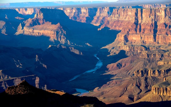
Arizona’s World Heritage Site, The Grand Canyon, the one spot in the World everyone really needs to see because it is one of the World’s Seven Natural Wonders. It stands out as the number one tourist stop of the American South West attracting up to five million visitors each year. Ninety percent visit the Canyon’s South Rim, others drive to the North Rim and a growing amount of the Las Vegas traffic is crowding onto the Haulapai West Rim, featuring “the SkyWalk” the Tribe’s key piece of a larger tourism development the tribe plans to build along their canyon’s rim, cashing in on the world attraction. Air traffic visiting the Grand Canyon must fall into “air corridors” and fly a counter-clock wise tour of specific features finishing spinning out of the washing machine tour, which is filled with as much air traffic, as most large municipal airports handling hundreds of flights daily. On the canyon’s East Rim at the confluence of the Little Colorado River and the Colorado, the place of emergence for the people of many southwest Indian Tribes, Navajo Tribal members debate over building a tramway to their planned riverside restaurant allowing everyone to visit the inner canyon. Outside money wants to build a 2000 home development in Tusayan AZ, taping the region’s fragile water aquifer, and straining existing supplies. Every corner of the canyon has outside pressure that compromises the Canyon’s “Wilderness” status but for five decades pontoon rafts powered with gas motors have cruised right down the middle of the tall cliffs and those motors alone (and the U.S. Congress) have kept America’s most Iconic Wild Place, the Grand Canyon, from it’s richly deserved and needed “Wilderness” status. Without the motors, the almost 20,000 raft visitors on the Colorado would shrink to 8-9,000 and frankly, “that would be unAmerican and totally unsatisfactory”. Meanwhile, many of these
 pressures could be mitigated with a “Wilderness” status not to mention new pressures to open old uranium claims and at the same time open new sources of mine waste pollution to Canyon waterways, creeks and streams, some of which are already unsafe for drinking. More than a half million unstable mine tailing ponds, shafts stand ready to drain into western water tables, as well as the Colorado River, a water source for 28 million people scattered across deserts from Tucson to LA.
The Golden Goose fable of our youth preaches that ‘Greed loses all by striving all to gain’! How many times have you circled a South Rim pullout looking for a parking spot ? How many “hard metal” spills in to the Colorado River will be okay, until we realize we are poisoning ourselves ? If you build a 2200 home development next to the Grand Canyon, it just becomes a “big ditch”! There are a lot of reasons for the situations facing the Grand Canyon many sadly are special interests …. One very obvious special interest is that National Park Service funds generated by the wildly successful “Grand Canyon” is funneled off to less successful parks while its own needs suffer. Some Navajos argue jobs are more important than preserving the traditions and sacred lands of the Navajo. Others say without the customs, beliefs and land, nothing else matters. Mining in the region has a history of irresponsibility and negligence, there is more than one superfund cleanup sites looking for funding. The River Runners Assoc. points to a solar-powered boat motor being developed and so all this should fade if the motor sound and emissions disappear. Then there would be no obstacle to the needed “Wilderness” Status. For many years as Republican budgets have strangled NPS funds to repair and rebuild infrastructure often pushing arguments for privatizing Parks, “Coca Cola’s Grand Canyon”, is often suggested as where such actions would led.

 Motorist entering the Grand Canyon’s South Entrance is entering one of the NPS busiest gates any where in the United States, four lanes of traffic, bringing in annually 5-6,000 visitors daily. Today lane four is closed and traffic is backed up 13-15 cars deep in lanes one thru three, “Lane four was worn down to the bare dirt, it was really bad–they had to close it. “Just worn out”! Driving through the park the first signs you see ask the public not to approach wildlife or feed it, deer frequently graze on the roadsides and close contact with motorist is always possible. Almost two dozen deer were destroyed in Indian Gardens after becoming addicted to junk food and were slowly starving to death after campers had pampered the deer with handouts that destroyed their wild constitutions.

I pull into the Desert View Point, the first view of the Grand Canyon seen  by visitors arriving from the East Entrance Gate, making my way to the Lookout I start getting the idea English may not be the first language of
 choice, but the common denominator is the Grand Canyon, everyone wants to see it. Sunset is approaching and the building crowd is drifting toward the point jutting out from the South Rim’s iconic Historic Tower. As the sun lowers folks begin to debate whether this is the BEST viewpoint to photograph the Sunset, for many visiting the Grand Canyon is a once in a Lifetime happening, so photographers want to make the most of the moment.
  Tourist begin squeezing toward the furthest spot to get their iconic photo of their visit to the “big ditch” a photograph destined for a lifetime in a frame. Four English-speaking Ukrainian women take their turn when a
  Greek man pushes to the viewpoint moments before the sun sinks into the horizon. “We made it”, he proclaims spinning taking in the whole 360 degree panarama, he pulls out his five week old chichuaha pup and hoists the dog above his head giving Marianna the ultimate viewpoint. “She goes everywhere with me, he says I’ve been trying to get here since I was in the fifth grade, he whoops. “We made it” he repeats asking the Ukrainian women to take his picture passing his phone only to have it returned. Dead battery!
The Ukrainian women pull out their iphones and produce the needed pictures and exchanged email addresses. Then the Greek wants one more picture. Pushing Marianna to the women, he faces into the abyass, thrusts his arms into the air and throws his head back like in a rockyesque goal-line celebration or was it more like one does in the bow of a ship as it breaks through the waves and a great sensation of being alive washes over you! “Take the picture”, he asks realizing his lifetime goal. For many people a trip to the Grand Canyon is the trip of a lifetime.

As old as time itself the Grand Canyon has been loved and appreciated almost to death. Four and a half Million Tourists come each year to view the Canyon about the size of Delaware, 277 miles in length and averages about ten miles across. While the Grand Canyon is one of the biggest  money makers in the National Park portfolio, it was Jan Brewer,Governor of the State of Arizona who paid to keep the Canyon open when Republicans shut down the US Government. The tourist dollars fallout from a Canyon visit for the State of Arizona is enormous. It is so beneficial that places like Las Vegas, keeps trying to sell it as Nevada’s Grand Canyon, selling flights to the Canyon including flyovers and ground visits via buses or the popular Pink Jeep Tours. Not long ago I heard a NPR broadcaster speaking about Utah’s Grand Canyon and that I can sort of understand. Utah’s still sore because Arizona stole Monument Valley and could be looking for payback…

More than 30 Helicopter fly out of Grand Canyon Airport many more leave daily from Phoenix, Sedona, Flagstaff, Salt Lake and Las Vegas, Nevada. Some fly solo flight missions, others off load passengers for ground transport, while other packages include the Sky Walk or inner gorge visits.

For most Americans, visiting the Grand Canyon, is on their “Bucket List”. For some it is a once-in-a-lifetime experience, for many seeing all its grandeur, and how it is experienced, depends upon your abilities. For some hiking in, while others pullout hop along the rim, some raft through and other fly. Grand Canyon Airport daily handles the flight load of major cities airports, and built a new $9M 120′ flight tower for the only airport owned by the State of Arizona. In addition to the 300 flights originating at GCA daily, the tower sees incoming flights all day from Las Vegas, Sedona, Phoenix, Salt Lake, not to mention cross country jets. Like the two that collided over the Canyon June 30, 1956.
The 1956 Grand Canyon mid-air collision occurred at 10:30 am when a United Airlines Douglas DC-7 struck a Trans World Airlines Lockheed L-1049 Super Constellation over the within the boundaries of Grand Canyon National Park, resulting in the crash of both airliners. All 128 on board both flights perished. It was the first commercial airline crash to result in more than 100 deaths, and led to sweeping changes in the control of flights in the United States. The location of the crash has been designated a National Historic Landmark.

 Garrett Paulsen writes in the SWAviator.Com Blog NPS Special Flight Routes ….flying into the Grand Canyon still allows for sightseeing even though pilots “are operating within certain constraints”. “Flying in the Canyon is no longer a free-for-all”, Paulsen reports.
Then there are the money people ! The Grand Canyon when on hard times and Republican Administrations we have frequently heard the need for Corporate sponsors so America’s Coca Cola Company could have a chunk of the Canyon, placing their logo on signs and no doubt advertising, privatization is not too far off on that path. The Sierra Club recently proclaimed the Canyon “the most endangered park” due to wear and tear, new Uranium mine claims and needs for modernization for the safety of the millions who visit Arizona’s Grand Canyon. As I enter the popular SouthWest Park Entrance and flash my ID and fabulous Senior Park Pass, the friendly Ranger says this entrance sees between 5,000-6,000 people a day and is one of the busiest NPS gates in America. Lane Four was coned off and workmen were scrapping off the old roadway and were preparing to lay down a new surface.Cars begin to stack up ten-thirteen vehicles are politely waiting, after all, we are all on vacation.  I move on to the Canyon’s edge. “I’m on the edge of the World”, shrieks a eight year old, his arms spread as wings cast long shadows as the Canyon light moves lower in the West. As old as it is, fans and new technologies, still bring fresh perspectives to the timeless Grand Canyon. Selfies are what the Grand Canyon is all about. Gone are the days of everyone passing their phones or cameras so everyone had a view in their phone gallery.
  Today the “Selfie Sticks” and “Selfie Apps” which allow you to view your camera’s viewfinder in your phone’s monitor allowing for ease in composition, gone are the “Hail Mary” composition where you just pray you included everyone in the photograph. Couples now just hold out their camera or phone on a extension stick replace the middle man.
 Like Marianna and endless number of others had pleasant exchanges with people from all over the world in that simple moment when they turned to a strangers and universally ask them to make their picture, technology often loses the human part of life in its rush to make our world better.
 Whether you have seen the Grand Canyon from the North, East, West or South Rim, from a raft or kayak on the Colorado River or by sitting atop a mule or walking in to Indian Gardens or Phantom Ranch and climbing
 back out. Everyone enjoys the Canyon at their own pace, some never get enough, there is a large number of folks who walk from atop the South Rim down to Phantom Ranch, cross the Colorado River by bridge, climb up to the North Rim, turn around and go back to the South Rim in one day. Who does that ? A surprising enough number of people who love the challenges the Canyon throws at them and finds the challenge fills their inner soul as well as pushing their bodies to overcome natures obstacles. Rather than being punished on the trail-some want to experience the Canyon on the back of a mule and are willing to pay $550 for one or $960 for two to overnight at Phantom Ranch. But first, riders must be at least 4 feet 7 inches in height and must speak and understand English, must be in good physical condition, should not be afraid of heights or large animals, and cannot be pregnant. Finally must weigh less than $200 full dressed.

Mule rides from the South Rim can be reserved through: Xanterra Parks & Resorts. Call (303) 297-2757 or toll free (888) 297-2757
Xanterra Parks & Resorts, 6312 S Fiddlers Green Circle, Suite 600 N, Greenwood Village, CO 80111 Visit: www.grandcanyonlodges.com
For Day Before waiting list information, call (928) 638-2631 or contact the Bright Angel Lodge transportation desk inside the park.

“I have come here to see the Grand Canyon of Arizona, because in that canyon Arizona has a natural wonder, which, so far as I know, is in kind absolutely unparalleled throughout the rest of the world. I shall not attempt to describe it, because I cannot. I could not choose words that would convey or that could convey to any outsider what that canyon is. I want to ask you to do one thing in connection with it in your own interest and in the interest of the country–to keep this great wonder of nature as it now is. I was delighted to learn of the wisdom of the Santa Fe railroad people in deciding not to build their hotel on the brink of the canyon. I hope you will not have a building of any kind, not a summer cottage, a hotel or anything else to mar the wonderful grandeur, the sublimity, the loneliness and beauty of the canyon.
 El Tovar Grand Canyon first opened for service in 1905. The premier hotel and restaurant at the Grand Canyon was originally operated by the Fred
 Harvey company. The El Tovar is been the most sought after lodging for over 100 years. In 2005, the Park celebrated the 100th anniversary for this classic historic National Park lodge. It was originally built to accommodate those distinguished passengers who arrived on the Sante Fe Railway. You can make the El Tovar a part of your Grand Canyon vacation if you plan far enough in advance. If you desire to stay at the El Tovar, we recommend that you call Xanterra Parks and Resorts at 1-888-297-2757 at least 18 months in advance.
ABOUT XANTERRA PARKS & RESORTS Open all year, Xanterra South Rim, L.L.C. offers the largest provider of ”in-the-park lodging.” We are authorized by the National Park Service to provide many visitor services within the park: Six distinctive lodges – all lodges are within walking distance of the South Rim! All provide Fine and casual dining, retail shops in unique, historic buildings and the world famous Grand Canyon mule ride, as well as, motorcoach tours of the park.
 “THUNDER RIVER”, Arizona Senator Barry Goldwater once said was his favorite spot in all of Arizona. He was mesmerized by a river appearing wild in the wall of a rock cliff and watching it tumbled down the rock and create Deer Creek, a trusted water source.
 One late afternoon sitting alone at a random roadside pullout a car full of tourists pulled into the drive and out jumped one nice Asian lady who did a quick left to right scan with her video camera and jumped back into the crowded car and spun off. I figured she was the trip photographer and they were running late so she jumped out to record the vista and would share her video with her companions at trips end. It is also possible that some find one vista of the Grand Canyon looks a lot like the last, hopefully not! I would like to think others share my love for the beauty of the American SouthWest and no place is more iconic of America’s grandeur and exceptionalism and its beauty changes constantly with the light.
 Activist say the Grand Canyon is facing the most serious threat in its 95-year history. It would alter the natural beauty of the canyon and encroach on its borders. Secondly, a major housing and commercial development, jeopardizes the fragile ecology and water supply on the arid South Rim. The Tusayan development would add 2,200 homes and 3 million square feet of commercial space to a town two blocks long. Park officials say existing development around the park and the scarcity of water have already stressed the park’s ability to handle visitors and new projects will only make matters worse.
 LA Times reports water is already so precious in the park’s resident elk herd have figured how to operate the Grand Canyon’s new water faucets
![]()
 and began serving themselves. A young elk defending his water fountain began chasing away all who would drink. The park imports all water for its South Rim hotels, restaurants and amenities from springs on the north side of the canyon. An antiquated aluminum pipeline threads 13 miles though the serpentine fissures on the canyon floor, then up a mile of sheer rock on the South Rim. The pipeline regularly breaks down, requiring helicopters and burros to ferry crews at a cost of $25,000 per service call.
The park would like to replace the water system, but the price tag — as much as $150 million — is more than twice the yearly construction budget for all 400 parks in the National Park Service system.


Only the South Kaibab, Bright Angel, and North Kaibab Trails (known as the Corridor Trails) are maintained and patrolled on a regular basis. These three trails meet at the bottom near the only bridges that span the Colorado River. Together, they create a popular cross-canyon “corridor”. The Corridor Trails offer expansive views, reliable water sources, great camping, and the opportunity for hiking in and out on different trails. Backcountry rangers highly recommend this area, especially for your first Grand Canyon adventure.
Gary Olson recently made the hike into the depths of the Canyon from the South Rim to Phantom Ranch. “Yeah, it was my 14th time to the bottom, probably my last hiking it. Just too tough humping it out, although I did it in just under 6 hours, always a benchmark time for me. This trip was with 11 other members of the Southern Arizona Hiking Club, all but 3 of them older than me. I finished the trips in and out at least an hour and a half faster than many.”

“Last time I hiked the Canyon was at least 8 years ago. Few things change other than the trail and those hiking it. The South Kaibab Trail was in terrible shape, worst I’ve seen it. Huge holes from the mule hooves, which makes for awkward hiking at best and very tiring. One in our group misjudged a hole, tumbled on his face and had to turn back.”
“I passed a drover with his pack train going in and asked about his animals kicking holes in the trail. He said it was rain water causing the holes, which, of course, was bullshit. We discussed it some at the bottom. One contended the park service fills the holes twice a year and we were just early for the latest repair efforts. I don’t know about that, but the constant pressure from the animals certainly exacts a toll on the trail and the hikers for the sake of profits. The Bright Angel was much more user friendly as usual but very slushy the last half mile.”
“Everyone in our group remarked at the number of French people on the trail, noteworthy given recent events in Paris. Lots of Asians, and a good sprinkling of Middle Eastern-looking types.”
“Usual mix of Americans, just younger (or am I just older?). More teens than I’ve seen before, bopping along the trail with no packs and light to inadequate footwear, passing me like I was standing still; they seemed oblivious to the potential for problems. Even toddlers and babes in arms making their way down Bright Angel. I hiked out hopscotching with a group of 6 with a very talkative guide, who sounded like a blowhard from my knowledge about the Canyon. An old guy like me and 5 relatives from 20s to 40s. Strange thing was they were equally divided, half from Maine, half from Hawaii.” Gary Olson
For Info on Camping and Backpacking in the Grand Canyon…click here

HIKING THE GRAND CANYON BACKCOUNTRY …. CLICK HERE
Hikers can walk down the three most popular trails — Bright Angel and South Kaibab from the South Rim, and North Kaibab from the North Rim — as far as they’d like, although the National Park Service discourages trips to the Colorado River and back in a single day. Each of the three proposals for revising the backcountry management plan would institute a day-use permit for hiking more than 5 miles on those trails and at least a $5 fee. Park officials say it’s meant to cut down on overcrowding farther below and improve the experience for hikers. The park would reserve the right to limit group sizes and set daily caps.
The three options for backcountry management took years to develop.  Each has a different focus from balancing recreation with resource protection, to solitude to expanding recreation activities. Another option would leave things as is. The public has 90 days to comment. Park officials are trying to get a better handle on how many people head into the canyon and to the most primitive areas with recent proposals to manage the backcountry. They say the trails are too congested and hikers complain of noise, trash along the trailss and long lines for toilets. The park says it will be a year or more before a final decision is made.
For more information, go to www.parkplanning.nps.gov/grca
The park also wants to monitor relatively new activities like rim-to-rim excursions, canyoneering, climbing and short rafting trips on the Colorado River to get backpackers to the other side. The proposals aim to reduce conflicts among outdoor groups seeking the solitude of the backcountry and to ensure the park’s resources are protected. Between 30,000 and 35,000 people a year spend the night in the backcountry, according to park officials.

WHAT IS THE BACKCOUNTRY?
Anything below the rim of the Grand Canyon is considered the backcountry. Much of it has been managed as a wilderness area since 1980, which means motorized travel, power drilling to place bolts into rocks and helicopters largely are prohibited. The backcountry is divided into four zones that range from having developed campsites and lodging, water faucets and well-maintained trails to absolutely no amenities and only natural water sources. Overnight stays in the inner canyon require a backcountry permit.

Havasupai means people of the blue-green waters. The spectacular waterfalls and isolated community within the Havasupai Indian  Reservation attract thousands of visitors each year. The Havasupai are intimately connected to the water and the land. This blue- green water is sacred to the Havasupai. It flows not only across the land, but also through each tribal member. When you enter their land, you enter their home, their place of origin.
Frequently Asked Questions about the Grand Canyon…click here

Each year, over 20,000 visitors hike, ride horses, or fly by helicopter the last 8 miles into the canyon where the Havasupai Indians live. Tourists from around the world come to Havasupai to see this remote Indian village tucked away in the Grand Canyon, to see the last U.S. mail mule train in the country, to see the turquoise blue water and travertine pools of Cateract Creek, and to see the beauty of Navajo, Havasu and Mooney Waterfalls, and to camp, swim and play in this unbelievable setting. Visitors to Havasu Canyon assume all risks while in the canyon and should come prepared. Be aware! Havasu Canyon is a fragile environment and is subject to flash floods as are all canyons in the region.
LAS VEGAS GRAND CANYON TOURS….CLICK HERE
 Supai village, is located in Havasu Canyon, a large tributary on the south side of the Colorado River, is not accessible by road. The Havasupai Tribe administers the land, which lies outside the boundary and jurisdiction of Grand Canyon National Park. Approximate driving time from Grand Canyon Village (South Rim) is four hours. West from Williams on I-40 to Seligman, turn off on U.S. 66. Look for Indian Highway 18.

Please note, if you do not have a reservation, and just show up – you will be billed at twice the amount of the regular price. That’s $114 plus tax per person not $57. According to the tribal website the Havasupai Reservation is largely dependent on tourism as the primary revenue generator of the Havasupai Tribe and individual tribal members.Operation Supai began in 1995 when the Northern Arizona Marine Corps League requested a squadron to deliver goods to the Havasupai. HMM-764 was selected for the mission, and the squadron has delivered goods every year for 17 years to the tribe which consists of around 300 people. HMM-764 partners with the local Marine Toys for Tots program based in Flagstaff and St. Mary’s Food Bank every year to bring 150 bags of toys to over 100 children and 100 boxes of food and turkeys to the small, remote tribe. Their CH-46 helicopters allow them to deliver the goods down into the Grand Canyon where the Havasupai live. The Grand Canyon airport serves as a staging area to load goods and personnel and refuel the helicopters. The Havasupai Reservation is remotely near the southwest corner of the Grand Canyon National Park outside of the main park. The Havasupai Tribe is a primary source of employment for the Havasupai tribal members. Tourism provides revenues for the Havasupai Reservation and the Havasupai Tribe is actively engaged in the tourism business.The Havasupai has four tribal enterprises: Havasupai Tourism, the 24-room Havasupai Lodg, Havasupai Cafe, and Havasupai Trading Post. The four tribal enterprises are primary generators of revenue for the Havasupai Tribe and its members. Contact Information: Tel: 928 448 2111 or 928 448 2201 Email: lodge@havasupai-nsn-gov The Tourism Office (the Camping Office) is the point of contact for all reservations except for the Lodge. You must call the lodge directly to make a reservation or inquiry about a room.
Example Camping Fees: Note these charges double if you don’t have a reservation…For Party of 4: 2 adults, 2 children ages 14 & 10 Hiking in and camping for 2 nights
|
QTY
|
DESCRIPTION
|
AMOUNT
|
TOTAL
|
|
4
|
Entrance Fees
|
$35.00
|
$140.00
|
|
8
|
Per night Camping Fees
|
$17.00
|
$136.00
|
|
4
|
Environmental Fees
|
$5.00
|
20.00
|
|
Subtotal
|
$296
|
||
|
10% Tax
|
$29.60
|
||
|
Total
|
$325.60
|
“We have no reservation but here we are anyways “ Camping Fees are doubled ! $651.20 now not $325.60 !
For camping reservations, please call:1-928-448-2141 or 1-928-448-2121 or 1-928-448-2174 or or 1-928-448-2180 If lines are busy, keep trying! They try to answer all calls. The Camp office needs to know your Desired dates and Number of people in your party and Number of nights of camping (This is NOT an overnight adventure 3 days is best…)


The Grand Canyon Skywalk is located, not in Grand Canyon National Park, but at Grand Canyon West, on the Hualapai Indian Reservation, approximately halfway between Las Vegas and Grand Canyon’s South Rim. It is a three-hour drive from Las Vegas by way of Hoover Dam, a six-hour drive from Phoenix through Wickenburg and Kingman, or a five-hour drive from the Grand Canyon’s South Rim. The other side of the canyon can be seen three miles away. The Skywalk is not directly above the main canyon, or Granite Gorge, which contains the Colorado River. Rather, it instead extends out over a side canyon. No more than 120 persons are permitted on the structure at one time, cameras, cellphones and all personal belongings must be checked and everyone’s shoes are covered with cloth booties to avoid scuffing the glass view of the canyon.

Don Havatone, of the Hualapai tribe, watches the rollout of the Skywalk on the Hualapai Indian Reservation at Grand Canyon West, Ariz., Wednesday, March 7, 2007. The tribe will open it to the public later this month, charging $25 per person in addition to other entry fees. Organizers expect the Skywalk to become the main draw in a community of tribal attractions that includes a cowboy town, an Indian village, helicopter tours and Hummer rides through the outback. (AP Photo/Ross D. Franklin)

Former astronaut Buzz Aldrin and his wife Lois, waves to the crowd after making the ceremonial first walk Tuesday afternoon, March, 20, 2007, on the glass-bottomed Grand Canyon Skywalk located at Grand Canyon West’s Eagle Point in Arizona. Indian leaders, former astronauts and other visitors stepped gingerly beyond the Grand Canyon’s rim Tuesday, staring through a glass floor and into the 4,000-foot chasm below during the opening ceremony for a new observation deck. (AP Photo/The Arizona Republic, Rob Schumacher) ** MARICOPA COUNTY OUT, MESA TRIBUNE OUT, MAGS OUT, NO SALES **

Tourists walk on the glass-bottomed Skywalk that extends 70 feet over the edge of Grand Canyon West’s Eagle Point, Wednesday, March 28, 2007, in northwestern Arizona. The Grand Canyon Skywalk opened to the general public on the Hualapai Indian Reservation. (AP Photo/The Arizona Republic, Rob Schumacher) ** MARICOPA COUNTY OUT, MESA TRIBUNE OUT, MAGS OUT, NO SALES **
Famed astronaut, Buzz Aldrin, the Apollo lunar explorer lead the first walkers onto the Grand Canyon Glass Skywalk in a private ceremony on March 20, 2007. The Skywalk is the cornerstone of a larger plan by the Hualapai tribe, which hopes the structure will be the catalyst for a 9,000-acre development called Grand Canyon West. Future plans call for a museum, movie theater, VIP lounge, gift shop, restaurants and a golf course. There are plans for a high-end restaurant called The Skywalk Café, where visitors will be able to dine outdoors at the canyon rim. There would be cable cars to ferry visitors from the canyon rim to the Colorado River, which has been previously inaccessible, except by helicopter.
The SKYWALK Legacy Gold Package Includes:
– Entrance Fee to the Hualapai Tribal Lands
– Skywalk ticket to walk on the glass bridge over the Grand Canyon.
– Meal at viewpoint of your choice.
– Photo opportunities with Hualapai Members
– Hop-on-Hop-off shuttle to all 3 viewpoints

Tourists walk on the glass-bottomed Skywalk that extends 70 feet over the edge of Grand Canyon West’s Eagle Point, Wednesday, March 28, 2007, in northwestern Arizona. The Grand Canyon Skywalk opened to the public on the Hualapai Indian Reservation. (Arizona Republic Rob Schumacher)
Gold Package
$80.94 Per Person: Be sure to allow 3 to 4 hours for your visit
Skywalk ticket to walk on the glass bridge over the Grand Canyon
Meal at viewpoint of your choice and photo ops with Hualapai Members
Hop-on-Hop-off Shuttle to All 3 Viewpoints: Eagle Point, Guano Point, Hualapai Ranch Visitors may purchase professional photographs of their visit to the Skywalk in the gift shop. Personal cameras -OR- Cell Phones are NOT allowed on the Skywalk itself; along with other personal property, all must be stored in a locker before entering the Skywalk. Grand Canyon West is located on the Hualapai’s Tribal lands, and the National Park Passes and other Entrance Fee’s DO NOT apply at Grand Canyon West. Info&Reser: 1-888-868-9378 Email:reservations@grandcanyonresort.com

Looking eastward from the popular South Rim, visitors could soon see a construction as workers build restaurants, hotels and shops on a distant mesa on the Navajo Indian reservation. The developers also plan a gondola ride from those attractions to whisk tourists to the canyon floor, where they would stroll along an elevated riverside walkway to a restaurant at the confluence of the Colorado and Little Colorado rivers.
The question before the Navajo Tribe being argued “Is it the best thing to do to sacrifice this nationally important, internationally important resource, the Grand Canyon, and the confluence of the Colorado and Little Colorado rivers in the name of economic development?” The confluence of the Colorado and Little Colorado River is a sacred place to many Navajo, to the Hopi, to the Zuni and to other tribes, and it’s an internationally important place as well.
“There should be some places that you just do not mine. Uranium is a special concern because it is both a toxic heavy metal and a source of radiation. I worry about uranium escaping into the local water, and about its effect on fish in the Colorado River at the bottom of the gorge, and on the bald eagles, California condors and bighorn sheep that depend on the Canyon’s seeps and springs. More than a third of the Canyon’s species would be affected if water quality suffered.”
— Steve Martin, former Grand Canyon National Park Superintendent
Permanently polluted land and water are a direct result of federal programs that encouraged uranium prospecting on public lands beginning in the 1950s. That mining and milling boom in the Four Corners area lasted for about three decades before going bust. When the bottom dropped out of the uranium market, the industry went belly-up, leaving thousands of poisonous surface sites and deadly groundwater plumes.
In 1979, an earthen dam breached, releasing 1,100 tons of radioactive mill wastes and 90 million gallons of contaminated water into a tributary of the Little Colorado River. In 1984, a flash flood washed tons of high-grade uranium ore from Hack Canyon Mine into Kanab Creek, which drains into Grand Canyon. Located within the Park’s south rim, the Orphan Mine continues to contaminate creeks, prompting the National Park Service to warn backpackers along the Tonto Trail not to use water from two drainages.

Today, the NPS advises against “drinking and bathing” in the Little Colorado River, Kanab Creek, and other Grand Canyon waters where “excessive radionuclides” have been found. Although it is difficult to attribute this contamination to any specific activity, there can be little doubt that the cumulative effects of mining, milling, and transporting radioactive materials are causing long-term, adverse effects on people, water and other resource values in the Grand Canyon region.
Beginning in 2006, the price for uranium began to rise. Thousands of new claims have been filed within watersheds that drain directly into Grand Canyon National Park and the Colorado River. A Canadian-owned company reopened the White Mesa Mill in Blanding, Utah, and began processing uranium for powering nuclear reactors in South Korea and France. Without requiring any revisions to outdated environmental assessments, the BLM automatically allowed the same company to begin opening mines that were abandoned by its previous owners in the 1980s.
“This is bad news for protecting Grand Canyon and tribal sacred sites,” said Roger Clark of the Grand Canyon Trust. “Over the last two decades, we’ve learned how uranium mining can pollute aquifers that feed canyon springs and Havasu Falls. But the Forest Service has ignored that information and failed to require Energy Fuels to take reasonable steps to prevent contamination of water, sacred sites and public lands.”
“This is bad news for protecting Grand Canyon and tribal sacred sites,” said Roger Clark of the Grand Canyon Trust. “Over the last two decades, we’ve learned how uranium mining can pollute aquifers that feed canyon springs and Havasu Falls. But the Forest Service has ignored that information and failed to require Energy Fuels to take reasonable steps to prevent contamination of water, sacred sites and public lands.”

The Forest Service first approved the Canyon mining plan in 1986, despite a challenge from the Havasupai tribe. Uranium prices plummeted shortly thereafter and the mine closed in 1990 before producing any uranium. The Forest Service allowed the Canyon Mine to reopen in 2012 without a plan update or environmental assessment to reflect the extensive changed circumstances since the original review and approval. These changes include the 2010 designation of the Red Butte traditional cultural property, reintroduction of the endangered California condor in the vicinity of the Canyon Mine, and the 2012 decision to ban new uranium mining across 1 million acres near the Grand Canyon.
“This uranium project could haunt the Grand Canyon region for decades to come,” said Katie Davis with the Center for Biological Diversity. “Uranium mining leaves a highly toxic legacy that endangers human health, wildlife and the streams and aquifers that feed the Grand Canyon. It’s disappointing to see the Forest Service prioritizing the extraction industry over the long-term protection of a place as iconic as the Grand Canyon.”
Geologists have warned that uranium mining could deplete and contaminate aquifers that discharge into Grand Canyon and that cleaning them up would be next to impossible. A 2010 U.S. Geological Survey study found elevated uranium levels in soil and water sources associated with past uranium mining.
This summer U.S. District Judge David Campbell denied a moritorium to halt uranium mining at the Canyon Uranium Mine. Only six miles from the Canyon’s south rim, The Havasupai Tribe and several conservation groups had challenged the U.S. Forest Service to reopen the mine without consulting with the Havasupai or completing an environmental review. Opponents fear the mine endangers wildlife, endangered species, Tribal Cultural values and the risk of toxic uranium waste contaminating the aquifers and streams in the Grand Canyon feeding the Colorado River.
“We will continue to fight to protect Grand Canyon, its waters and its watershed,” said Sandy Bahr, director of Sierra Club’s Grand Canyon Chapter. “The Forest Service should consider the harm this mine could cause to the groundwater and ultimately the waters in Grand Canyon National Park. We are extremely disappointed in the judge’s failure to recognize that.”

Leave it as it is. Man cannot improve on it; not a bit. The ages have been at work on it and man can only mar it. What you can do is to keep it for your children and your children’s children and for all who come after you, as one of the great sights which every American, if he can travel at all, should see. “Keep the Grand Canyon of Arizona as it is!” concluded President Teddy Roosevelt during his first visit to Arizona on Wednesday, May 6, 1903, 112 years ago…
GRAND CANYON ITALIAN SOUTH ENTRANCE DEVELOPMENT ON HOLD FOR NOW
SIGN THE PETITION FOR OBAMA TO CREATE A GRAND CANYON MONUMENT
SIGN PETITION TO STOP GRAND CANYON PROJECTS
GOPRO VIEW OF GRAND CANYON SKYWALK…A HUNDRED DOLLAR VALUE
WALL STREET JOURNAL … A SELF GUIDED RAFT TRIP THROUGH THE GRAND CANYON
LINE UP YOUR GRAND CANYON AIR TOUR…
VISIT THE SOUTH RIM OF THE GRAND CANYON
VISIT THE NORTH RIM OF THE GRAND CANYON
VISIT THE EAST RIM OF THE GRAND CANYON
VISIT THE WEST RIM OF THE GRAND CANYON
MORE GRAND CANYON PHOTOS CLICK HERE FOR SOUTHWESTPHOTOBANK PHOTO GALLERY…..
![]()

<a href=” SPANISH TRANSLATIONS:">
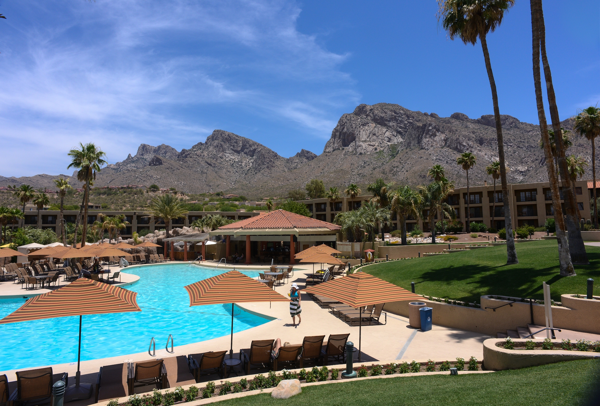
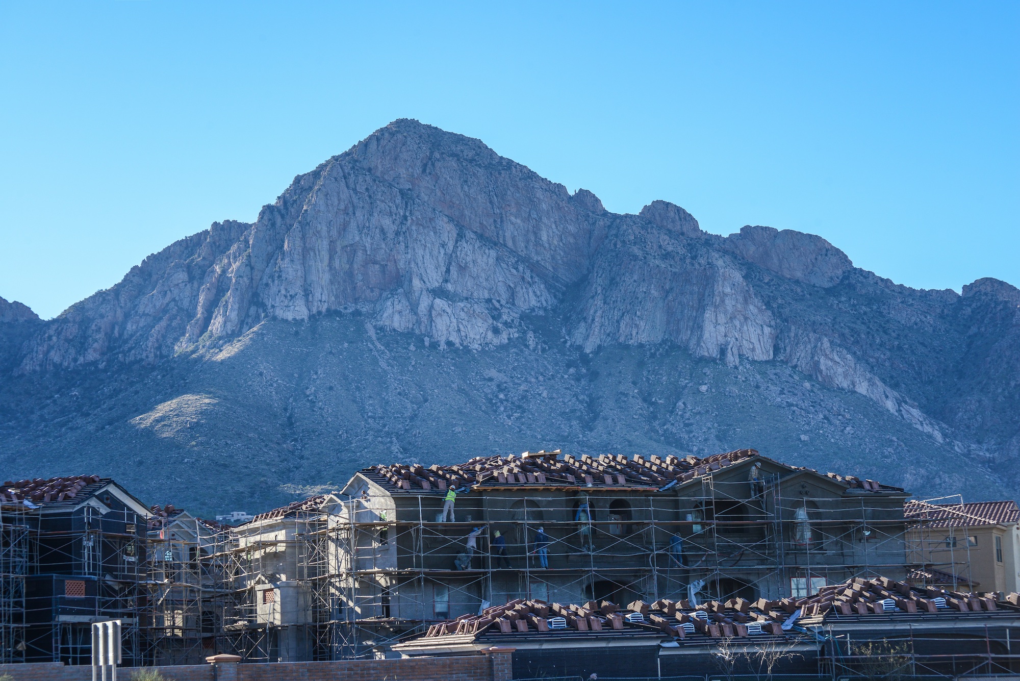
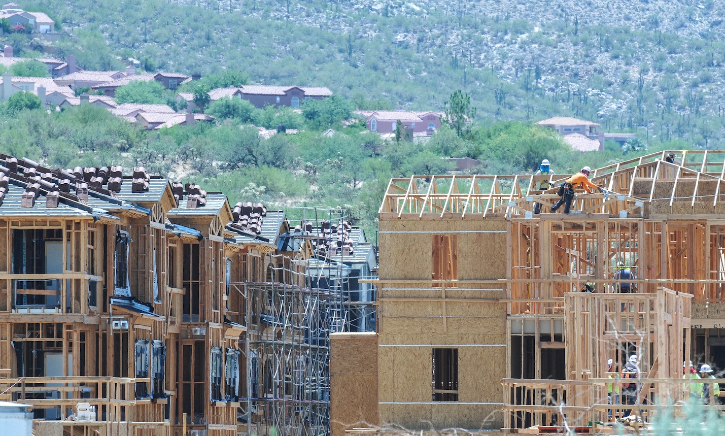
RAINBOW GOLD GROWTH ? ORO VALLEY AT THE TURNING POINT, SAVING THE SANTA CATALINA RANGE AND ORO VALLEY FROM ITSELF…


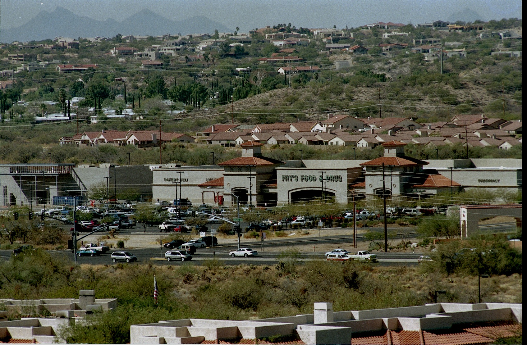
The Canon del Oro Valley is the gold at the end of the rainbow. The original Rancho Vistoso was a large Adobe ranch house located where the Walmart parking lot at Oro Valley’s Marketplace Plaza buzzes with activity as shoppers visit big box stores.
Life rarely gives us second-chances, but they do happen. Oro Valley Arizona has a second chance to decide what their Future should look like. Town residents have banded into two groups, recall elections are November 3rd, emotions have flared-assault charges and lawsuits filed and election signs vandalized and tossed into the bushes. The usual politics one finds in Small Town USA all over the country. Oro Valley’s problem: it’s one of the most beautiful places in the United States and finding the proper balance between preserving the Canon Del Oro Valley’s “Drop Dead Gorgeous” status and developing the town wanna be city so everybody is happy. Making everyone happy will be a tall order.

Walmart Shopping Center at MarketPlace

Same view as above 40 years earlier…
Mainly, because Oro Valley has become a developer’s paradise and any change there will be bumping heads with BIG bucks. Oracle Road, which is State Highway 77, which is the town’s main drag has been a 7 mile construction zone for so long know one can remember when it started. Much of this work is ramping up and adding another lane, taking two lanes to three, making room for future development. They are also building expensive wild life crossings, both over and under styles. In Colorado they have found predators just await their prey on the blind side of these crossings and just gobble till they are full. Speedtrap.org lists 80,000 bothersome speed revenue mills and knows Hwy 77.
Developers in Oro Valley in recent years, have squeezed in 800 apartments, providing housing for Iowa farmers who want to get out of the snow. Sun Dorado, the next generation of Mark-Taylor Apts, has the prime spot nestled into the Santa Catalina range at 1st Ave and Oracle Road, featuring the “largest health center you have ever seen in a apartment complex”, dog-friendly and walking access to all the unique shopping nearby. Mountain views cost extra, it’s cheaper to stare at Oro Valley and Oracle Rd, for a one bedroom it’s $930 with a view, large kitchen and a closet but a three bedroom with a view tops out around $1650-but up to six people can sign the lease. No one bedrooms available now, but some might open up.

That boutique shopping experience as you leave San Dorado’s lighted gated community begins with CVS Drugs; store number 10,006 now found on most corners near you, the next shop is a FIRM mattress shop and everyone needs one, the next is a Nail Spa, also found everywhere. So the question facing the voters, what premium do you place on living in one of the most beautiful places in the U.S., or is growth-any growth worthwhile ? Some voters might argue that building all those apartments at the junction of lst Ave and Oracle Road and providing pads for businesses found on most every street corner in Tucson on a spot which was the community’s focal point of the Catalina Mountains might have been insensitive and might better have been a green space for the community to feed their souls and revel in the beauty that GOD has provided. That would not have made someone rich but it would have made the community richer.


Catalina Arizona sits next to Oracle Road north of Sun CityRancho Vistoso just south of the Pima-Pinal County Line…in the distance stands the Santa Catalina Mountains
Oro Valley has some nice green spaces, along the (dry) riverbed–Steam Pump Ranch was a nice idea until it was squeezed in by gas stations and commercials strip malls, something was lost. Lunching on day at the amazing Saguaro Cafe in Oro Valley my dog engaged me in a conversation with two realtors who suggested Oro Valley’s real prosperity will come from commercial development along Tangerine Road. “It will be the next Speedway”, they agreed since it is a major I-10 to Oro Valley corridor.

Oro Valley No vote Council members meet with residents explaining how “dirty” actions from the Mayor and the other YES votes for the new City of Oro Valley Recreation Center compromised their vote with a rushed agenda. Councilman Mike Zinkin in the foreground, Councilen William Garner in RED, and Brendan Burns in blue behind.

Oro Valley residents listen to Councilmen opposed to the purchase of the Old Conquistador Country Club also stressed concerns about Golf dying as a business, water woes. In Phoenix several golf course are rebranding their communities, they are tearing out the fairways and adding boulevards. An uncertain future shadowed these concerns…
Now Oro Valley has a second chance to make the right decisions. It is my opinion the present mayor, will continue to fuel development since a large portion of his election campaign has been financed by the folks doing the building, that’s the way politics works. Mayor Satish Hiremath is running to hold onto his office in the Nov. 3 recall election along with town council members Lou Waters, Joe Hornat and Mary Snider. The recall was initiated by the Oro Valley Citizens for Open Government after the Town Council voted 4-3 in December to buy El Conquistador Country Club and increase the town’s sales tax to raise money to remodel the facility into a community and recreation center. The council members facing recall all voted in favor of the proposal. The facility was purchased for $1 million and includes 324 acres, 45 holes of golf, 31 tennis courts and two swimming pools. A 31,475 square-foot building that requires renovation will be paid for with a half cent sales tax that took effect in March.

Rancho Vistoso in 1975 today its someone’s front yard in the HoneyBee Reserve gated community…
Oro Valley was incorporated in 1974 and has grown from a shady Oasis to one of the more prosperous communities in Arizona with almost 130,000 people within seven miles, incomes averaging around $70,000, it has been voted Best Place to Raise Kids, Good Place to Retire because of the strong property values and low crime. Truth is, Oro Valley and the Tortolita Mts

Arizona Governor Bruce Babbit turns over the soil dedicating Catalina State Park and at the same moment he opens Rancho Vistoso Sun City for business.
for decades was everyone’s backyard. Quail Hunters reveled in the explosion of birds they found there, javalina hunters still tell tales of the hunt and folks like me, explored and hiked, searched for the wild herd of mustangs running free in those hills. After the land swap, when Governor Bruce Babbitt, created Catalina State Park and in return made possible Rancho Vistoso Sun City, locked gates started appearing–pushing long-time Tortolita Mountain lovers from their haunts. Thinking maybe when they are through building, I thought, but that is when the gated communities started popping up, so for most of us, it was goodbye to the Tortolitas. Growth has continued unabated, in 2008 when housing all over the U.S. died. Oro Valley barely skipped a beat sales slowed and inventory faded but not like the rest of the country.
Cows on trust land equals tax break, the field feed the cows. A lean farm operation.
In the early 1970’s John Ratliff and his associates requested that Pima County rezone a 4,000-acre parcel of land lying east of Oracle Road, north of Tucson. The property known as Rancho Romero was located adjacent to the western slopes of the Coronado National Forest’s Santa Catalina Mountains. The proposed development included a variety of housing units that would accommodate 17,000 people, which would surround golf courses along the Canada de Oro and Sutherland Washes. When this rezoning request came before the Pima County Planning and Zoning Commission, there was so much opposition from the public that the proposed plan was put on hold. Tucson residents said they preferred the preservation of this area as open space, with developed recreational facilities, this was the beginning of Catalina State Park. But not the last attempt by developers to put subdivisions on the east side of Oracle Road.
Before Oro Valley, the grassy field is today’s Marketplace.
The Oro Valley Conquistador Hotel, the first construction on the east side of Oracle, has been on the auction block, off and on, last time was 2012. The 400 room structure began life as a Sheraton Hotel, then Hilton presently Premier Hospitality Management maintains the contract. Its restaurants were a big draw in the beginning but as growth came to Oro Valley more restaurants came in and greater variety made expensive Mexican food less interesting.

Desert Springs was one proposal recently turned down, Sabino Springs popped up in 1990 but developers will be back.


For me, the building East of Oracle Road is the most offensive. West of Oracle, growth will continue north until it hits Oracle Junction, nothing will change that. More than once, developers have attempted massive subdivisions featuring more than 500 homes, shops, condo and apartments east of Oracle Road where Tangerine Road intersects, Sabino Springs
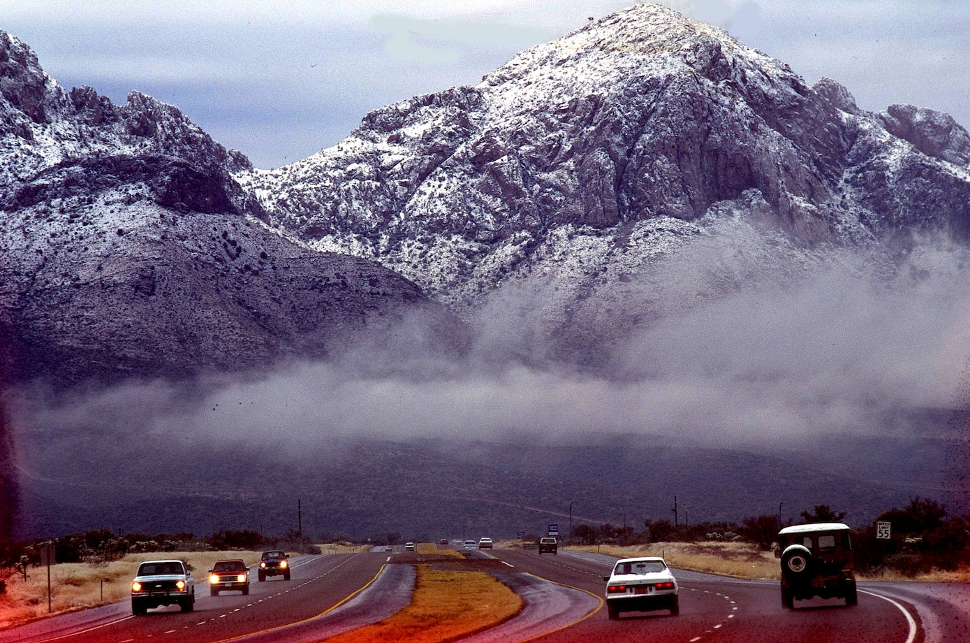
Oracle Road after a winter dusting of snow.
was one name, others will come and they will keep coming until they get their prize butted up against Catalina State Park. Folks will awake in the campground and stare into someone’s back yard. SunChase Holdings Inc. pledged “a high quality project” that would be tasteful and would fit in with the surroundings. Another attempt for this prize was fought off in 1990, with a progrowth Mayor, they will get the land and that will be the beginning of the end for the Catalina Mountain Range. Sunchase said they needed 85 acres with up to five homes per acre, 13 acre of five home per acre and up 11 acres of commercial and offices. In between they plan to weave hiking and biking trails, blending stores, offices and a mix of housing types. One caveat floated was the possibility of a Tram from Oro Valley to Mt Lemmon, making Oro Valley a must stop for all tourist blowing through Tucson. Much shorter ride than when it was first suggested from downtown Tucson decades ago.
Oro Valley’s First Avenue and Oracle Road has become downtown for the community…
With the new animal crossings on Oracle Road, any concern about “wildlife corridor” between the Catalina and the Tortolita Mountains pretty much go out the window, regardless of major habitat fragmentation.  A short while ago I listen to an Oro Valley resident wish she was living in SaddleBrook just up the road. She was simply amazed by all the wildlife those residents enjoy. After the bright lights of Oro Valley chased off the last of the Desert Bighorn living atop Pusch Ridge-the town adopted the Bighorn as a symbol of the community erecting several life-sized statues throughout the town. Today new bighorn have been transplanted atop the nearby ridge but disease and mountain lions have taken their toll.

Many years ago, I was out-raged by the wall built to block the view across the Canon Del Oro Wash that eliminates out the most perfect view of the mountains. I was sure they just wanted to be sure everyone had their eye on the road (now they are texting) but after while I realized how wrong I was. That wall is a sound barrier for all the expensive homes that soon will be built above the road level and on top of the first foothills, most money gets the highest spot. No one will pay big bucks for the spectacular sunset views if the road noise from below drowns out the elevator music.

Sound Wall for the big bucks lots yet to come.
It is all going to change soon, unless it is stopped now. The Town of Oro Valley Special Recall Election will be held Tuesday November 3, 2015. A polling place election, voters may request an early mail ballot, for more information call the Pima County Recorder 520-724-4330…

I began this blog pointing out that Oro Valley’s problem is that it is one of the most beautiful places in the United States. What I haven’t said is when folks finally end their long journey on I-10 and the Catalina’s finally come into view, there is a sigh, and I know I’m home again. We all take their beauty for granted but try to imagine that skyline without those hills and take stock in what we have and the responsibility to leave this beauty for the children, our future-what will Oro Valley look like tomorrow.
ORO VALLEY CITIZENS FOR OPEN GOVERNMENT
PIMA COUNTY RECORDER-REGISTERING TO VOTE
![]()
<a href=” SPANISH TRANSLATIONS:">
IN TOUCH WITH THE MIMBRES, MOGOLLON, SALADO PROBLEM IN MULE CREEK NEW MEXICO, SOUTHWEST ARCHAEOLOGY FIELD SCHOOL PROBES FOR ANSWERS


Using Stone Axes DIANA TREVIZO and ALEXANDRA NORWOOD try to scrape the bark from the roof poles for the 13th Century Pueblo they are building near Mule Creek, New Mexico. They are building a adobe pueblo at the same time they are digging one up near Cliff.
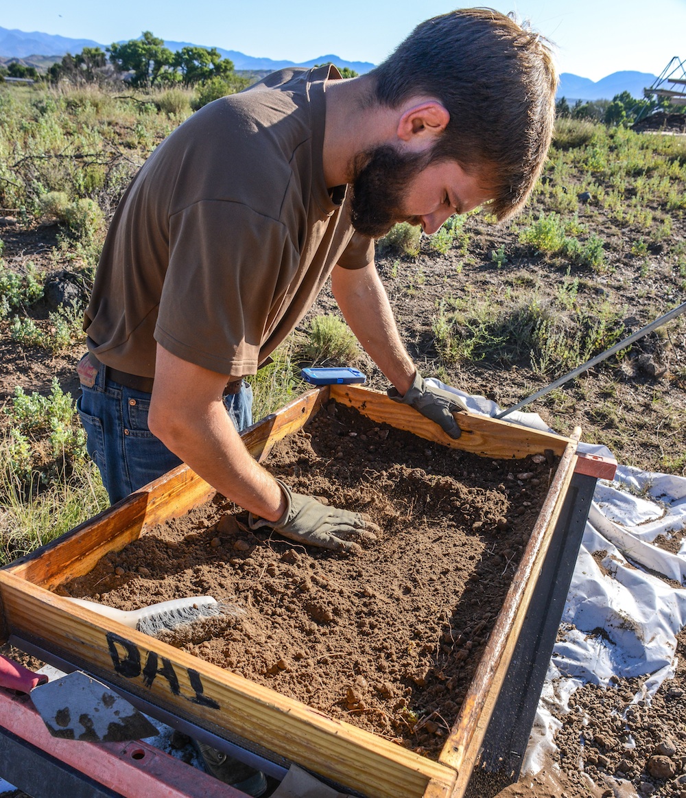
JOE HALL screens fill from a new room block using window screen for every fourth load. Lots of info can fall through the cracks, like fish bones, turquoise bead.
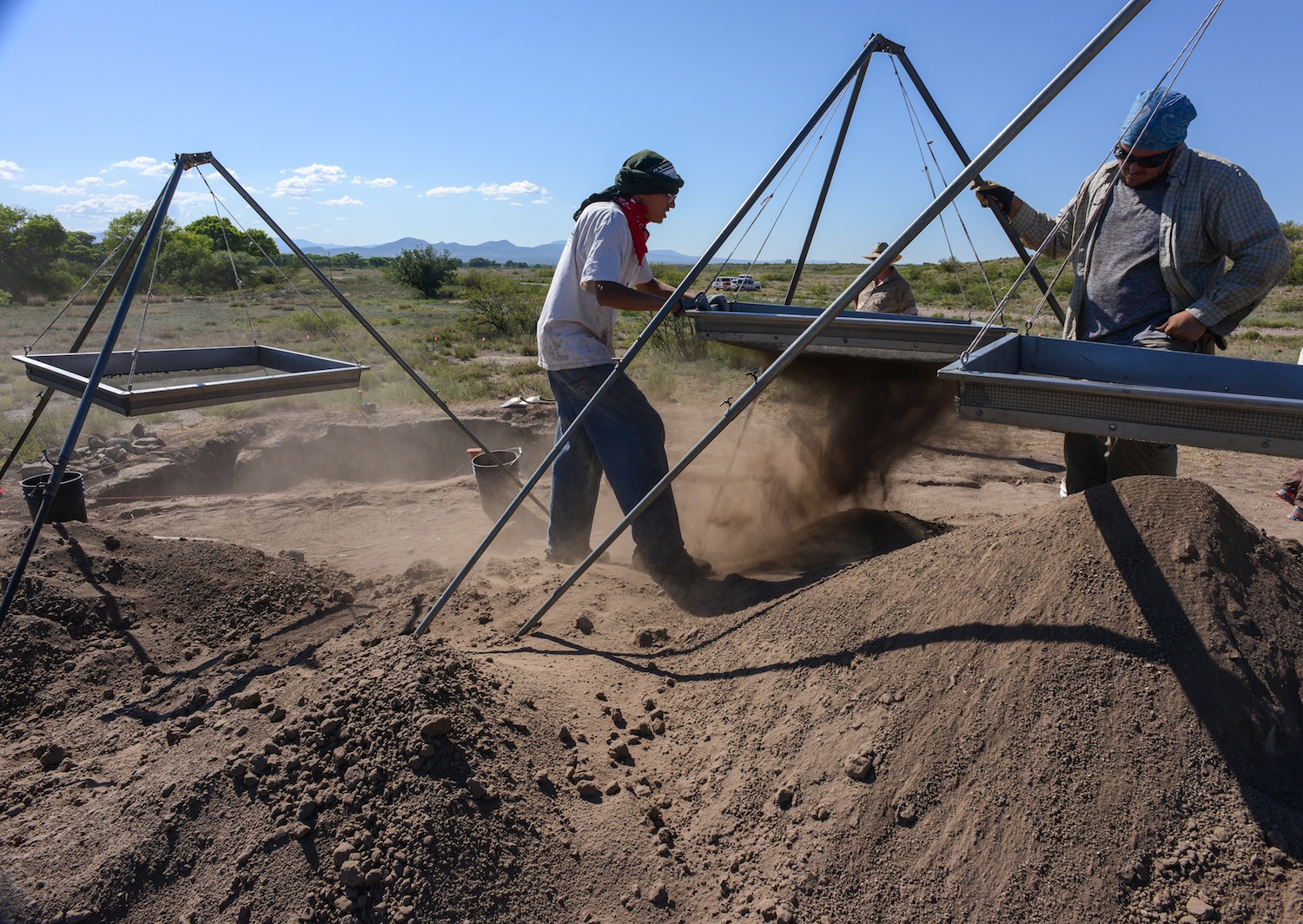
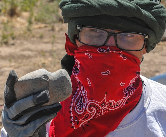
Students in the 40-day Preservation Archaeology Field School sift through fill from a prehistoric Pueblo called the Dinwiddie Site in east central New Mexico. Fourteen students, the best of the best, 4.0 students were turned away, each student chosen brought a special something to the school. Unlike the traditional Field School this curriculum highlights preservation archaeology, an experimental component has the students building an adobe pueblo like the one they are digging up. Students also compete throwing 4′ Atlatl darts.
The peopling of the South West is a story best told by pottery. Ceramic pottery can tell archaeologist what they ate, where it was made, who made it and with whom the owner traded or aligned with…in a sense what was important to that culture and how successful or influential the culture was, how long it survived, and finally where did they go. But until tree ring dates, the chronology of all the ruins of the southwest, was a mystery until one afternoon when two pieces of charcoal crystalized everything that was known about the prehistory of the South West. In the one hundred years since man began probing the earth beneath their feet looking for secrets from the past much has been learned revealing to archaeologist how little they know or understand about early residents. So new strategies have evolved aided by the quick fresh minds of the next generation of archaeologist, new software that peels back the past, reveals pigment lost by time, using the sum knowledge from the past to build on future studies by incorporating all the data from all the earlier digs, aided by data from neighboring or regional sites. But more importantly, these new-age archaeologist, are tearing down fences that have long existed in the Cliff Valley and getting a first hand look at the prehistoric cultures that once called southwestern New Mexico home.
ALEXANDRA BALLESTEROS

MONICA VEALE
The 2015 Preservation Archaeology Field School staff is a combination of a lot of talent from Archaeology Southwest, Desert Archaeology, ASU and University of Arizona to structure a learning experience for a group of fourteen students who signed up for this opportunity to learn the general field and team work and the lab techniques necessary to extract science and knowledge from the soil.
Students are exposed to the principles of preservation archaeology, acquire the basic skills of excavation and survey, develop working strategies and write notes and reports that apply the logic of archaeological thinking to fieldwork, laboratory analysis, and applying the data we gather to answering anthropological questions. Finally think critically of issues about archaeological ethics.
As prehistoric man moved about he enjoyed a nomadic lifestyle of visiting old haunts places where they might have dropped some seed but most usually had luck hunting or gathering seasonal fruit. As more migrants entered the area, the nomadic Mogollon hunter found himself being crowded out and his old haunts now taken by the Anasazi fleeing their homes south east of Mesa Verde and looking for places to farm and live in safety. Local nomads soon were forced to stay at home and watch the crops.
The Mogollon and the Anasazi Material Cultures merge and disappear as the two groups diverge. Some Archaeologist believe the Kayenta Anasazi was traveling light, carrying what they could, leaving most of their culture behind. The nomadic Mogollon become seditary farmers, adopting some of the practices of their new neighbors, and soon they look pretty much alike. Except for ceramics! Archaeologist believe the Kayenta maintained contact with folks back home, perhaps opening trade connections with folks back home but meanwhile looping in the new immigrants settlements and establishing a trade network. When the bottom dropped out of the Colorado Plateau and everyone started looking for someplace wetter, the Kayenta knew where to go and who to stay with. They thought!
Rough corrugated ceramic pots are a clay signature for the Kayenta Anasazi and corrugated pottery left a trail from the Arizona Strip with some eventually reaching the Rio Grande and more was found south into Arizona Rim Country, visiting Mogollon Pueblos like Kinishba, Grasshopper Pueblo, Point-of-Pines, Cline Terrace. The Kayenta would build fortified hilltops above the floodplain along the Gila and San Pedro Rivers. Many of these sites are linked by signal towers to quickly communicate up and down the stream. The black and white pottery found at Salado sites suggests to some Archaeologist that the Kayenta continued to trade north to south until the end. But then Salado appears and everything changes. Four different archaeologist saw “Salado” arrive in different areas of the South West, but Harold Galdwin of Gila Pueblo received the credit for defining the Salado Culture but 85 years later we still disagree on much.
Agreement seems to be centering on Salado as a religion characterized by a distinct polychrome pottery and adobe compounds. The Salado message centered on fertility and cooperation, instead of honoring elite rulers, and some archaeologist have called it the first feminist movement, because in the day it was believed women did the most potting of clay and saved the South West from self destructing by intervening and preaching peace and working together. Others say shaman wheeled great power by producing the Mimbres Pottery characterized by “kill holes” which released the soul of the potter from the pot after his death.
The pottery design adapted reflected Mesoamerican imagery and changed in time but
researchers believe folks began thinking of themselves as Hohokam Salado or Kayenta Salado.
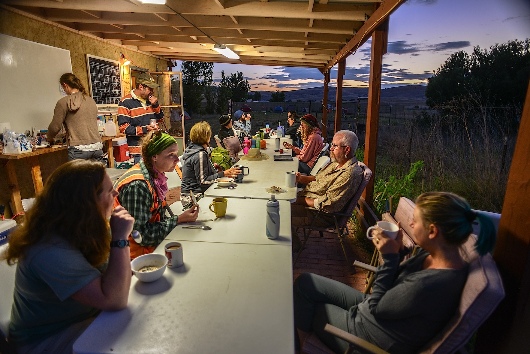
BREAKFAST can be the quiet time of the day as folks scurry around to make a lunch, finish breakfast and do the dishes and dash off for a full day in the sun.
The Archaeology Southwest Preservation Field School in it’s 5th season is an important component of our Upper Gila research, writes Karen Schollmeyer. “The results of this work contributes to Archaeology Southwest’s research on the formation and dissolution of late prehistoric communities. Dinwiddie’s occupation in the 1300s occurred during a period of substantial changes in the Southwest. Centuries earlier, large Classic Mimbres period villages were inhabited throughout the area. Around 1130, residents left these villages, and local populations remained small and scattered for the next 150-200 years. In the 1300s, large villages again began to form in the area. While people in the Upper Gila area were aggregated in large communities in the late 1300s, much of the rest of the southern Southwest was experiencing population decline. Our research examines the effects of the 14th century influx of residents to the Upper Gila. How did migrants from diverse cultural groups form cohesive villages? How did they structure social relationships with existing communities in their new home? How were social and natural resources affected by the long-term patterns of human population aggregation, dispersal, and re-aggregation? Our research at Dinwiddie will provide insights into these questions.”
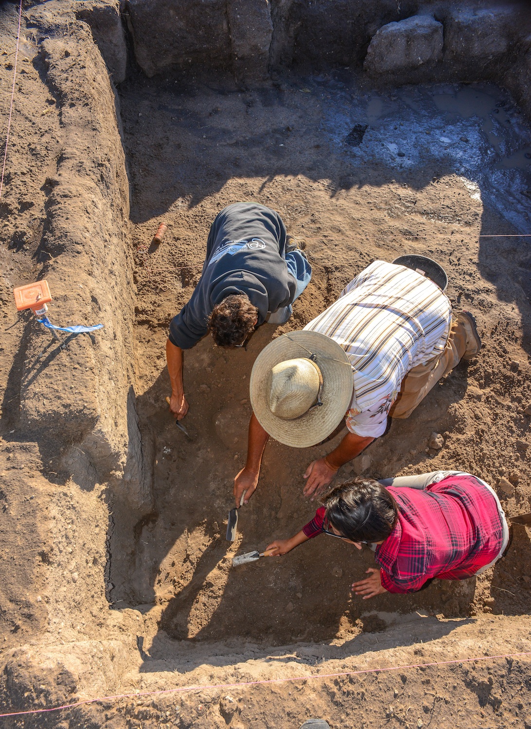
Archaeologist Will Russell from ASU works with Alexander Ballesteros and Alisha Stalley to get the knack of working with a trowel in an archaeological dig. The Dinwiddie site was dug
Will Russell, one of ASU’s ceramics experts, oversees the trowel work and lectures the students crawling in the dirt “to move
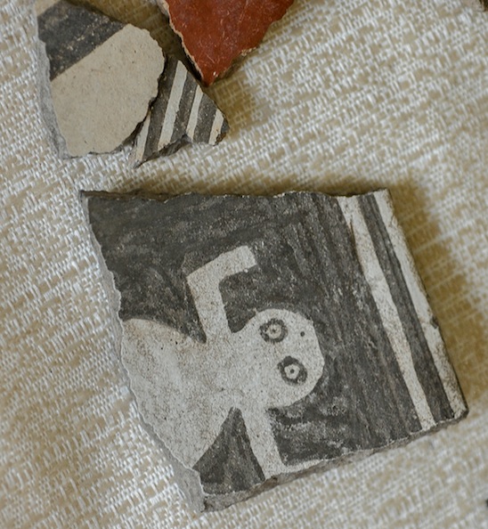
Negative Mimbres Pottery
from what you know to what you don’t”. Emphasizing the feel of the trowel and how it changes as it moves through the fill. “You can kinda feel these powdery, sugar forms on the floor, so you can see the visual clues…flecks of white (from the floor). You learn to read the vibrations he says. The trowel vibrates differently when hitting large particles and sounds differently–many different senses come in to play when excavating. Time is tight for the group they are half way through the 40 day class and they still have digging to do. Some of their time is filled with their preparation of displays for the community updates, reports, class trips to Silver City, the Gila Cliff Dwellings, Chaco Canyon, Acoma and the Zuni Pueblo. Screening is essential to separate the ceramics from the dirt and every fourth screen is window screen diameter to make sure nothing of importance is slipping through like the bones of fish and prairie dog which supplemented the prehistoric diet here in west central New Mexico.

A morning monsoon drizzle dampens breakfast as students prepare for a wet day in the field.
My first morning in Mule Creek where the field school is headquartered at the Rocker Diamond X Ranch there was a morning drizzle and students scurried around before sunrise eating breakfast, brushing teeth and making lunches and preparing for their day. Everyone has a job each day, each serves as a cog in the wheel and things happened smoothly until dinner when Mary shows up with dinner for the hungry staff, students and visitors. Students divide up into the field crews, survey and the experiemental crew who spend the day with archaeologist Allan Denoyer who is a master flintnapper and he and his crews are putting the finishing touches on a Salado Pueblo which they have constructed during the past field seasons. Denoyer has reverse engineered the adobe pueblos the field crews are excavating at the Dinwiddie Site with hopes the students will gain a greater insight into pueblos by building one as well as digging up what remains of numerous melted room blocks. Students learn to skin the timbers using stone axes and how to construct the roof. All knife work is from obsidian blades that slice as quick and accurately as steel.

Dinwiddie site under excavation near CLIFF New Mexico.
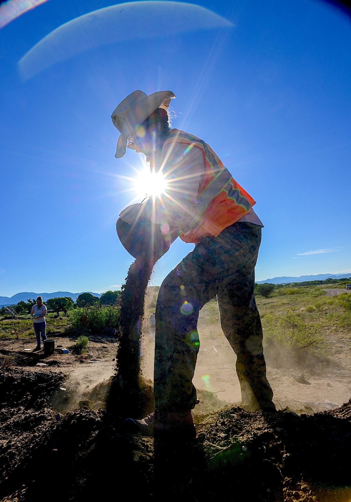
Field Supervisor LESLIE ARAGON pours off buckets of fill taken from the Dinwiddie Ruin dig. Three days will be spent back-filling the excavations with the soil they pain removed.
Students are responsible for blog posts, and displays for community outreach projects which hold public meetings in the region giving archaeologist the opportunity to explain to residents what they are looking for, what they found and often those exchanges open doors to archaeology not presently known and the field school survey crew go out looking for sites people tell them about. One student turned up a ten-room pueblo which was previously unrecorded. The survey crew often camps, to allow more boots on the ground than drive time. The easy duty appears to be the field work until you see there is no shade, students on their hands and knees with metal trowels pushing back the dirt from a solid polished adobe floor.

Ceramic marbles ? Fired in the flame and preserved but why ? Checkers, board games, marbles ?
For the past few days they have turned up almost 50 ceramic marbles of varying diameters and for whose purpose is unknown, today, they turned up a nice 3/4 groove axe head next to the unique t-shaped doorway recently unearthed. At room one, a cry alerts us, a metate and a mano, together, intact–beautifully preserved.

A vocational archaeologist working in the 1960s and 1970s and some early work contributed important information to our knowledge of Salado archaeology.  These excavations did not follow collection and reporting standards of their era, and information from these older excavations is now unavailable. Collections from these excavations were housed in private museums and everything disappeared upon their owners’ deaths, scattering collections so that they are no longer available for research. The Dinwiddie site saw several field seasons of avocational excavation, with 37 rooms in two room blocks partially excavated by Jack and Vera Mills (1972) they are thought to have taken more than a hundred pots from these rooms, some of those pots reside today in Safford, Arizona at the Museum for Eastern Arizona State.
Archaeology SouthWest’s interest in the Cliff Valley “Dinwiddie” site came as a part of the Upper Gila research, using the field school as an important component of the research, searching for the formation and dissolution of late prehistoric communities. Dinwiddie’s occupation in the 1300s came at a time of big changes in the Southwest. Centuries earlier, large Classic Mimbres period villages had inhabited throughout the area. Around 1130, those residents left these villages, and local populations remained small and scattered for the next 150-200 years. In the 1300s, large villages again began to form. People in the Upper Gila moved into large communities in the late 1300s, while much of the southern Southwest was experiencing population decline. Karen Gust Schollmeyer, believes the Dinwiddie dig will provide insights into the 14th century influx of residents to the Upper Gila. In 2008, Archaeology Southwest received a National Science Foundation grant to study the Salado phenomenon in the greater Upper Gila region of southwestern New Mexico, an area traditionally assigned to the Mogollon archaeological culture area

EXPERIMENTAL FIELD SUPERVISOR ALLAN DENOYER THROWS THE ATLATL DARTS AT A DEER TARGET
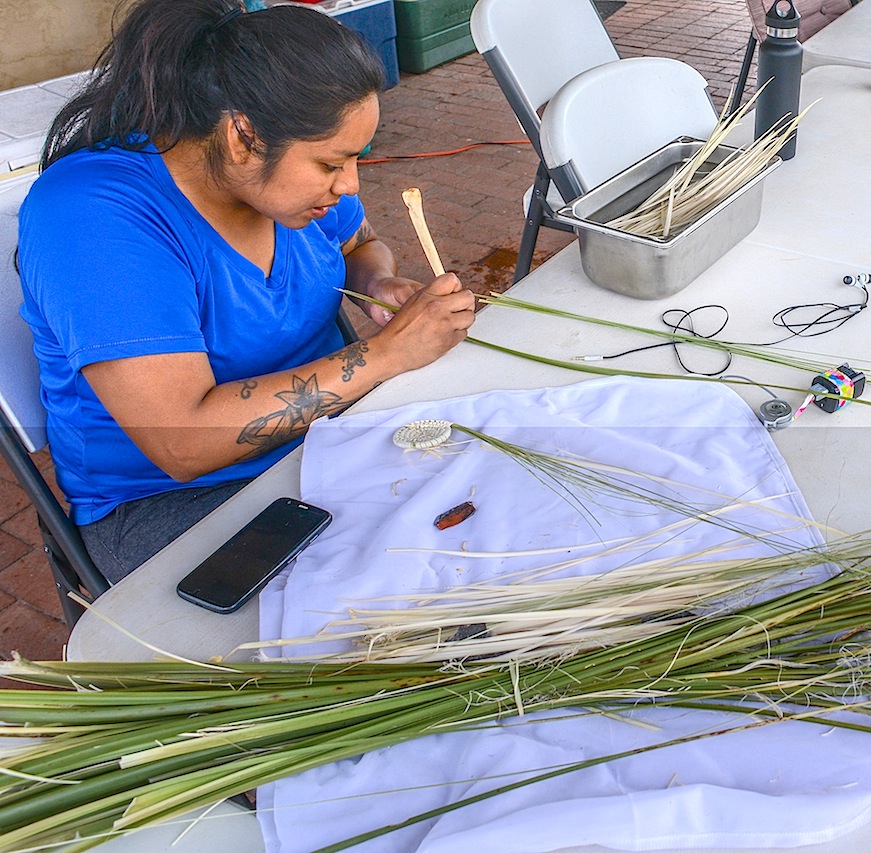
Marcy Pablo, a Tohono O’odham from Topawa prepares basket weaves for their “Community OutReach” Pablo intends to assist New Mexican residents to begin weaving their own basket using her starts. The School tries to lower barriers between locals and archaeologist by sharing their research with locals.

JOE HALL (Sierra Vista) and DEVINNE FACKELMAN (Allendale, Mich.) together dug up this Metate and Mano while searching for a wall.
“The Archaeology Southwest Field School was a life changing experience. I learned more about the southwest in those 6 weeks than in my two and a half years prior exploring in Southeastern Arizona. I had just graduated from Cochise College with a degree in Anthropology and immediately attended the ASW Field School with no real experience in archaeology. I am so fortunate to be given such a great opportunity to learn. From the field trips to the guest lectures, there was never a dull moment around the camp. Even in our down time we used the skills we had learned from experimental archaeology and our guests to do assorted crafts. The research the group of students accomplished was also inspiring, and attention grabbing. Post-field school I am more interested in Archaeology than ever. I plan to use my Non-Profit Leadership and Management degree at Arizona State University to get myself and others involved in the Archaeology field.”..Joe Hall

This Pueblo erected with the energy of field school students but with the same technology that the Mogollon used.
Field school students had some unstructured time in the evenings. But most worked on their field reports, blogs and burning designs

Archaeozoology – The study of animal remains, usually bones, from the past. Alexandra Norwood (Pasadena, CA) enjoys the final product.
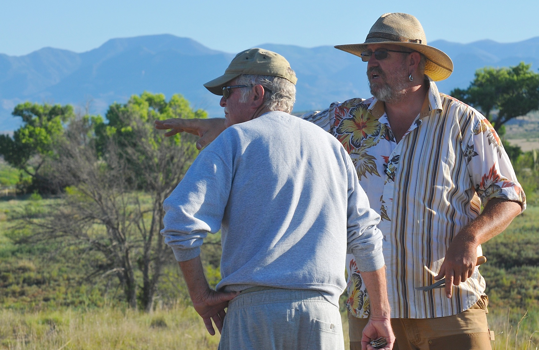
Field Supervisor Will Russell (ASU) fields questions from Bill Jamison, a Duck Creek resident for the past forty years. Jamison mentioned about 10 years ago, a burial fell into the creek.
The next morning at the Dinwiddie Dig a 40 year resident of the Duck Creek Community dropped by to visit the site and Will Russell was able to share with Bill Jamison the Field School’s focus and share with him some of what had been found. Jamison pointed out for a decade a burial eroded out of the river bank
and eventually was washed away. He did say a friend now living in San Diego had collected enough sherds to completely restore three pots and Russell asked him if photos were available or if they could be sent Another lead to another piece of the puzzle.

VICTORIA BOWLER shows ALEXANDAR BALLESTEROS how to throw ATLATL darts. Bowler works as an archaeologist and interpreter at Fort Bowie and Chiricahua National Monument and feels this field school will allow her to put these new ideas into practice.

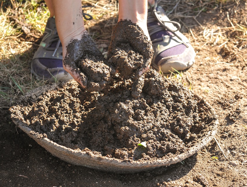
Mixture of water and mud

Flintknapper Allan Denoyear made these two points at the field school for his orientation discussion.

Allan Denoyer mixes adobe mud for the walls of the pueblo.

JODI REEVES-FLORES (ASU) adds a layer of mud to the walls of the adobe Pueblo.
Digital Antiquity is a nonprofit grassroots effort to get all Archaeological data archived by creating a multi-institutional, non-profit organization dedicated to overseeing the use, development, and maintenance of the Digital Archaeological Record (tDAR), an international repository for the digital records of archaeological investigations, organizations, projects, and research.

Students listen to a digital workshop produced by ASU’s Jodi Reeves-Flores on Digital Antiquity’s tDAR, an archaeological online data base where data input will be preserved, and reinterpreted as a piece of the whole.
One of Digital Antiquity’s key objectives is to foster the use of tDAR and ensure its financial, technical, and professional sustainability. Use of tDAR has the potential to transform archaeological research by providing direct access to digital data from current and historic investigations along with powerful tools to analyze and reuse it.
Digital Antiquity was created through the collaboration of archaeologists, library scientists, and administrators from the Archaeology Data Service, the University of Arkansas, Arizona State University, the Pennsylvania State University, the SRI Foundation, and Washington State University.
By enhancing preservation of and access to digital archaeological records, the mission of Digital Antiquity to permit researchers to more effectively create and communicate knowledge of the long-term human past; enhance the management, interpretation, and preservation of archaeological resources; and provide for the long-term preservation of irreplaceable records
Using Decorrelation Stretch to Enhance Rock Art Images
By Jon Harman, Ph.D. (dstretch@prodigy.net) Web site: http://www.DStretch.com
Decorrelation stretch, an image enhancement technique first used in remote sensing, can be usefully applied to rock art. In pictograph images from Baja California, Utah and Arizona I demonstrate its ability to bring out elements nearly invisible to the eye and to improve visualization of difficult sites. A decorrelation stretch plugin to the imaging program ImageJ is available from the author, free for personal use. It’s free but suggested contribution is $50. You can make a contribution via PayPal. My account is JonHarman “at” prodigy.net, if you want to send a check you will find his address on the email he sends back.

Lizard shaped pictograph in a cave near Mulege BAJA Sur…. This rock art is made with paints perhaps from crushed rock with iron.
Decorrelation stretch was developed at JPL and it has been used in remote sensing to enhance multispectral images. NASA used it to enhance Mars Rover images. DStretch has become a very useful tool for archaeologists

Filtered photograph of Lizard now only shows a hand print which was made by an artist filling his mouth with paint and blowing it through a reed toward his hand on the rock.
involved in the study and documentation of rock art. Its enhancement techniques can bring out very faint pictographs almost invisible to the eye. Subtle differences in hue are enhanced to puzzle out faint elements. Use of DStretch is simple as just hitting a button, but it also contains sophisticated tools for the manipulation of false color images. Because the enhancement works by increasing differences in hue, the technique gives better results for pictographs than petroglyphs.
The technique applies a Karhunen-Loeve transform to the colors of the image. This diagonalizes the covariance (or optionally the correlation) matrix of the colors. Next the contrast for each color is stretched to equalize the color variances. At this point the colors are uncorrelated and fill the colorspace. Finally the inverse transform is used to map the colors back to an approximation of the original. DStretch supports several different colorspaces, the image is converted from RGB to the colorspace, the calculation and transformation is performed, and then the colors are converted back to RGB before writing into a digital image.

Cave in Northern Baja along Highway One
The most common color found in pictographs is red, followed by black, then white, then rarely other hues. Often the rock shelter or cave wall is reddish or blackened. There are common types in the color distributions of pictograph images and this causes a consistency in the decorrelation stretch enhancements. DStretch works well to enhance red pigment but suppresses white and blacks. By bringing out the red painting and suppressing the background shades it can help clarify image composition.
DStretch is a plugin to ImageJ which is a full-featured imaging program. It is written in Java and can run on PC’s, Mac’s and Linux computers. When the button is pressed the plugin calculates the covariance matrix of the image colors (within the chosen colorspace) and then determines the transformation. Different decorrelation results are possible by selecting different parts of the image.
Different colorspaces give different results. DStretch has implemented the algorithm in the standard RGB and LAB colorspaces and also in the colorspaces: YDS, YBR, YBK, LDS, LRE. These colorspaces are modifications of the YUV or LAB colorspaces that give good decorrelation stretch results on images of rock art. The YDS and LDS colorspaces are good for general enhancements and can bring out faint yellow pigments. YBR and espeically LRE enhance reds. YBK can help with black and blue pigments and also enhances yellows well. The user can design their own colorspaces using the YXX and LXX buttons. The enhanced image is false color, the color scan be radically different from the original. In Expert Mode DStretc has the ability to shift the hues in the enhanced image to increase contrast.
CLICK HERE FOR SLIDE SHOW OF ROCK ART USING FALSE COLOR TO PRODUCE ADDITIONAL DETAIL…
http://pkweis.photoshelter.com/gallery/ROCK-ART-FILTERS/G0000oUHzJSUXcUI
Each image enhances differently, depending on its own unique distribution of colors. Another useful enhancement technique, not related to decorrelation stretch, is the manipulation of the hue and saturation of the image. DStretch (in expert mode) can do hue histogram equalization and saturation stretching. DStretch also contains a tool that allows a region of the enhanced image to be isolated by hue and then added back to the original image. This can be used to isolate an enhanced element then return it to the original image.
http://pkweis.photoshelter.com/gallery/ROCK-ART-FILTERS/G0000oUHzJSUXcUI
3D Scanning: Cultural Heritage and the Arts
Using 3D or “White Light” Scanners can uncover details from the past and today there is no better way to record a complex object than with a high resolution 3D white light scanner. The fringe projection method used in 3D white light scanning make non-contact digitization of art and sculpture and historical artifacts possible. Direct comparisons can be made of dimension and shape. Structured light Scanning allows revisitation of any object over time, creation of databases, redrawings of cross sections and 3D volume calculations. Today 3D scan data has a growing value in archaeology, paleontology and cultural heritage, collection of 3D scan data provides a digital archival record allowing access in remote locations, and the ability to produce replicas useful for exhibits.
One strategy under consideration at the Preservation Field School is the possibility of being able to actually see the “fingerprints” of the potter in ceramics. If that study moves forward there is a hope that not only will archaeologists know where the “Ancient Ones” went, they may be able to follow the fingerprints of a single women walking across an prehistoric landscape to her final resting place.
Kristin Safi in this month’s Kiva Journal outlines his “least cost” migration routes from the San Juan region to the Rio Grande Pueblo area. In this study 1200 possible routes are identified but many overlap and others had more costly terrain boiling the study down to 30 routes but when known archaeological sites were factored in, five routes were identified as the probable exodus path taken by the Kayenta Anasazi as they left the Northeast Arizona. Three of the routes probably were used by the later migrations because closer Pueblos were filled up earlier by early migrations. As for the question, “Where did the Ancient Ones go!” Not only do we know where the Kayenta went, we know why. FEAR!
![]()
<a href=” SPANISH TRANSLATIONS:">
THE GREAT FORT APACHE HERITAGE CELEBRATION or NDEE LA ADE’/ GATHERING OF THE PEOPLE WHOSE YOUTH ARE KEEPING THEIR TRADITIONS ALIVE !

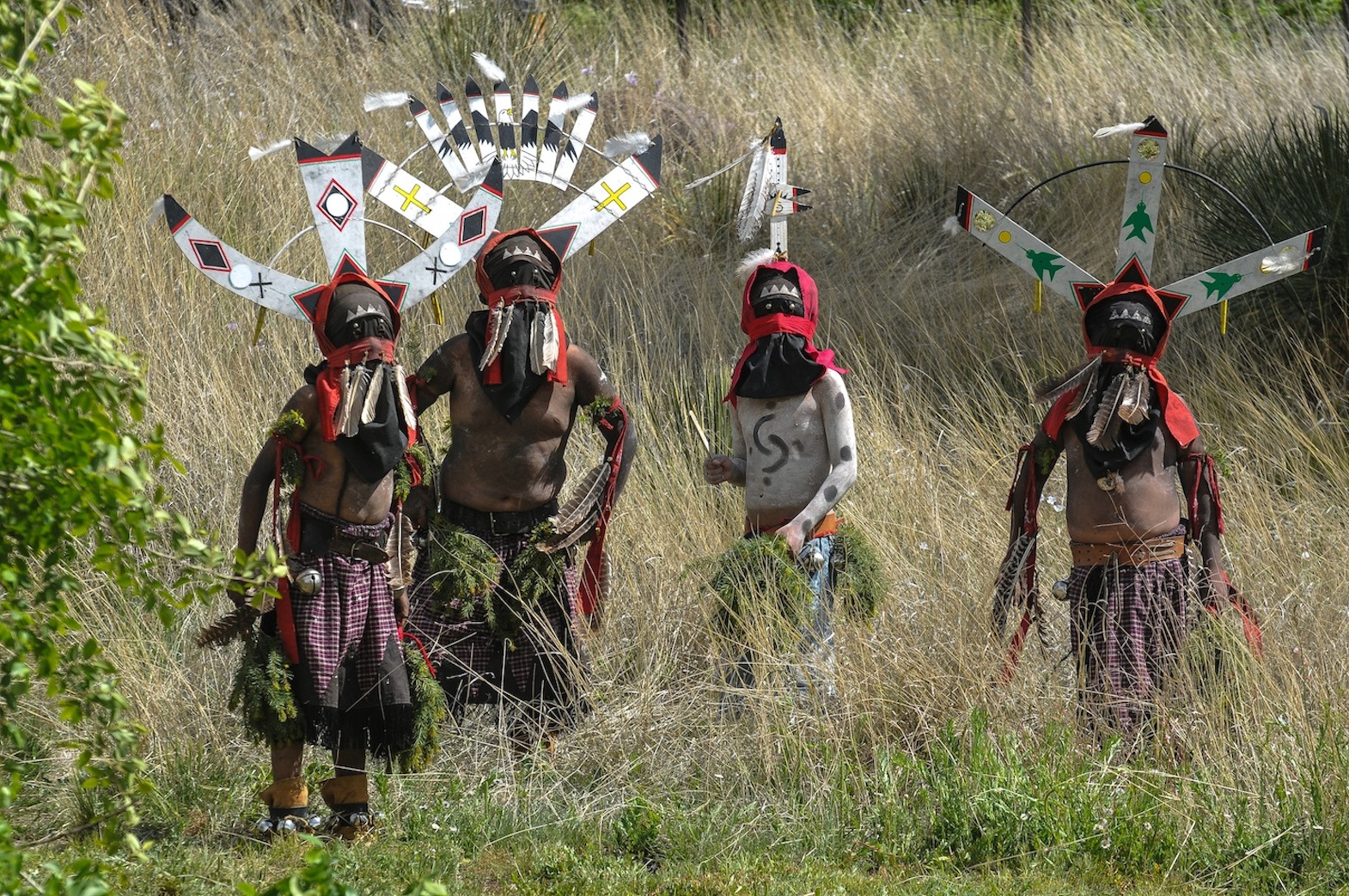
ROCK CREEK ELEMENTARY SCHOOL CROWN DANCERS WAIT A TURN IN THE DANCE ….

DANCERS JOIN IN THE GRAND PROCESSIONAL
The White Mountain Apache celebrates the Tribe’s Youth, it’s language and traditions through song and dance each year at the Great Fort Apache Heritage Celebration. It is a time of competition, Crown Dancers turn out to out dance other Mountain Spirit groups. Singers show up to entertain and to flaunt the Apache Spirit and Apache life ways. Participants may come from different districts, but they are all Apache. This Celebration each years serves as a reunion for former students of the Theodore Roosevelt BIA School, as well as, Apache from all directions. Holding onto the Apache customs, once taught from birth like language now competes with English and TV, and the Heritage Celebration highlight their traditions and celebrates the Apache Language. There is a flashing of colors as all participants of the Grand Processional join together on the dance floor. Earlier Apache children took a seven mile walk called the Seven Miles for Seven Generation Walk. “Youth keeping the future alive with traditions and culture” is the theme of the day meanwhile that night at the school they held a oldies dance for High School Alums that featured an Elvis look-a-like dance. The War Drum rang out from Fort Apache in the Arizona’s White Mountains as dancers took to the war path at the bidding of President Obama’s White House. The White Mountain Apache Tribe, (WMAT) accepted Obama’s Gen I initiative, the challenge is a Indigenous Youth Project designed to support cultural strategies to improve the college-and-career readiness of Native children or to preserve a culture”s traditions. A young WMA, Jared Ivins-Massey took that challenge, and brought the WAR dance to the iconic Fort this year. During the traditional building of furious resolve Warriors danced and thrust with traditional spears, others drew their bows with arrow, still another flaunted a hunting rifle, another still drew his large butcher knife leaving no doubt he stood ready to use it. These fierce warriors ranged from retirement to elementary school age and all welcomed the President’s initiative to focus on the lives of Native American youth and to restore the cultural rituals lost to Indian community in the early 1900s when the United States government banned Native American ceremonial dances. President Obama announced the Generation Indigenous (Gen-I) Initiative. Through this initiative Native youth are encouraged to conduct a positive event in their community that focuses on health and wellness, cultural preservation, and youth well being. Massey’s Gen-I event focused on the cultural preservation of the Apache language and traditions. For 75 years, many Native American ceremonial dances ceased and those that did manage to continue did so in secrecy. In 1978, when the American Indian Religious Freedom Act was passed, many ceremonies and healing rituals were re-established amongst the Tribes. Some think these rituals have lost meaning for the younger Indian generation and, they will never again be quite the same, but others are working to restore the rituals of the past.
 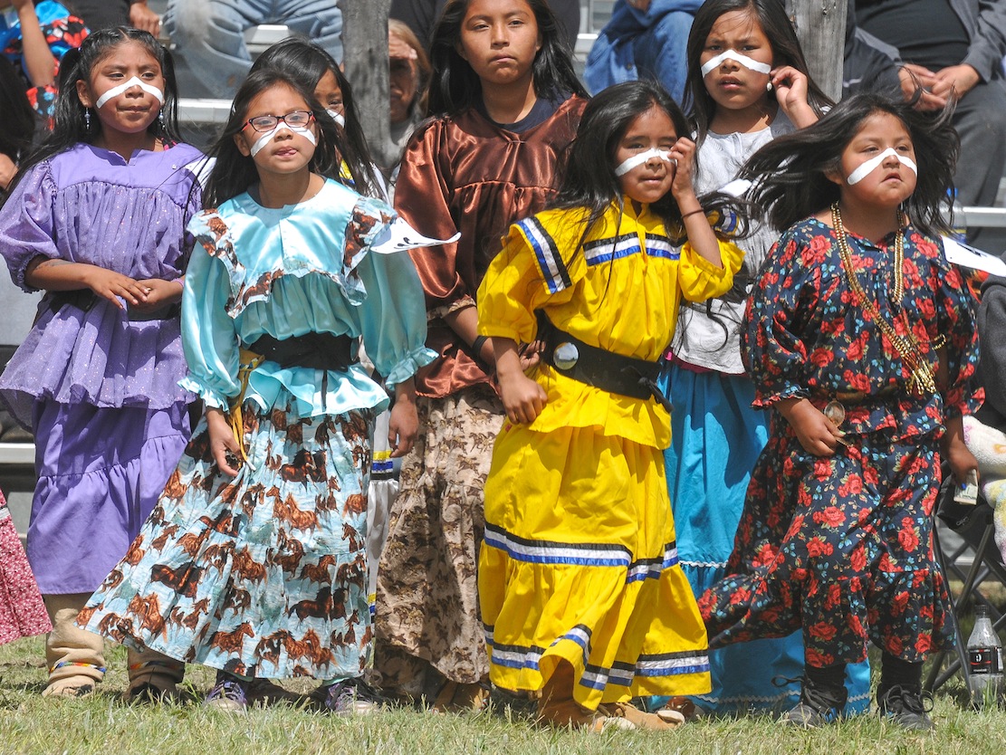 “The Great Fort Apache Heritage Celebration today provides an important opportunity for the White Mountain Apache community to come together to share the beauty and vitality of their Ndee heritage, and to shape a uniquely Apache present and future” writes Karl A. Hoerig, Ph.D. Director of Nohwike’ Bagowa Museum and Apache Cultural Center. Fort Apache for more than a century served as a military post and then as a boarding school for the White Mountain Apache Tribe. “The Theodore Roosevelt School National Historic Landmark campus was dedicated to the control of Apache people and the destruction of much of their heritage. Starting with the establishment of the first Apache Cultural Center at Fort Apache in 1969, and continuing with ever-expanding initiatives to re-establish the community’s sovereignty over the site–including this annual event–Fort Apache is becoming first and foremost an Apache place: a place for education, for the perpetuation of heritage, for economic development, for the community.”

WHITE MOUNTAIN APACHE RETURN TO THE WARPATH…
“This celebration is now truly by, for and of the White Mountain Apache Tribes citizenry” writes Jo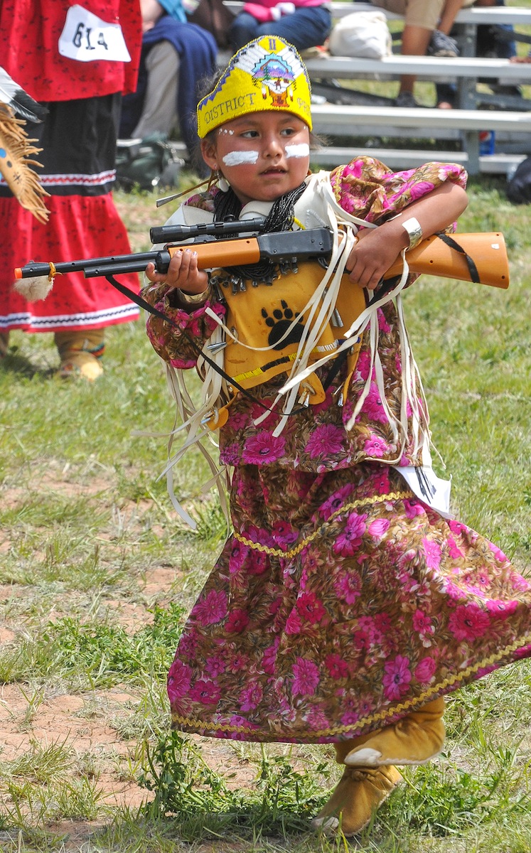 hn Welch, who produced the original 2001 event which has grown for the past 16 years into the event that now hosts Apache dance and singing each May when the tribe celebrates its annual gathering of the Apache People which now has grown into an “authentic expression of the communities interests and value.”
“Keeping the rituals of our ancestors alive”, say members of the Indian Club at Alchesay High School in Whiteriver. Their members who dance in the White Mountain Apache crown dance groups, find their roles “as Mountain Spirits who banish evil and bring good fortune”, culturally important. Some dancers come from Christian homes, go to church, and learn those traditions, and do not learn the Apache traditions. This is our heritage, and we have to keep it going.” teaches Rosalind Armstrong-Garcia, a group sponsor who believes the club fills a gap”. During this year’s Apache Heritage Celebration three school dance performed in the Gaan dance off which featured seven Apache Crown Dancers groups who delighted the crowd and competed among all the community dance groups.
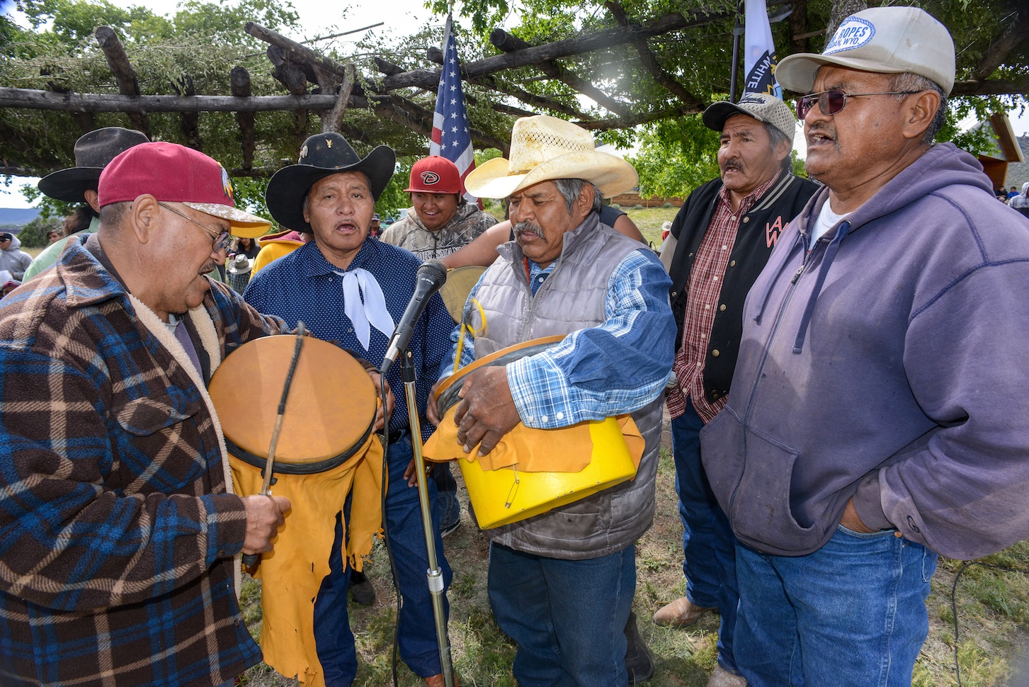

Manuel Cooley delights the crowd singing in Apache about the antics of a naughty little boy.

Second District Iola James
The Apache religion has been a fundamental part of the Apache lifestyle. Their worship for their God, Ussen, the Giver of Life and the Gaan or Mountain Spirits, who are represented in religious rites such as healing and puberty ceremonies. While the Crown Dancers who dress elaborately to impersonate the Mountain Spirits, wearing kilts, black masks, tall wooden-slat headdresses, and body paint and carrying wood swords have no supernatural powers they serve as a conduit for the Apache spinning their words into the heavens and assuring their prayers reach their God. “The mountain spirits have taught the Apaches to perform the Apache Crown Dance as a means of curing. The crown headdress is be-decked with eagle feathers; the teacher that flew the highest in the Heavens. The signs of lightning are sacred symbols of the Apaches which are placed on the bodies of the Apache Crown Dancers who are instructed by the mysterious mountain spirits to perform healing rituals for the Apaches. The crown dance is authentically performed today,” reported long-time Apache Tribal Chairman Ronnie Lupe in the Fort Apache Scout newspaper. 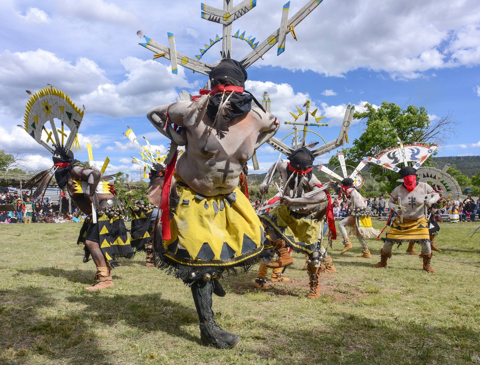 MOUNTAIN SPIRIT DANCERS COMPETITION

 FOOD FROLICS DELIGHTED THE CROWD OF ALL AGES….

Apache Royalty prepares to spread fruit out around on the dance floor for one of four fruit free-for-all-with all the thrills and excitement of an Easter egg hunt.
 Kaiden and Hayle DeClay torment their father, Chico, a Crown Dancer from the East Port Dance Group. Chico makes of point of
 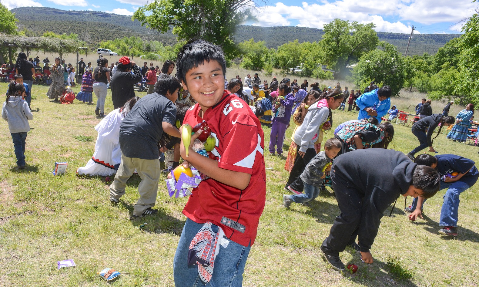 speaking Apache to his girls and they have learned to understand the language. Like many members of the White Mountain Apache People Chico and his wife Jenane believe their language and traditions is the key to holding onto the important rituals that make up the Apache traditions and ancient lifeways. In spite of the Batman, Superman and Star Wars t-shirts scattered throughout the crowd when the Cooley Mountain Singers Drum group begin beating out their songs. Apache youth began to sway to the Apache songs and the masked men they adore are Crown Dancers, whose color and sounds of bells bring them onto the dance floor as they try to copy their elders. White Mountain Apache Miss Indian Arizona Shasta Dazen tells the crowd “it’s a great day to experience

Linton Ethelbah Sr and Shannon

TANNER HENRY or “BEAR”
all the love that comes from our traditions and congratulations to everyone here for clinging to your culture.” Eleven month old Shannon Hope squirms from her daddy’s lap and begins dancing with the drum. Barely able to walk but she wants to dance. Her father Linton Ethelbah Sr. explains he speaks Apache to the toddler whenever he can and has noticed she appears to understand Apache and looks confused when his wife or other six kids speak English to her. Traditions are important to Linton whose medicine man grandfather, Thomas and his wife, Cecilia taught him the importance of the Apache way of life, I want her to understand Apache. His middle son is a graduate from McNary elementary school and just graduated from the Sherman B.I.A. Indian School in California. “He wanted to go elsewhere and learn to be independent. There’s nothing here right now, Ethelbah says, jobs are hard to find.” “Drugs and alcohol are problems here and in California he can learn to make a living…there are more opportunities there.”
 ROCK CREEK CROWN DANCERS BLESS THE YOUTH KEEPING ALIVE THE TRADITIONS FOR THE FUTURE GENERATION

Mylyle Ethelbah 3rd place
 “WHEN THEY GET THE CALLING…” Siting mesmerized the crowd just allows the music and dance take over. The Rock Creek Dancers, The Cooley Mountain Dancers, Diamond Creek Dancers were part of the dance off.
RAPTURED BY THE MUSIC AND THE DRUMS EVERYONE WAS ENJOYING THE DANCE… 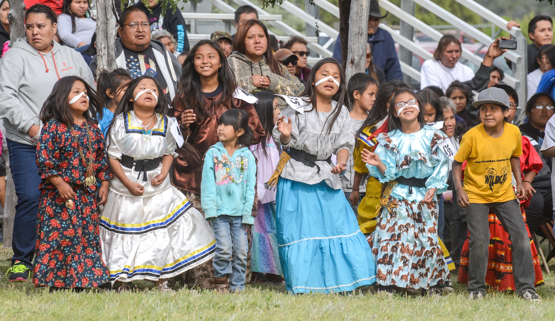
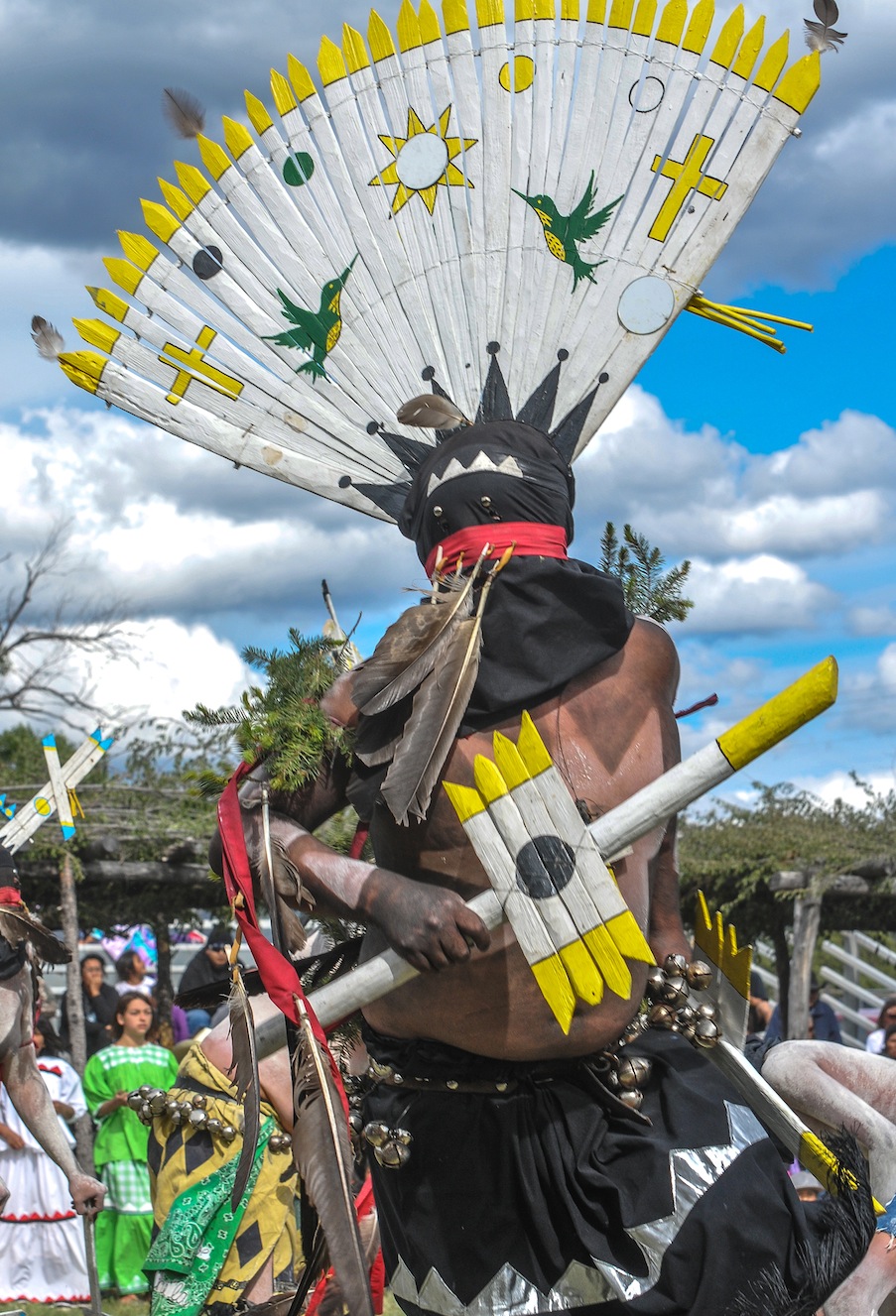 ” APACHE KIDS ASK ME-ARE YOU AN INDIAN “YES I SAY AND SO ARE YOU…”

Monty Stover Sr. comes to the Heritage Celebration every year because he wants Apache to know what “their ancestors looked like”.
Monty Stover Sr. comes to the Heritage Celebration every year because he wants the White Mountain Apache new generation to know what their ancestors looked like. “Apache kids come up to me and ask if I’m an Indian. I am,” I say and “so are you”. No we’re not! they say to me! ” Their parents speak English too much,” Stover says. “When a young Apache child comes up to me and speaks Apache to me! That’s beautiful”, he said. “Those parents are teaching that child our traditions. So each year we have this Celebration so people can see where we came from and how our ancestors lived.” “We dance and sing, enjoy the prayers” says Kicker Z. “To keep our traditions strong to show our children who they are…” “When the drums begin the kids try to dance like the Crown Dancers says Jenane DeClay who is part Sioux and married to an Apache Crown Dancer. “They reach a certain age and get the calling, then they try to copy their father.”
 Today there are many different nations of Apache people, the present-day Apache people include the Jicarilla, Mescalero, Chiricahua, Western Apache, Lipan-Apache, and Plains-Apache. The White Mountain Apache Tribe now consists of approximately 15,000 members. Many live on Tribal lands, but others live and work all over the country and the world. The majority of the population lives in and around Whiteriver, the seat of Tribal government. In 2000 U.S. census about 57,000 people identified themselves as Apache only; another 40,000 people reported being part Apache. Many Apache live on reservations in Arizona and New Mexico. The complexity in the cultural division of Apache tribes can be can be seen by breaking down just one of these subgroups, the Western-Apache, the Apache people residing in east central Arizona are known as Western Apache. Most of these Native Americans live within reservations called the White Mountain, Fort Apache, San Carlos, Yavapai, Tonto, and Fort McDowell Mohave reservations.
 “The War Dance Generation Indigenous Event is focused on Cultural Preservation, to protect my Apache language and to see my culture continue. This event brings comfort knowing that this dance will continue for generations to come. Apache Warriors will dance into the next Seven Generations.”
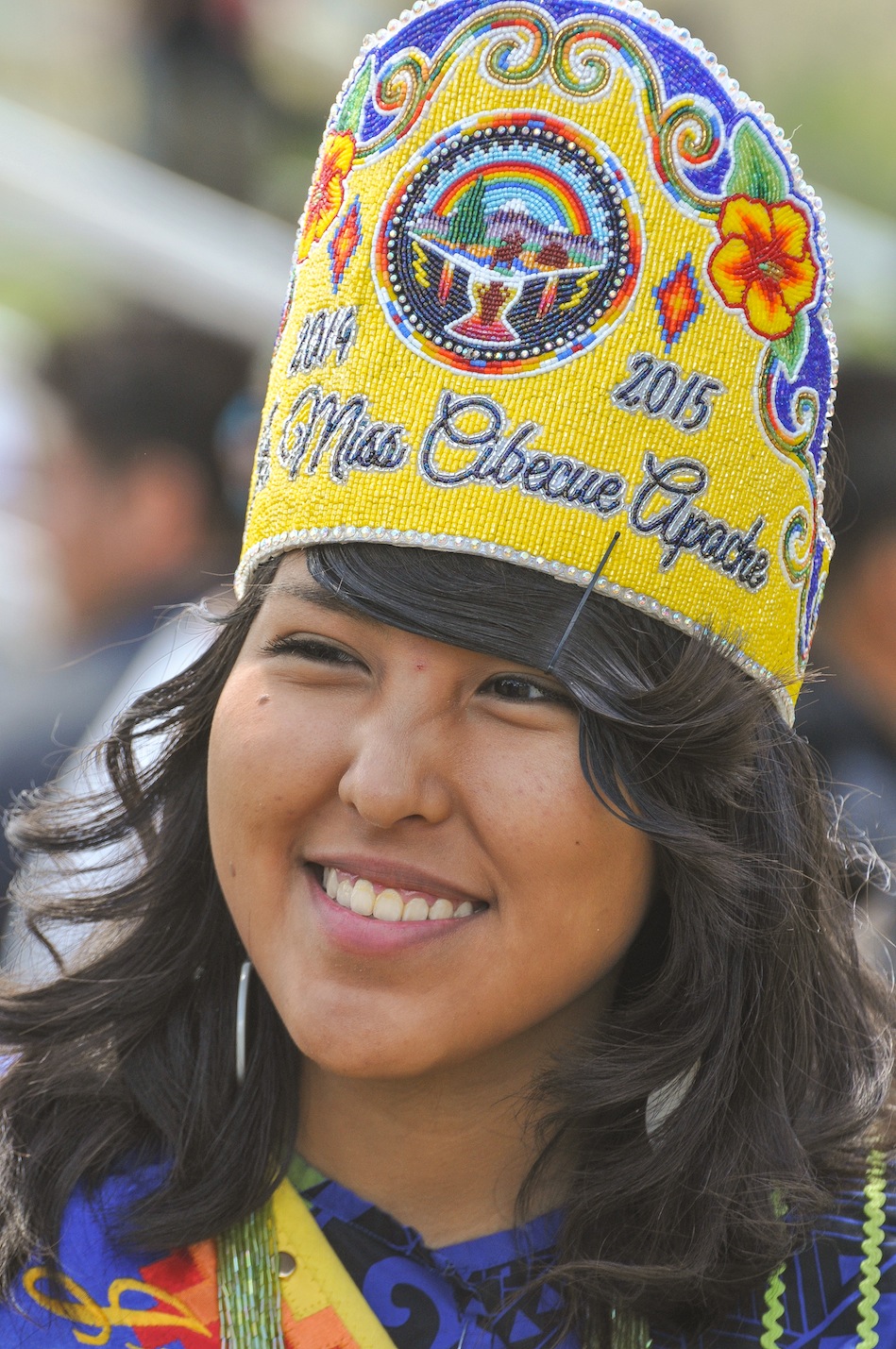
MAKANALANI PIKE
 In the old days, the two day War Dance was divided into discrete parts and began shortly after dark. In the first phase, called “going to war” the warriors of each clan were called to dance and demonstrate how they will fight the enemy. Those with spears would pretend to lance; those with bows would draw them back to show how far they can draw; those with shields used them also. The second phase was termed “cowhide, picked up” and involved the singing of chants that described the stealing of enemy property. In the third phase labelled “invite by touching” women of all ages were encouraged to choose a male partner and engage in social dancing. The final phase was performed at dawn the following day. Twelve of the bravest and most experienced warriors stood in a line and, one after the other, sang a song about personal success in war. After the last song, the warriors staged mock attacks on several camps, showing how they intended to surprise and defeat the enemy. This ended the war dance, and shortly later the war party made ready to depart writes Glenville Goodwin in his notes edited into the book, “Western Apache Raiding and Warfare” by Keith Basso.
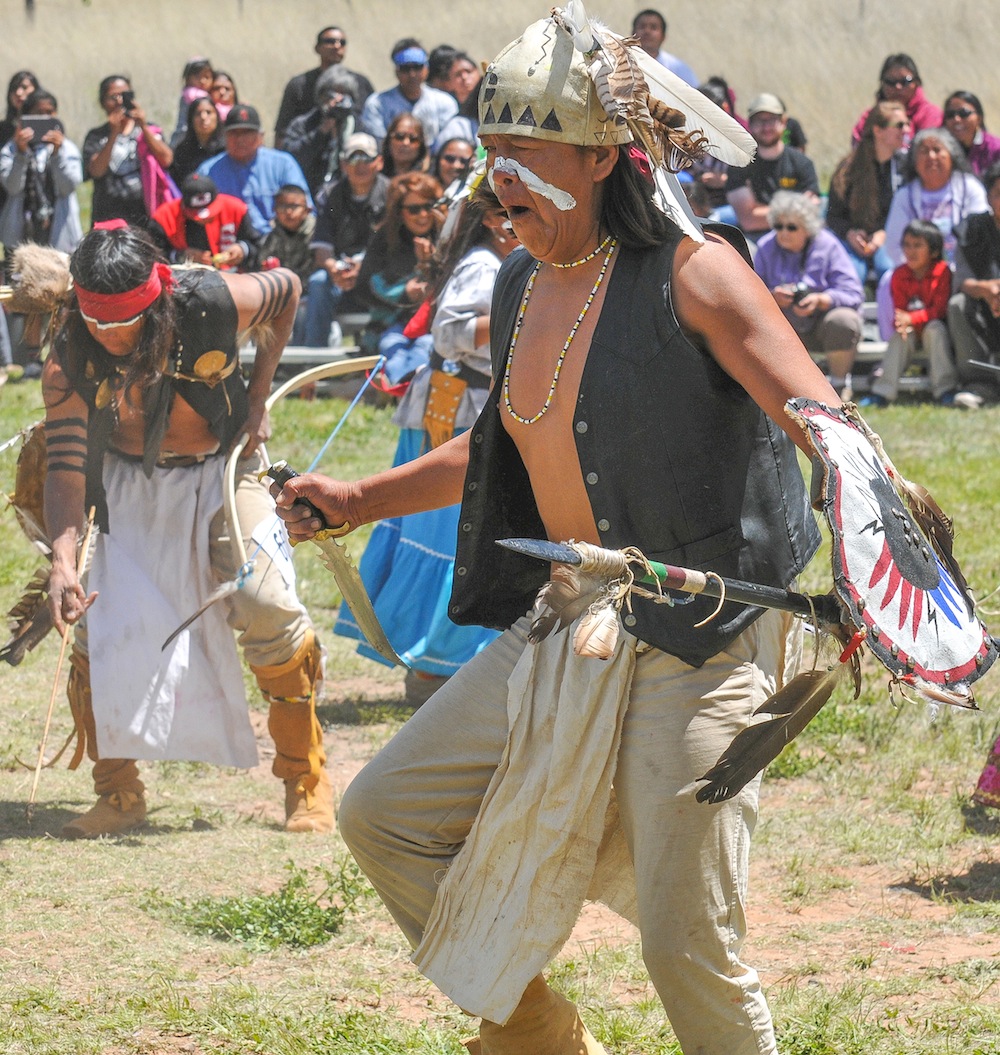
THIS YEAR’S SPECIAL WARPATH EVENT was a special White House Initiative to empower Native American Youth. The white house is launching Generation Indigenous or (Gen I), a Native youth initiative focused on removing the barriers that stand between Native youth and their opportunity to succeed. Jared Ivins-Massey, an ASU law student who produced a video of his community project showing the Heritage Celebration, the community initiative to restore past practices and traditions. Massey and others will share their stories online using #GenI …
13 year old Vernon Anderson says he loved the “War Dance” he got pretty excited thinking about things back in the day–“it was pretty cool” he said.

The Fort Apache Cultural Center called Nohwike’ Bágowa hosts exhibits, exhibitions, regularly scheduled Apache arts demonstrations. The museum houses the Tribe’s archival collection, including manuscripts, publications, and a large collection of historic photographs.

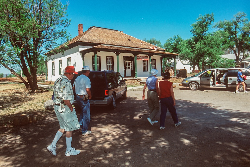 Fort Apache is an icon of the Apache Wars and the American West and is now a monument to celebrate Apache Heritage. Fort Apache Historic Park
sits on the confluence of the north and east forks of the White River in the White Mountains, homeland of the White Mountain Apache people. The presence of the U.S. Cavalry was initially to help the Apache live peacefully on their lands and to stifle conflict among the Apache clans and then arriving white settlers. Today Fort Apache recalls both a period of conflict and a time of cooperation between the U.S. Cavalry and several tribes from the Western Apache. The U.S. military left in 1922 after many years of declining use. The Apache Scouts that had been employed by General Crook were transferred to Fort Huachuca on the U.S,-Mexican Border, where they continued to serve. The last three Scouts retired in 1947. The Fort was transferred to the Bureau of Indian Affairs to house the Theodore Roosevelt Indian Boarding School. First intended to serve Diné (Navajo) children, by the 1930s, a majority of students at the school were Apache. Theodore Roosevelt School continues today on the very spot to serve as a middle school with a school board selected by the Tribal Council. From the founding of Fort Apache in 1870 until the capture of Geronimo in 1886, this fort was involved in the Indian Wars and was first called Camp Ord, in honor of General O.C. Ord, Commander of Arizona when it was built in the spring; however, just a few months later, the name was changed to Camp Mogollon in August, then Camp Thomas in September. The post was finally designated as Camp Apache on February 2, 1871 as a token of friendship to the Indians, the fort soldiers would spend many years fighting and trying to exterminate. The fort’s initial purpose was to guard the nearby White Mountain Reservation. Situated at the end of a military road on the White Mountain Reservation, which adjoined the San Carlos Reservation, the fort guarded the White Mountain Indian Agency, while Fort Thomas watched over the San Carlos Agency. However, both reservations became the focus of Apache unrest, especially after troops moved the Chiricahua Apache in 1876 from Fort Bowie to the White Mountain Reservation. On April 5, 1879, Camp Apache was renamed Fort Apache.

BUILT IN 1871, GENERAL CROOKS CABIN HOUSES A GLIMPSE OF THE MILITARY LIFESTYLE IN ARIZONA
Today, twenty-seven historic buildings make up the 288 acre National Register Historic District. Following maps available at the Museum, visitors can explore the district at their own pace. Interpretive signs located throughout the district explain the construction and use of the historic buildings and spaces, and allow visitors to immerse themselves in the history of what many consider the best surviving example of an Apache Wars-era military post. The Fort Apache Cemetery is 1/4 mile east of the main fort grounds and is accessible

The grave of an Apache Scout, one of many who served with the U.S. Cavalry during the Indian Wars .
by walking trail or road. Visitors interested in more adventure can hike the Historic Park ’s recreational trails, including a 1.4 mile loop through the East Fork canyon that passes the site of a historic Apache Scout camp. General Crook’s Cabin, built in 1871 and the oldest structure left on the fort today provides visitors with maps, historic photographs and murals allowing an historic overview of the fort and its impact on the Apache people. One room offers a glimpse into the lifestyle of army officers and their families living on a remote outpost in the wilds of the western frontier. The Fort Apache post office occupies the adobe adjutant’s building. The stone officers’ quarters, are today the residences of teachers and other Bureau of Indian Affairs employees. The sutler’s store and commissary building, cavalry barns, and guard house have not been significantly altered. One of the original four barracks, an adobe building in bad disrepair, houses the farm shop for the school. The parade ground provides a recreational area. The cemetery no longer contains dead soldiers, but does contain the bodies of Indian scouts. The fort is located five miles south of Whiteriver, Az, from Globe, take US 60 northeast 66 miles; turn east on State 73 and drive about 27 miles to Fort Apache.
FORT APACHE BIA INDIAN SCHOOL WOMEN DORMS
The White Mountain Apache Tribe is located in the east central region of Arizona, 194 miles northeast of Phoenix. This Tribe manages the popular Sunrise Park Ski Resort, Fort Apache Timber Company and the popular Hondah Casino near Show Low.

Located in the Fort Apache Historic Park, Nohwike’ Bágowa (House of Our Footprints) is the place to experience Apache history and culture.
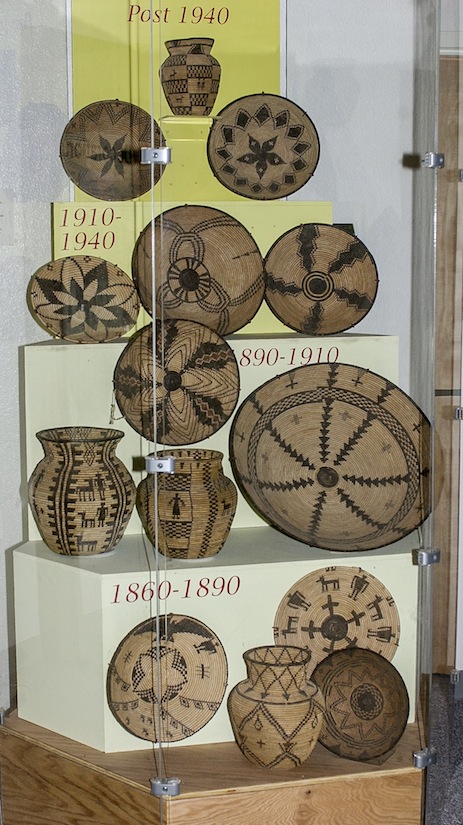 Nohwike’ Bágowa, the White Mountain Apache Cultural Center and Museum, is housed in a modern facility constructed to reflect a gowa, the Apache traditional holy home, the cultural center and museum is committed to the celebration and perpetuation of the Apache heritage. Nohwike’ Bágowa hosts long term exhibits, temporary exhibitions, regularly scheduled Apache arts demonstrations, and other special events. The museum also houses the Tribe’s growing archival collection, including manuscripts, publications, and a large collection of historic photographs. The museum shop offers a wide selection of the best Apache basketry, beadwork, and other arts, in addition to books, music, and Fort Apache and Tribal mementos.
Being held next to the Casino at HONDAH, AZ ON June 5th featuring Social Dances on Friday
and Pow Wow competition will be held Saturday and Sunday
GANN DANCE COMPETITION
Mountain Spirit Dance Off will be held in Canyon Day on August 1st

PREHISTORIC KINISHBA RUIN
The Fort Apache Historic Park, including Kinishba Ruins, is open daily from 7:00am to sunset. Nohwike’ Bágowa is open Monday-Saturday 8am to 5pmduring the summer, and Monday-Friday 8am to 5pm during the winter. Admission to the museum and park is $5.00 per adult, and $3.00 for seniors (64+) and students. Children under 7 are admitted free. Admission to the Park after-hours and on holidays is $5.00 per vehicle per day. Apache tour guides are available with advance reservation, and special accommodations and activities can be arranged for tour groups.
24 Hour information line: (928) 338-4525
Museum: (928) 338-4625 White Mountain Apache Office of Tourism: (928) 338-1230
 The death of Nochaydelklinne,”The Dreamer” at Cibecue Creek and the Apache attack on Fort Apache two days later is often considered the final battle between the Apache and the U.S. Cavalry at the fort. The Apache repeatedly attacked the fort at long range, firing vollleys and scoring. The U.S. cavalry and native allies fought back but the Apache remained at the end of their rifle range during the entire fight. Two days later, reinforcements arrived but by this time the Apaches had already retreated into hiding. Only three American soldiers were wounded and Apache casualties are unknown. The two separate engagements at Cibecue Creek and Fort Apache helped ignite another Apache war that would end with the surrender of Geronimo in 1886. But the last Apache attack on the U.S. at Fort Apache was led by Apache Lawyers who took the United States all the way to the Supreme Court and won $12 million. In 2003 the Supreme Court of the United States held in a 5-4 decision that when the federal government used land or property held in trust for an Indian tribe, it had the duty to maintain that land or property and was liable for any damages for a breach of that duty.
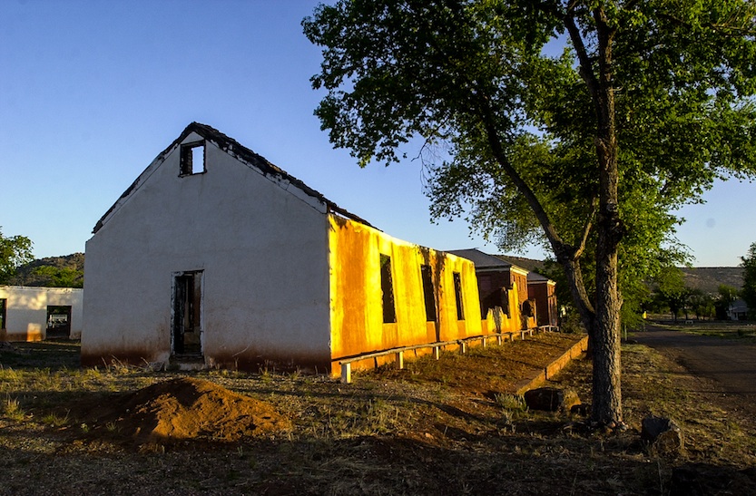
CAVALRY BARRACKS
The case involved Fort Apache, the collection of buildings on the reservation which were transferred to the tribe by the U.S. Congress in 1960. Although the tribe owned the Fort Apache buildings, they were held in trust and used exclusively by the federal government for an Indian school. This was a continuation of the building’s use from when the federal government retained title. As more schools were built at other Indian reservations, attendance dropped at the Fort Apache school. The tribe began to plan for use of the buildings and sought designation as a historic site. When the federal government wanted to turn the property over to the tribe for use, the tribe found that the property had deteriorated and sued for damages to the property. The Supreme Court affirmed the appellate court, holding that the federal government used the property it held in trust, and that it therefore had a duty to maintain the property. The loss led the government to settle with the tribe for $12 million. The buildings are managed by the Fort Apache Heritage Foundation and the case, helps to define the Indian Trust Doctrine. The case has been widely discussed in legal literature and books.
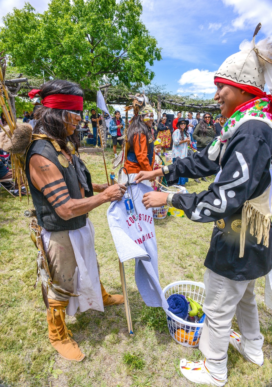
Jared Ivins-Massey gives Kicker-Z first place in War Dance
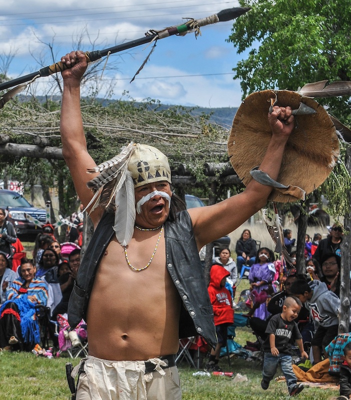
 President Obama launched the Gen-I Initiative at the White House Tribal Nations Conference to ensure all young Native people can reach their full potential. The Gen-I Initiative calls for Native Youth Community Projects, like the first White House Tribal Youth Gathering this summer that will engage hundreds of Native youth in a day-long convention. The Native Youth Report acknowledges past failures of federal policy, explores the challenges facing Native children, and creates a path forward.
 The Gen-I Native Youth Challenge is part of the process of establishing the National Native Youth Network. Native youth are invited to take part in the Gen-I Challenge. This call to action creates a network of people interested in the issues facing Native youth and creating an information platform about opportunities and highlight their voices and positive contributions. Jared Ivins-Massey, is an enrolled member of the White Mountain Apache Tribe of Arizona. He was born and raised on the Fort Apache Indian Reservation in Northeastern Arizona. Massey is one of seventeen Native Youth selected to create a steering committee for the upcoming White House Tribal Youth Gathering this summer that will engage hundreds of Native youth in a day-long convention. Jared is the son of Leo and Rolinda Massey of Fort Apache, Arizona and hails from the community of Seven Mile and Cibecue, Arizona. Jared is a proud graduate of Alchesay High School where he was elected student body president and elected the White Mountain Apache Youth Council Male Co-President. Currently Jared is a double major studying political science and justice studies. Jared currently resides at the Arizona State University Polytechnic Campus in Chandler, Arizona. Jared states, “With no Vision youth cannot prosper but with the guidance of our elders, a Vision is in our sight.” Jared is a traditional dancer and hopes to one day return to the White Mountain Apache Reservation and serve as a tribal attorney. I’m excited to share my Gen-I Native Youth Challenge! he shares on Facebook. My Generation Indigenous (Gen-I) Challenge Event focuses on Cultural Preservation. “In conjunction with the 2015 Fort Apache Heritage Celebration & Festivities, my family and I will be holding the “Jared Ivins-Massey Apache War Dance Special” This dance was done in times of victory and through the event I hope Apache youth will learn this powerful dance. In addition, I ask that all participants submit a half page essay on “What it means to be an Apache Warrior.” The reason for my Generation Indigenous (Gen-I) Event, is to ensure that my Apache language and culture continues. This event brings comfort knowing that this dance will continue for generations to come. These Apache Warriors will dance into the next Seven Generations. I see you Apache Youth! he writes. The National Congress of American Indians (NCAI) in Sacramento, CA. elected White Mountain Apache tribal member Jared Massey National NCAI Youth Commission Co-President. During his term Massey will work closely with tribal leaders in Indian country on BIA funding, healthcare, Indian Health Services, Indian Reservation Roads funding and gaming. NCAI is a national organization that advocates, lobbies and addresses issues throughout Indian country. “We are extremely proud of Jared. He is an excellent role model and ambassador of the White Mountain Apache Tribe. The National Congress of American Indians is a great organization that works for the betterment and well-being of Indian people. NCAI will be a great experience for Jared to further develop his leadership skills and solidify his future’s foundation with education, culture and experience,” stated Harrisen DeClay, WMAT Education Director.
 Jerad Massey hopes by providing insight and assistance to White House staff in planning the 2015 Tribal Youth Summit, he hopes challenges that youth face today on reservations will be addressed. Coming from the Fort Apache Indian Reservation, Massey has seen first-hand the struggles of reservation life and tribal youth. “I personally have experienced so many social issues that plague our youth and challenge our youth from breaking so many cycles with suicide, drugs, alcohol, poverty, sexual abuse and domestic violence. I am excited to work with the White House, because this personal testimony and experience is not just part of my past and my roots as a young Apache man, but they are the real-life and day-to-day things that face our youth. We need to use these issues to deliver messages to our youth empowering them to overcome these social issues and that we will survive to create an even better and more promising futures for our children.”

FOR MORE SOUTHWESTPHOTOBANK PHOTO GALLERIES ON RELATED TOPICS:
CLICK THE BELOW LINKS
HONEY BEE PIT HOUSE CONSTRUCTION MAPS OUT THE HOHOKAM’S LIFE WAYS AT STEAM PUMP RANCH IN ORO VALLEY EXPANDING THE PREHISTORIC RECORD !

Allen Denoyers is building a Hohokam village on Tucson’s northwest side. Visitors to Oro Valley’s historic
Steam Pump Ranch can crawl between two wood uprights and find themselves transported back to 900 AD. 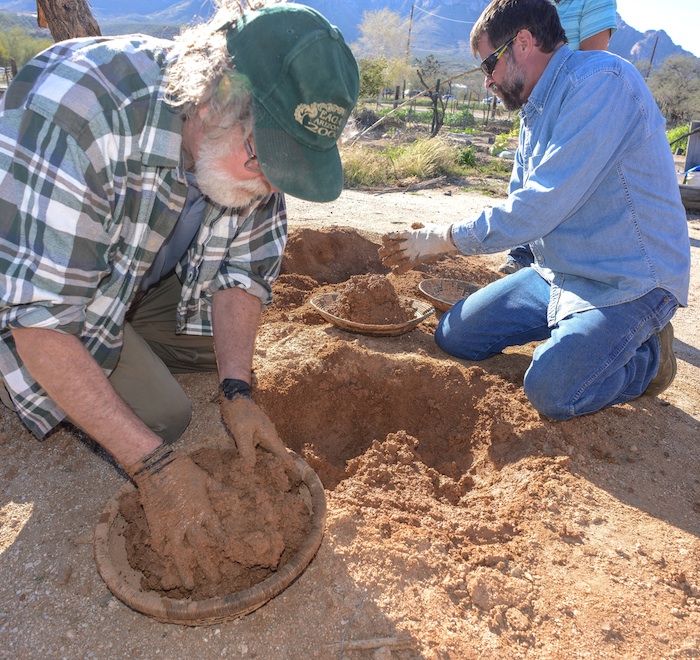 The southwest archaeologist has propelled his career by taking prehistoric technology into his hands and by learning from the past and teaching his students what life was like a thousand years ago. Denoyers passion for the past has taken many different forms, since junior high school, the self-taught flintknapper has created knifes, axes, spears, atlatls and now prehistoric pit houses. Archaeology Southwest, a local archaeology research firm, where Denoyer works, has long been responsible for expanding the prehistoric record by their survey of endangered sites and filling in the holes of existing knowledge about the folks who once lived here in the Sonoran Desert. So when Denoyer built his first pilot pit house, he was working from the knowledge gained from the past century of southwest archaeology and in partnership with the Town of Oro Valley and the Oro Valley Historical Society. In truth, most of what is known about the Hohokam pit house are the holes in the ground left behind by the wood uprights stuck in the ground centuries ago. The roofing, side and interior of these homes today are modeled on historic homes of the Hohokam descendents that today, are known as the Tohono O’odham and Pima people, of Southern Arizona.
When Hurricane Norbert dropped four inches of rain on Oro Valley last September, swelling washes to ten feet deep in places and requiring local fire and police to rescue motorists from swollen washes and flooded roadways. Loads of mud sloughed off Denoyers pit house completely filling it with water. That’s when the learning began for Archaeology Southwest who figured 40-50 percent of the mud was lost. Mud from the upper portions of the walls washed away or slumped in. The roof actually stayed relatively intact, with losses mostly confined to the edges. “But we don’t see this as a tragedy—in fact, we’re

Smoothing the mud produces a sheen that sheds the rain
 re-mudding they laid thatch mats over the new openings allowing air to circulate. Perhaps we need more thatching or interior support and possibly a different mixture of water and mud, to better combat the elements. Getting the moisture content of the earth just right is a real art, “I love the sound of the mud”, says Denoyer as he applies a rock to the wet surface smoothing it and creating a slick surface. “Floating the mud gives it a sheen and when the rain hits-it just rolls off.” “It really doesn’t take all that much work”, he says of pit house construction, “five or six people working together could finish in a couple of days”. “I love digging, screening earth, being out here all day. I’m so lucky so many people hate their work. At the end of the day, you can step back and appreciate what you accomplished.”
Archaeology Southwest has taken the next step to learn from the past, under the tutelage of Denoyer, the
research firm is offering several ongoing workshops, where participants will learn the basics of pit house  construction as archaeologists have learned from excavations. Denoyer will lead participants through the construction process, from excavation of the house pit to creating the superstructure, putting each student hands-on with traditional tools and materials. Through this work, Archaeology Southwest hopes to add detail to archaeological knowledge of how these structures were made by ancient people. Workshop sessions take place at Steam Pump Ranch in Oro Valley. Each session will last for three hours. Initial sessions will be dedicated to repairing rain-damages
  to the 2014 pit house. After that pit house is restored, participants will create small test pit houses that will enable us to compare how slightly different methods and materials respond to time and weather. Class Dates: Friday 3/6/15 from 9:00am-12:00pm – $40.00, Friday 3/13/15 from 9:00am-12:00pm, Friday 4/10/15 from 9:00am-12:00pm, Thursday 4/16/15 from 9:00am-12:00pm, Friday 4/24/15 from 9:00am-12:00pm -classes are for participants 18 years and older, there is a $40.00 charge.
ONE STUDENTS IMPRESSIONS ON THE HANDS-ON PIT HOUSE CLASS
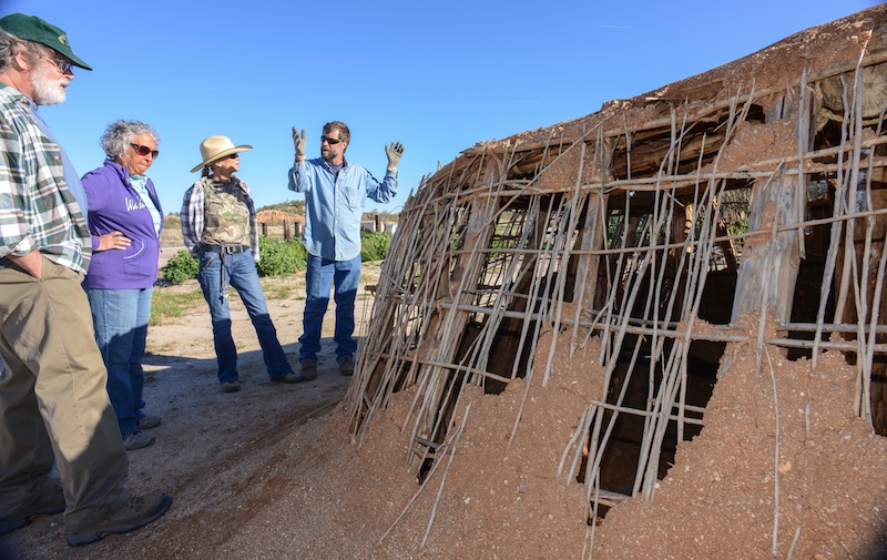
Allen Denoyer explains the class to Terri and Dave Wallace while Joyce Holloway listens to the plan.

Terri Wallace re-enforces the pit house wall with Seep Willows as support.
Denoyer has based the pit houses his classes are building on homes found in Honey Bee Village, an Oro Valley
Hohokam site, the 32 acres excavated by Henry Wallace, in 1986, his study turned up more than 2000 features, including 100’s of pit houses, a large plaza and a small ball court which established Honeybee as the economic center of several villages situated along the Canada del Oro River. The ball court Wallace believes was based on the Mesoamerican ball game, played with a rubber ball batted around with paddles perhaps resembling those used today in ping pong. The ball game, Wallace believes, was an “integrative tool” to bring folks together and exchange goods creating a “large trade fair”, around 800 AD, in the village’s center plaza. The larger excavation of the Tortolita foothills was undertaken by Desert Archaeology because of the advancing bulldozers for the development of the 5000 acre Rancho Vistoso housing project that today has covered over or bull-dozed many other sites right off the face of the earth. Honeybee’s sister site the larger “Sleeping Snake”, where “not much is left” says Wallace of the site now covered by a golf course. So when Wallace got to Honey Bee, the archaeologist trenched the village core and conducted a systemic shed collection, learning a lot about the residents of the 100’s
 of homes characterized by large oblong holes in the ground encircled by holes left by the pole uprights supporting the pit house village. Wallace believes the life of a pit house was 15-20 years and believed Honey Bee which was a “great place of ak-chin farming” said Wallace of the wide flood plain along Big Wash.
 It never supported more than a 100 people at any given time, saying the village’s population was “between 40-90 people at any given time” and that Honey Bee” was not alone but part of something larger”. Denoyer points out supplies were limited and not everyone could build a pit house whenever they wanted. “They wouldn’t pull out the plants”. which grew along side of the Canada del Oro River which provided weep willows, for the necessary wall and roof support, for the Hohokam pit house, instead “they would cut the plant and it would grow back the next year” and more homes could then be built. Carbon 14 dating has placed some of the wood found around 1050 AD, and Wallace feels the wood was carried a great distance, climbing into the Catalina Mountains and carrying it many miles home. There was a lot of competition for building supplies, Honey Bee was far from alone along the CDO, notably the Romero Ruin now protected in Catalina State Park and Rooney Ranch site was bulldozed, and now is named after a shopping center. There were fifty pit houses and the bulldozers had entire pots rolling down the hillside, along with burials from between 700AD to 1380AD. One pit house had an altar at one end, where a bighorn sheep’s lower jaw was found buried shows a large populations lived along along this stream and visited the high country to hunt and possibly worship. Henry Wallace believes the Catalina high lands brought spirituality to the Hohokam people, “so it was important to bring a piece into your home,” speaking of the large ridge poles carried from the mountain.
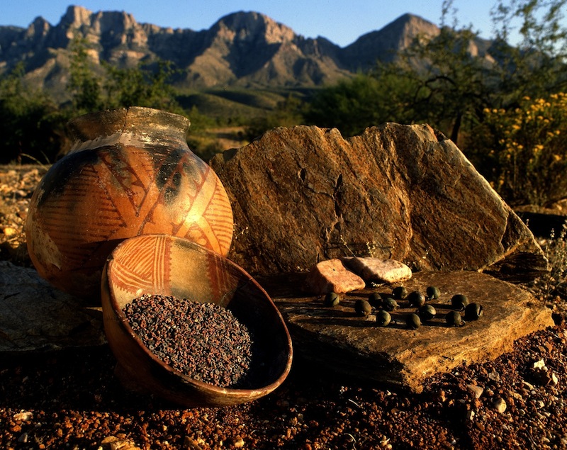
Today, archaeologist study a rich rock art site, surrounding the “easiest path to high altitude” up the Catalina Sutherland Ridge. In November 1949, a hunter’s foot broke through the earth’s crust and Ray Romo peered into the past. The broken ground revealed a Hohokam pot cupped over another larger pot, inside were 25 copper bells and a 100,000 beads, Emil Haury and Carol Gifford speculated that the Romo Cache was an offering to insure the welfare of a village. The beads weighed 3.5 pounds, some are made of steatite or talc. These are black. Some are of a ferruginous aphanitic matrix containing quartz grains. These are red. Some are of chryosolla or turquoise. These are green and blue. A dozen are made from seashells. The black beads make up 40 per cent, the red beads 58 per cent, turquoise beads about 2 per cent. Some have marks, showing they were worn at one time. The bells were all made in Jalisco, more than 1200 miles south in Mexico. Someone carried them here and carefully hide them in these rocks, below you would have seen Honey Bee, the larger Sleeping Snake Village and the Romero village and many more villages laced along the running Canada del Oro stream. Who left it, we can’t say nor do we know why ? Maybe it begged God for his blessing ! After the Aspen fire, lots of pottery showed up, along the pathway up to the Catalinas. Excavations turned up one bell at the Rooney Ranch site, one more bell was found at Honeybee village–whatever the message the Romo cache begged, “in 950 AD, the Tucson villages fragmented”, people were moving away from Honey Bee’s Plaza, “they were moving out”, says Wallace. “There was a drastic and sudden change in 1150.” “Perhaps warefare or environmental change and social divisions created by a hierarchy of people with power living over people,” speculates Wallace. “Not long after this, they are all gone…”

Henry Wallace shows a tour of the Honey Bee Preserve the ballcourt.
“It’s very sad” Wallace says, “that east ridge is where all the Hohokam houses were–that’s where all those new houses are now.” A coalition of groups recognizing the prehistoric value of the Honey Bee Village proposed a preservation effort about a decade ago. In 2006, Oro Valley and Pima County, through a land donation from Steve Solomon, owner of Canada Vistas Homes, the development company that purchased the land, together created the Honey Bee Village Preserve.
The new preserve was established to protect the large Hohokam Indian community that occupied the site between 700 AD and 1200 AD, according to archeologists. Honey Bee Village is located just north of the intersection of Rancho Vistoso Boulevard and Moore Road. Archeologists have identified the locations of hundreds of pit houses, a ball court, a walled compound and a central compound on the relatively undisturbed site where developers once intended to build the town center for Oro Valley. Preservation of the 13-acre village was possible with the $8 million donation of real estate placed into public trust. “On one hand, we have 13 acres of highly valuable real estate, and on the other hand we have an invaluable prehistoric resource that would be plowed over and lost forever,” said Steve Solomon, owner of Canada Vistas Homes, the development company that had originally purchased the land and donated it.

Wallace shows off a pit house site in the Honey Bee Preserve.
Today the 13-acre core of Honey Bee Village is now preserved for future generations. The preserve

Honey Bee Preserve Map

Neglected after the depression tall grass and trash became an issue
HONEY BEE VILLAGE PRESERVE TOUR CLICK HERE…
For South West archaeologist, the ubiquitous pit house, clouded the prehistoric picture of ancient man. The Hohokam is now known to be the primary prehistoric agriculturalist of the Sonoran Desert. This ancient man surrounded himself with Mother Earth to protect his family from his harsh environment, like the sun and rain, that fell from the sky or the cold that surrounded them. The pit house has roots in prehistoric times in the arctic, the desert, the mountains, the plains and in woodland areas over a large part of North America west of the Mississippi River. The earth-covered frame house changed slowly in architecture, no two pit houses were exactly alike but their features are typical of homes found in northeast Asia, across the Bering Strait, throughout North America and deep into South America. From the earliest dates, the pit house changed very little, it’s shape evolved from a square, to a rectangular, eventually taking an elliptical shape over the centuries. The Hohokam evolved their oblong pit homes with rounded ends, the front and back wall were parallel and sized approximately 6 meters wide x 3 meters depth.

Hohokam Pit House Drawing Copyright by Rob Ciaccio
Archaeologist find pit homes of the Plains cultures as far East as the U.S. southeast in Arkansas, there historical earth lodges of the plains Indian seem identical to the type used by the prehistoric man. Typically the pit house had four central roof supports in early homes, the supports increased later with a side entrance composed of a covered passage-way, inclined from the floor. The floor of well plastered caliche, was built on native soil. The fire pit was a deep basin in the interior with a thick coating of caliche, the rim being flush with the floor. Cross beams, spaced at irregular intervals, held a thatch of twigs and grass, which was covered with caliche. The dirt covering the roof extended down onto the walls, they were plastered and renewed as the need arose.
Many were burned, perhaps as part of a funeral rite ?
Archaeologist believe most villages were economically related through exchange systems, typified by the trading of shell bracelets and jewelry from the Sea of Cortez for cotton textiles from the Salt/Gila canal systems. A larger widespread trade network is suggested by the trade of shell from the Gulf of California, parrots and macaws from Mesoamerica and turquoise from various Arizona locations.
Villages were small with houses centered around plazas. During the Colonial Period AD 775-975 homes are arranged in house clusters or courtyard groups archaeologist Dave Wilcox finds two to four houses arranged with entrances facing a common courtyard and sites generally contain one or more house clusters. Many archaeologist see this as a time of expansion-the Sedentary Period 975-1150 AD saw continued growth of existing settlements and new villages sprang up along rivers and in the open desert. Irrigation canals expanded in the Salt Gila and houses increased in size. Public architecture like ball courts occur now, public architecture including platform mounds became more elaborate, some larger sites had one or more ball courts as well as platform mounds. After 1300 AD everything starts to diminish and withdraw – platform mounds begin to be encircled by adobe walls, the Casa Grande great house was built during the late classical period. Walled terraces or cerro de trencheras, were constructed on steep hillsides, in the Tucson Basin. Extensive agricultural farms are expanded in the desert regions and agave farms are expanded. Bill Doelle and Henry Wallace have argued the Tucson Basin emerged as a regional center during the Classic period, they suggest that cerro del trencheras were defensive and indicate warfare or the threat of warfare between the Tucson Basin and the Salt-Gila Complex (Phoenix). Archaeologist find an increase in site hierarchy along the Salt-Gila and the Tucson basin during the Colonial period. Ball courts were first constructed along the Canada del Oro and served to integrate a number of associated smaller villages within the Hohokam community. By AD 1000, the Hohokam were using all parts of the Tucson Basin, they built their villages along streams and rivers and hunted and gathered in the foothills and mountains.
BECOME A MEMBER OF ARCHAEOLOGY SOUTHWEST….CLICK HERE

Experience the ancient art of flintknapping. Join Allen Denoyer for his Hands-On Archaeology class, “How Did People Make and Use Stone Tools?”. In each of these beginner classes, you will use ancient techniques and replica tools to create a stone projectile point. You will also learn more about how people made and used such points, and that points were just one component of a complete hunting technology. The class is for individuals 18 years of age and older and lasts approximately 3 hours. This class will meet at Steam Pump Ranch at 10901 North Oracle Road, Oro Valley, AZ 85737. If you are interested in registering a group of three or more participants, please contact Kathleen Bader by phone at (520) 882-6946 x26 or by email to reserve space for your entire group. Class is Friday 3/20/15 from 9:00am-12:00pm – $40.00

“I love to making Clovis points”, says Allen Denoyer who often demonstrates prehistoric technologies at Steam Pump Ranch on Saturday mornings.”They are my favorite thing to make.”
PREHISTORY PHOTO COLLECTION OF PHOTOS CLICK HERE
![]()
<a href=” SPANISH TRANSLATIONS:">CLICK HERE
SAN CARLOS APACHE MARCH TO OCCUPY OAK FLAT PROMISE A FIGHT TO SAVE THEIR HOLY GROUND FROM THE GREED OF McCAIN, KIRKPATRICK, FLAKE, GOSAR AND THE RESOLUTION COPPER MINE !


Marchers on Route 6 enroute to Highway 70
Campfire smoke is thick in the morning chill on Oak Flat in the lush 5000′ Arizona high country. Western Apache from all over the state have come together to “occupy” their ancestral homeland and the smell of breakfast drifts across the Flat as members of the San Carlos Apache, White Mountain, Yavapai and Tonto Tribes leave their
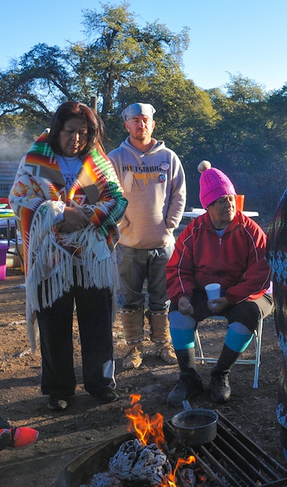
High country chill makes a morning fire a good thing to have
warm sleeping bags and meet up around the oak wood fire. There is little said about the planned Resolution Mine that will collapse this spot into a huge hole when their robots have undermined this land. President Eisenhower set aside this treasure by Presidential decree to save America’s unique wild places. Instead talk centers on happier days! Days spent with their mothers, fathers and grandparents, aunts and uncles, the kids and babies, as everyone scurried about harvesting the rich, sweet-tasting acorns which for centuries have been a delicacy of the Apache people and a centerpiece to their ceremonies marking each chapter of their lives, like joyous weddings.
Today some of those beloved relatives are now buried in Gann Canyon, their wakes and funerals where held here in the campground, acorn stew was boiled with meat, into a pancake batter like paste, and served honoring those who have now met their Creator. Many Apache Sunrise ceremonies are held here each summer to celebrate Apache daughters reaching womanhood, accented by the Apache Crown Dancers, twirling and funneling their prayers to God.
Today, Anthony Logan, an Apache medicine man will bless this holy ground beneath them and they will all dance to the drums and pray that God will answer their prayers.

Medicine Man Anthony Logan blessed the morning meal before being the first in line
Many will pray the Creator protect Oak Flat from the destruction set in motion by politicians, like Arizona Sen. John McCain, who behind their backs put a land swap into the “must pass” defense spending bill at midnight. The new Republican Senate then passed the $585 billion National Defense Authorization Act of 2015…89 to 11. Tucson representative Raúl Grijalva has called this “a grave injustice” and calls this “unjust legislation” be repealed, a motion supported by more than 70 Indian Tribes across the United States who now join him in demanding protection for Oak Flat. The Apache protest began in San Carlos last week when tribal members started a 50 mile march to their sacred holy ground two miles east of Superior, Arizona. In spite of a few blisters, they arrived more than 250 strong supported by Tribal members from all over the U.S.. They filled the campground and Anthony Logan, aka “Rolling Fox”, conducted the “Holy Ground Blessing” ceremony held beneath the mine shafts being constructed by Resolution, a British mining company who wants to undermine the mountain and collapse the entire sacred Mountain into the country’s third largest copper mine to sell the ore to China, leaving the Apache the hole and a compromised water supply. Apache drummers and singers performed sixteen songs blessing the sacred land
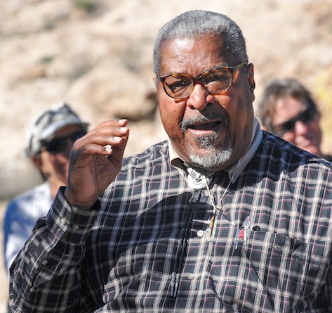
The Reverend John Mendez
and dancers who came to take to back their ancestral land. After the ceremony, the Reverend John Mendez, an internationally recognized civil rights activist, told the crowd that the Apache spiritual movement would move “like a prairie fire”. The fire and brimstone preacher from Emmanuel Baptist Church in North Carolina told the mostly Native American audience, “they can’t stop you, when we unit”. “A people united won’t be stopped. We will not quit, there is nothing that can stop you.” Mendez closes in pray “Father we put all things in your hands, guide us.” “We have to stand up and fight Congress, laws can be made and laws can be changed! John McCain made a big mistake doing this to us said Terry Rambler, present Chairman of the San Carlos Tribe, who gave all tribal employee an administrative day off to join the March.
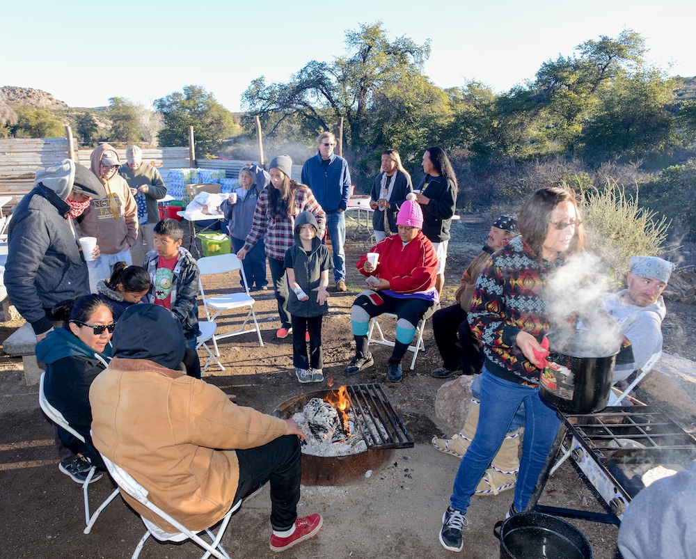
Hot coffee coming off the stove for chilled campers

San Carlos Apache Chairman Terry Rambler
They put this (land swap) in behind our backs-then they stabbed us in the back.” God blesses the world–he put us here to protect the land and as

Wally Davis, Chairman of the Tonto Apache Tribe
long as we put God first–he will fight for us. Apache people were taught to pray and only through prayer will we win. The white man came to America in search of religious freedom but still they deprive the Apache of what is his religious right.” “We are still prisoners-of war” said Wally Davis, chairman of the Tonto Apache speaking of how all Apache had historically been forced marched to the San Carlos Indian Reservation. “This is a message to all Native Americans.” “San Carlos is still a prison,” Davis said.

Apache Leap Mountain hangs over the mining community of Superior.
Apache Leap Mountain gains its name from the Pinal Apache Band who lived in these hills and valley, the rocks still carry rock drawing left from their dreams of successful hunts for deer and mountain sheep, game that filled their stomachs and fueled their children’s futures, their love of the land and their freedom. Fifty of the 1870 band died leaping from the ragged mountain edge as they were surrounded by the United States Cavalry who demanded they return to the reservation in San Carlos, or die by their sabers. They chose to leap instead knowing their God knew best how they should live and die.
Speaking in one voice for Native Americans everywhere, tribal members attended from all over the world and former San Carlos Apache chairman Wensler Nosie announced Thursday February 4th, 2015, to be a historic day as
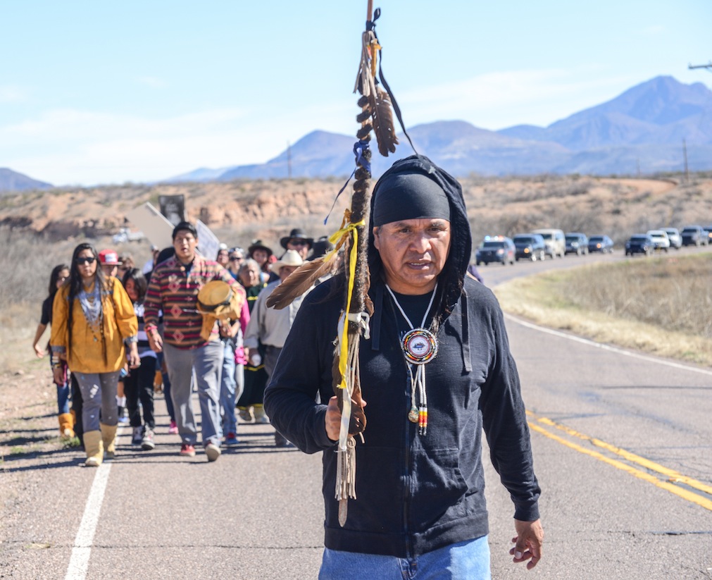
Wendsler Nosie Sr. leads the march to Oak Flat.
the Apache once again took the field against the United States of America. “We were pushed here”, we used to roam the entire South West, but we were told to stay on the reservation and extermination was the response when we didn’t. The white man killed our ancestors, my great-grandparents, when they tried to continue their nomadic lifestyle! My mother told me, stay on the reservation-don’t bother those white people outside or they will hurt our people! That was a sickness pressed upon our people by the U.S. government, that ends today, says Nosie, “Today we pray to our God and through God we will win.” Nosie told the 250 people and media assembled outside the Tribal Administration building to begin their march to Apache Leap Mountain which towers over the Arizona community of Superior.

Anthony Logan, an Apache medicine man will bless the holy ground (right) and leads his people to Holy Ground.
Their voices thundered with emotion Thursday as the San Carlos Apache prepared to march on Oak Flat the words spoken left no doubt that “greedy politicians”, like Senators John McCain and Jeff Flake Representatives Anne Kirkpatrick and Paul Gosar, have worn out their welcome in San Carlos, Arizona or in Indian Country anywhere else in the United States. “The rape of Indian land stops today on this historic day. Oak Flat was a gift from God to the Apache people, may we all be blessed from this day forward,” Nosie told the crowd. “We are spiritually guided today–indigenous people from all over the world are watching our fight”! If America is the World’s Policeman, and this under-handed maneuver is how they treat their native peoples, then what hope do native souls have anywhere.

Marchers leave San Carlos for Oak Flat
“They think we are stupid, he said, “but our ancestors are smiling down on us and saying those our children — our educated children! “We want entitlement to our land and reservation, this is a day of healing and through prayer,
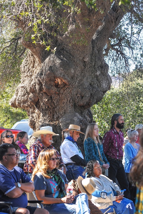
Emory Oaks, native to Arizona, New Mexico, Texas grow up to 80 feet tall.
we are going to win this! Today we are bringing down the barriers imposed upon us and today we breakout, our children are strong and the abuse from the people outside (the reservation) ends today.
All 2,400 acres of the land swap are part of Apache ancestral and ceremonial lands. So although Republican lawmakers have tried for years to secure the transfer of these lands, they have always run into strong opposition from the San Carlos Apache Tribe and Democratic lawmakers and conservation advocates, so they stole it. If the legislation succeeds, it will allow Resolution Copper Mining Co. to exchange more than 5,000 acres of environmentally sensitive land it owns throughout Arizona for about 2,400 acres of federal land near Superior. The company would develop a 7,000-foot-deep mine there, opening the third-largest undeveloped copper resource in the world.
Councilman Fred Ferreiria from the San Carlos Peridot district says “they gave us this land because no one wanted it — they found minerals — and they took it. If we don’t stop it now — bit by bit they will take it all away again.” We learned the laws and how things are done, we were doing that, and the government broke the rules, we continue this fight, we are here today for our children.” “We have champions in Congress and they will help us “repeal this law” said Ed Norris, chairman of the Tohono Oodham.

Crowd hears Tohono Oodham Chairman Ed Norris after the Blessing Ceremony
The Tonto National Forest is this country’s fifth largest forest and has on average 5.8 million visitors annually.

Resolution drills into the pristine Tonto Forest.
It was set aside as a national forest back in 1905 in order to protect its watersheds around key reservoirs used by the people of the communities around it which include Phoenix, Flagstaff, Prescott, Snowflake, Winslow and the nearby Apache Reservations. The forest produces an average of 350,000 acre-feet of water each year feeding into Theodore Roosevelt Lake and the Salt River which bisects the national forest running east to west. In 1955 Eisenhower used Public Land Order 1229 to protect parts of Tonto National Forest from the mining industry that wanted to despoil it for profits. Thanks to the work of conservationists over the decades, without a doubt, it is one of the most beautiful unspoiled areas this nation has left…
For 50 years Vonda Cassadore whose grandmother Josephine always brought them camping at Oak Flat, to the very campsite we enjoy today as they prepare breakfast for the Apache protestors. They had fun picking up the acorns and now Cassadore shares that experience with her little grand-daughter Amaee Talgo who is learning the art of baking bread. For today’s breakfast Vonda and her friend, Kris Salaloa, work together to fry bread and tortillas, Theresa Nosie is dishing out the biscuits and gravy, hash browns, bacon and sausage for the hungry, growing

For breakfast Vonda Cassadore (left) and her friend, Kris Salaloa, work together to fry bread and tortillas for the hungry, growing camp of protestors.
camp of protestors. The Apache Way makes it’s grandma’s duty to teach her grandchildren the traditions of their people. “Since I was a little girl I came here with my mother and now I bring my grandkids says Salaloa, some of these trees are as old as I am and God knew what he was doing when he gave Apache acorns. For Cassadore, today’s memory of watching her mom sitting at the base of the Emory Oak shading them today is still quite vivid. “She would check to make sure we were okay and where we were, “making sure we didn’t get more acorns picked than she did”. Since I was age 3, I started picking up acorns and filling up coffee cans”, they always arrived in July before the monsoons came, the whole family came to pick, the babies would be hung in their cradle boards from the huge Emory Oaks while we searched for acorns. The acorns would be transferred to a glass jar with old levi’s wrapped around the glass and soaked in the cool stream to keep them fresh. Mom would let us run free here around “Grandmother’s Tree” where we camped while they picked plants for the burden baskets and medicinal plants. “Go to the new trees”, she would say, “they have the biggest acorns”.
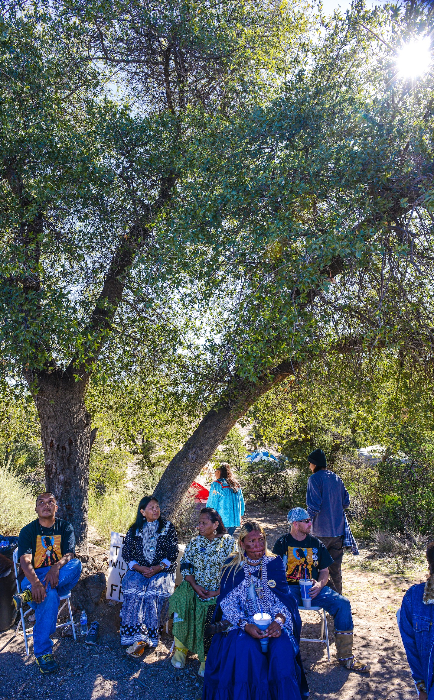
“Grandmother’s Tree” where baby cradle boards once hung while grandma enjoyed its shade.
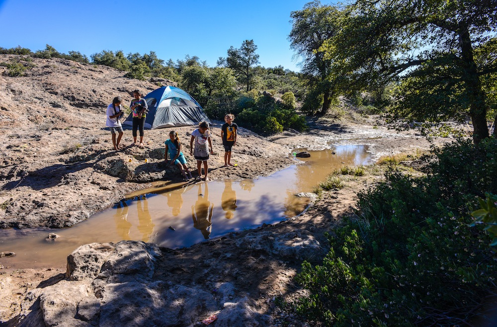
Indian kids play in the stream beneath the thick canopy from the Emory Oaks that provide the sought after acorn.
“This is Apache territory and Oak Flat belongs to the Apache–they took it away from us and we must take it back says Chairman Terry Rambler. I am very proud of my ancestor’s “Apache Pride” we were supposed to be exterminated but we are here today, let’s take over Oak Flat, this is our time to be involved! Apache were slaughtered and killed here–we will fight for the blood of our ancestors. “The chairman continues saying San Carlos Tribal council went on record voting against any copper mine being built upon their land and notes the white people came to this land in search of religious freedom, fleeing persecution, they wanted “to have the ability to pray, we want the same freedom”.”Some people have to visualize something, like a church, a structure to express their love of God, Oak Flat is our church, it is no different today, today is about religious freedom, we need to keep our connection to our God.”
Resolution plans to collapse the land beneath the Oak Flat Campground and it will be out of bounds forever.
“Oak Flat is our high ground, our mountains are called “weather makers”, they attract snow, it melts and the water flows in the four sacred directions. It flows to the Gila River, Queen Creek, the Salt River it makes the water that flows to us–it is the giver of Life and when Resolution Mine drill a mile deep making a hole a thousand times the size of a professional football stadium, it will subside and cave in–it will change the water.” All our medicinal plants will go away… We followed all the rules for ten years, we were winning and they put in a rider which made it hard for the legislature to say no. So without public input they passed this bill…”
When thunderstorms hit in this region, the mountains are where water is deposited before it flows downward toward the streams, rivers, underground aquifers and lakes. The water from the Oak Flat area continues eastward underground and flows down from the Pinal Mountains into Gilson Wash, then into the San Carlos River onward to the Gila River before it reaches San Carlos Lake. Our water is precious and limited. Resolution Copper Company will poison our waters and drain our aquifers.
Resolution Shafts #9 and #10 stand ready to begin
“We are not going to give up, it’s because of our children–our children’s children…we must fight this land deal!
White Mountain Apache Kay Lewis, a former tribal judge, wearing yellow pollen on his cheek noted Rep. Anne Kirkpatrick was raised on the WMA reservation where her father made his living from a Trading Post selling to the

Kay Lewis,former White Mountain Apache Tribal Judge (center)
Apache and “she should know better”. “I was surprised”, Lewis noted, Apache are Democratic voters and they supported Kirkpatrick in her last successful re-election.”She used the Apache! She should know the Apache values, traditions, customs and ceremonies and she did not speak up for the Tribe on this land. The Apache are really done with her !” Signs proclaims “AZ. TRIBES BEWARE OF KIRKPATRICK”, “DON’T UNDERMINE OUR SACRED LANDS”, black teeshirts say “PROTECT SACRED OAK FLAT”, “YOU CAN’T GIVE AWAY LAND THAT ISN’T YOURS TO GIVE” “SAVE,PROTECT AND OCCUPY OAK FLAT — NO LAND EXCHANGE, NO COPPER MINE !
Sandra Rambler says if bulldozers show up on Oak Flat, I will stand in front of them and “they can bulldoze me if they want…I am all in !” says the sister of Chairman Rambler.
Sandra Rambler
“It will be a great devastation, I don’t want our ancestors graves disturbed, my daughter had her Sunrise Ceremony on Oak Flat, if these laws can be made and they can be changed! We want justice for the Apache people, we are educated not stupid, they brought us here and made promises now broken, we are too smart to let this happen again!” Rambler says. “I have ancestors who fought for the U.S. Army, who weren’t given the right to vote until 1948”, even though Native Americans were given the right to vote on June 2nd, 1924, but because of some state law, Indians were not allowed the vote until 1947 except for Arizona and New Mexico who finally dropped their prohibition in 1948 because of legal rulings. Three main arguments for Indian voting exclusion were Indian exemption from real estate taxes, maintenance of tribal affiliation and the notion that Indians were under guardianship, or lived on lands controlled by federal trusteeship.
U.S. Rep. Paul Gosar’s reference to American Indians as “wards of the federal government” following a discussion about the controversial Arizona land deal that opens the door for the country’s third largest copper mine. The Arizona Republican in responding to concerns from Phil Stago of the White Mountain Apache Tribe when he made the comment that stunned people at a December round-table talk in Flagstaff, as well as Indians all across the United States.”He kind of revealed the truth — the true deep feeling of the federal government: ‘Tribes, you can call yourselves sovereign nations, but when it comes down to the final test, you’re not really sovereign because we still have plenary authority over you,'” Stago told The AP.
In 1978 Indians were given the right to express our religion through the American Indian Religious Freedom Act, Aug. 11, 1978 a United States federal law, enacted by Congress to protect and preserve the traditional religious rights and cultural practices of American Indians, Eskimos, Aleuts, and Native Hawaiians. These rights include, access to sacred sites, freedom to worship through ceremonial and traditional rights, and use and possession of objects considered sacred. The Act required policies of all governmental agencies to eliminate interference with the free exercise of Native American religion, based on the First Amendment, and to accommodate access to and use of religious sites. It also acknowledges the prior violation of that right. Due to the complex nature of American Indian religious beliefs, American Indian religions have often been at odds with existing federal laws and government policies. There have been several areas of conflict. Firstly, American Indians did not have access to a number of sacred places that the tribes had traditionally used in religious ceremonies. Native American religious practices often came into conflict with the idea that American public lands exist for the use and benefit of the American people.
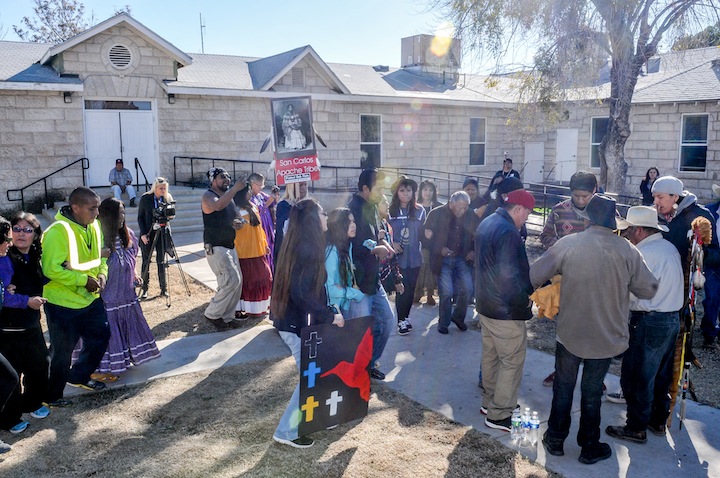
Dancers celebrate the beginning of the Occupying of Oak Flat

MAY LENCA
“You don’t get tired dancing, the drums put you into a meditative state.” The drum is like a heartbeat and it pushes you on”, says May Lenca, from western Honduras where her indigenous people live in the endangered rain forest. She is a spiritual person and came to Oak Flat to link spiritually with her Apache brothers and sisters. “John McCain has no heart, conscience or soul and he gave them up long ago for power, money and greed. You can’t do this if you have a heart ! “McCain is a lost soul.” We natives have joined together here, Lenca said. “We are all from the creator and we have to gather to protect Mother Earth.” “People can chose to be good”! The legislatures who did this – used to be people you could work with. But power corrupts and you have to learn to be humble with people.”
“We are a non-violent religious movement, said Wendsler Nosie at the conclusion of the Holy Ground Blessing.
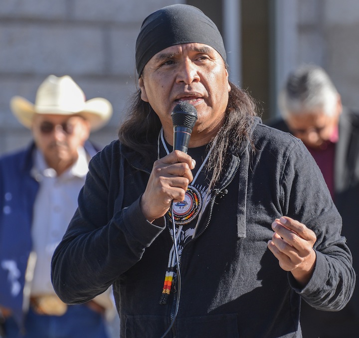
Wendsler Nosie Sr.
“Today eagle feathers arrived here on foot, this is a spiritual gathering. The idea is to get here so the blessing can be given by God. We have arrived so God will have blessed us … we are all brothers and sisters here. Together we will protect our waters so we can continue to live as human beings. The Apache need to be afforded the same protection as all U.S. citizens — we Apache want the same rights afforded everyone else. This is a gift from God to help save the world may we all be blessed from this day forward,” Nosie concludes.
Carrie Curley, age 26 is dancing with her aunt Margie Curley and says she is fighting for “my identity, our religion and our ancestral land”. Curley says every time she drives into the valley she stop at Oak Flat to pray. Her fondest memories are in Gann Canyon, where she prays thanking the good spirit for their land and to grace us with

Carrie Curley dances with her aunt Margie Curley
his blessing. “The creator gave us land so they can’t take it away.” Margie remembers Oak Flat from her high school days where she attended high school there, her fondest memories of the Easter celebration celebrated by the much of the whole town who moves to Oak Flat over the Easter weekend-but as an Apache, she loves Oak Flat as “a holy land, a land of prayer.”
On a bronze plaque in front of the San Carlos Apache Administration building is written beneath the names of all the Apache who served as chairman or leaders of the San Carlos Tribe; it reads: “We remember those who sacrifice and defended our people–we recognize our great leaders and their respect for those who know freedom. We must guide our people to, once again, hold our destiny in our own hands, so I challenge each of us to overcome the oppression and begin the process of believing in ourselves. This must be the first step…
Usen, we ask for your blessing to guide our current and future leadership so that our children and the unborn will inherit our Apache Way of Life…..Wendsler Nosie Sr.
The Oak Flat Campground was set aside in 1955 by President Eisenhower in an effort to preserve special public lands from threats like mining and development. Since that time, thousands of visitors have enjoyed the wilderness.
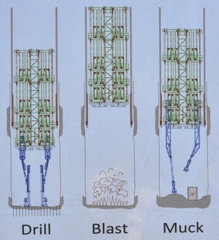
Shaft # 10 Mucking Process
Copper mining would shut out visitors to Oak Flat and allow international mining companies like Rio Tinto the power to disrupt the land by digging mine shafts, excavating minerals and carving roads through a once wild landscape. The tribes would be stripped of access to native and sacred lands to practice their religion, contrary to the 1978 American Indian Religious Freedom Act.
Block cave mining is a technique that involves drilling and blasting from underneath the copper ore body, creating an underground cavern. This method causes instability within the mine and at the surface, making it collapse. At the Henderson Mine near Empire, Colorado, an entire mountainside collapsed after undergoing block cave mining. At Oak Flat, this would put sensitive ecological areas and sacred tribal lands at risk and would change the landscape forever.
MORE PHOTOS OF SAN CARLOS APACHE MARCH AND OAK FLAT WEEKEND….CLICK HERE
JOHN McCAIN CHASED BY PROTESTORS OFF INDIAN LAND BY OAK FLAT PROTESTORS…..CLICK HERE
AVAAZ.ORG PETITION….CLICK HERE
PETITIONS.ORG
AGAINST PRIVATIZATION OF FEDERAL LANDS
PROPOSES OAK FLAT BE MADE A NATIONAL MONUMENT
NEW YORK TIMES EDITORIAL AGAINST THE POLITICAL CORRUPTION INVOLVED IN THE OAK FLAT SALE….CLICK HERE
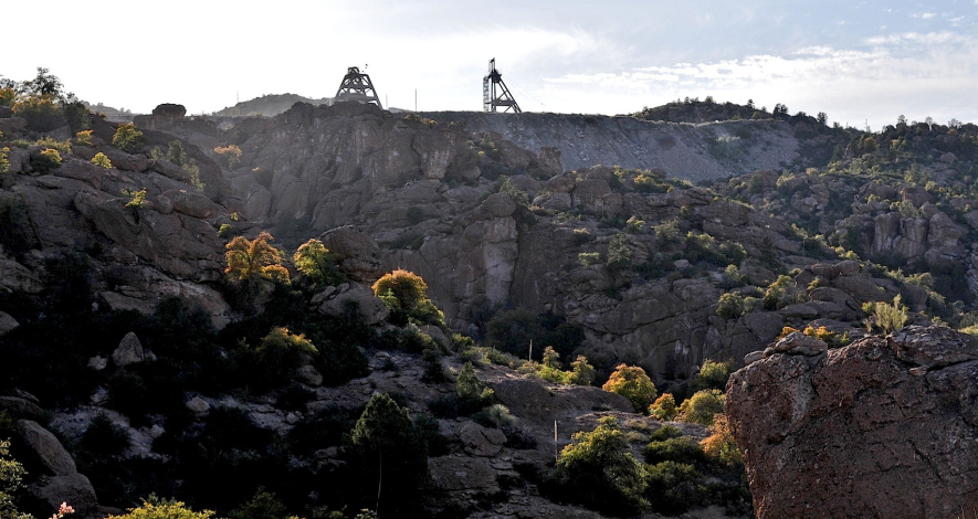
![]()
">CLICK HERE FOR SPANISH TRANSLATION
TUCSON’S NEW SKATE BOARD GENERATION CATCHES WAVE TOWARD THE NATIONS BEST SKATESCAPE …
 The first skateboarding wave washed across the United States in the 1960’s. Like all fads from the coast I had seen the hula-hoop and had little hope skateboarding would last long, locals nailed their sister’s skates to the bottom of a board and went for the downhill. You either knew if you were a skater or not, I was not the right stuff and knew it instantly. Historically the first skate park was made of plywood on a half acre sand lot in Kelso, Washington in 1966 and it had lights. The first modern concrete skate park opened in 1976 in Port Orange Florida and Carlsbad California, followed by indoor parks in less temperate climates but high insurance premiums caused the first wave of skateboarding died in court, but realized a resurgence followed in the United States when legislation in states like California’s 1998 law that said skateboarding is an inherently “Hazardous Recreation Activity” and cities will not be held liable for claims of negligence resulting in a skateboarding injury. Skateboard construction improved and skate parks have become more common.

TUCSON’S 22ND STREET SKATE PARK
 Today some cities put in skate parks with features not designed for skateboarding, but are street legal for skaters, other not. Tucson’s has a number skate parks in different parts of town, Tucson was once one of the best skateboarding scenes in the country, which is a little known fact about earlier times when Tucson skateboarders had permission to skate “THE BLOCKS” at El Presidio Plaza after 5pm until 1994. Rumor has it Skateboarders got the skate park at Randolph Park in exchange for no longer skating at “The Blocks” downtown. Today Tucson Skateboarding is a new force and has hopes of becoming politically active and wants to approach the city council in hopes of taking back “The Blocks”, and Tucson’s claim to top ten spots in the US to skate. Downtown Tucson has a new skateboarding shop opened by two brothers Kenzo and Zen Butler and their partner Jerry Jordon have moved into The Arches, a high ceiling warehouse at 35 E. Toole Ave and have spacious floor space and stylish fashions, boards at their The BLX Skate Shop dedicated to the “Golden Age of Skateboards” and the Skateboard culture which has its own set of values and language. Since downtown is the heart of this skateboarding culture, BLX is pronounced “Blocks” named for the feature now off-limits to skaters, but a short distance away.


 Skateboarding is a popular recreational activity among children and teenagers — especially boys. In recent years, skateboarding spin-offs, such as long-boarding and mountain boarding, have become increasingly common. Although it is a fun activity, skateboarding can result in a serious injury.
  In 2011, skateboard-related injuries accounted for more than 78,000 emergency room visits among children and adolescents 19 years old or younger. On average, about 52% of skateboard injuries involve children under age 15. Eighty-five percent of the children injured are boys. Many injuries happen when a child loses balance, falls off the skateboard and lands on an outstretched arm. Skateboarding injuries often involve the wrist, ankle, or face. Injuries to the arms, legs, neck and trunk range from cuts and bruises to sprains, strains, and broken bones. Wrist fractures are quite common. Wearing wrist guards can reduce the frequency and severity of these fractures. Facial injuries, such as a broken nose or jawbone, are also common. Severe injuries include concussion and other head injuries. There are many things that parents and children can do to help prevent skateboarding injuries, such as carefully selecting safe places to ride, and wearing protective gear, especially helmets. According to the American Academy of Pediatrics, children under age 5 years should not ride skateboards. Children aged 6 to 10 years old need close supervision from an adult whenever they ride a skateboard.
Practice tricks and jumps in a controlled environment, such as a skate park that has adult supervision and appropriate access to emergency medical care.
Be considerate of fellow skateboarders, especially those who are younger and/or less skilled. Take turns on ramps or other equipment.
Learn the basic skills of skateboarding, especially how to stop, slow down, and turn. Be able to fall safely: If you are losing your balance, crouch down on the skateboard so that you will not have as far to fall. Try to land on the fleshy parts of your body rather than your arms. Relax and roll.
Skateboard according to your ability level. Skateboarding skill is not acquired quickly or easily. Do not take chances by skateboarding faster than your experience allows, or faster than is safe for the surrounding conditions.
Practice and master each skill before moving on to a more challenging trick. Staying in good physical condition can help to prevent skateboarding injuries.

Directions to follow to Santa Rita Skate Park I-10 Fwy Westbound – exit Starr Pass Blvd/22nd St, take 2nd right at 22nd St, left at 3rd Ave into Santa Rita Park. 
Albert M. Gallego Skate Park Santa Rita Park 3rd Ave and 22nd St GPS 32.207522,-110.963395 Date Opened 2009 Square Footage 12,000  Just off the 10 Fwy in Tucson lies Santa Rita Skatepark.
The Albert M. Gallego Skate Park is located within the Santa Rita Park and should be on your list of places to go. This park opened in 2009 after almost 10 years of fundraising and plan changes. Santa Rita consists of three separate bowls: The Bonnie Bowl (a 12’ deep keyhole), a 4-6’ deep flow bowl, and a good size kidney. The Bonney Bowl is a classic 80’s style keyhole. It felt 12’ deep and fast. The shape is not perfectly round, but slightly squashed and the lip is finished with tiles and orange pool coping. The flow bowl varies in depth from 4′ to 6′ with a clamshell in the middle and a couple of hips. The bowl is finished with metal coping. The last bowl is a righthand kidney with an 8′ deep end and 3′ shallow end. This bowl is pretty mellow and good for beginners learning to carve. Santa Rita skate park opens at 6am and has lights until 10:30pm, which is necessary considering the daytime heat of the desert.
Now go check this one off.


WORLD’S LARGEST SKATE PARK….CLICK HERE
MORE PHOTOS FROM THE 22ND STREET SKATE PARK CLICK HERE
ARIZONA’S BEST SKATE PARKS…CLICK HERE
TUCSON’S BEST SKATE PARKS….CLICK HERE
<a href=” SPANISH TRANSLATIONS:">CLICK HERE FOR SPANISH
BIRDING IN THE SOUTHWEST, TAKE YOUR SCOPE ! NO MATTER WHERE YOU ARE IN ARIZONA THERE IS A HOT BIRDING PARADISE AT A WETLAND NEAR YOU !

SouthEast Arizona comes out number TWO on a list of twenty-five of the best birding locations in the Southwest. For one thing Southeast Arizona is the hummingbird capitol of the United States, particularly in August. Ramsey Canyon in the Huachuca Mountains is the place to head toward for hummingbirds in July or Augustlike the Blue-throated, Broad-billed, Black-chinned. The Arizona-Sonoran Desert Museum is said to attract desert species including Verdin, Gilded Flickers and Gila Woodpeckers. Cave Creek which runs through Portal in the Chiricahua Mountains along the South Fork Trail may yield Elegant Trogan or Flame-colored Tanager and owls. Madera Canyon/Florida Wash/Santa Rita Mountains area is known for its Magnificent Hummingbirds, Buff-collared Nightjar, Cassin’s or Botteri’s Sparrows at Florida Wash. The Strickland’s Woodpecker is found at higher elevation and the Elf Owls nests in the area. The Patagonia/Sonoita Creek is famous for its roadside rest area, watch for the Gray Hawk, Thick-Billed Kingbird, and Rose-throated Becard. Sonoita Creek Sanctuary is a hot birding spot, but may not be open every day .
NEED TO NAME A BIRD YOU HAVE SEEN TRY CLICKING HERE ….
BE SURE TO CHECK OUT THIS INCREDIBLE BIRDING BLOG CALLED: TOMMY’S BIRDING EXPEDITIONS
GREAT NEWS ! PATAGONIA’S PATRON’S BIRD HAVEN TO BE PRESERVED
To reach Paton’s Birder Haven from Tucson, take Interstate 10 east to Arizona 83 and follow 83 south to Sonoita. From Sonoita, take Arizona 82 southwest to Patagonia. In Patagonia, take Fourth Avenue west from Arizona 82 four blocks to Pennsylvania Avenue. Turn left, south, on Pennsylvania. The haven is the first house on the left after the avenue crosses a small creek.
Tucson and Southern Arizona is one of the best bird-watching destinations in the United States. More than 500 bird species have been observed here at different altitudes throughout the year. Hummingbirds are especially plentiful; more than 150 species have been seen in a single day during the spectacular spring and fall migrations.  Public gardens and state and national parks surrounding the city are havens for various winged natives and seasonal visitors. A short drive south of Tucson, in Southern Arizona’s rolling grasslands and lofty mountain ranges, one can find the Elegant Trogan, Broad-billed Hummingbird, Vermilion Flycatcher and many other species. Bird-watching festivals and nature walks are very popular during migration times.
Bird watching may be a quiet market, but Paul Green from the Tucson Audubon Society said cash is flying in with the help from visitors.
“When they come here they spend money mainly on food, lodging transportation and that’s worth to the state about 1.5 billion dollars a year. And Pima County more than 300 million dollars a year,” Green told KVOA TV. An avid bird watcher for more than 60 years, Richard Carlson said tourists come to Tucson with binoculars in hand to watch more than 400 species, while bringing in some big bird bucks.”If it’s a really great bird people will be buying airline tickets that day to come to that spot,” said Carlson. Business owners in Madera Canyon said if it wasn’t for the birding community, they would notice a substantial loss of business. “We probably have 50 percent of our clientele are bird watchers. Out of state people are flying into Tucson, renting a car and obtaining lodging here with us,” said Luis Calzo. “We’re looking to work more with businesses there in town to market the benefits of coming to Tucson for birding,” says Green.
10 best birding spots in southern Arizona
1. Chiracahua National Monument
2. Portal
3. Ramsey Canyon Preserve
4. Whitewater Draw
5. Muleshoe Ranch
6. San Pedro Riparian National Conservation Area
7. Buenas Aires National Wildlife Refuge
8. Sabino Canyon
9. Madera Canyon
10. Patagonia-Sonoita Creek Preserve
The first thing you notice about the Sweetwater Wetlands is that it doesn’t smell so sweet. But the restored wetlands has brought back wildlife and habitat once lost to the Santa Cruz River Valley and now through recycling sewage, it gives new life to this river. The wildlife is thriving here, as attested by two visiting photographers who frequently come by like Tucson lawyer Steve Kessel and R.C. Clark, both drop by all the time and see what is happening. Kessel said he has visited for an hour or two most days for the past year. He recently got “skunked” or saw nothing for five days, and on day five he stumbles across a momma bobcat watching her two kittens play and scamper about. Being bobcats they could care less if anyone watched or made pictures. After recovering from the awesome bobcat encounter, Kessel comes across the memorible sight of “four Giant Egrets, they have black legs, orange bills and are powder white, you will never forget that sighting,” says Kessel fueled by those encounters he is now back out walking the pathways with Clark enjoying the deepening shadows, richer light and constant bird chatter. “All the birds you want to see, all types are right here! The raptors, the songbirds, owls and ducks all find there way here and you never know what you are going to see.”


STEVE KESSEL (RIGHT) AND R.C. CLARK (LEFT)
Sweetwater Wetland is a constructed wetland located in Tucson between I-10 and the Santa Cruz River, near Prince Road. Built in 1996, it helps treat secondary effluent and backwash from the reclaimed water treatment system at adjacent Roger Road Wastewater Treatment Plant. Sweetwater serves as an environmental education facility and habitat for a wide variety of wildlife. Sweetwater Rarities seen here over the years include Least Grebe, Chestnut-sided Warbler, and many others. A group of Harris’s Hawks is often reported in the large eucalyptus trees north of Sweetwater, near the Roger Road Wastewater Treatment Plant. Sweetwater Wetland consists of several ponds surrounded by cattails, willows, and cottonwoods. Ducks visit the ponds while Red-winged, Yellow-headed, and Brewer’s blackbirds frequent the cattails. Thick stands of saltbush provide cover to Song Sparrows, Abert’s Towhees, wrens, and many other species. Paths, both paved and unpaved, visit all the ponds and give a view to the large detention basins to the south which attract wading birds and shore birds.
The hours for Sweetwater is 6am-6pm, opening 8am on Mondays. Tuesday to Sunday it opens at Dawn to approximately one hour after dusk Monday: 8 AM to one hour after dusk. Gates are locked 1 hour after dusk, don’t get locked in! The Wetland is closed on Monday mornings usually from late March to mid-November.
FREE BIRDING TRIPS IN TUCSON …..CLICK HERE
Trips hit all the important spots plus some out of the way locations but try Tucson’s Sweetwater Wetlands on Wednesdays. Join the TUCSON AUTUBON for an easy walk through the Sweetwater wetlands to see waterfowl in the hundreds, regular and visiting warblers, and several exciting species hiding in the reeds. Birders of all experience levels welcome! Contact leader for start time and to sign up, mike.sadat@gmail.com
See the Sweetwater online bird checklist.
LISTING OF BIRDING FESTIVALS ALL ACROSS THE UNITED STATES
Every year a part of Apache Junction, Arizona is transformed into a 16th Century European Country Fair when the Arizona Renaissance Festival opens to the public during the months of February and March.  One of the favorite shows is the Birds of Prey show on the grassy green next to the bird castle called "The Falconer's Heath." You get to see up close the awesome power of nature's most exciting birds. The time we were there they had a falcon tear through the air like a little winged thunderbolt. Then there was a scary South American vulture that cleaned a whole turkey leg in a few seconds. Like a piranha with wings.
The Arizona Renaissance Festival is a wonderful combination of amusement park, shows, comedy, music, feats of daring, street performers, shopping, and indulging. The Festival is spread out over 30 acres, and it is easy to spend an entire day there. Arizona Renaissance Festival will be open every Saturday and Sunday from February through March. Hours are 10 a.m. to 6 p.m. It is open rain or shine. Take State Highway 60 East, east of Apache Junction, just east of Gold Canyon Golf Resort, is the Renaissance Festival?
Bearizona Wildlife Park is proud to be the new home for the High Country Raptors, a nonprofit organization dedicated to promoting raptor conservation through education. The High Country Raptors are stationed in Fort Bearizona. There are three scheduled free-flight shows daily, 11am-1-3:00pm, during these shows, visitors come face to face with hawks, owls, falcons and other raptors. Programs have included “on the fist” demonstrations and dramatic “free flight” shows, all with a narrative on natural history, conservation and interesting facts while entertaining audiences of all ages.
At the conclusion of every show the handlers will have the birds throughout Fort Bearizona “on the fist” for visitors to get an up-close look and answer any lingering questions they might have.
Directions to help you get there. Parking is free
Bearizona Wildlife Park
1500 Historic Route 66, Williams, AZ 86046
(928) 635-2289
Hours: Wednesday 8:00 am – 4:30 pm

The barn owl is recognizable by its ghostly pale color and heart-shaped facial disc. The barn owl is one of the most wide-ranging birds in the world. Barn owls do not hoot, instead emitting a long, eerie screech. They also hiss, snore and yap. With its asymmetrical ears, the barn owl has the most acute hearing of any animal.

When we first opened the Arizona-Sonora Desert Museum‘s hummingbird aviary, writes Karen Krebbs, we had no idea whether or not any of the seven species of the birds on exhibit would breed and rear young.  Since opening day, however, we’ve seen Costas, Broad-billed, Black-chinned, Anna’s, and Calliope hummingbirds nest, lay eggs, and rear young. There have been a total of 114 nests built, 186 eggs laid, 116 birds hatched, and 102 birds fledged. No other zoological institution can boast of such success!

For more information, visit High Country Raptors.
Arizona Sonora Desert Museum
2021 N Kinney Rd
Tucson, AZ 85743
(520) 883-2702
desertmuseum.org


Arizona’s unique combination of geography and climate supports more than 500 species of birds. That’s almost half the total of all bird species that can be found in the United States and Canada!
Feeding along side of one of America’s grandest mirgratory flyways, the Rio Grande River which winds through New Mexico provides feed and rest for migrating birds, like these Sandhill Cranes.
Welcome to registration for the 21st Annual Wings Over Willcox Birding & Nature Festival
If you have any questions call 1-800-200-2272 To register online click here…
15 Jan 2014 – 19 Jan 2014 includes Sandhill Cranes Tours – Thousands up close and personal, southwest mountain birds, wildlife photography, and beginning birdwatching. Tours are limited and many fill early. Contact Terry Rowden with the Willcox Chamber of Commerce and Agriculture in Willcox Call the Chamber of Commerce at 520-384-2272, 800-200-2272 or go online at Website: http://www.wingsoverwillcox.com
1/17/2014 Friday
Daylong Photography Remaining Tickets: 7 Meet at WCC: 5:50 AM Return: 4:00 PM $100.00
Spend time with two wildlife photography experts THOMAS WHETTEN AND GEORGE ANDREJKO at Whitewater Draw and other southeastern Arizona sites, photographing Sandhill Cranes and other birds. Less than ½ mile of easy walking. Intermediate to Advanced Photographers. Includes lunch, drinks. A visit to the Willcox Playa Wildlife Area offers a rich experience in an otherwise desert environment. Bird-watching at the playa and associated habitats is a fantastic way to spend a day or a weekend. Birds that can be seen range from shorebirds to the always enjoyable flocks of sandhill cranes that are the focus of the annual Wings over Willcox birding festival where each winter, Bird-watching and photography takes center stage as hundreds of species of birds visit the Willcox Playa Wildlife Area. Growing interest in viewing wildlife sparked this annual event, Wings over Willcox.
Tucson Audubon’s Harvest Festival …August 13–17, 2014
Bring the family to Tucson Audubon’s Mason Center to celebrate the edible bounties of the Sonoran Desert. There will be vendors and exhibitors, family activities, guided bird walks, sustainability tours, food trucks, a plant sale, and opportunities to mill your mesquite pods into delicious, gluten-free flour. Tucson, AZ, US Tucson Audubon Contact: Kara Phone Number: 520-629-0510 Website: http://www.tucsonaudubon.org/harvestfestival
THE TUCSON’S VALLEY AUDUBON CHRISTMAS COUNT WILL BE HELD DECEMBER 15, 2014
The National Audubon Society has conducted Christmas bird counts since 1900. Volunteers from across North America and beyond take to the field during one calendar day between December 14 and January 5 to record every bird species and individual bird encountered within a designated 15-mile diameter circle.
WINGS OVER WILLCOX
15 Jan 2014 – 19 Jan 2014
25,000+wintering Sandhill Cranes; area hosts many hawks,eagles,&falcons; also20+sparrow species. Bird tours(expert guides),free seminars, & nature expo(vendors & live animals). Banquet speaker Bill Thompson III (“BirdWatcher’sDigest” & “BilloftheBirds” blog) on “Perils and Pitfalls of Birding”. For non-birders–tours & free seminars on local history, geology, natural history, agriculture &astronomy. Sierra Vista, AZ, US
Tours include Sandhill Cranes – thousands up close and personal, southwest mountain birds, wildlife photography, and beginning birdwatching.
Tours are limited and many fill early. Contact the Willcox Chamber of Commerce at 520-384-2272, 800-200-2272 or go online at http://www.wingsoverwillcox.com

ARIZONA is home to more than 500 species of bird which bring $1.5 billion of tourism to the area.
In Parker, Arizona since the 1930’s the large cottonwood-willow forests along the lower Colorado River have largely disappeared. The Bill Williams River National Wildlife Refuge contains the last extensive native riparian habitat in the Lower Colorado River Valley. For many species of birds this is the only habitat remaining in the area for breeding; for others, it is a vital stopover during migration. The refuge is also home for the largest populations of many resident birds found in the valley. Habitats found on the refuge include desert uplands, marshes, riparian forests, and the open water of the delta. The diversity and uniqueness of the Bill Williams River NWR provides visitors with a rewarding birding experience.
Neotropical migrant landbirds are those species of land birds that nest in the United States or Canada, and spend the winter primarily south of our border in Mexico, Central or South America, or in the Caribbean. Many of them, including conspicuous or colorful hawks, hummingbirds, warblers, and tanagers, and less colorful but no less important flycatchers, thrushes, and vireos, are experiencing population declines due to widespread loss of habitats important for their survival. Preservation of many different habitats for nesting, wintering, and migratory stopover sites is becoming vital for the survival of many of these birds.
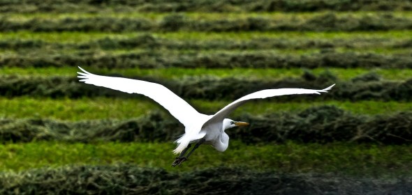
The Whooping Crane (Grus americana), the tallest North American bird, is an endangered crane species named for its whooping sound. In 2003, there were about 153 pairs of whooping cranes. Along with the Sandhill Crane, it is one of only two crane species found in North America. The Whooping Crane’s lifespan is estimated to be 22 to 24 years in the wild. After being pushed to the brink of extinction by unregulated hunting and loss of habitat to just 21 wild and two captive Whooping Cranes by 1941, conservation efforts have led to a limited recovery. As of 2011, there are an estimated 437 birds in the wild and more than 165 in captivity.
Havasu National Wildlife Refuge encompasess 37,515 acres adjacent to the Colorado River. Topock Marsh, Topock Gorge, and the Havasu Wilderness constitute the three major portions of the refuge. Habitat varies from cattail-bulrush back waters and shrubby riparian lowlands to steep cactus-strewn cliffs and mountains. Due to the southery location of the refuge it is primarly a wintering area and stopover point for migrating birds.
The area in and around Lake Havasu City is rich in bird watching opportunities, with more than 350 species identified in the local area. Consult the Mohave County Field Check List to learn of the possibilities. One of the best ways to observe waterfowl is from a kayak or canoe in early morning. Free non-motorized boat launches are located at Castle Rock Bay Canoe Takeout Point and Mesquite Bay, maintained by U.S. Fish & Wildlife.You’ll find cattails and sandbars for loons, grebes, ducks, larids, raptors and coots. Horned Grebes favor this area in winter, along with the more usual grebes and flotillas of coots. For land based excursions, try the free fishing piers at Mesquite Bay on London Bridge Rd., just north of Industrial Blvd., which are open 24 hours. The walking trail and Arroyo-Camino Interpretative Garden at Lake Havasu State Park offers opportunities for both land and water bird viewing.
Leaving early the first morning, take Highway 95 South for approximately 20 miles to the Bill Williams River National Wildlife Refuge. The refuge office is located between mileposts 160 and 161. There is plenty of parking. The Visitor Center is open from 6:30 AM to 4:00 PM, Monday through Friday and from 10:00 AM to 2:00 PM on weekends. Stay as long as you like, then return to Lake Havasu City for dinner.
Leaving early the next morning, take Highway 95 north to I-40 West (direction of Needles/Las Vegas) to the Havasu National Wildlife Refuge. Exit I-40 at exit marker 1. It is posted as Havasu National Wildlife Refuge; follow the signs to the refuge. There is plenty of parking. The Visitor Center is open from 8:00 AM to 4:00 PM, Monday-Friday.
Imperial National Wildlife Refuge consists of approximately 25,000 acres along the lower Colorado River. Spring and Fall offer the greatest variety of birds and the best birding opportunities. Also, the refuge is important as a wintering area for Canada geese and many species of ducks. Maps and regulations are available at the refuge headquarters for your convenience.


Little Picacho is a hot spot in the summer and this bird and his buddies look for the unprepared.
Welcome to the Bureau of Land Management’s (BLM’s) Yuma District. The District encompasses over 2.5 million acres of land, of which almost 1.25 million acres are public lands. These are your lands to enjoy and protect. They are managed and administered by the BLM to maintain the multiple use values of all resources, for you, and for future generations.
The Yuma District encompasses over 2.5 million acres of land, of which almost 1.25 million acres are public land along the entire 280-mile length of the lower Colorado River, from Davis Dam along the Nevada border on the north, to the border with Mexico on the south. It includes portions of Arizona and California and contains a wide diversity of wildlife habitat.

Winter visitors flock to the Yuma Colorado River each fall for the warmer temps and bird-watching.
Cibola National Wildlife Refuge on the Colorado about 40 miles north of Yuma includes 18,300 acres of riparian habitat with more than 288 species of birds, including endangered southwestern willow flycatcher and Yuma clapper rail; desert tortoise, mule deer, bobcats and coyotes. Use the visitor center, and enjoy the 3-mile auto tour loop and 1-mile nature trail but camping is not permitted.
This list of 271 species highlights birds found along The San Pedro Riparian National Conservation Area includes over 56,000 acres in Cochise County, Arizona. Extending approximately 40 miles northward from the Mexican border to a few miles south of St. David, the NCA represents the most extensive, healthy ripari an ecosystem remaining the desert Southwest. The Bureau of Land Management manages the area to protect and enhance the existing riparian habitat and wildlife communities, as well as provide for recreational use, cultural interpretation, and educational opportunities.
The 40,000-acre Cienega de Santa Clara is a principal stopover point for migratory waterfowl and home to hundreds of bird species, including the endangered Yuma clapper rail, a secretive shorebird whose cry sounds like hands clapping.

Santa Clara Wetlands lies in Mexico in the Colorado River Delta and serves as a flyby rest stop.
The 40,000-acre Cienega de Santa Clara is the largest remaining wetland in the Rio Colorado delta; it supports endangered bird and fish species. The wetland is maintained by agricultural drainage water discharge from the USA which may be diverted to the Yuma Desalting Plant in the future. The distribution of marsh plants is related to salinity and water depth within the Cienega. During 8 months of unplanned flow interruption due to the need for canal repairs, 60-70% of the marsh foliage died back. Green vegetation was confined to a low-lying geologic fault which retained water; though the vegetation proved resilient, prolonged flow reduction would unavoidably reduce the size of the wetland and its capacity to support life.

“I’ve been birding the Verde Valley and Flagstaff area for 13 years now and know it to be a wonderful spot where anyone can turn up a real gem at any time,” says Tom Linda, a birder and popular guide at the Verde Valley Birding & Nature Festival. The annual Nature Festival takes place at Dead Horse Ranch Park in Cottonwood, Arizona, during the last weekend in April.

The Continental Lake on Flagstaffs northeast side at sunrise.
SOUTHWEST BIRDING HOTSPOTS OR RARE BIRD ALERTS
SOUTHWESTPHOTOBANK.COM PHOTOS GALLERY FOR SOUTHWEST WILDLIFE…CLICK HERE
Condor Viewing in the Vermilion Cliffs National Monument

ARIZONA STRIP’S VERMILLION CLIFFS IS HOME TO THE CONDOR
California condors were placed on the federal Endangered Species list in 1967. Only 22 condors were known to remain in 1982, while today the world population exceeds 400, with over 225 condors living in the wild. Approximately 75 condors reside in the Vermilion Cliffs National Monument. In Arizona, reintroduction is being conducted under a special provision of the Endangered Species Act that allows for the designation of a nonessential experimental population, under this protections for a species are relaxed, allowing greater flexibility for management of a reintroduction program.
Since December of 1996, program personnel have released condors every year. Each condor is fitted with radio transmitters and is monitored daily by field biologists. Directions to visit the condor viewing site in Arizona, drive north on Highway 89 out of Flagstaff, Arizona. Turn left onto Highway 89A toward Jacob Lake and the North Rim of the Grand Canyon. Drive approximately 40 miles (past Marble Canyon, Vermilion Cliffs, and Cliff Dwellers lodges); turn right onto House Rock Valley Road (BLM Road 1065) just past the House Rock Valley Chain-Up Area. Travel approximately 2 miles to the condor viewing site on the right. Atop the cliffs to your east is the location where condors are released, and a good place to see condors year round. In winter months, condors frequent the Colorado River corridor near Marble Canyon, which is east of the condor viewing site on Highway 89A. In the summer months condors are seen frequently at the South Rim of the Grand Canyon and at Kolob Canyon in Zion National Park north of St. George, Utah on Interstate Route 15. Hours: 7:45 a.m.-5:00 p.m. Monday through Friday 10:00 a.m.-3:00 p.m. Saturday. Closed Sunday.
Vermilion Cliffs National Monument 345 E. Riverside Drive St. George, UT 84790-6714 (435) 688-3200
photographed in Southern Arizona at Parker Canyon Lake.
Spring in the Chiricahua Mountains — BIRDING LINKS
Southeastern Arizona Bird Observatory
P.O. Box 5521
Bisbee, AZ 85603-5521
(520) 432-1388
The Sulphur Springs Valley is a winter paradise for birds of prey. Up to twenty species may be found here between November and March, including eagles, falcons, buteos, accipiters, harriers, kites and owls. The Southern Arizona Bird Observatory Hawk Stalk tours take you down highways and back roads in search of these magnificent predators and other species that share their habitats. Along the way, your expert naturalist guides will share their knowledge of the identification, behavior, ecology, and history of the valley’s raptors, Sandhill Cranes, sparrows, and other wintering and resident birds. These all-day tours depart at 8 a.m. from downtown Bisbee and return around 4 p.m. Participants travel in a 15-passenger van (or minivan for groups of 5 or fewer), with frequent stops for roadside birding and short walks. The group will stop for lunch. Tours begin Thanksgiving weekend and continue most weekends through February. Please register at least one week in advance. $75 per adult for members of SABO, $85 for non-members; $40/members, $45/non-members for children age 10-16 when with by an adult. Educational handouts and transport from Bisbee is included.

Massi Point in the Chiricahua National Monument over looks the Sulpher Springs Valley.


Come visit the Southwestern Research Station Birding Paradise located at 5400 feet elevation in one of the world’s Biodiversity Hotspots.
The Southwestern Research Station is located in the heart of the Chiricahua Mountains and is famous for its close proximity to nesting Elegant Trogons, a large diversity of hummingbirds, and other spectacular bird migrants from Central and South America. Enjoy cabin accommodations, cafeteria dining, a reservoir for swimming, our hummingbird area and gift shop, and a multitude of hiking trails within walking distance or a short drive.
The Southwestern Research Station, located 5 miles from Portal, AZ, is hosting 7 day/6 night birding tours in Cave Creek Canyon, an area of high bird species diversity. Each trip is limited to 10 persons or 5 couples. Registration for tours is one month prior to tour date.
The Chiricahua Mountains of S. E. Arizona afford some of the best birding in the United States. Our 6 night Bird and Nature Tours include:
— Round trip transportation from the Tucson airport;
— Double-occupancy in our newly remodeled cabins, including a small kitchenette;
— Breakfast, Lunch, and Dinner in the SWRS dining area;
— Hearty and sumptuous sack lunches and bottled water on day field trips;
— Professional guide and all park entrance fees;
As space permits, people other than scientists and researchers are welcome to stay at the SWRS. The Chiricahua Mountains are a prime destination for nature enthusiasts, with some 265 bird species recorded in the area, including nesting Elegant Trogons, Montezuma Quail, and over 13 species of hummingbirds. About 30 species are of sub-tropical origin and have their northern limits within this area.
Tour groups are welcome to stay at the Southwestern Research Station when space is available usually only during the spring and fall. Tour participants are housed in private rooms, double occupancy (some single occupancy rooms are available). All rooms have small kitchenette. Tour organizers must coordinate reservations and room assignments, and handle payment. Each room in our newly remodeled triplexes has either two single beds or one king size bed. Additionally, each room has a comfortable sitting area that includes a sofa that can convert to a bed, a private bathroom, and a kitchenette unit with microwave, coffee maker, and small refrigerator. The room cost includes three ample, delicious meals, served cafeteria style. Handicap accessible rooms are available.The cost per room, including three meals, is $90.00/person/night double occupancy or $130.00/night single occupancy.
Individuals may make reservations from 1 March to 15 June and from 1 September to 31 October. All rates include three full meals (vegetarian option) in our cafeteria where you have the opportunity to chat with other visitors and share birding experiences. On those days you wish to travel to more distant areas to bird watch, we will provide you with a sack lunch.

Cave Creek on the east side of the Chiricahua Mts where the Apache once farmed and where the Southwest Research Facility now calls home.
Biological Field Station located nestled in the Chiricahua Mountains in Southeastern Arizona, there the Southwestern Research Station (SWRS) is a year-round field station under the direction of the Science Department at the American Museum of Natural History (New York, NY). Since 1955, it has served biologists, geologists, and anthropologists interested in studying the diverse environments and biotas of the Chiricahua Mountains in southeastern Arizona. Southwestern Research Station, P.O. Box 16553, Portal, AZ 85632; FAX: 520-558-2018 http://research.amnh.org/swrs/about-swrs

Mt. Lemmon – At 9157 feet, Lemmon is the highest peak in the Santa Catalina Mountains. Vegetation ranges from saguaro-palo verde desert scrub at its base to mixed conifer forest at the summit. The drive from Tucson is via the winding paved Catalina Highway with frequent precipitous slopes that give majestic views of southern Arizona. Many miles of trails are available, traversing lush mountain meadows, dark forests and open woodlands of pine and oak. A remarkable variety of birds can be found April through September, including Red-faced, Olive, and Grace’s Warblers, Hepatic Tanager, Greater Pewee, Zone-tailed Hawk and many more.
Huachuca Mountains – Home to some of the best birding in Arizona. The superlative quantity and diversity of hummingbirds are probably unmatched in the U.S. and nowhere else north of Mexico are Buff-breasted Flycatchers more common. Spotted Owls and Elegant Trogons are also highlights. The main birding areas are in canyons on Fort Huacuhuca and the Coronado National Forest and at privately-owned feeders.
Santa Ritas (Madera Canyon) – Madera Canyon is one of the most famous birding areas in southeast Arizona. This canyon’s habitat consists of riparian woodland along an intermittent stream, bordered by oak woodland and mountain forests. The road enters through desert grassland and ends above the oak woodland, where hiking trails lead up the “sky island” through pine-oak woodland to montane conifer forest and the top of Mt. Wrightson (elevation 9453 feet). The spectrum of birds found in these varied habitats includes four tanagers: Summer, Hepatic, Western and Flame-colored as an occasional breeder. Hummingbirds, owls, flycatchers and warblers are also very well represented in this area.
Patagonia-Sonoita Creek Preserve is the centerpiece of Santa Cruz County’s birding hot spots. This sanctuary, owned and managed by The Nature Conservancy, is one of the best birding spots in the Southwest. This lush riparian area provides habitat for over 200 species of birds plus rare fish, frogs, and plants. Gray Hawks nest in the large Fremont Cottonwoods along the creek, and Zone-tailed and Common Black-Hawks are occasionally seen. Over 20 species of flycatchers have been recorded on the preserve, including Thick-billed Kingbird and Northern Beardless-Tyrannulet. Recent rarities include the first known Sinaloa Wren in the United States. The preserve is on the west side of Patagonia; turn off Hwy 82 at Fourth Avenue, then follow the signs to the visitor center. The Nature Conservancy charges a general admission fee of $5.00 per person for adult non-members, $3.00 per person for adult members of TNC. Children under 16 and Patagonia residents are admitted free. Admission is valid for 7 days from the date of purchase; annual passes are available. The preserve is closed Mondays and Tuesdays year round, and visiting hours vary seasonally.
Southwest of Patagonia is the famous Roadside Rest Area. Many rare or hard-to-find birds have been sighted here, the most famous of which are the Rose-throated Becards that often nest in the Arizona Sycamores along Sonoita Creek across the highway from the rest area.
BOSQUE DEL APACHE WILDLIFE PRESERVE
Make plans to attend the 26th Annual Festival of The Cranes, Nov 19-24, 2013. Six great days of workshops, tours, lectures, hikes, special activities, and wildlife exhibitions. Register today and don’t miss out on this unique festival celebration!
The tour loop is a 12 mile, one-way graded road with a two-way cut-off which divides the full tour into a shorter South Loop of 7 miles and a North Loop of 7.5 miles. Both portions provide excellent winter viewing of wetland wildlife and raptors; the North Loop passes close to daytime winter foraging areas of cranes and geese. In spring and early fall; both loops provide close viewing of shorebirds and waterfowl. During the summer, impoundments adjacent to the North Loop are drained for vegetation management, but wild turkeys, songbirds and mammals may be present. Summer wetlands for waterfowl are along the South Loop, and along a seasonal road which is open April 1 to September 30. Stop as often as you wish along the tour loop to view wildlife; just pull to the side so others can pass. If you remain inside your vehicle, it serves as a blind so wildlife may remain closer while being viewed. Viewing platforms along the tour route accessible to people with disabilities offer viewing of cranes and geese during fall and winter. Some are equipped with a spotting scope.
Click here for videos of Bosque del Apache….
BE SAFE WHILE BIRDING IN THE SOUTHWEST… HERE’S HOW, CHECK IT OFF !

HUMMINGBIRD
$6.00 per person. Conservancy members and Cochise County residents, $3.00 per person. Children under 16 – FREE. There is no admission charge the first Saturday of every month. Annual passes available, as well as two-fer that covers this preserve and Patagonia-Sonoita Creek ($10 general public). Group visits require prior arrangements. Please call (520) 378-2785. 27 E. Ramsey Canyon Road, Hereford, AZ 85615
Open 8 a.m. to 5 p.m. Closed Tuesdays/Wednesdays. Preserve parking is limited to 23 spaces. Spaces are available on a first-come, first-served basis.

Entrance to Madera Canyon, one of Southern Arizona’s favorite places to look for feathered winter visitors.
Madera Canyon, one of the most famous birding areas in the United States, is a north-facing valley in the Santa Rita Mountains with riparian woodland along an intermittent stream, bordered by mesquite, juniper-oak woodlands, and pine forests. Madera Canyon is home to over 250 species of birds, including 15 hummingbird species. Visitors from all over the world arrive in search of such avian specialties as the Elegant Trogon, Elf Owl, Sulphur-bellied Flycatcher, and Painted Redstart.
MADERA CANYON is 25 miles south of Tucson and 11 miles east of Green Valley. Turn east off of I-19 at the Continental Exit 63. Follow the signs to Whitehouse Canyon Road and on to the Forest boundary, about 11 miles. At the end of the road at the parking lot, the trailhead leads to Old Baldy.
In the Santa Rita Experimental Range below Madera Canyon can be found birds of the desert grasslands and brush, including Costa’s Hummingbird, Varied Bunting, Blue Grosbeak, Scaled Quail, Phainopepla, Botteri’s, Cassin’s, Black-throated, Brewer’s, and Rufous-winged Sparrows.
At Proctor Road, most birders walk the productive first section of the trail to Whitehouse Picnic Area to find Northern Beardless-Tyrannulet, Sulphur-bellied Flycatcher, Bell’s Vireo, Lucy’s Warbler, Blue Grosbeak, Varied Bunting, Summer Tanager, and sometimes Yellow-billed Cuckoo. The dirt road shortly above the parking lot may have Western Scrub-Jays and a Crissal Thrasher. Farther up the road, the Madera Picnic Area has Acorn and Arizona Woodpeckers, Mexican Jay, Bridled Titmouse, Painted Redstart, and Dark-eyed Junco. Three Myiarchus flycatchers , Western Wood-Pewee and Hepatic Tanager can be found here in season. Watch overhead for Zone-tailed Hawk among the Turkey Vultures.

INCA DOVE
The road to Madera Canyon enters through desert grasslands and ends in juniper-oak woodland, where hiking trails lead up in the “sky island” through pine-oak woodland to montane conifer forest and the top of Mt. Wrightson (elevation 9,453 feet). The spectrum of birds found in these varied habitats includes four species of tanagers: Summer at Proctor Road, Hepatic starting at Madera Picnic Area, Western up the trails in the conifers, and Flame-colored as an occasional breeder. Hummingbirds, owls and flycatchers are also very well represented in this area. Montezuma Quail are inconspicuous but present near grassy oak-dotted slopes. Madera Canyon makes a large dent in the northwest face of the Santa Rita Mountains. Its higher elevation grants relief to desert dwellers during the hot months and allows access to snow during the winter. A world-renowned location for bird watching, Madera Canyon is a major resting place for migrating species, while the extensive trail system of the Santa Rita Mountains is easily accessed from the Canyon’s campground and picnic areas. Madera Canyon has a long and colorful history. The Friends of Madera Canyon, a cooperating volunteer group, has developed a small booklet that can be requested at the gatehouse. Elegant Trogons are most often found along the first mile of either the Super Trail of the Carrie Nation trail. Hermit Thrush, American Robin, Plumbeous Vireo, Painted Redstart, and Dusky-capped Flycatcher are common along the trails. Yellow-eyed Juncos breed higher up towards Josephine Saddle.Night birding is a Madera canyon highlight, especially in May. Listen for Western and Whiskered Screech-Owls, Elf Owls and the much rarer Flammulated and Spotted Owls. Whip-poor-wills are in the forest and Common Poorwills can be heard near Proctor and below. Lesser Nighthawks, Barn and Great Horned Owls often fly across the road through the beam of your headlights as you approach the canyon.
A Coronado Recreation Pass or a National Interagency Recreational Pass must be displayed. Day Pass $5. Week Pass $10. Annual Pass $20

BABY HORNED OWLS
Muleshoe Ranch Service, Gailuro Mountains, Arizona
In southeast Arizona, the great Sonoran desert and the Chihuahuan desert reach out to meet one another. Lofty mountains with large undulating flat basins provide runoff to the streams and tributaries of the San Pedro River. The river is born in Mexico and flows north with life-sustaining water to produce a desert wetland, a sanctuary for year-round mountain and desert species, and a rest stop for flocks of migrating birds.
Breeding diversity in southern Arizona riparian areas is higher than in all other habitats combined, and Western riparian areas contain the highest non-colonial bird breeding densities in North America. More than 400 species of birds have been recorded within the San Pedro River basin’s major habitats. Nearly one-half of the United States’ bird species frequent the area as they migrate. The tremendous importance of the San Pedro River system was established in 1988 when it was recognized as this country’s first Riparian National Conservation area. The river is a 140-mile long desert oasis — a dry San Pedro would mean no green corridor or birds migrating across the arid land of the Southwest. The consequences are hard to fathom. Careful conservation planning is necessary to help preserve the right kind of natural areas in just the right places in order to keep migratory corridors connected. Purchased by the Nature Conservancy in 1982, Muleshoe Ranch is one of the most biologically diverse desert riparian areas in the world.

It’s easy to see why people fall in love with desert habitats after a late-afternoon walk in Sabino Canyon. When the setting sun casts a golden glow on the mountains, I have to remind myself that I visit this place with the intention of birding. I’m brought back to the task at hand by the inquisitive wurp of the locally common Phainopepla and the activity of bold, noisy Cactus Wrens. On spring evenings, Elf Owls can be heard barking from the surrounding saguaros, and they are often joined by Common Poorwill, Western Screech-Owl, and Great Horned Owl. Winter is my favorite time to bird the canyon. I like to walk the lower stretch of the creek to where an old dam has backed up moisture and created a thick willow forest. In the colder months, it’s possible to see four species of towhee here: Green-tailed, Canyon, Abert’s, and Spotted. Numerous rarities have also shown up over the years. Sabino Canyon’s variety of habitats (including a rare desert creek lined with riparian vegetation) has prompted its inclusion as an Important Bird Area in National Audubon’s program in Arizona. The birds seem to know of the canyon’s regional importance. They are abundant, taking advantage of the excellent protected habitat in the area. – Matthew Brooks

Residents: Abert’s Towhee, Black-chinned Sparrow, Western Screech-Owl, Northern Cardinal, Pyrrhuloxia, Greater Roadrunner, and Rufous-crowned, Rufous-winged, and Black-throated Sparrows. Summer: Northern Beardless-Tyrannulet, Elf Owl, Brown-crested Flycatcher, Bell’s Vireo, Broad-billed Hummingbird, Lucy’s Warbler, Bronzed Cowbird, Hooded Oriole, and Varied Bunting (uncommon). Winter: Hermit Thrush, Lawrence’s Goldfinch, and Green-tailed Towhee. Rarities: Plain-capped Starthroat, Violet-crowned Hummingbird, Winter Wren, and eastern warblers.
Sabino Canyon tours offers a narrated, educational 45-minute, 3.8 mile tour into the foothills of the Santa Catalina Mountains. The trams have nine stops along the tour with several restroom facilities and picnic grounds located near Sabino Creek. The tram turns around at Stop #9 and heads back down to the Visitor’s Center, at which point riders may remain on board and hike back down. Trams arrive on average every 30 minutes.
Summer Hours: (July through mid-December) Monday-Friday: 9:00 a.m. – 4:00 p.m. Weekends & Holidays 9:00 a.m. – 4:30 p.m.
Winter Hours: (mid-December – June) Monday-Sunday 9:00 a.m.-4:30 p.m Visitor Center: Monday-Sunday 8:30 a.m.-4:30 p.m.
Fees: $8.00 adults, $4.00 children 3-12. Children 2 and under are free.
Driving from Tanque Verde Road in Tucson turn north on Sabino Canyon Road 4 miles to the Sabino Canyon Recreation Visitor Center or the coordinates: 32°18’36.09N 110°49’20.27W 5700 N. Sabino Canyon Rd. Tucson, Arizona 85750 (520) 749-8700
911 OR ARIZONA / SOUTHWEST BIRDING HOT SPOTS AND RARE SIGHTINGS

Suffering from drought the once three pond compound has shrunk up and now has only the main pool.

Organ Pipe Cactus scheduled tours to historic Quitobaquito last year and we hope they planned a couple weekend tours to give visitors an opportunity to take part in the tour. Last year’s tours were scheduled: February 8, 15, 17, 22 & 24 ; March 1, 8 & 15.
Anyone wishing to reserve a seat on the van this year should call 520-387-6849, extension 7302 for and see if they are taking reservations. The number of available seats were limited, so reservations were required. No personal vehicles are permitted on the tour. A National Park Service van will transport visitors to Quitobaquito with a Park Ranger who will provide a guided tour of the area. Participants should arrive at the Kris Eggle Visitor Center no later than 7:45 a.m. The tour will leave the visitor center after a safety briefing. The van will return at approximately noon. Children must at least 12 years old and accompanied by an adult.The walking tour will last approximately two hours and be through the historic area over uneven ground. Participants should bring a snacks, water, sunscreen, brimmed hat and wear sturdy shoes. People may bring binoculars and cameras, however the van does not have storage capacity so large camera bags and tripods will not fit. All participants will be required to go on the walking tour and stay as a group with the Park Ranger.
BIRDING IN ARAVAIPA CANYON … CLICK HERE
Aravaipa is famed as a birder’s paradise, with nearly every type of desert songbird and more than 150 species documented in the wilderness. Isolated Aravaipa Canyon is one of the true natural Arizona wonders, featuring a desert steam, majestic cliffs and bighorn sheep. Located about 50 miles northeast of Tucson, the preserve includes lands at both the east and west end of Aravaipa Canyon, as well as preserved lands intermixed with public land on the canyon’s south rim. The 9,000 acres owned by The Nature Conservancy are managed in conjunction with about 40,000 acres of federal lands. Preserve elevation ranges from 2,800 feet at the west end of the canyon bottom to 6,150 feet on Table Mountain. The 10-mile long central gorge, which cuts through the northern end of the Galiuro Mountains, is a federal Wilderness Area managed by BLM. Access into Aravaipa Canyon is by permit only and available only through BLM.Among the more than 200 species of birds found at Aravaipa are black and zone-tailed hawks, peregrine falcon, yellow-billed cuckoo, Bell’s vireo, and beardless tyrannulet. Saguaro and other cacti grow on Aravaipa’s rocky ledges, providing nest sites for small owls, woodpeckers, and other desert birds. Mesquite-covered grassy flats furnish cover for abundant birdlife on the canyon floor. Birds of prey include peregrine falcon, common black-hawk, zone-tailed hawk, and elf owl. Migratory songbirds include vermilion flycatcher, black phoebe, canyon and rock wrens, white-throated swift, yellow warbler, and Bell’s vireo. The sheer cliffs are good places to look for bighorn sheep. Riparian species include javelina, Coue’s white-tailed and mule deer, coyote, mountain lion, ringtail, and coatimundi. Nearly a dozen bat species flourish in Aravaipa’s small caves, emerging at dusk to hunt for insects. Aravaipa Creek is often considered the best native fish habitat in Arizona.A Wilderness permit is required from BLM. While a hiker can cross from the west end of Aravaipa Canyon Wilderness to the east end by hiking only 11 miles, the entrances are nearly 200 miles apart by road. Canyons can flood; be aware of weather forecast before entering.

Picacho Reservoir is a rarity in central Arizona: a marshy oasis in the midst of an arid cotton-growing region. The lake draws waterfowl and shorebirds, and attracts unusual vagrants. The reservoir is less than 60 miles from both the Phoenix and Tucson areas. Despite its proximity, the reservoir has been a somewhat obscure destination for Phoenix birders; this article is intended to serve as a guide for MAS members and others who may wish to visit the area. The reservoir was built in the 1920’s as part of the San Carlos Irrigation Project. The reservoir’s original purpose was water storage and flow regulation for the Florence-Casa Grande and Casa Grande Canals. The lake’s design capacity was 24,500 acre-feet of water, with a surface area of over 2 square miles. Over the years, siltation and vegetation have reduced the capacity and surface area, so that much of the reservoir is a shallow marsh with extensive stands of cattails and rushes. Water level is highly variable, and the lake is completely dry in some years.
Turn east onto the Selma Highway (which becomes a dirt road). Continue on the Selma Highway 1 mile east to a T intersection in front of some electrical equipment and an embankment. Turn right (south) and go 0.3 mile to a canal road; turn left and follow the canal about 0.6 mile. The reservoir levee will be in front of you; take the road up the levee. This is the “southwest corner” of the reservoir, with a view over the main body of the lake. The tour continues counterclockwise around the reservoir from here. If the water is low, you can drive down into the lakebed from the levee at the southwest corner; park here and walk toward the water for closer views Returning to the SE corner, take the road NNE along the canal. This road has a stand of mesquite along the left (west) side, with a similar stand across the canal to the east. Species such as Bell’s Vireo and Lucy’s Warbler may be seen here in spring and summer, and Pyrrhuloxia and Cardinal are both found along the road. Phainopepla also frequent the mesquites. The road is wide enough to park along the shoulder and walk. Occasional passages break through the mesquite to the west, into an open area. Thrashers and Abert’s Towhee may be found along the edge of the open space, and Gambel’s Quail are common. Ladder-backed and Gila Woodpeckers may be found in the mesquites. From fall through early spring, wintering sparrows may be found, including Lark Sparrow and Vesper Sparrow. The road continues generally north along the canal for about 2.9 miles before crossing a large floodgate. This gate is the main feeder for the reservoir; water may be sent down a channel heading WSW toward the lake. Just before the floodgate, a road heads SW (marked “E”) into the open region which may be birded for arid-scrub species. Just past the floodgate, the road around the reservoir turns WSW, while the canal road continues north. This is the “northeast corner”. Turn left (WSW) to continue on the reservoir road.

Las Cienegas National Conservation riparian district is a protected area for birding without hunting.
At Cienega Creek Preserve, a perennial creek channel is surrounded by mountains and rocky hills.
Las Cienegas NCA – In 2000, the 45,000-acre Empire Cienega Resource Conservation Area was expanded and renamed Las Cienegas National Conservation Area. Starting in 2010, the BLM began working to restore the high desert grasslands to their original condition by removing much of the mesquite that invaded the arroyos during the cattle boom years. Several areas are now being used for the reintroduction of endangered black-tailed prairie dogs. Varied habitats including a perennial stream with cottonwood-willow riparian areas, cienegas (small marshlands), juniper-oak woodlands, sacaton grasslands and mesquite bosques support diverse bird species.
A section of the creek within the Preserve has been designated as a “Unique Water of Arizona”. The mature cottonwood and willow trees that line the creek are a dramatic contrast to the surrounding Sonoran Desert. Rich cultural and historical features are displayed here as well. One of the most significant vantage points is the area near the Marsh Station Road Bridge over Cienega Creek. The visual features and relatively good access from this point make it one of the most popular places to visit on the Preserve. The preserve is a protected riparian system without designated trails or facilities for visitors. The Arizona Trail system along the edge of the preserve allows equestrian, biking, and hiking use. The management plan for Cienega Creek Preserve restricts the number of visitors per day, and permits are required for access. Take a casual stroll through the cottonwoods and willows to spot songbirds as well as raptors. Start at the Gabe Zimmerman Davidson Canyon Trail head at Cienega Creek Natural Preserve, 16000 E. Marsh Station Rd.
More info 615-7855 or eeducation@pima.gov.
Cienega Creek & Davidson Canyon – Nine miles of dense riparian habitat between two railroad lines were acquired by Pima County in 1986 and set aside as a nature preserve. The Preserve is significant regionally due to the presence of perennial stream flow and lush riparian vegetation. In combination, these conditions create an area with very high values for recreation, scenic quality and wildlife habitat. It is a summer home for Yellow-breasted Chat, Yellow-billed Cuckoo, Northern Beardless-Tyrannulet, Bell’s Vireo, Summer Tanager and Yellow and Lucy’s Warblers. It is an excellent site to look for migrants and eastern vagrants.
The Gila Box Riparian National Conservation Area includes four perennial waterways, the Gila and San Francisco rivers and Bonita and Eagle creeks. This region is a very special riparian ecosystem abounding with plant and animal diversity. Impressive Gila Conglomerate cliffs tower more than 1,000 feet above the Gila River, and bighorn sheep are commonly spotted. Canoeing, kayaking, and rafting enthusiasts take advantage of the spring run-off to enjoy an easy to moderately difficult floating adventure down the Gila. Many people also float the river in inflatable kayaks during the low water of the summer. Lower water also affords hikers the opportunity to safely enjoy the scenic canyon. Numerous prehistoric and historical structures can be viewed. A network of primitive roads provides hours of backcountry adventure for four-wheel-drive and mountain bike trekkers. The Bonita Creek Watchable Wildlife Viewing Area provides a bird’s-eye view of the riparian canyon below, with over 100 species of birds recorded here. A homestead cabin, rock art and cliff dwellings, show evidence of the occupation of this important perennial stream by earlier inhabitants.
Fees are charged at two developed campgrounds, Riverview and Owl Creek. Use of the Flying W Group Day Use Picnic Area is free of charge, but can be reserved for a fee. Those floating the river also pay a permit fee. Camping at developed sites, and primitive camping elsewhere, is limited to 14 consecutive days. No permits or fees are required for primitive camping. Camping is not permitted in riparian areas or designated picnic sites. All other activities, such as fishing, hiking and back country driving within the Gila Box are free of charge. Both Riverview and Owl Creek campgrounds, the Bonita Creek Wildlife Viewing Area, the Flying W Group Day Use Site, and all picnic areas are wheel-chair accessible.Developed campgrounds include the 13-unit Riverview Campground and the 7-unit Owl Creek Campground. Each has tables, shade structures, grills, restrooms, and trash cans. Riverview also has potable water. Fees are charged at both. Camping is also permitted on adjacent public lands, but no facilities are available. Camping is not permitted in riparian areas and designated picnic sites. Lodging is available in Clifton and Safford, AZ.

The great blue heron is often observed motionless, as it pursues its prey while standing in a stream, river or wetland. Unlike numerous other predators that actively stalk on foot or wing, the great blue heron takes the complete opposite approach-it stands still, watching the water for a fish. Then in the blink of an eye, in a sharp and seamless movement it will snare its prey. The great blue heron stands nearly four feet tall. It has a whitish head with black plumes that originate just above its eyes and project out behind its head. The plumage of the body is brown, black, and white, yet it gives an overall appearance of being a bluish-gray color. The toes of its feet are not webbed.
This checklist, documents over 370 bird species, has been compiled from historical avian records within the Upper San Pedro River Valley and from biological inventories.
USA Endemics in Arizona
___ California Condor
North American Endemic Specialities in Arizona
___ Abert’s Towhee
___ Allen’s Hummingbird
___ Anna’s Hummingbird
___ Aztec Thrush
___ Baird’s Sparrow
___ Bendire’s Thrasher
___ Bewick’s Wren
___ Black-capped Gnatcatcher
___ Black-capped Vireo
___ Black-chinned Hummingbird
___ Black-chinned Sparrow
___ Black-headed Grosbeak
___ Black-tailed Gnatcatcher
___ Black-throated Sparrow
___ Blue Grouse
___ Blue Mockingbird
___ Blue-throated Hummingbird
___ Bridled Titmouse
___ Brewer’s Sparrow
___ Broad-billed Hummingbird
___ Bullock’s Oriole
___ Bumblebee Hummingbird
___ Cactus Wren
___ California Gull
___ Calliope Hummingbird
___ Canyon Towhee
___ Canyon Wren
___ Cassin’s Finch
___ Cassin’s Sparrow
___ Chestnut-collared Longspur
___ Chihuahuan Raven
___ Clark’s Grebe ___ Clark’s Nutcracker
___ Common Poorwill
___ Cordilleran Flycatcher
___ Costa’s Hummingbird
___ Crissal Thrasher
___ Curve-billed Thrasher
___ Eared Trogon
___ Elf Owl
___ Ferruginous Hawk
___ Five-striped Sparrow
___ Gambel’s Quail
___ Gila Woodpecker
___ Gilded Flicker
___ Greater Roadrunner
___ Grey Flycatcher
___ Grey Vireo
___ Grey-crowned Rosy-Finch
___ Harris’s Sparrow
___ House Finch
___ Lawrence’s Goldfinch
___ Le Conte’s Sparrow
___ Lewis’s Woodpecker
___ Lucifer Hummingbird
___ Lucy’s Warbler
___ McCown’s Longspur
___ Mexican Chickadee
___ Mexican Jay
___ Montezuma Quail
___ Mountain Bluebird
___ Mountain Chickadee
___ Mountain Plover ___ Phainopepla
___ Pinyon Jay
___ Plain Titmouse
___ Prairie Falcon
___ Pygmy Nuthatch
___ Pyrrhuloxia
___ Red-breasted Sapsucker
___ Red-naped Sapsucker
___ Red-shouldered Hawk
___ Rufous-backed Thrush
___ Rufous-crowned Sparrow
___ Rufous-winged Sparrow
___ Sage Sparrow
___ Sage Thrasher
___ Say’s Phoebe
___ Scaled Quail
___ Scott’s Oriole
___ Smith’s Longspur
___ Spotted Owl
___ Spotted Towhee
___ Strickland’s Woodpecker
___ Thick-billed Parrot
___ Townsend’s Solitaire
___ Verdin
___ Violet-crowned Hummingbird
___ Western Bluebird
___ Western Grebe
___ Western Gull
___ Western Screech-Owl
___ Western Scrub-Jay
___ Williamson’s Sapsucker
Other Speciality Birds in Arizona
___ Black-capped Gnatcatcher
___ Bridled Titmouse ___ Dusky-capped Flycatcher ___ Mexican Jay
___ Yellow-eyed Junco
![]()
<a href=" SPANISH TRANSLATIONS:
SELLS 75TH ALL INDIAN RODEO & FAIR, OLDEST IN THE UNITED STATES & BEST ENTERTAINMENT TICKET!


Yree Lepa
Celebrating the 75th year of the Tohono O’odham Nation Rodeo & Fair, the longest running All-Indian rodeo in the United States! The Rodeo & Fair is the biggest and most expansive event of the year. Bring the family out to enjoy the full experience there is sure to be something for everyone – rodeo competitions, traditional games, food, crafts, carnival rides, fun run, exhibits and performances. The U.S. longest-running American Indian rodeo has a Junior Rodeo which this year fielded 300 young ones, it has a powwow, carnival, parade, Wailia dances, and food/crafts at the Livestock Complex in Sells, 60 miles west of Tucson.  This year’s schedule ran from January 31 through February 3, 2013 at the Eugene P. Tashquinth Sr. Livestock Complex in Sells, Arizona. Named after the long-time voice of Tribal Rodeo’s, the Chu Chui resident (1929-2006) Eugene Tashquinth spent his days bringing order to chaos, heading up most of the events at the livestock area, so when they built the new one, they named it after Eugene Tashquinth. Equally proud is the Tohono O’odham Hedricks family whose matriarch Silas’s name blesses the Rodeo pavilion where he excelled in the arena, his grandson Chad Hedrick put the first score (6.3) on the clock with his bareback ride. Sells is a place of tradition and for the ten thousand residents of the third largest Indian reservation in the United States the annual rodeo and fair is a time of gathering, folks begin gathering before noon and the festivities go way into the night with the Wailia ending around l a.m.. The Rodeo and Pow Wow bring in native American competitors from all over the South West, particularly from Arizona tribes, like the Navajo, Hopi, San Carlos Apache, White Mountain Apache Tribe and their Tohono cousins: the Pima and Maricopa Tribes. Every year, is an old-home-town visit, with folks coming together to visit, catch-up, see who big all the cousins have gotten and to get new pictures of the kids.

 The mid-way is a beacon to all who love carnivals, greasy food, fast rides, regge music from Bob Marley, and tee shirts featuring heavy music idols and black goth signs. Visitors pay $8 for a wristband allowing all day access, for those over 55 years-of-age, the senior charge is $2. The annual Toka Tournament brings together the Tohono O’odham “Dream Teams”, like “Sun-Running-Women” who battle it out on a football sized field fighting over a wooden puck laced with leather and flung up-field with long sticks pulled from the ribs of the saguaro cactus. The start is much like the game lacrosse-another Indian game, it begins almost like a rugby scrum–and then off down field, very little is out of bound. These women celebrate this age old tradition all afternoon long with teams chasing each other up and down the playing field, the ebb and flow, the eventual goal and high-fives all around, losers too. The Pow Wow begins with the traditional Gourd Dance and breaks down into male, female, fancy, Plains categories featuring the finest in Pow Wow and Drum traditions. Just off the mid-way, the crowd not to photograph are the Yaqui Deer dancers nor can you record them with smartphones. The Yaqui Band features a combination of home-made instruments which accompany the dancers, one wears the head of a small deer atop the head, the main dancers each wore a mask to fill out the cast for their dance.

The Santa Rosa Shell Dancers
Earlier the Santa Rosa traditional dancers displayed their dance abilities, wearing their eye-catching shell-leg chaps, made from the shell carried from the Sea of Cortez by their ancestors who later traded the shell to Hohokam in the Salt-Gila River area for their cotton. The Tohono’s Hohokam ancestors valued the shell as a sign of rank, wealth, and much of it was fashioned into jewelry, like bracelets, necklaces, and leggings with shell leg tinklers for dancers The Tohono ancestors had a prehistoric salt trail across the vast waterless Sonoran Desert, across what is today’s US-MEXICO Border and into the blackened landscape of the Sierra de Pinacate lavafields, before crossing the enormous star sand dunes of the Grande Deserto for ten miles before reaching the Gulf of California where they harvested the precious salt and processed the shell, carrying home only what they needed to make jewelry to trade. Traditions have lasted thousands of years in the lands west of Tucson, they exist today and they will thrive tomorrow. The Tohono Tribe are gracious hosts and they welcome young and old, Indian or not as visitors to their Rodeo and Fair. It surprises me how few Tucsonans take advantage and visit the annual Tohono gathering, it surprises me more how few Tucson businesses sponsor, advertise or even acknowledge the tribe and its good work and its people of sterling, ageless character who have been our faithful neighbor for centuries.
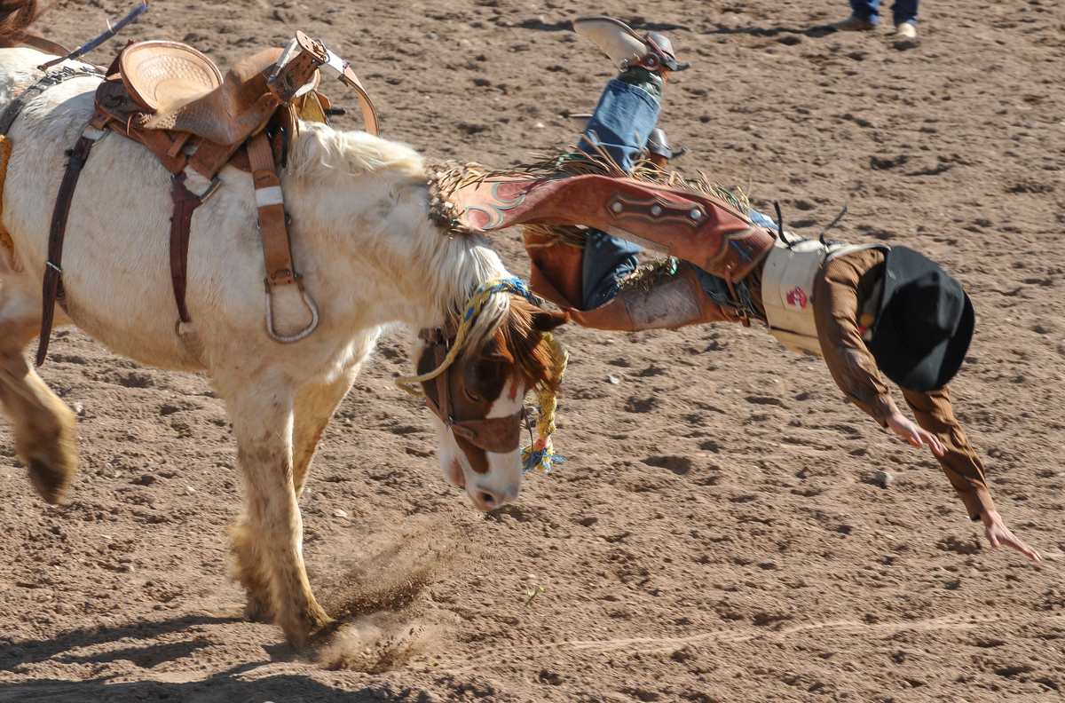

SOUTHWEST PHOTOBANK GALLERY FOR MORE SELLS AZ RODEO PHOTOS CLICK HERE ….
2013 RODEO SCHEDULE…CLICK HERE
![]()
<a href=" SPANISH TRANSLATIONS:
TUCSON’S NEW YEAR FROSTING, WINTER STORM BRINGS RAIN, SNOW TO SOUTHERN ARIZONA


Catalina State park received close to an inch of rain and flurries of snow.


Grazing in Snow
Southern Arizona’s Sky Islands are frosted over for the 2013 New Year and new storms promise to spread snow throughout the border regions of Arizona. Forecasts predicts more, Bisbee has 9 inches, Naco has 7 inches, Sierra Vista has 3 inches and Mount Lemmon’s hwy is now open to four-wheel drive, and is a good place to screw up a nice 4×4, all that traction on ice…?
“It’s beautiful”, says a photographer at Catalina State Park, who has pulled over off the roadway to make a photo. Another lady stopped and rolled down her window, if the ranger sees you stopped on the shoulder, he will ticket you for being off road. Thanks I say as I pull away, that’s total bullshit I think.
VISIT SOUTHWEST PHOTOBANK TUCSON NEW YEAR’S SNOW……….CLICK HERE

CATALINA HIGHWAY THROUGH ORACLE ROAD IN SNOW FLURRIES
SNOWBALLS ARE MEANT FOR LITTLE BROTHERS

![]()
<a href=" SPANISH TRANSLATIONS:
SPANISH ENTRADA SEARCHES FOR CITY OF GOLD, CORONADO FINDS AMERICAN SOUTH WEST, SEES LITTLE TO VALUE EVEN LESS TO CARRY OFF!


THE SPANISH ENTRADA AND CORONADO VISITED MANY OF THE RIO GRANDE PUEBLOS. THE TAOS PUEBLO (above) WAS VISITED BY OUT-RIDERS AFTER DEFEATING CIBOLA OR TODAY’S ZUNI PUEBLO IN NEW MEXICO.
Crossing into the US from Mexico at this spot in the San Rafael Valley, the Franciscan friar FRAY MARCUS de NIZA with his Moorish guide, Estevan, entered from Mexico at this spot in Arizona’s San Rafael Valley, where this concrete cross stands as a memorial of decades of Spanish rule in North America which was followed by a “tidal wave of white men”. De Niza’s journey ended South West prehistory and marked the beginning of written history.
Beside this dusty dirt road only a short distance north from Lochiel, Az, stands the 20 foot cross with a metal plaque that proclaims “On this spot FRAY MARCUS de NIZA entered this Valley of San Rafael, as Commissary of the Franciscan Order and a Delegate of the Viceroy of Mexico, de Niza entered Arizona the first European west of the Rockies on April 12, 1539. Here began the friar’s historic journey to explore the American Southwest, his journey ignited a decade of searching by conquistadors for the gold and riches they hoped to exist in the legendary “Seven Cities of Cibola”.[caption id="attachment_5114" align="aligncenter" width="950"] Marks de Niza Entry
Ironically, at the time of the march to Cibola (Zuni N.M.) and Quivira (Kansas) in 1541, Hernando de Soto’s army was probing west from Florida. In May of 1541, at the same time Coronado was in Texas and starting north to Kansas, de Soto was crossing to the west bank of the Mississippi River. The armies may have passed within some hundreds of miles of each other. While Coronado was in Kansas and marching back to the Albuquerque area, De Soto was probing west of the Mississippi, where he died on the Red River in April of 1542. If the two armies had met up, they might have considered their expeditions more successful.

CONQUISTADORS CLIMBED INTO THE SKY CITY OF ACOMA, THEY WISHED THEY HADN’T.

NATURAL WATER CATCHMENTS ARRESTED RUNOFF ON THE MESA FLOOR

A POTTERY TRADITION EXISTS IN MOST PUEBLOS.

NORTH CENTRAL NEW MEXICO
De Niza’s visit to Arizona’s opened the door for Spanish exploration that defined the size, the people and the nature of today’s American West. FRAY MARCUS de NIZA, found himself about 15 miles east of what is today’s Nogales, Arizona and Sonora as their horses picked their trail through the rich Arizona grasslands. De Niza was guided by Estevan, an Moor slave who had survived the same decade of slavery and walking through Texas to Mexico after being ship-wrecked off the Florida coast with the Spanish mariner named Álvar Núñez Cabeza de Vaca who reported to the Viceroy of Mexico the riches of Cibola. The Viceroy sent the Friar de Niza and Estevan to learn the truth about “Cibola”, was it made from gold or wasn’t it? Estevan knew from his travels the Indian of the time perceived “Cibola” as the “greatest thing in the world”, so-the servant said. Survival had taught him how to excite the average Indian village, the large charismatic black man who wore tinkers and led a large entourage of slaves and women whom he had collected. Estevan had learned it was better to be the point of the spear ahead of the main expedition finding water and probing their path for guides and information, rather than playing the role of a slave. Estevan was charged to send back runners with crosses, if news was promising about riches ahead send a big cross, he had been told, if chances were poor, then send a small cross. Estevan decided to promote his own agenda sending back crosses that got progressively larger. Estevan was the original Kokopelli, he captivated the locals, wowed the maidens, had a few and moved on to the next village before the larger expedition arrived.

FIREARMS, HORSES AND CROSSBOWS TOOK A TOLL ON THE INDIAN
De Niza, upon his first return to Mexico City from Cibola, he had reported finding “good and prosperous lands” others soon twisted that translation into a new land of riches, equal to the wealth of gold, silver and gemstones, taken from the Aztec and Inca civilizations of Mexico and South America. Cibola was soon thought to be where “trees hung with golden bells and people whose pots and pans were beaten gold”, so with that promise of riches, finding soldiers and patrons to fund the journey became easy, everyone wanted a piece of the action. De Niza’s companion Estevan de Dorantes was killed at Cíbola, as de Niza watched from afar, but from that range the friar affirmed that the “grand city” report was true. The Friar’s report had inspired Francisco Vázquez de Coronado to make his famous expedition to Zuni Pueblo, using Fray Marcos as his guide; their journey had many hardships: thirst and hunger, many died and most were left penny-less. So it’s an understatement the expedition had a great disappointment, when they had finally saw Cibola for themselves, Coronado then sent Friar de Niza back to Mexico City for his own protection. Fray Marcos returned in shame and became the provincial superior of his order in Mexico and performed the highest office of the Franciscans Order in Mexico before dying in 1558.
In “Cities of Gold” by Doug Preston 1992 Simon/Schuster narrates the rich history of the American South West as the author retraces the Route of Coronado from the US-Mexico Border through a very rugged Arizona and into a waterless New Mexico. Preston and with his cowboy/photographer/artist/sidekick, Walter, with four horses found the trip, life-imperiling as well as life-changing. Another author, Paul Wellman wrote in his book; “Glory, God and Gold” that “Every Spaniard in the expedition” he wrote “would plunge his arms elbow-deep in gold ingots before he returned,” that’s why not a peso came from the King and each participant paid what they could. Captains paid $55,000 pesos, average guys paid $35,000 pesos and Coronado himself paid $85,000 pesos, taking a loan out on his wife’s estate. In preparation for this journey, Coronado had taken seven slaves four men and three women, others took their wives, children and companions.
Scholars say there were 2,000 in the expedition, with 67 plus European soldiers-45 fellas carried European metal helmets, 1300 natives were from central and western Mexico, some were servants, wranglers and herdsmen so writes Richard Flint in the Kiva article entitled “What they never told you about the Coronado Expedition”. He points out there were 19 crossbow, 25 arquebusiers and additional slaves to tend the 1,000 extra horses, 500 head of cattle, and more than 5,000 sheep was taken to feed the expedition. These folks were not trailblazers-they followed well established paths, each village they passed they would enlist guides to lead the way to the next water hole, to make introductions at the next village and to show the Spanish the road to the Seven Cities of Gold.
Just a few years earlier the chosen champion of the Cuban governor, Conquistador Hernando de Soto, who learned the Indian slave trade in South America. There the Spanish looted temples and ransacked graves for their mortuary offerings. Finally De Soto captured the Inca emperor who offered him a room 22′ by 17′ stacked 9′ to the ceiling with gold ornaments, vases, goblets and statues plus another smaller room filled twice over with silver for his freedom. De Soto accepted the gold and silver treasure, still killed the king and soon returned to Spain and became a favorite in the King’s court to whom he loaned money and soon was given the license to explore Florida. In return the King was to receive “one-fifth of all spoils of battle, one-fifth of any precious metal taken from the ground and one-tenth of everything taken from graves. De Soto was to finance the entire expedition, at its end he would received 50,000 acres of his choice and an annual salary of $60,000, in return he would pacify all the natives, and provide the necessary priests and friars needed to convert them.

DESOTO; Followed the footsteps of his heroes, Balboa and Ponce de Leon….

CORONADO: Freely joined the chase for gold and riches ….

EL MORRO NATIONAL MONUMENT STOOD OUT FROM THE FLAT LAND AND BECAME A BEACON FOR TRAVELERS. CORONADO DIDN’T LEAVE HIS JOHN HANCOCK, BUT HE DID VISIT

The native Americans believed the Spanish horses were supernatural creatures.
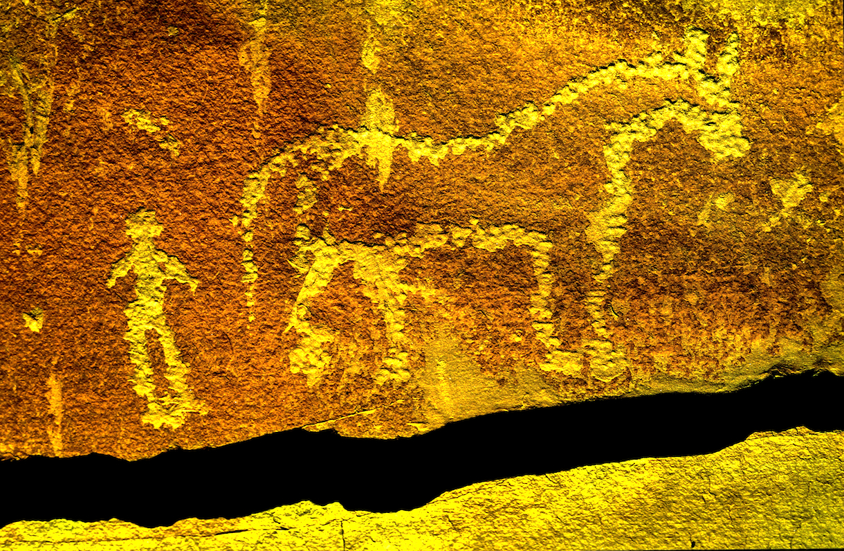
This rock art in southern Utah commemorates the first time the indian and the horse meet.
So eighty years before the Pilgrims landed at Plymouth Rock. Spanish Explorers visited Kansas: Francisco Vasquez de Coronado, seeking gold in New Mexico, was told of Quivera where “people’s pots and pans were beaten gold”. With 30 picked horsemen and a Franciscan Friar, Coronado marched “north by the needle” from the Texas panhandle until he reached Kansas. Here he found no gold, but a country he described as “the best I have ever seen for producing all the products of Spain.” The expedition entered present Kansas near Liberal and moved northeastward across the Arkansas River to what is now Rice and McPherson counties perhaps probing to present day Lawrence near the Kansas River before turning back. The guide, they called the Turk, confessed he had deceived the Spaniards and one night he went into his tent and the next morning when they broke camp he left only a dirt mound. He was strangled, buried and forgotten. For 25 days in the summer of 1541 the Turk had led Coronado among the grass-hut villages of the Quivira Indians, hoping to lose Coronado and men in the tall grass and waterless plains.

PECOS PUEBLO stood at the Cross Roads of the Great Plains and the Rio Grande Pueblo Communities.

Statue of the Conquistador Coronado stands next to a traffic circle in Liberal, Kansas near where the Spanish entered from Texas. JOHN MADSEN, BELOW
CORONADO AND QUIVIRA

The exact route that the Coronado Expedition took between Sonora and the Zuni Pueblos is currently unknown writes John Madsen, curator at the Arizona State Museum. He writes some have surmised that the trail led through Arizona, as far west as the Casa Grande Ruin, before turning northeast into the White Mountains region. Others, like historian Herbert E. Bolton, suggest a route along the San Pedro River, turning northeast below Benson, crossing the Gila River near Bylas, and passing near White River and Springerville before descending into the Zuni region. Madsen prefers the path similar to that proposed by archaeologist Carroll Riley. It traverses the country on what is now the Arizona–New Mexico state line, following the San Francisco River. Spanish accounts as early as 1747 reveal considerable use of the drainage by Zunis and Apaches. In 1795, Sonorans viewed the San Francisco River area as a potential trade route linking them with the Pueblo of Zuni and Santa Fe area pueblos like Pecos and Taos Pueblos.
Madsen teamed up with a Public Broadcast Station and launched a search for clues of where the Spanish had been targeting areas along their suspected route. Many historians and archaeologists along the route have tackled their piece of the mystery, many adding to the research, Madsen “had a hunch that the best source of information would come from the ranching communities along the Arizona–New Mexico border. These people know the land, and generations of family members have covered most of this dirt on horseback. The end result were 33 Spanish colonial period or Mexican historic artifacts like period spurs, coins, and horseshoes. Chain mail was take from a site in Kansas….more clues appeared.
Hartmann Map for Tracking the Expedition’s Route: Sleuthing for Clues and Artifacts

For over 100 years, the exact route of Coronado has been an American mystery. Generations of scholars have tried to retrace the steps of the army from their descriptions of villages, rivers, mountains, and native communities. National commissions have grappled with the problem of designating a “Coronado Trail” that tourists could follow, but clues were sparse, and politics raised its head when various factions tried to claim parts of the route for their state. Because we don’t know just where they were, it is tantalizingly hard to interpret the Coronado chronicles’ descriptions of native villages and other sites they visited.

GREENLEE COUNTY ARIZONA
Archaeologists William K.Hartmann, his wife Gayle and Richard Flint have worked tirelessly to sleuth out the route of the Coronado Expedition being guided by de Niza who the year before had seen Cibola from a distance. They found he might have followed the Rio Sonora to the river’s headwaters and then crossed the Cananea grasslands for four days past Arizape picking up the San Pedro River North turning east toward the Wilcox Playa North past present day Safford or the present day Sulfur Springs Valley crossing the Gila River cresting the Mogollon Rim past Point of Pines. William and Gayle Hartmann sees them moving east from the San Pedro, stopping at Turkey Creek in the Chiricahua’s then moving east through Apache Pass via Portal and into New Mexico and eventually into Texas. For more explanation visit their website….http://www.psi.edu/epo/coronado/coronadosjourney.html
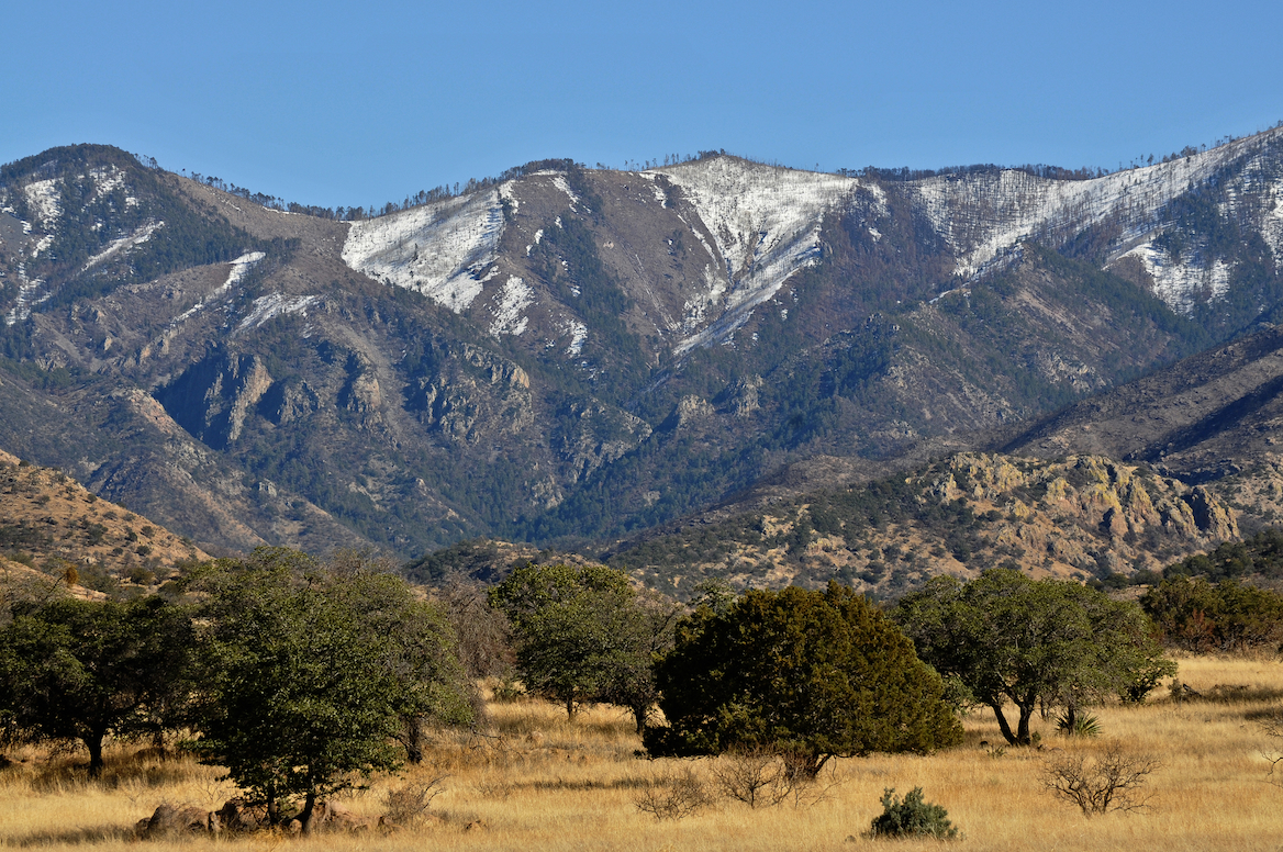
WEST TURKEY CREEK, IN THE CHIRICAHUA MOUNTAIN RANGE, ONE PROPOSED STOP ALONG CORONADO’S ROUTE.
REPORTED DISCOVERY OF CHICHILTICALE The most exciting development is the apparent discovery of the long lost Coronado camp site at the Chichilticale New Mexican exploration geologist Nugent Brasher devoted several years to this problem. With brilliant deduction, mapping, and hard work, he began metal detecting surveys at several water-source sites he reported finding an iron cross bow point and other possible fragments from the Kuykendall ruin, a large pueblo ruin site at the foot of the Chiricahuas. The site appears definitely to be a the first Coronado camp site known in Arizona, and almost certainly is the Chichilticale ruin.
• ONGOING EXCAVATIONS AT CHICHILTICALE Brasher has set up a web site at www.chichilticale.com to record progress with the survey and excavations at the Chichilticale site. Excavations are continuing by Brasher and archaeologist Deni Seymour. Two more cross bow bolt heads have been shown on her web site that details excavation plans and progress, at http://www.seymourharlan.com/default.htm
• NEW BOOK FROM RICHARD FLINT In 2008, Richard Flint published a popular-level account of the expedition, “No Settlement No Conquest: A History of the Coronado Entrada,” a book that bids to replace Herbert Bolton’s volume as the best general account of the expedition.
• NEW BOOK FROM TONY HORWITZ In 2008, also, Pulitzer-prize winning journalist/writer Tony Horwitz dealt with the Coronado expedition as a major section of his book “A Voyage Long and Strange,” which is an account of the explorations in North America before the 1700s, adjusting and correcting some of the mythic tales that most American children learn about the initial European explorations of our continent.
Picked up by a local rancher In the 1960s and Little known for years, the Floydada gauntlet and some newly-found associated artifacts, such as odd-shaped metal arrow points, have recently been recognized as priceless relics of the Coronado army expedition.
THE JIMMY OWENS SITE IS LOCATED NEAR FLOYDADA ON THE TEXAS PANHANDLE SEE PICTURES OF COLONIAL SPANISH ARTIFACTS, SPURS, MESH GLOVE…
KIVA The Coronado Expedition to Tierra Nueva: The 1540–1542 Route across the Southwest by Richard Flint; Shirley Cushing Flint
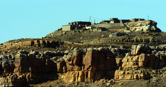
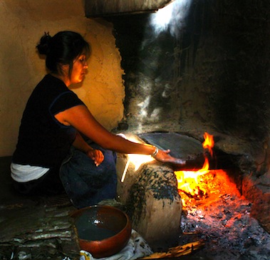
HOPI WOMEN have been making the ceremonial PIKI Bread for centuries in a special cooking space behind the main house

AFTERMATH of DE NIZA’S JOURNEY TO CIBOLA
Cultures, old as time, were attacked as pagan by the Catholic priests who accompanied the Conquistadors and who blessed their cruel attacks, in the name of saving pagan souls. The vanquished Indian was used as slaves, sold, slain or simply worked to death. The Cross, the symbol the Spanish brought the Indian and who adopted it, as pagans you can always use another God. Finally, the Spanish opened the West, the Conquistadors began the mapping of the West which became the United States of America’s quest for it’s “manifest destiny”. The American Indian, time and time again found himself in the way of the white man’s greed, the white men attacked the first Americans stealing their lands, their game and their lives, their homes, eventually they stole their children!
The facts show the journey of FRAY MARCUS de NIZA, a man of God, began an “era of extermination”, a period when approximately 20 million Indians inhabited this territory before the Conquest, and after just one century of Spanish rule there were only 1 million left! Many vanquished by Old World diseases brought to the New World with Europeans. The epidemics that broke out as well as the merciless workload imposed on the Indian dramatically diminished the Indian population. The scope of the epidemics over the years was tremendous, killing millions of people—in excess of 90% of the population in the hardest hit areas—and creating one of “the greatest human catastrophe in history, the most devastating disease was smallpox, but other deadly diseases included typhus, measles, influenza, bubonic plague, cholera, malaria, tuberculosis, mumps, yellow fever, and pertussis (whooping cough). The Americas also had a number of local diseases, such as tuberculosis and a type of syphilis, which soon went viral when taken back to the Old World.
“The moving multitude…darkened the whole plains,” wrote Lewis and Clark, who encountered a buffalo herd at South Dakota’s White River in 1806. With westward expansion of the American frontier, systematic reduction of the plains herds had began around 1830, when buffalo hunting became the chief industry of the plains, organized hunters killed buffalo for hides and meat, often killing 250 a day.

The White Man also almost exterminated the American Buffalo, herds said to be 20 miles wide and 20 miles deep, roaming the valleys they have always grazed, only a few small herds survive today. At that time, some white men sought to eradicate the buffalo to take away the Indian’s livelihood and well-being. Native American tribes depended on the buffalo’s meat and hides, and many still today believe the animal has special spiritual and healing powers, making it an important part of their culture. The railroads laying track across the plains further depleted the buffalo, as well as the Indian’s hunting grounds because hunting from train windows was widely advertised and passengers shot buffalo as they raced beside the trains. By 1883 both the northern and the southern herds had been destroyed. Less than 300 wild animals remained in the U.S. and Canada by the turn of the century out of the 30 to 75 million that was once thought to live there.
The Navajo “Long Walk” was the 1864 forced-deportation and some say attempted ethnic cleansing of the Navajo by the U.S. Government notes Wikipedia. The Navajos were forced to walk at gunpoint from their Arizona reservation to eastern New Mexico. Some 53 different forced marches occurred between August 1864 and the end of 1866. The “Trail of Tears” is a name given to the forced relocation and movement of Native American nations from southeastern parts of the United States Many of re-settled Indians suffered from exposure, disease and starvation on the way, many died, including 4,000 of the 15,000 relocated Cherokee. By 1837, 46,000 Native Americans from southeastern states had been removed from their homelands opening 25 million acres for predominantly white settlement.
SOUTHWESTPHOTOBANK’S PREHISTORY PHOTO GALLERIES CLICK HERE….
CONQUISTADOR ARMOUR BY ERIC THING
![]()
<a href=" SPANISH TRANSLATIONS:


